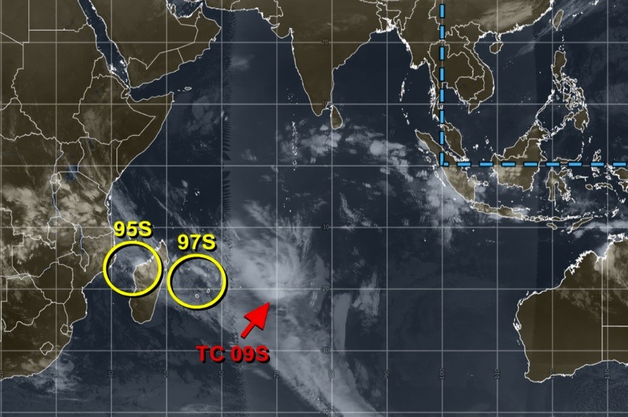
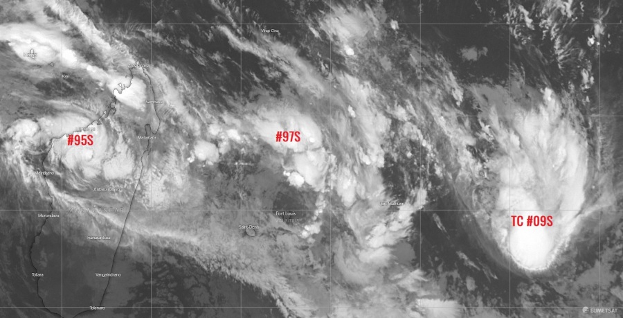
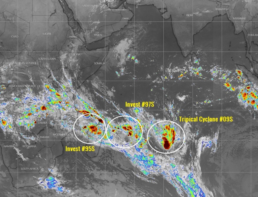
Tropics are becoming more active this week, especially over the Indian Ocean. Currently, there is an active zone containing three tropical waves simultaneously ongoing in the Southwest Indian Ocean – the first wave – Invest #95S – is located along the west coast of Madagascar, the second wave – Invest #97S – is located to the north of Mauritius while the the third wave – Tropical Cyclone Nine / #09S – is located further southeast over the open waters.
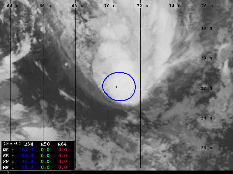
Infrared satellite image of all three waves this evening (night local time) indicated the strongest is the #09S, while the other two waves are still not well organized. The #95S is producing severe storms across western Madagascar, while strong storms are also ongoing around the virtual center of Invest #97S. A very high cloud tops are visible on the storms of Tropical Cyclone #09S.
Tropical Cyclone NINE – #09S
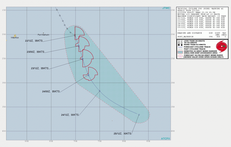
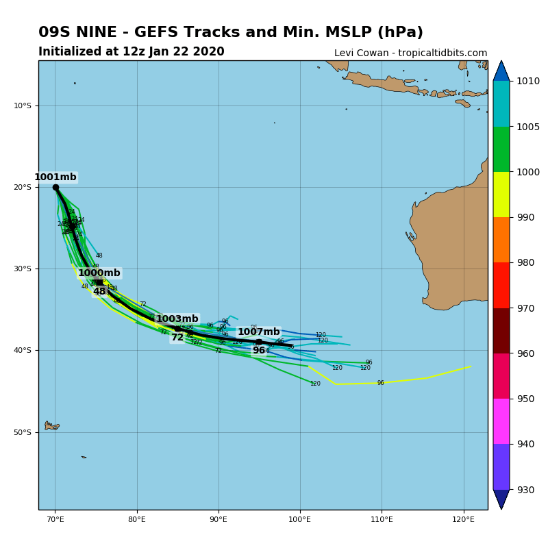
The strongest among the three waves is the easternmost system – it has become a Tropical Cyclone Nine (originated from the Invest #09S) today. It is currently packing maximum sustained winds of 35-40 knots and central pressure around 1005 mbar. #09S already has tropical-storm-force winds, extending 50-65 miles around the center of the low. It will continue moving south-southeast and will not affect any land areas during its lifecycle, surviving until early next week.
Invest #95S
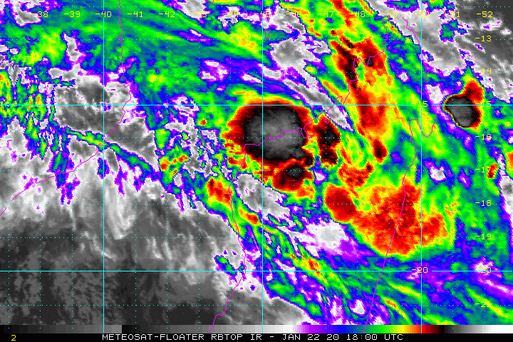
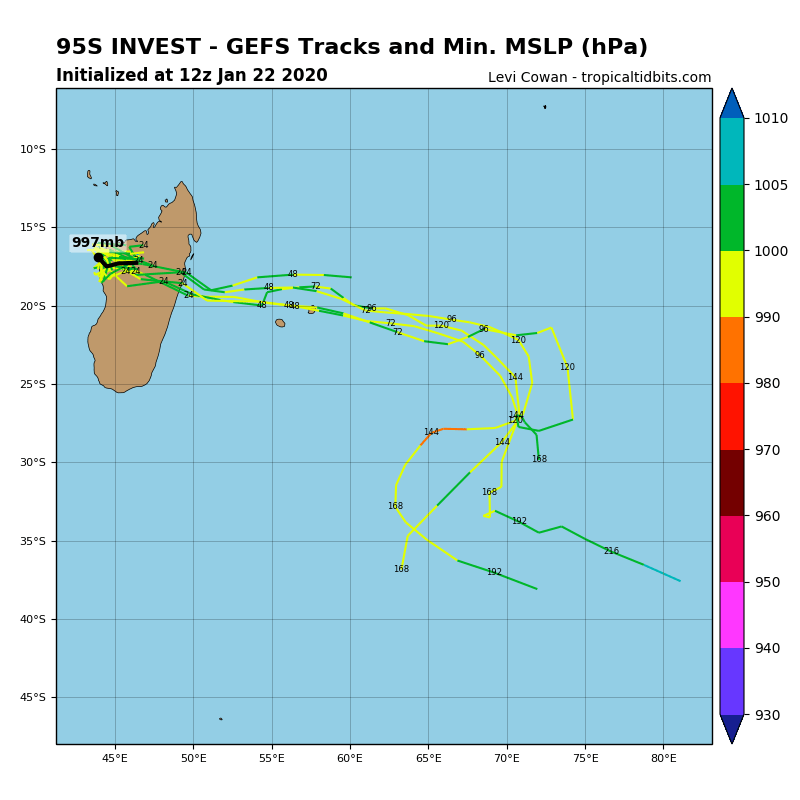
Invest #95S is currently located over western Madagascar, producing severe storms with torrential rainfall and potential for flash floods. Model guidance is suggesting the system will cross Madagascar tonight and tomorrow and then head towards Mauritius sometime around Friday. However, storms should remain rather disorganized and any significant strengthening is unlikely.
Invest #97S
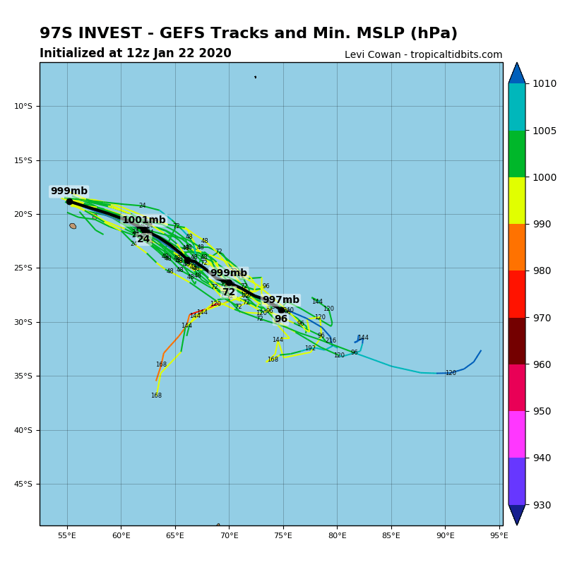
Invest #97S is located to the immediate north of Mauritius, producing strong storms. Model guidance is not hinting it will develop into a stronger system but should remain a poorly organized cluster of storms through the next days while moving southeast.
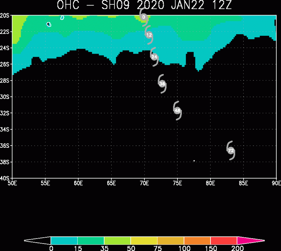
Ocean Heat Content (OHC) map indicated all three systems are still in good sea surface temperatures, fueling the storms associated with them. Attached is the map of TC #09S which will be the first system moving out of the best conditions tomorrow, this will weaken it with time.
We will continue monitoring this tropical activity and will be updating if necessary – stay tuned!
