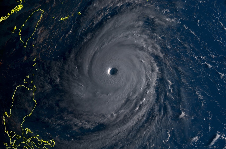
As expected, Super Typhoon Trami has intensified into a Category 5 typhoon overnight and is now a powerful storm with 160 mph ( = 260 km/h) sustained winds and gusts up to 196 mph (= 315 km/h). Central pressure is around 916 mbar. It is expected to maintain this strength through the next 3 days and could eventually even strengthen a bit more (could reach near 180 mph sustained winds given the very favorable low shear and high sea weather temperature along its future path.
First morning light reveals an exceptionally impressive structure of Trami, with completely symmetrical outflow and a thick very intense eyewall surrounding the large eye. The stadium effect is incredible to see in the morning light over the typhoon.
Infrared satellite image if CAT 5 super typhoon #Trami right now!https://t.co/7hlaJlTnYB pic.twitter.com/8mLanm9vWp
— severe-weather.EU (@severeweatherEU) September 24, 2018
Water vapour satellite animation if CAT 5 super typhoon #Trami right now!https://t.co/7hlaJmaYQ9 pic.twitter.com/1GouXWlAH6
— severe-weather.EU (@severeweatherEU) September 24, 2018
Here is the latest guidance regarding its future track – Trami will likely turn more north soon and head towards Miyakojima island on Friday, Sept 28th. This would mean that Trami would miss landfall on Taiwan completely. Still a few days ahead for the system before it approaches landfall anywhere, so its path could change.
Stay tuned for further updates tomorrow!

