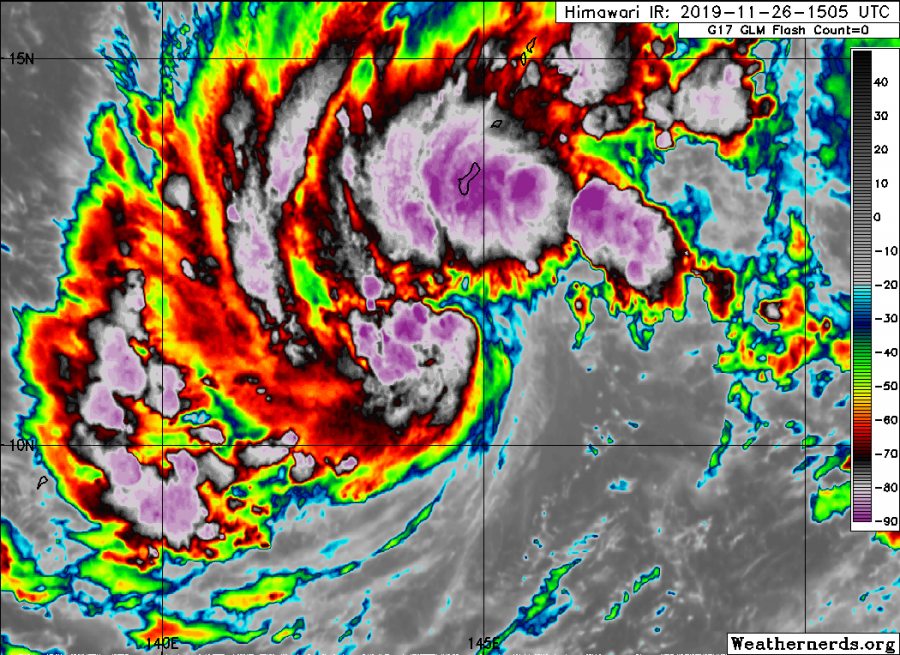
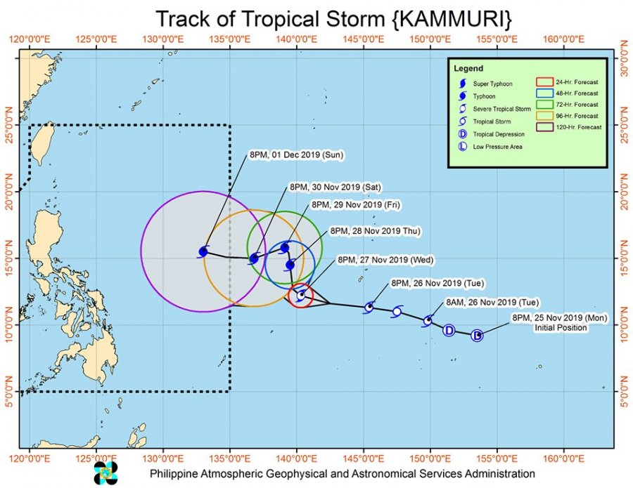
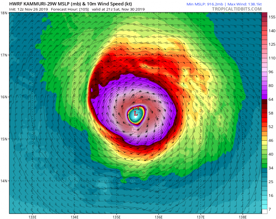
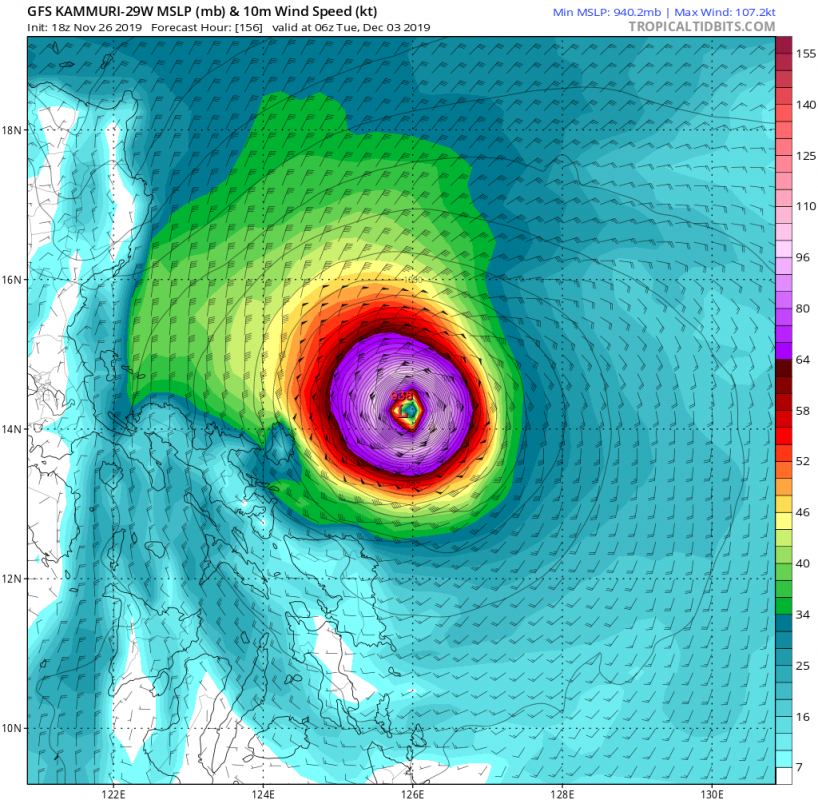
A few days ago a low-pressure system developed to the southeast of Guam. It then began to show a defined circulation, developing into a tropical depression yesterday, Nov 25th, with the JTWC assigning it as 29W. The circulation then began to develop banding features across the NE quadrant, continue intensifying and becoming a Tropical Storm #KAMMURI. Storm is currently packing maximum sustained winds of 50 knots and central pressure around 989 mbar. Kammuri is expected to continue strengthening and is likely to begin rapid intensification towards the end of the week when it could potentially become a Super Typhoon and reach Category 4 or even Category 5 strength! The track is yet to be defined, Kammuri might remain over open waters moving north or could even reach Philippines next week.
Based on the latest satellite imagery, model data and western Pacific conditions – the poleward and equatorward outflow, widening upper-level anticyclone, very high OHC and warm near 20-30 degrees C SSTs within very low vertical wind shear – the system has a high potential to become a very powerful typhoon in a few days. Satellite images indicate the broad circulation with its center now SW of Guam.
https://twitter.com/HurricaneRiley5/status/1199355387750825984
https://twitter.com/guahanweather/status/1199452505421148161
https://twitter.com/HurricaneiOS/status/1199428669044908035
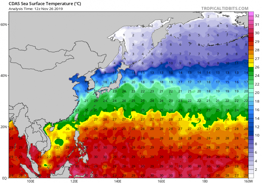
The Ocean Heat Content (OHC) and SST analysis reveal the Pacific sea waters ahead of Kammuri are incredibly warm, OHC even exceeding 100 with SSTs above 29 degrees Celsius! Which is more than enough supportive of rapid intensification after Thursday / Friday.
The future track should bring Kammuri further WNW through the next 24 hours, then north and possibly towards the sharp west turn again on Friday. At that time, typhoon would be rapidly intensifying into a Super Typhoon.
Latest Advanced Dvorak Technique (ADT) analysis support gradual strengthening of Kalluri with tropical-storm force winds and already quite wide field of 34kt radii winds.
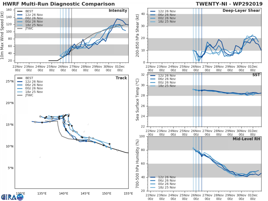
Let’s take a brief look what HWRF and GFS models are hinting regarding the Kammuri’s future intensity. Both models are aligned that typhoon would become at least Category 4 by the end of weekend. If not even 5! One model pushes its track north while the other one brings it towards Philippines – similar track also visible on ECMWF model.
We are closely monitoring the evolution of this potentially violent Super Typhoon and we will keep you updated in the coming days – stay tuned!
Interested in our calendar? We are proud to present and promote the best weather photographers in Europe – see details:


