A powerful windstorm has developed in response to a rapidly deepening cyclone ejecting from the British Isles towards N France this morning. An intense sting jet has developed within the cyclone. The jet is traveling right across Brittany, NW France, and is resulting in extremely dangerous weather conditions.
So far, the peak wind gusts observed across the Brittany region coastal areas were locally up to 193 km/h! Here are some of the local station reports:
- 193 km/h – Camaret
- 191 km/h – Ouessant
- 180 km/h – l’Ile de Groix
- 170 km/h – Pointe du Raz
Wind field analysis at 9am today, March 6th, 2017, Source: ventusky.com
Both water vapour and visible satellite imagery are revealing a well-developed cyclone with a strong dry intrusion on its back side, penetrating into NW France:
Visible satellite image of a rapidly deepening cyclone over NW France, Source: sat24.com
Water Vapour satellite image across W Europe. Source: vedur.is
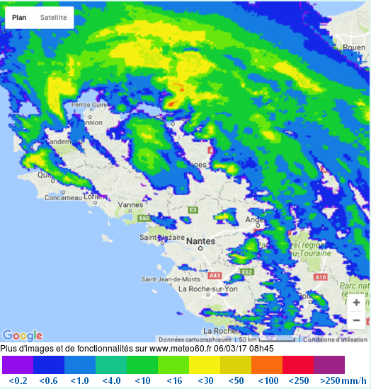
Radar image across the NW France revealing a textbook signature of cyclonic rain bands, rapidly moving towards southeast:
Radar image of NW France, source: infoclimat.fr
Latest surface pressure analysis revealing a central pressure of 995mb which continues falling as the trough/cyclone progressing further inland into France:
Surface pressure analysis map across Nw France. Source: meteociel.fr
Peak wind gusts were observed across the Brittany region costal areas, locally up to 193 km/h:
Map of peak wind gusts across NW France. Source: infoclimat.fr
Map of peak wind gusts across NW France. Source: meteociel.fr
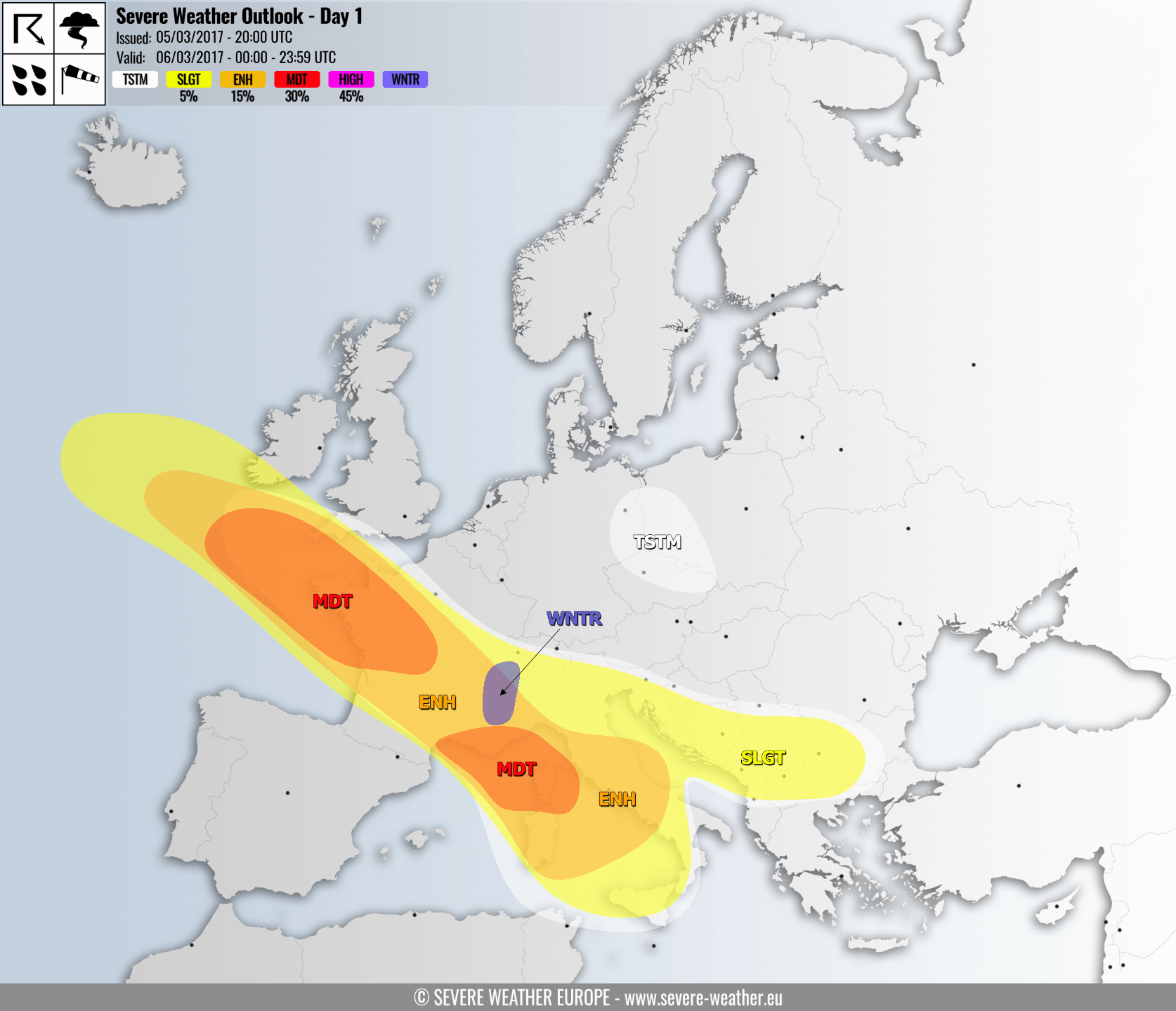
The area is included in an MDT risk for severe weather as a powerful wind storm was expected this morning, refer to our official outlook for further details. The cyclone will be moving further SE across France with a gradually diminishing windstorm threat but will re-develop and intensify once the system enters the Mediterranean later this afternoon and tonight, stay alert!
See details of the outlook: Severe Weeather Outlook for March 6th, 2017
Follow the severe weather in risk areas with radar:


