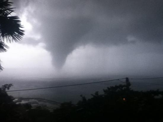
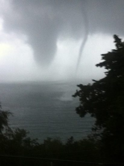
An impressive tornado appeared in the Gulf of Trieste, Italy, just offshore Grignano, Trieste on September 17 between 7:10 and 7:20 am local (CEST). The tornado formed over the sea and then tracked NE past the Grignano marina and onshore, where it left a 2 km long damage track (OSMER FVG, personal communication).
The tornado was witnessed, photographed and videoed by many people, and was the first event Severe Weather Europe reported on. Data from nearby meteorological stations allow a detailed analysis of the event.
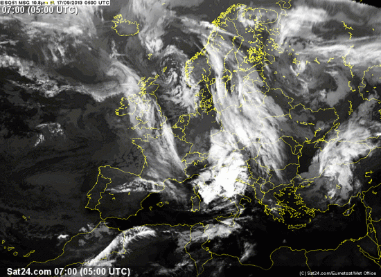
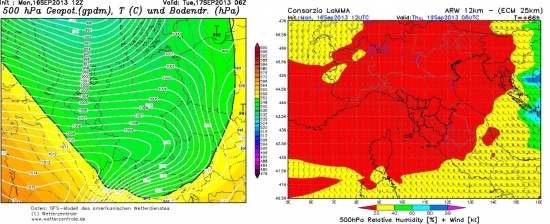
A strong negatively tilted trough was crossing central Europe with a surface cold front extending across the southern Alpine region (see Fig. 1 and 2 below). Southerly low-level winds were present across the N Adriatic sea and Trieste gulf, maintaining moderately unstable and sheared environment across the warm sector.
REGIONAL MODEL
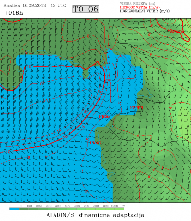
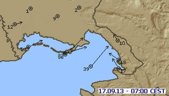
Surface cold front was rapidly moving from southern Friuli region towards the gulf of Trieste, where tight pressure gradient and SFC wind convergence with tramontane wind coming immediatelly behind the front and SE winds over the SE parts of gulf of Trieste (Fig. 3,4).
LOCAL ANALYSIS
The tornadic supercell formed on a strong surface frontal convergence of SE and SW winds (Fig. 5) with 5 m/s SE and over 10 m/s SW, while the strong tramontane winds supported the tornadogenesis process in this supercell.
Modified 00Z Udine sounding (Fig. 6) with OSMER FVG Trieste station data yields notable shear and helicity parameters.
- DLS (sfc-6 km): 34 kt
- LLS (sfc-1 km): 21 kt
- SREH3: 190 m2/s2
- SREH1: 102 m2/s2
Surface temperatures and dewpoints in the inflow region were 19/17 °C (OSMER FVG Stations Trieste, Muggia and Monfalcone). This resulted in significant CAPE:
- SBCAPE: 1253 J/kg
- 0-3 km CAPE: 192 J/kg
- EHI 0-2 km: 1.4
OSMER Fossalon Doppler radar shows a clear presence of a mesocyclone between 7:00 and 7:20 CEST located just offshore Grignano, tracking NE (Fig. 7).
Interestingly, a satellite waterspout briefly formed next to the tornado (Fig. 8).
Damage track: 2 km long (OSMER FVG, personal communication). Damage mostly limited to broken trees, as the ground track missed populated areas. The tornado hit and damaged an amateur astronomical observatory on Campo Sacro/Božje Polje. Peak recorded wind speeds at Grignano station were in the 150 – 180 km/h (EF1) range, but the station’s anemometer failed during tornado passage (OSMER FVG, personal communication).
