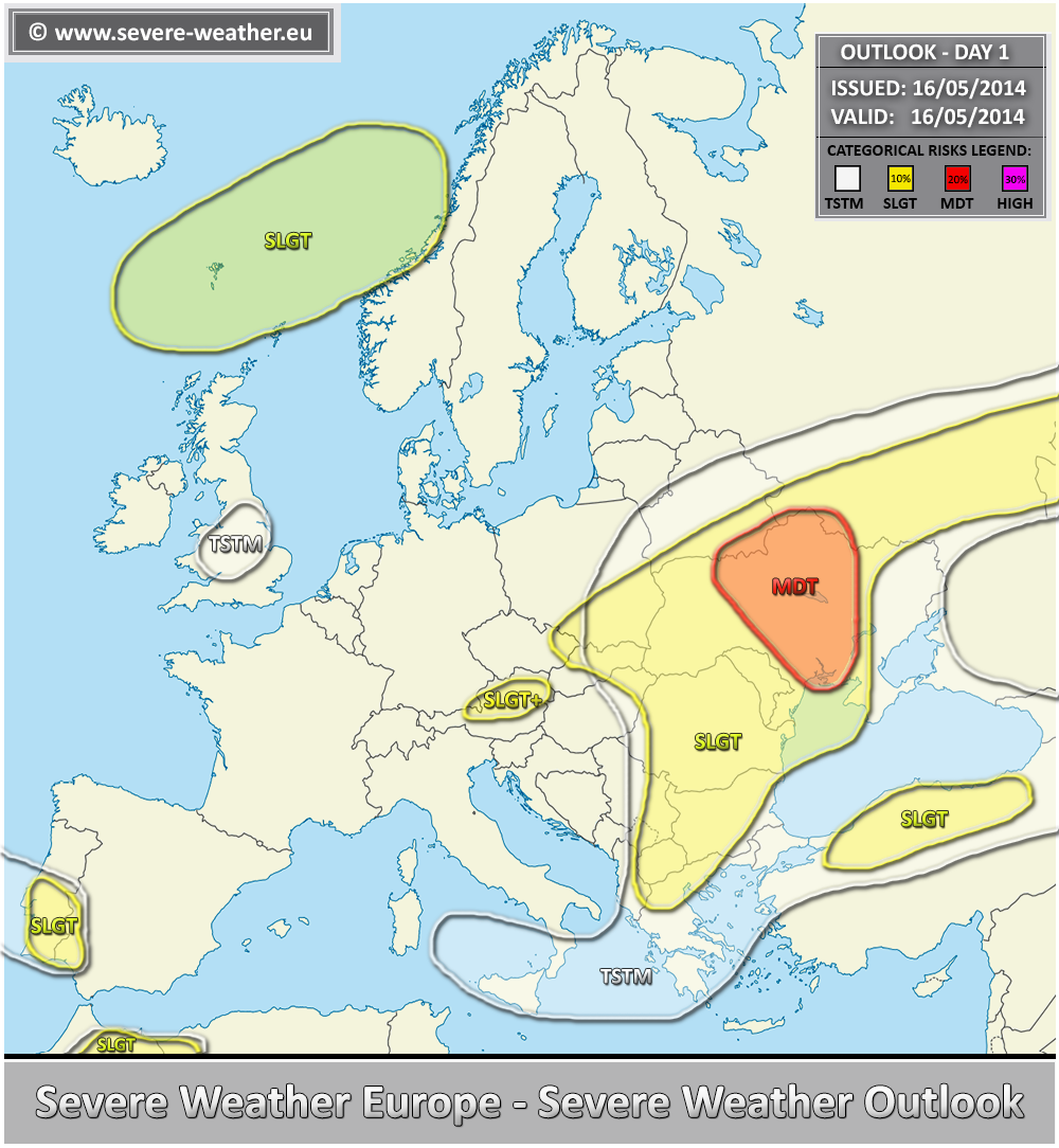
VALID FOR 16-05-2014
A large upper low centered over the central Balkans finally begins to weaken today (Friday) while ridging conditions persist further north. A weak upper low moves along the SW Iberia towards Morrocco while a short wave trough with a deepening low moves across the Norwegian sea.
A MDT risk has been issued for CNTRL Ukraine into S Belarus and SW Russia with threat for very large hail, severe winds, tornadoes and torrential rain. A robust environment with around 40-50 kt deep layer shear coupled with moderately strong instability (1000-2000 J/kg) will become supportive of numerous supercell storms starting in the early afternoon. SR helicity between 200-300 J/kg should be favorable for tornadoes as well, some of them could be stronger intensity.
A SLGT risk has been issued for surrounding areas of MDT risk extending along the front eastwards into the western Russia and west towards Slovakia, Moldova and eastern Romania. Here, organized severe storms are as well possible given the available instability and sheared conditions. Further south into the SE Balkans, moderate instability and weak shear under the upper low suggest pulsating storms with heavy rain / flash floods and marginal hail are likely.
A SLGT risk has also been extended towards northern Slovakia and E Czech Republic given the favorable conditions for persisting orographic rain onto the Western Carpathans mountains. Additional 50-80mm are possible today.
A SLGT+ risk has been issued for parts of northern Austria with threat for excessive rain. Peristing strong orographic rainfall should result in high amount of rain, locally in excess of 100 mm / 24 hrs possible.
A SLGT risk has been issued for northern Turkey with threat for large hail and severe winds.
A SLGT risk has been issued for extreme SW Iberia and parts of NE Morrocco into NW Algeria with threat for large hail, heavy rain and severe winds.
A SLGT risk has been issued for southern Norwegian sea into western Norway with threat for strong to severe winds.

