VALID FOR 15-04-2017
A large upper low dominates N half of Europe with a short wave crossing NNW Mediterranean in the afternoon and evening hours. An associated cold front crosses NW Balkan and N Italy. A weak upper low moves across SE Turkey and extreme E Mediterranean.
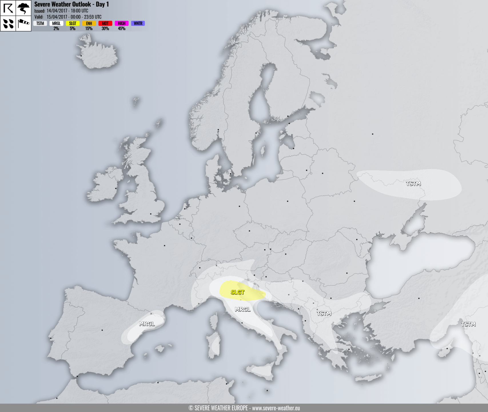
A SLGT risk has been issued for parts of N Italy and N Adriatic sea with threat for severe storms, capable of producing large hail, severe winds and torrential rainfall. Storms should form in the afternoon along the S Alpine flank and spread towards the Adriatic sea in the evening.
A MRGL risk has been issued for N-CNTRL Italy and N Adriatic region with some isolated storms threat, storms could bring heavy rainfall, strong to severe winds and marginally large hail.
A MRGL risk has been issued for NE Spain where some isolated severe storms are possible in the afternoon, threat should diminish until the evening.
TSTM risk areas have been placed where some storms are possible, but should remain sub-severe.
