SYNOPSIS
A deep trough digs south from north into central Europe with a surface cold front moving towards the Balkan peninsula and N Mediterranean. An upper ridge remains over Greenland and N Atlantic. A short-wave trough pushes across the S Mediterranean with a frontal system across the Ionian sea.
DISCUSSION
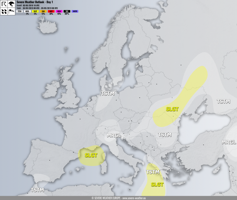
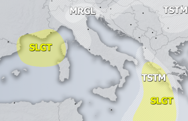
SLGT risk has been issued for Ionian sea into SW Greece with threat for severe storms, capable of producing severe winds, marginal hail and some tornado threat. Strong southerlies will enhance LL shear / helicity and support organized storms along/ahead of the moving front.
SLGT risk has been issued for S France into NW Mediterranean with threat for severe non-convective wind gusts in excess of 90 km/h. Threat develops in the evening hours when cold front pushes through.
MRGL risk has been issued for N Italy into SW Slovenia and NW Croatia with isolated threat for severe storms, capable of producing strong to severe winds, marginal hail and torrential / excessive rainfall.
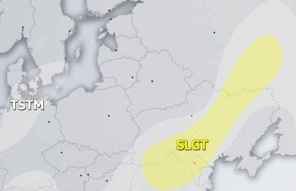
SLGT risk has been issued for NE Romania, Moldova across central Ukraine into SW Russia with the isolated threat of severe storms, capable of producing severe winds, large hail and torrential rainfall. Moderately strong instability in marginal to moderate shear should support some organized storms along the moving frontal boundary in the afternoon hours.
MRGL risk has been issued for E Turkey into N Syria with threat for isolated severe storms, capable of producing severe winds, large hail and torrential rainfall.
TSTM risk areas have been placed where convective storms are likely to occur but should remain sub-severe.


