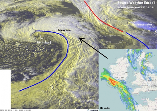
Here is an evening visible satellite analysis of a well organized frontal system approaching western Europe this early evening. An intense surface low, its latest central SFC pressure is at 984 mb, centered SW of UK is moving east across the SLGT risk area. Some severe storms are possible within the well-defined convective activity along the frontal boundary. Severe winds and heavy rain are the primary threat with any stronger storms.
Source: EUMETSAT / netweather.uk
Follow the ongoing activity on UK radar, Ireland radar and satellite pages.

