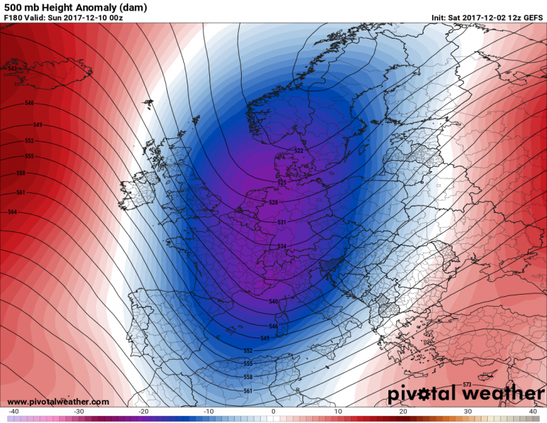
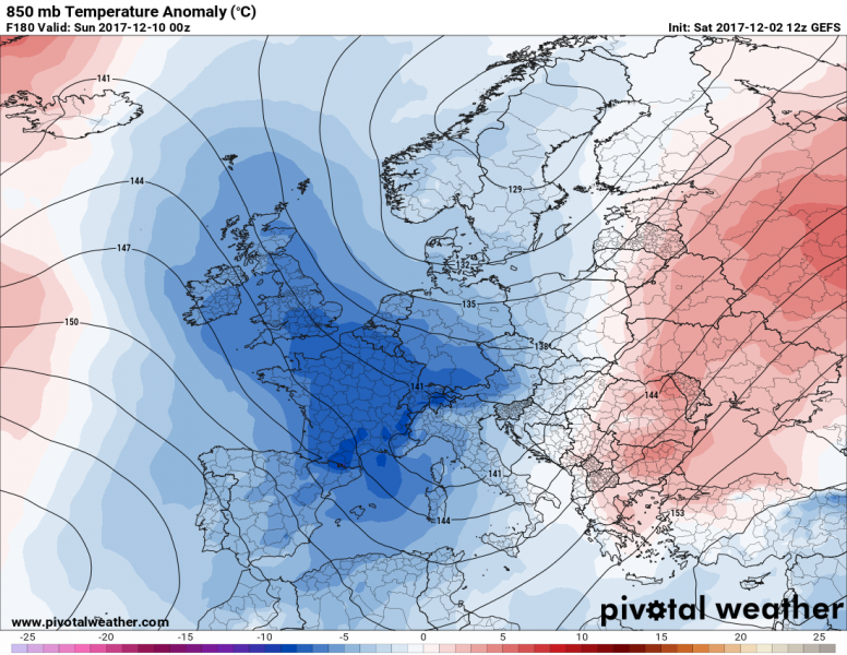
Global models are in quite good agreement for the next 10 days: a likely new outbreak of Arctic airmass will be pushed meridionally across Europe next weekend. Indeed it is still 7-8 days ahead and many details have yet to be determined. As far as models are predicting currently, a deep trough will result in several deep cyclones in the Mediterranean, bringing frontal systems with severe weather (excessive rainfall, severe storms, waterspouts, excessive snowfall, blizzard conditions) in some places. We will be closely monitoring the evolution of the pattern through the coming days and will keep you updated.
Both GFS and ECMWF (including ensemble forecasts) are simulating a deep trough pushed south towards the Mediterranean which would result in significantly colder weather across the west-central and even southern Europe again. This means colder than average winter weather should continue well into the month of December, despite some near-normal temperatures in the coming week.
Stay tuned!

