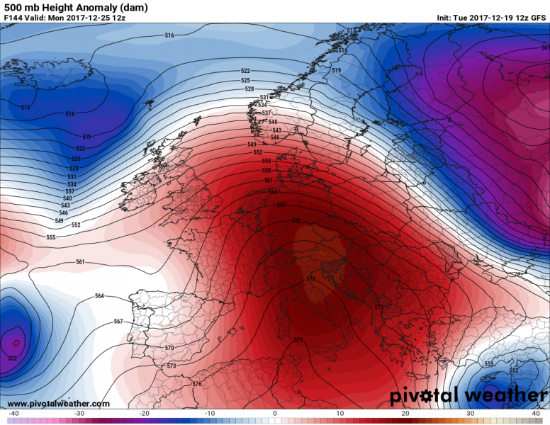
Let us take a look into early next week, precisely days around Christmas. Will there be white and cold weather for Christmas or will it be mild this time? Looking over the current global mid/long range models, trends are towards a powerful upper ridge dominating Europe this coming weekend into early next week. This means weather for Christmas (Monday, Dec 25th) should likely be affected by the ridge and high pressure system for many across the continental Europe. However, looking at the 500 mb geopotential map below, more dynamic weather can be expected across far NW Europe including Iceland, Faroe Islands as well as Scandinavia and NE Europe.
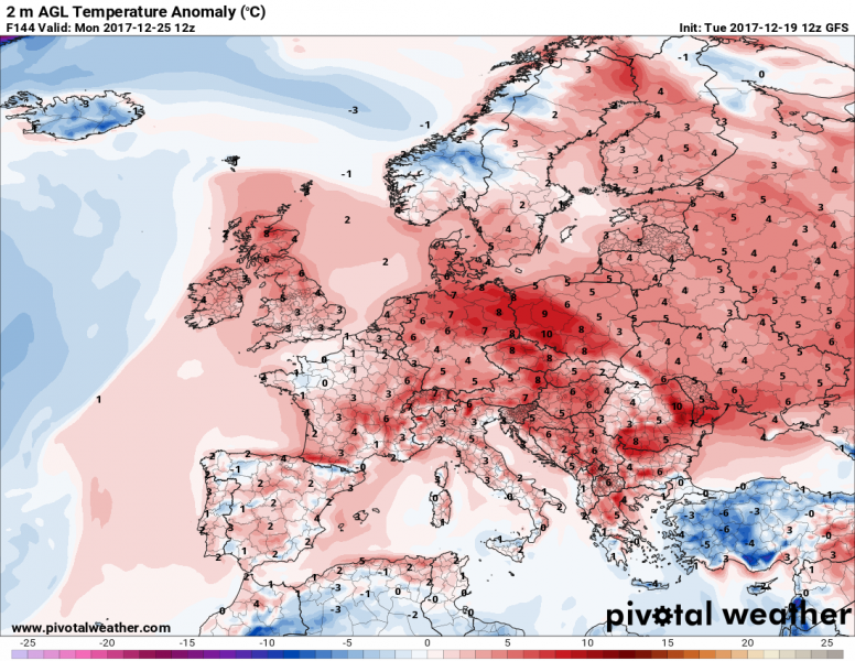
A closer look at 2 m temperature anomalies on Monday, almost the whole Europe should experience warmer than usual weather, with exceptions like Iceland, Turkey and parts of Norway where colder weather seems more likely. Central Europe and surroundings should expect quite unusually warm days compared with the the long-term average – locally 7-10 °C warmer!
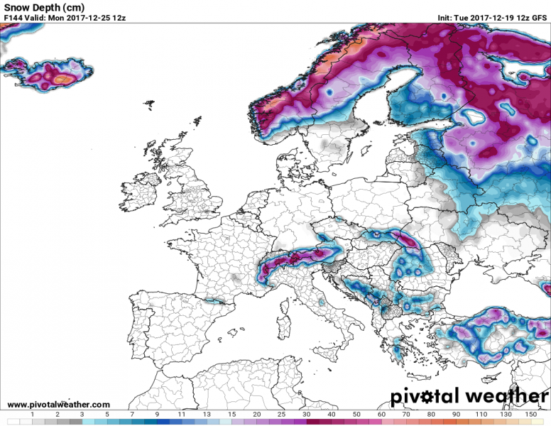
This might be a more interesting map to look at: snow depth on Christmas day – current model simulations hinting there will be a so much welcomed “white Christmas” across large part of north-central Scandinavia, far NE Europe, much of Iceland and of course over mountain ranges e.g. Alps, Carpathian Mountains and Pyrenees. While other regions should be without snow in majority. Indeed we are speaking about large scale patterns, but there could be some snow left on the ground from the latest events elsewhere.
We will have updates tomorrow evening, stay tuned!


