The south half of Europe is in for a period of very warm weather: temperatures will be well above average for mid-October, with some places pushing into low to mid-20s.
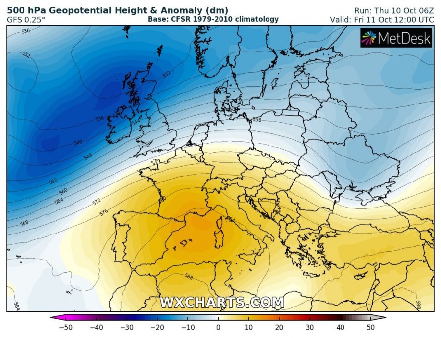
An upper ridge forms over the Mediterranean on Friday and slowly pushes eastwards into eastern Europe, where it persists until the beginning of next week. It brings very warm weather to the region.
500 mbar geopotential height anomaly across Europe until Tuesday. GFS model guidance. Maps: Wxcharts.
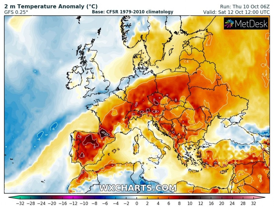
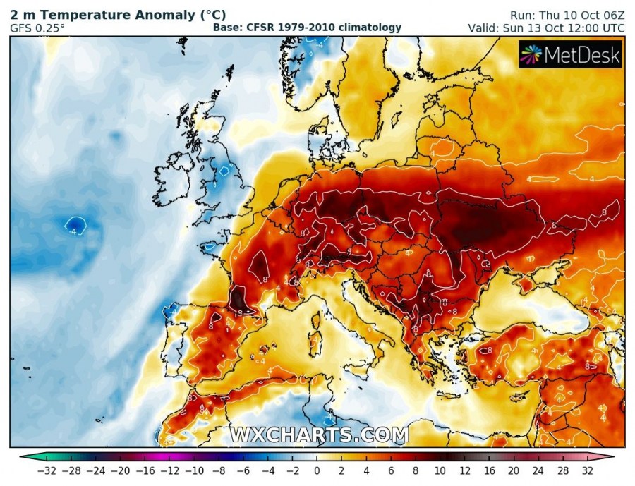
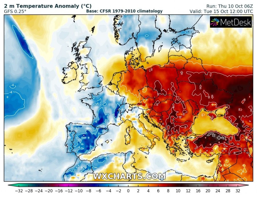
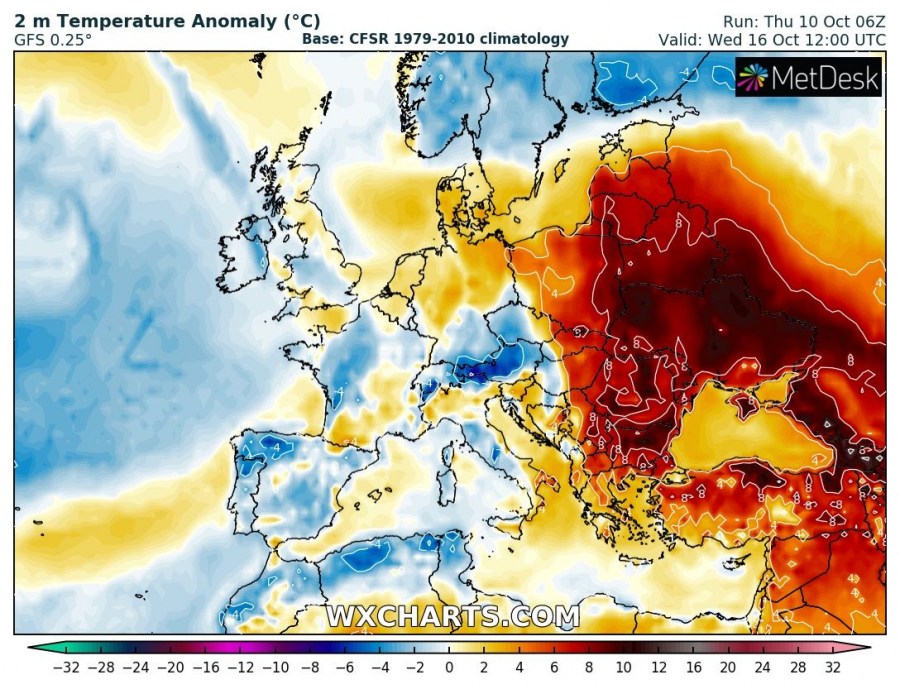
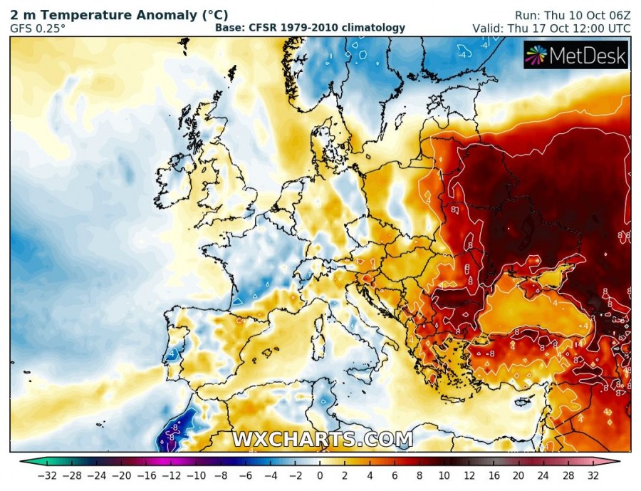
Warm weather across southwest, south, central, as well as eastern and southeastern Europe during the weekend with temperatures mostly 4-8 °C above average. Even warmer at the beginning of next week, about 8-10 °C above average across central, eastern and southeastern Europe!
2 m temperature anomaly across Europe until Thursday. GFS model guidance. Maps: Wxcharts.
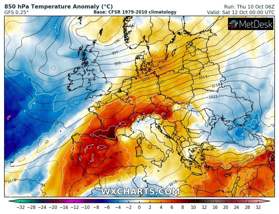
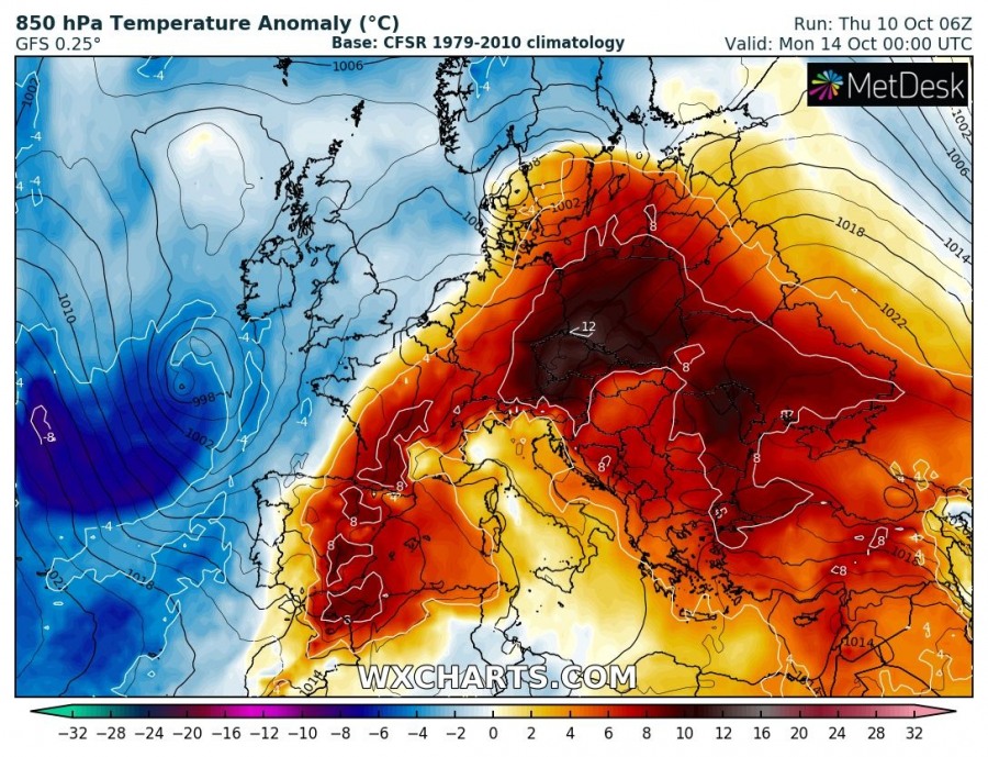
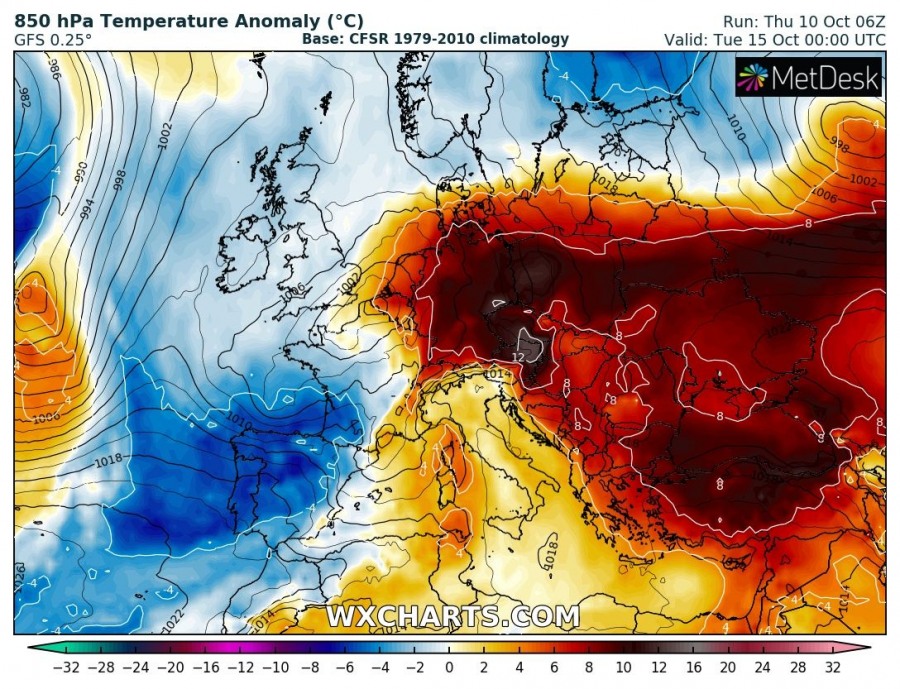
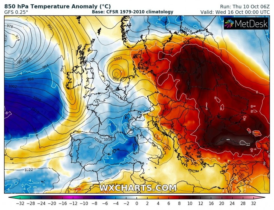
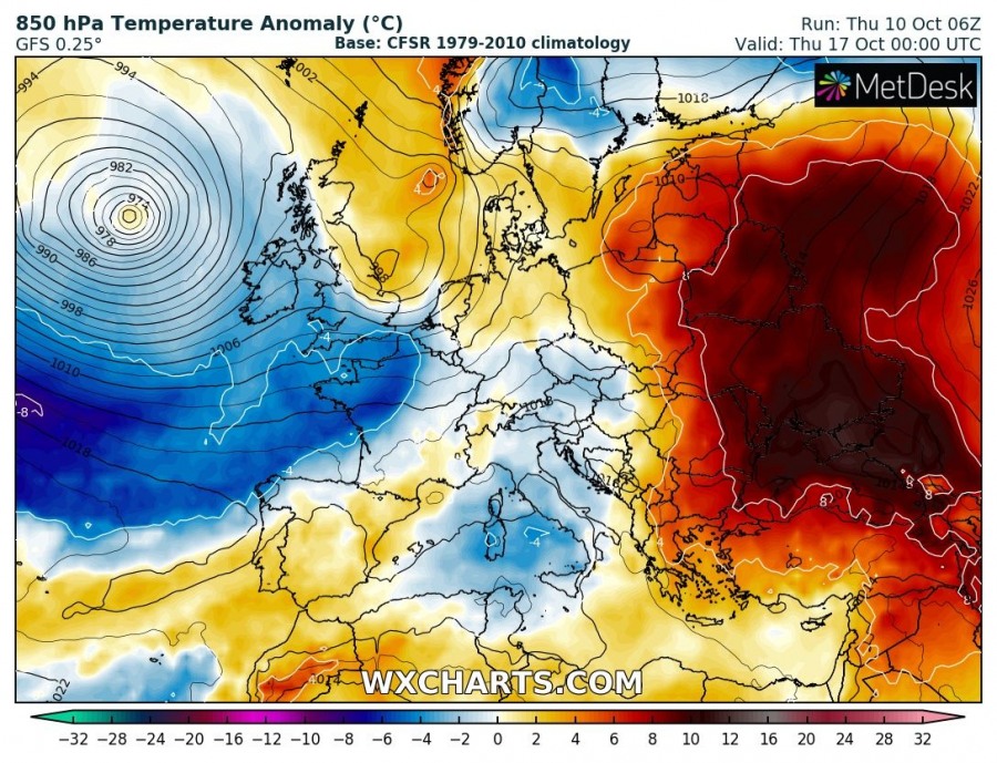
850 mbar level (~1500 m) temperature will be very high, far above average: up to 8-12 °C above average.
850 mbar temperature anomaly across Europe until Thursday. GFS model guidance. Maps: Wxcharts.
Stay tuned for updates as the pattern unfolds!
