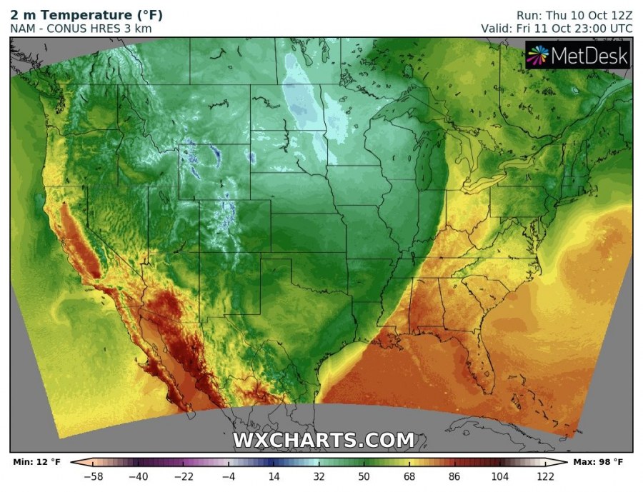
The sharp cold front and cold polar airmass is blasting across western USA today, pushing into the Great Plains. Some locations went from T-shirt weather to snow in a matter of hours! We take a look at first reports and forecasts for the next few days.
The cold front will move across the Great Plains towards the east and south in the next 24-48 hours, reaching the Gulf of Mexico and the Appalachians.
Surface temperature Thursday through Saturday. Note the sharp frontal boundary and the steep temperature gradient across the front! NAM – CONUS HRES model guidance. Map: Wxcharts.
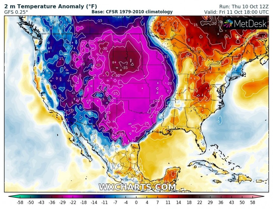
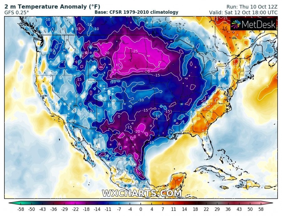
Temperatures will be well below average for the period. Latest GFS model guidance indicates temperatures 20-35 °F (10-16 °C) below long time average for this period. The airmass ahead of the front will be significantly warmer than average.
Surface temperature anomaly over the next 4 days. Temperatures will be far below average for this time! GFS model guidance. Map: Wxcharts.
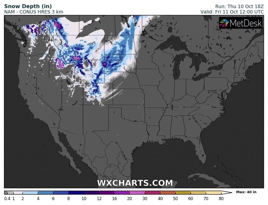
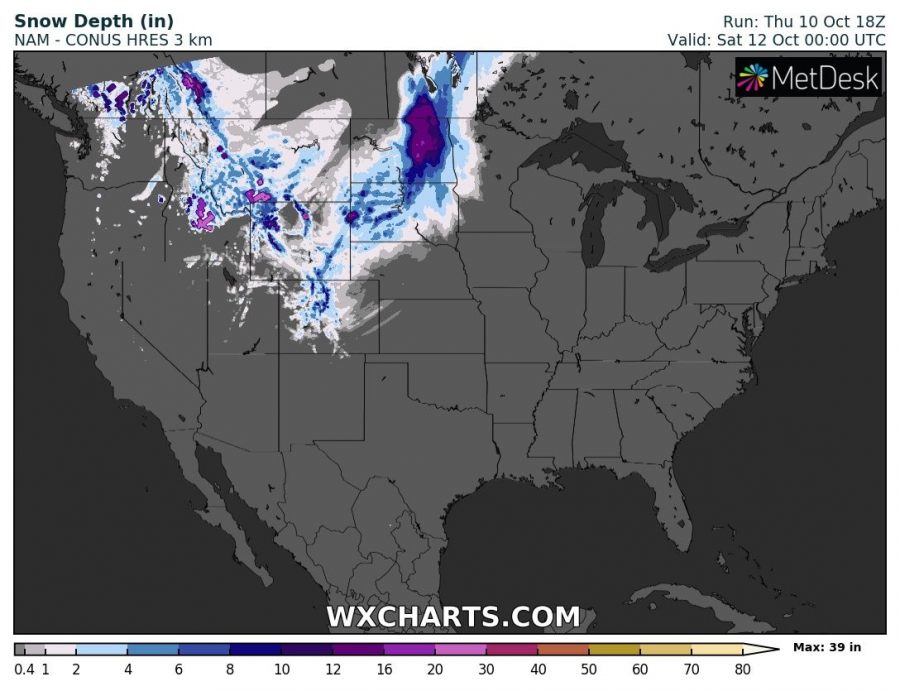
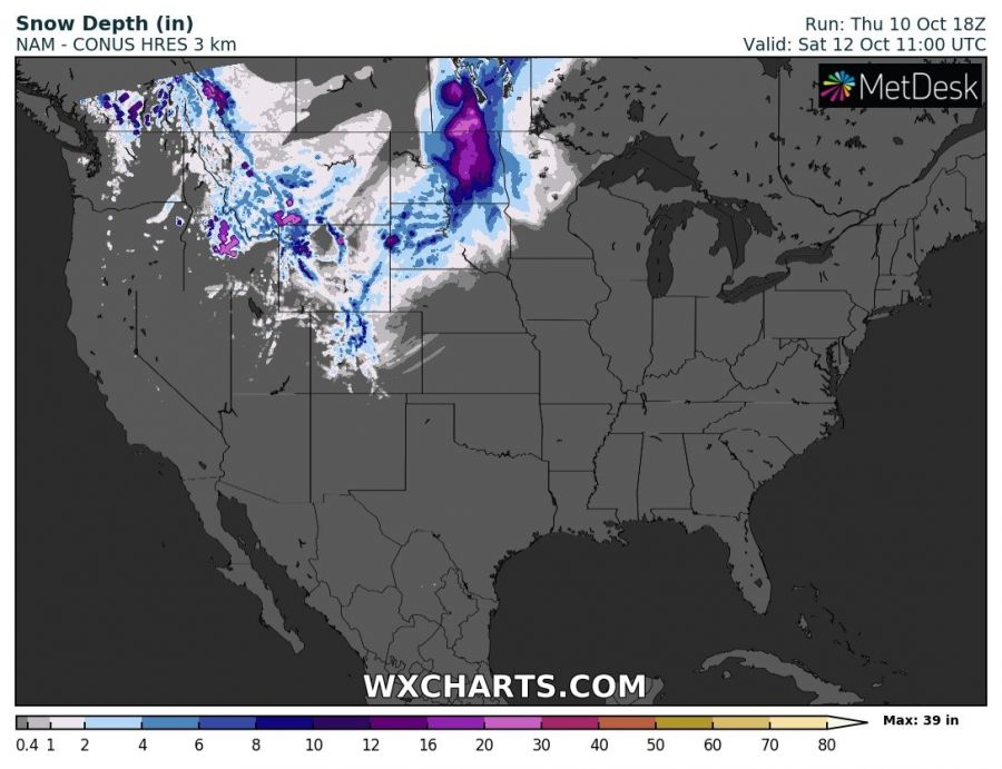
Heavy snowfall is expected across parts of South Dakota, North Dakota (USA) and Manitoba (Canada) in the next 24-48 hours. Total snow depth will locally reach above 10-12″ (25-30 cm), up to 20″ (50 cm). Expect blizzard conditions in some areas across the aforementioned states, as peak wind gusts reach 70-100 km/h.
Snow depth across the CONUS between late Wednesday (local) and Friday. NAM – CONUS HRES model guidance. Map: Wxcharts.
Stay tuned for further updates!

