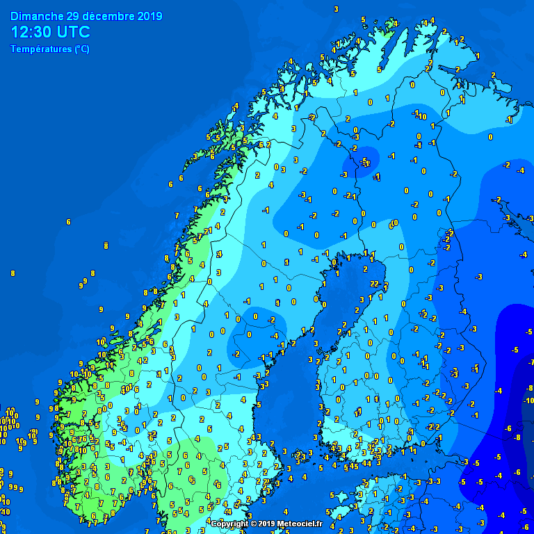
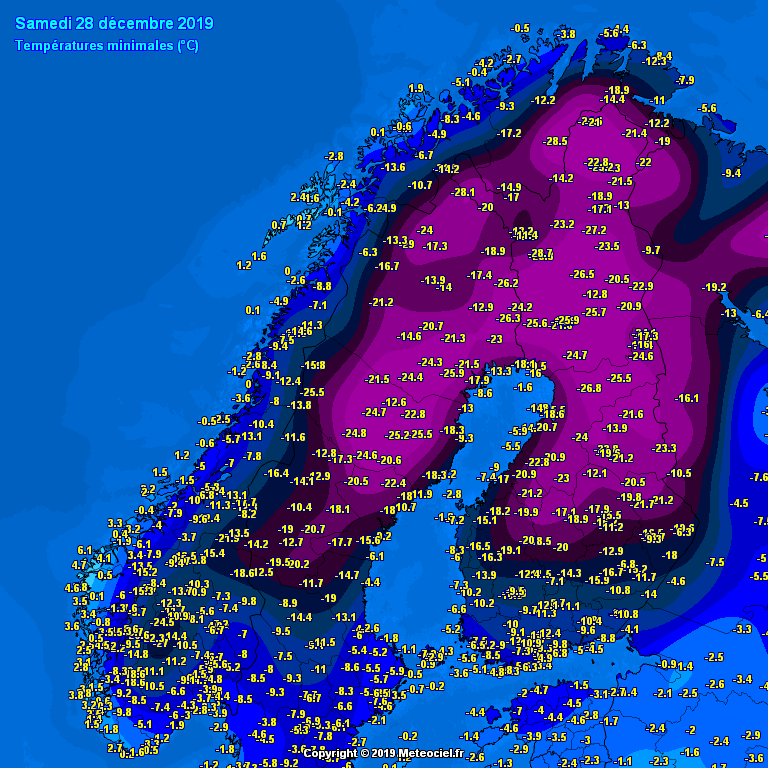
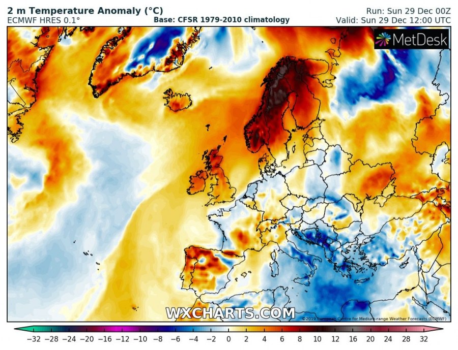
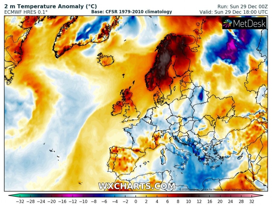
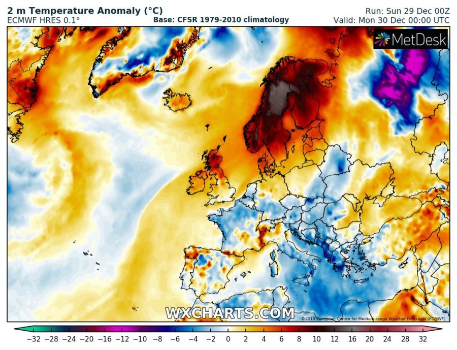
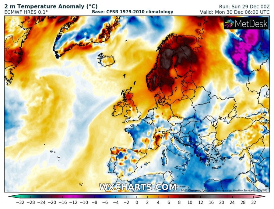
The dynamic pattern over North Atlantic lately is also pushing waves towards northern Europe, while extensive upper-level ridging is persisting over the rest of continental Europe. This weekend, strong westerlies brought a very strong warm advection into Scandinavia and temperatures warmed up for 20-30 °C in many areas compared to the past days!
Temperatures this afternoon compared to yesterday morning, Dec 29th vs 27th – notice parts of Lapland is almost 30 °C warmer compared to yesterday morning!
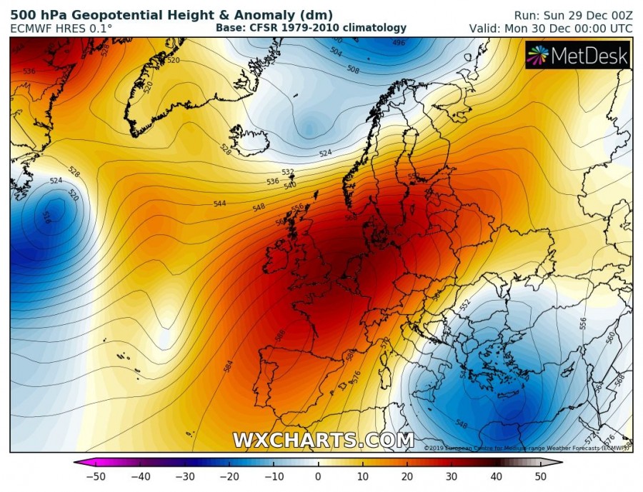
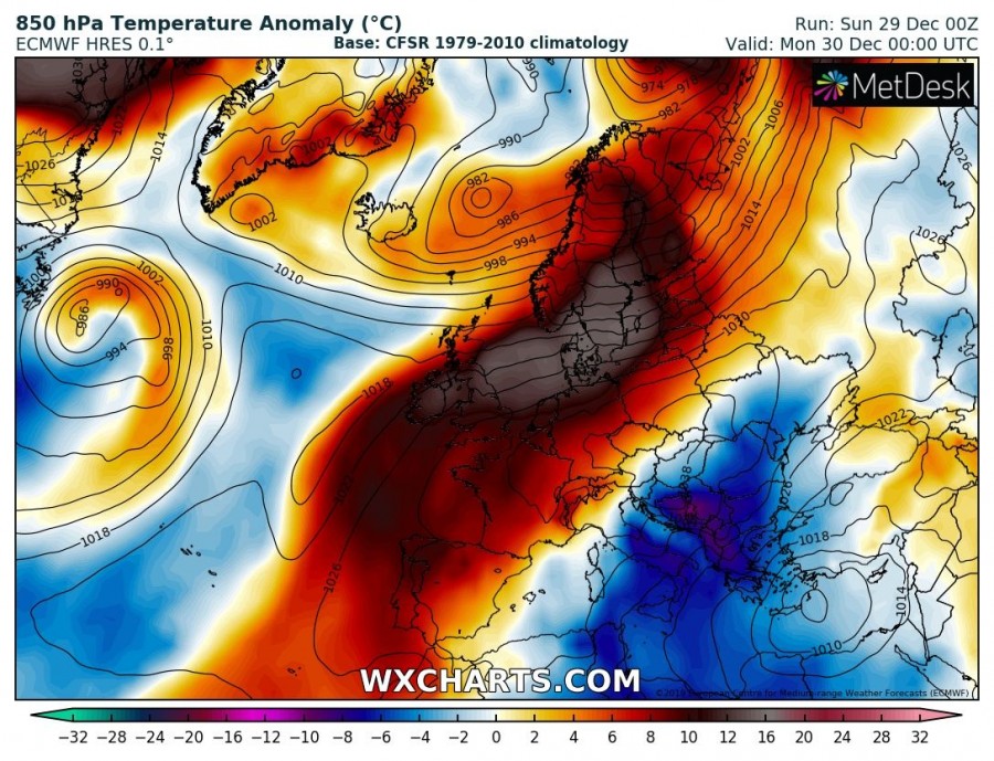
A powerful upper-level ridging is maintaining across much of Europe, centered over western Europe. Along its eastern flank, a large upper low is resulting in unsettled weather conditions and cold advection into SE parts of Europe and the Balkans. While on the northern part of the ridge, a short-wave is moving across northern Scandinavia. An extremely warm airmass is advection ahead of the surface low over the Norwegian sea, spreading into Scandinavia and towards the Baltic region.
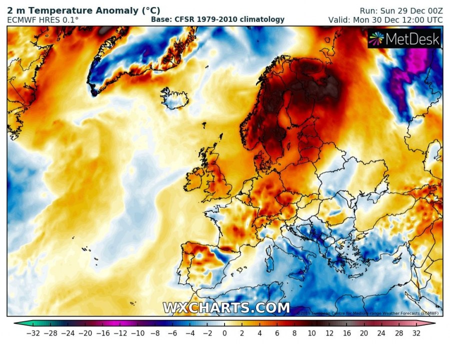
A very warm air mass is spread across much of Scandinavia, being 10-15 °C warmer than normal of the end of December.
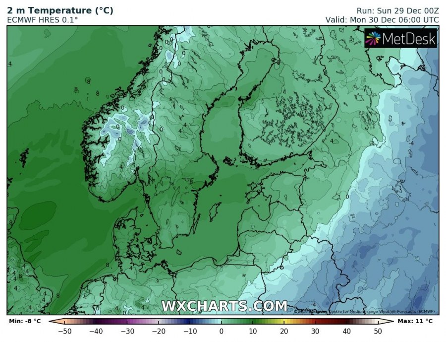
Most of Scandinavia will experience well above 0 °C temperatures for another 36 hours, so there goes the winter fairytale. Parts of Sweden and western Finland could even experience around +8 °C tomorrow morning!
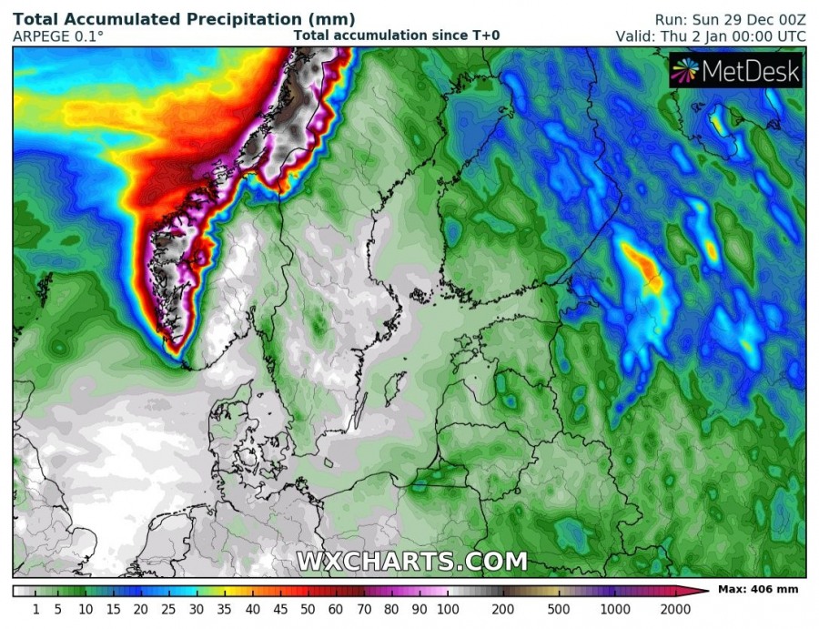
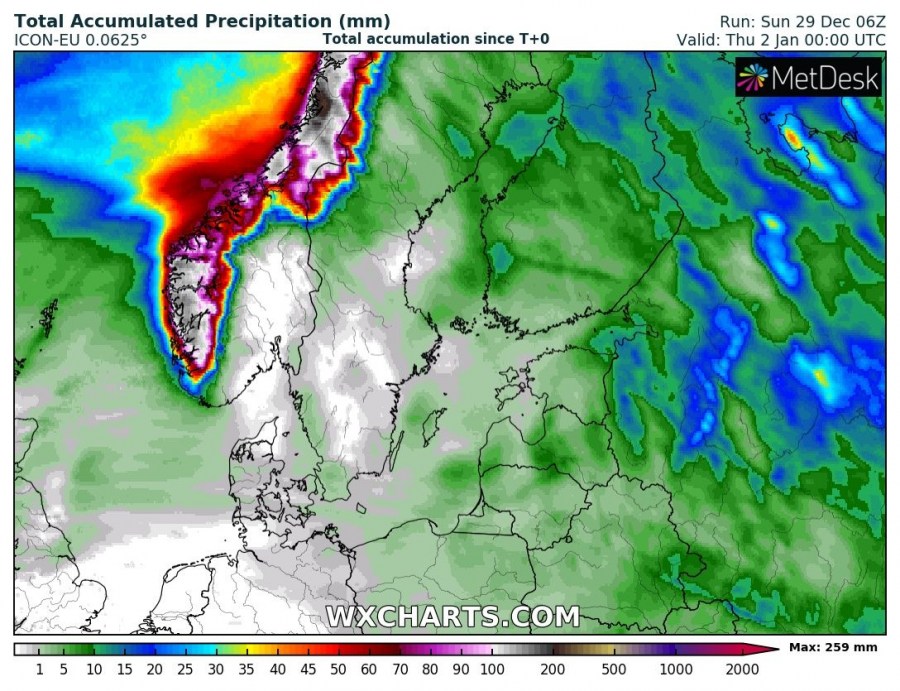
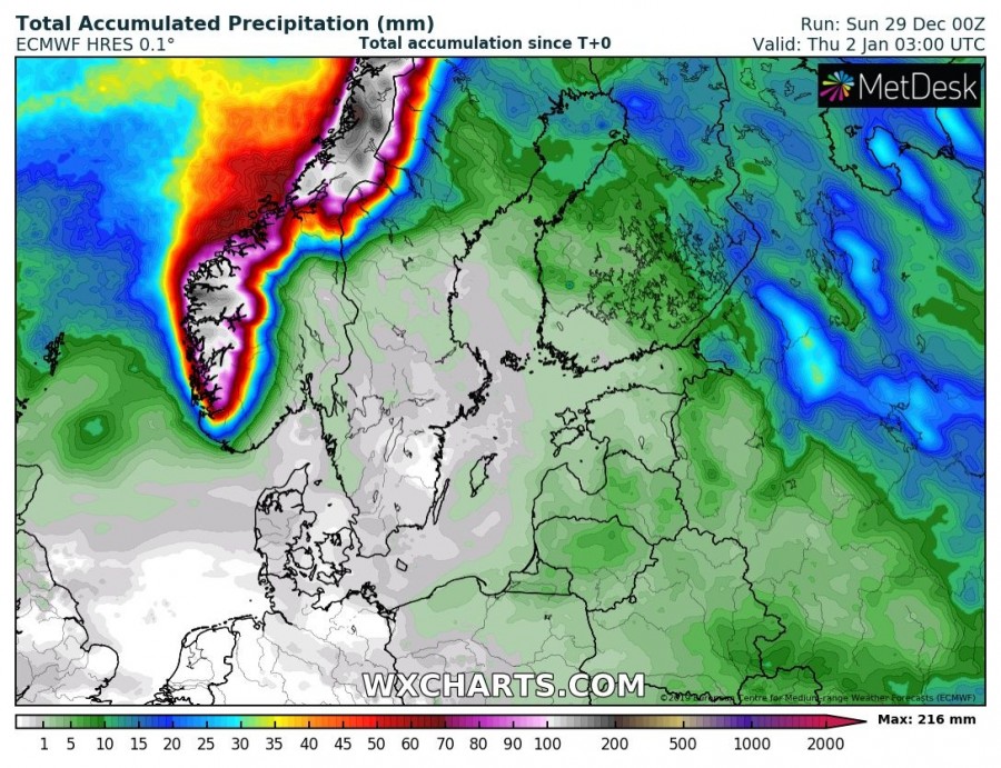
Another effect of such pattern is strong westerly flow along the northern flank of the ridge, advecting moist airmass into mountains of WSW Norway and resulting in a persisting strong orographic precipitation. Most of it will be excessive rainfall, while snowfall will be limited to the highest elevations only. Locally 250-400 mm is likely by Thursday.
However, much colder airmass returns soon, at least across Lapland, when a strong cold advection spreads in the wake of the wave ejecting on Tuesday.
Interested in our calendar? We are proud to present and promote the best weather photographers in Europe – see details:
