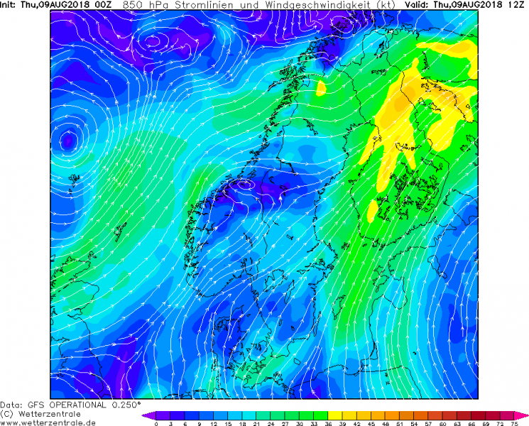
Another focus for today’s convective activity across Europe will be a part of Scandinavia where severe storms with damaging winds and tornadoes are likely this afternoon. While the northeastern Europe is under an extensive strong ridge, a short wave trough with a surface front slides across N Scandinavia on the western edge of the ridge. This allows a corridor of strongly shear environment and forcing for storm development across south-central Finland by mid-afternoon hours.
500mb chart across Europe reveals a strong jet stream rounding the large upper trough over E Atlantic while strong ridge is placed over ENE Europe. The tight pressure gradient between the two brings a strong shear across France, N Germany up across Scandinavia.
With all the heating across Finland over the past weeks, boundary layer thermodynamic environment across Finland is unstable due to enhanced moisture from the strong evapotranspiration from the vegetation as well as warmer lakes and the exceptionally warm Baltic sea. S-SW low-level winds are advecting additional moisture from the Baltic sea towards the north, which allows moderate instability to build up under the strongly sheared environment.
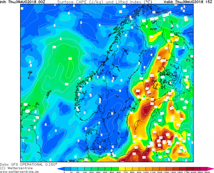
Looking at the MLCAPE map for today, the strongest instability is expected across south-central Finland, locally even well in excess of 1000 J/kg.
Storms are expected to initiate in the early to mid-afternoon hours when front pushes in. With the shear and moderate instability available, storms will organized into severe modes and intense, fast moving supercells are expected. The strong wind field with enhanced veering with height suggests the primary threats will be severe winds, large hail and also tornadoes as a couple hundreds m2/s2 of SR helicity will be in place due to SE component of low-level winds across central Finland. Clustering into larger system is possible across S Finland where weaker shear will be in place, storm initiation there seems also likely from the sea breeze convergence zone moving from the Baltic sea inland. Flash floods threat will exist with slow moving storms there.
Storms should gradually spread NE across Finland until the evening hours when they finally weaken as instability diminishes.
Another, more robust environment for severe weather exists over E France, W Germany and Benelux today, see details: Severe weather outbreak with damaging winds across large part of Germany today, Aug 9th


