A very extreme and rare early May (mid-spring) Arctic cold outbreak (note: Arctic outbreak means the airmass originates from the Arctic region) is shaping up for large part of Europe this weekend. A potentially dangerous pattern establishes across Europe with a powerful upper-level ridging over the Arctic region and the Atlantic ocean, resulting in a strong meridional flow of very cold Arctic airmass far south across western and central Europe towards the deep south Mediterranean and North Africa! Temperatures from May 3rd to 7th will be much lower than normal for this time of the year with a high risk for severe damaging morning frosts across many parts of east, central, western Europe and the Balkan peninsula through Sunday to Wednesday!
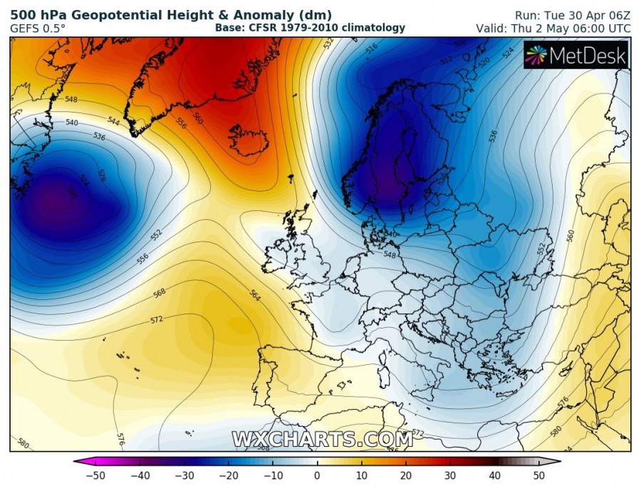
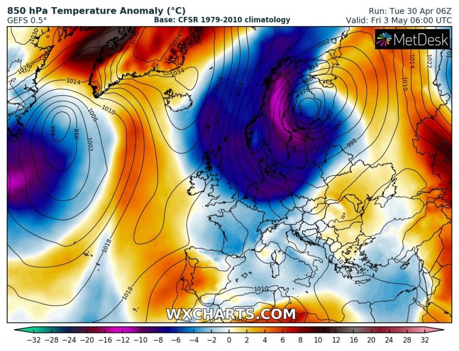
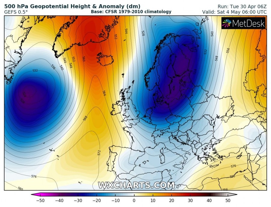
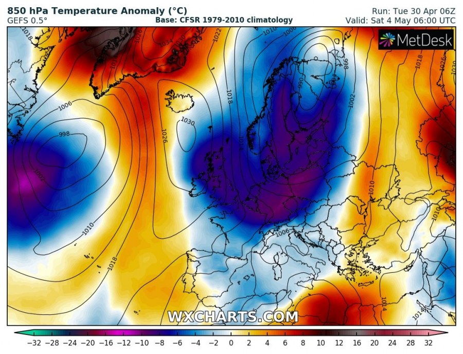
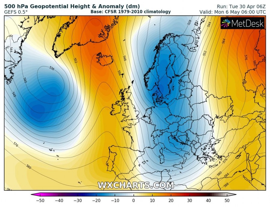
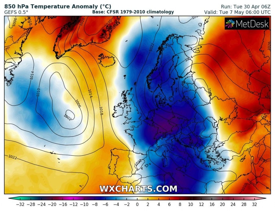
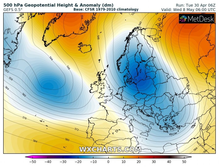
The cold outbreak starts off on Thursday over northern Europe as a deep trough advects from the Arctic Russia towards Scandinavia. Strong upper ridging with high pressure system persists across Greenland and further north towards the North Pole. This allows the trough’s track directly SSW into Europe. Attached are day-to-day maps of 500 mbar geopotential height and 850 mbar temperature anomalies, indicating just how significant the outbreak of cold airmass will be.
Thursday – A deep trough with much colder airmass enters Scandinavia while cold airmass spreads also towards the North Sea, Denmark and the British Isles.
Friday – a very deep upper trough / very cold core low develops over Scandinavia while a significant cold advection continues south and reaches France, south Germany, Czech Republic, Slovakia and south Poland.
Saturday – the core of the upper low over Scandinavia weakens, but the low itself expands towards central Europe, so the significant cold outbreak continues south. Arctic airmass spreads across the Alps into the north Mediterranean and north Balkan peninsula with a strong surface cold front, likely resulting in snowfall at very low elevations.
Sunday – now the long-wave trough digs further south into the Mediterranean, while ridging strengthens over western Europe, resulting in a strong high-pressure system there. Arctic airmass continues across the Mediterranean and reaches deep south overnight to Monday.
Monday/Tuesday/Wednesday – the large upper trough is affecting most of east, central and south Europe, resulting in additional strong cold airmass advection towards north Africa, south and east Mediterranean. Very cold weather remains over central and eastern Europe with significant frost danger!
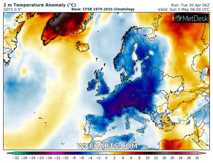
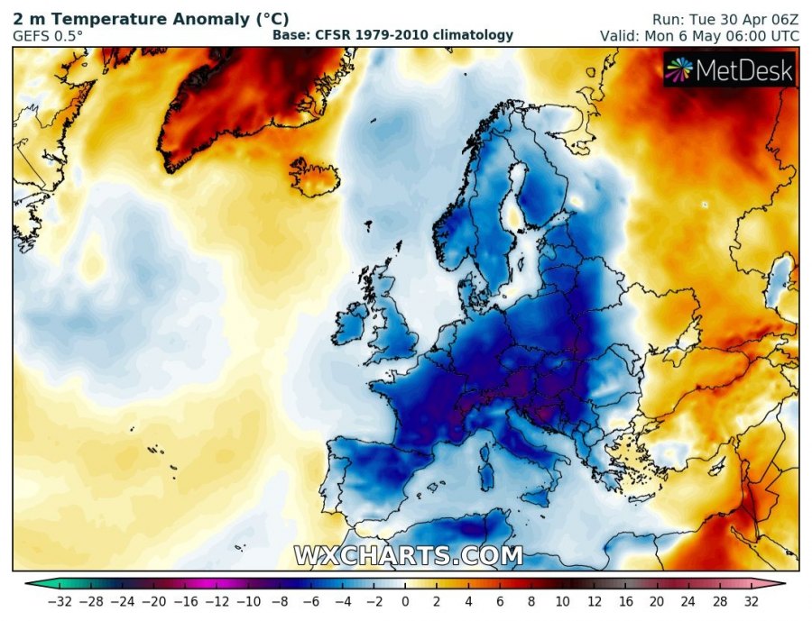
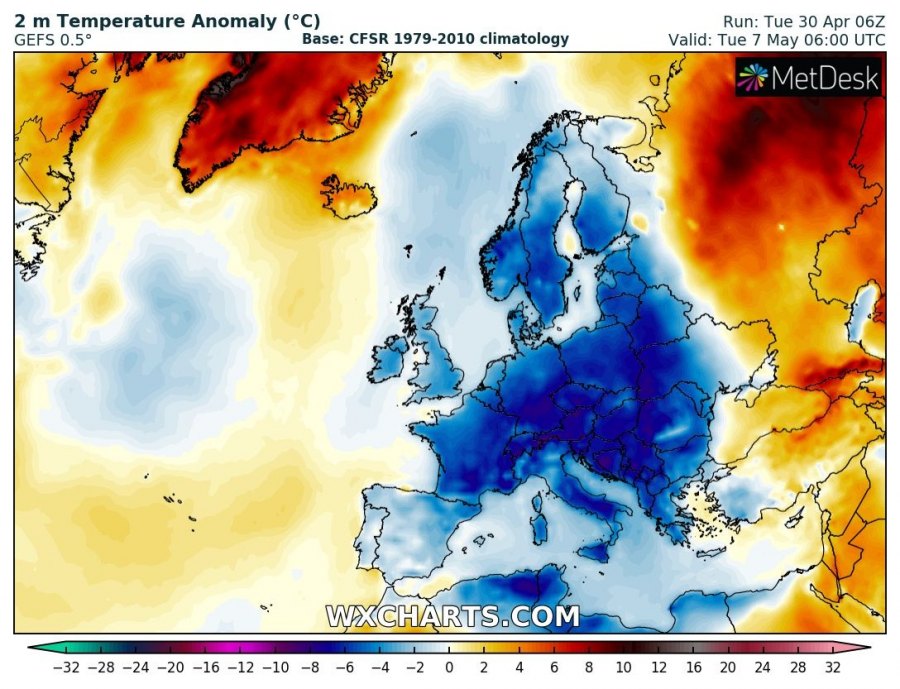
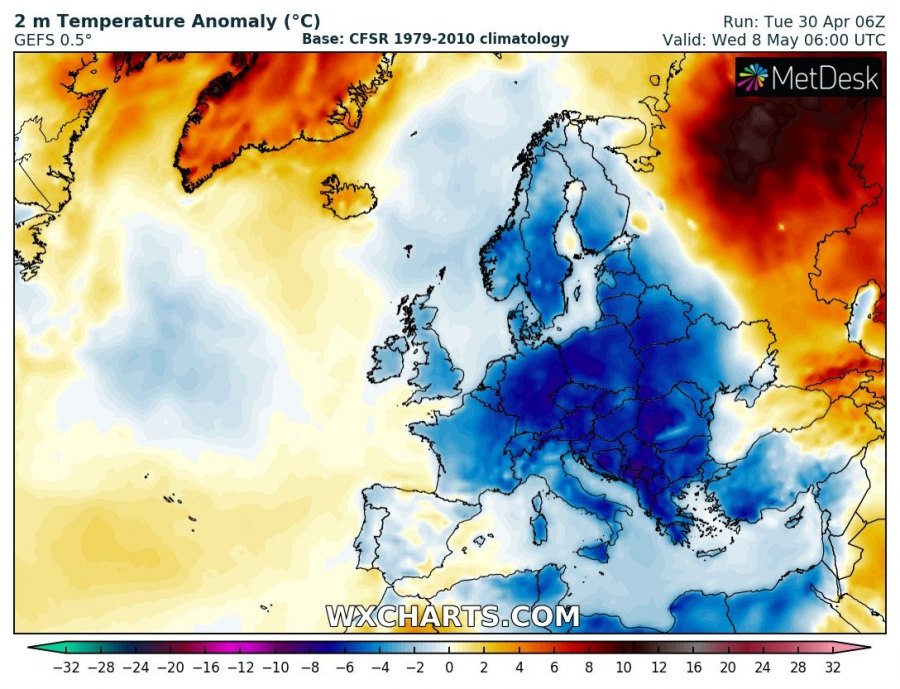
2 m temperatures anomaly across Europe through Sunday to Wednesday. A very large part of Europe should experience significantly colder weather than normal for early May with a high risk for damaging morning frosts threatening agriculture and vineyards across France, Germany, north Italy, Slovenia, Croatia, Czech Republic, Hungary and Slovakia.
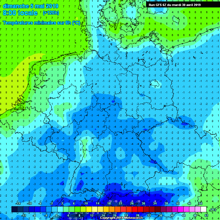
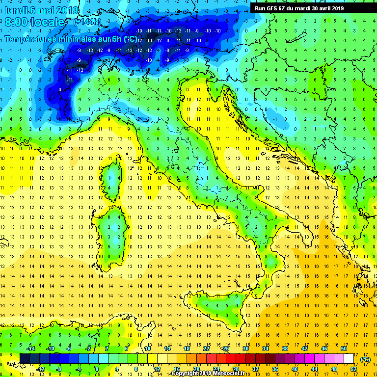
Minimum temperatures across many lowlands in Europe could dip well below zero as the GFS model is hinting at. France and Germany are well exposed to a significant morning frost danger through Sunday to Tuesday. Also significant morning frost danger for the Balkan peninsula across parts of Slovenia, Croatia, Bosnia and possibly also some plains across northern Italy.
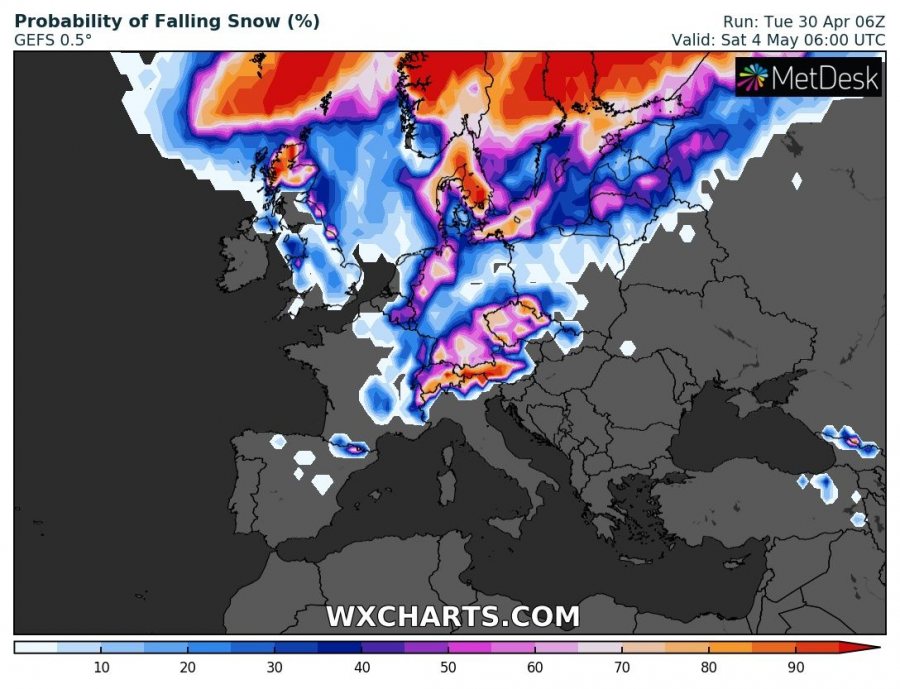
An interesting view of snow probability across Europe map for Saturday and Sunday mornings.
Saturday – quite good chances of snowfall across parts of Germany, Czech Republic, England, Scotland, Denmark and indeed across the Alps. Some chances also over Benelux, east France and Pyrenees.
Sunday – fresh snow should be quite likely across the Alps, Slovenia, Austria, Slovakia, parts of Croatia, Bosnia, north Italy, ESE France and Pyrenees.
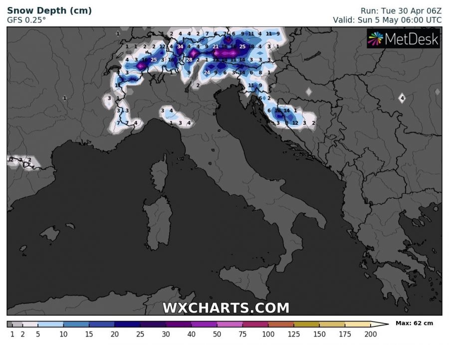
A very strong surface cold front is expected to cross the Alps, northern Balkan countries and north Italy overnight to Sunday with very low snow limit. Models are indeed hinting at quite some fresh snow over south Germany, Austria, north Italy, Slovenia, northwest Croatia and Bosnia and Herzegovina.
It appears likely a significant Arctic outbreak will develop over Europe this weekend and result in a high risk danger for severe morning frosts across many parts of Europe. Stay tuned for additional details in the coming days!
