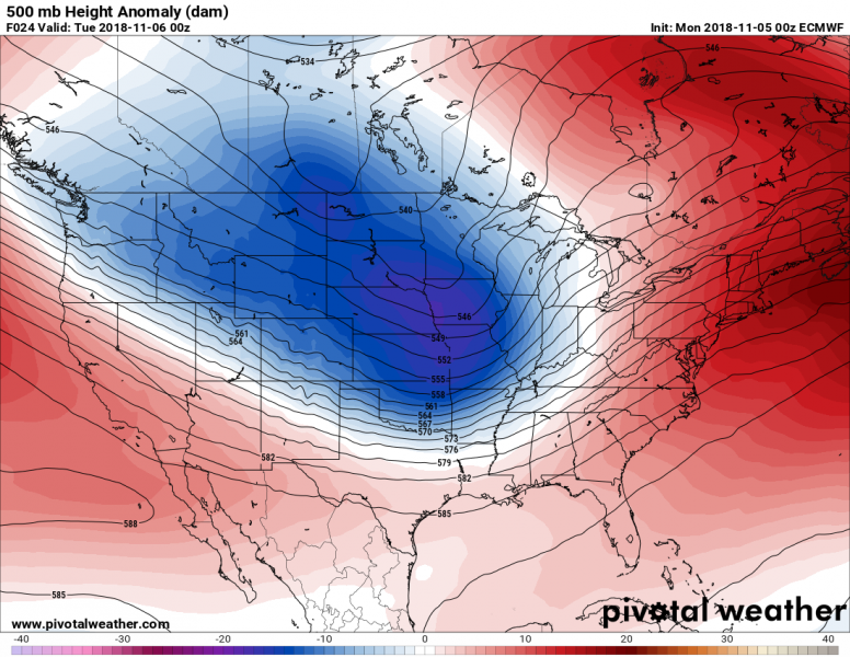
While the European continent will be experiencing an unsually warm early November pattern, the North American continent (both Canada & United States) are in for a significant Arctic cold outbreak this week. A very sharp cold front will push across the continental US after Tuesday and bring much colder airmass across the Midwest and East coast, and also into the southern US.
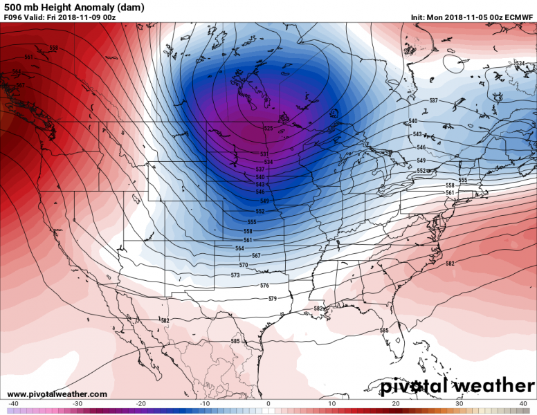
The pattern that is currently establishing is defined by a very strong upper ridge developing across the N Pacific ocean and Northwest US, while a deep trough pushes from Canada towards the SE across the Midwest and Great Lakes. This brings very cold airmass far south across most of the eastern two thirds of the continent by mid to late this week.
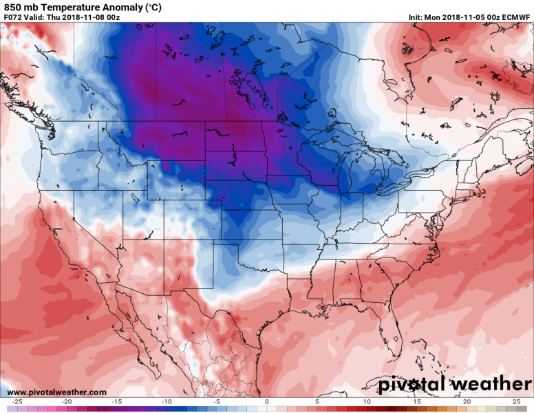
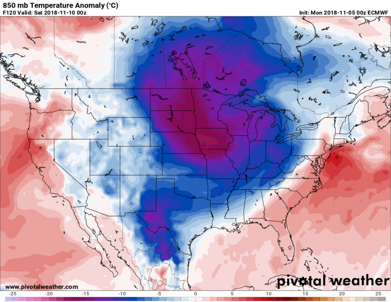
Airmass 15-20 °C colder than average will move over the Northern plains by late Tuesday and Wednesday, continue towards south-southeast towards the weekend and reach south/southeast US on Saturday. The main cold front will likely bring an outbreak of severe weather across the so-called “Dixie Alley”, which often brings dangerous storms and tornadoes.
Trends for mid November suggest the pattern will remain similar for North America – this usually means no significant changes also for the European continent. So we can expect the warm weather across Europe to continue – see details:
Weekly pattern across Europe overview – unusually warm weather continues (Nov 5 – 12th)


