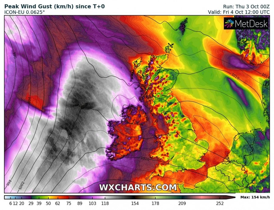
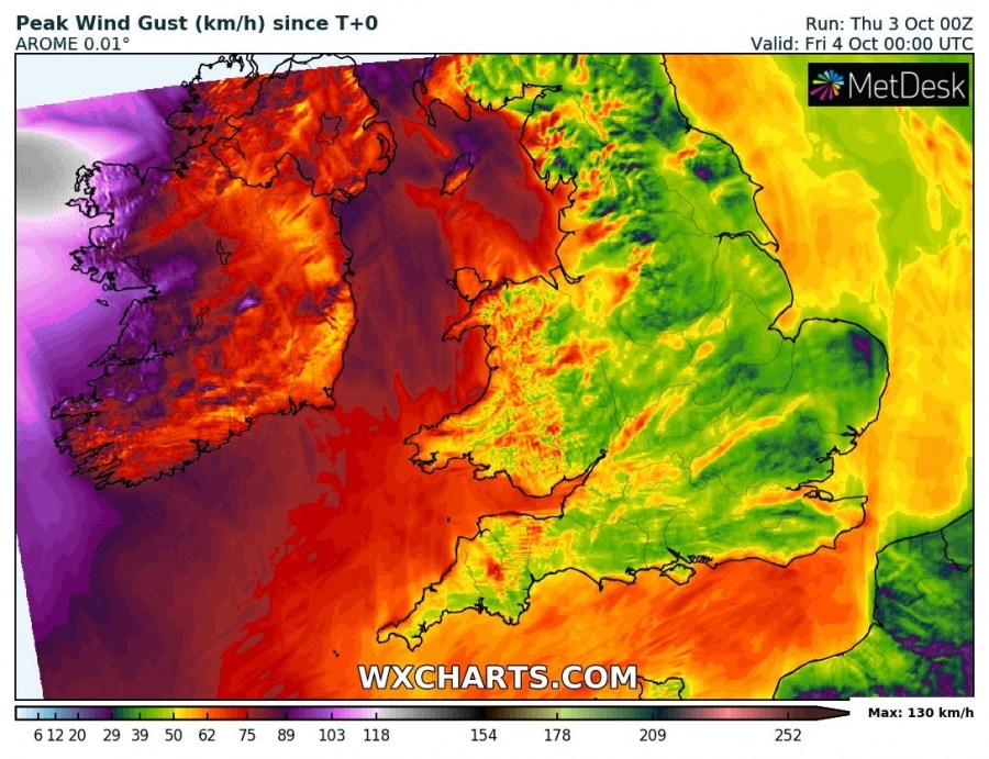
Ex hurricane Lorenzo will be impacting Ireland today as a post-tropical storm. Intense winds and extremely dangerous large waves are expected in parts of Ireland.
Post-tropical storm Lorenzo will track across Ireland today. The system will track northeast across the Atlantic west of Ireland, then sharply turn ESE late in the day and track across Ireland tomorrow morning. It will remain a deep system while over the ocean, likely bottoming out at ~970 mbar central pressure and rapidly fill by the time it reaches Ireland, likely to around ~990 mbar.
Expect peak wind gusts along the western coast of Ireland to reach into 120-140 km/h, with many locations along the coast reaching 100 km/h and above.
Also expect major waves to hit the southern, northern and in particular western coast of Ireland. Significant wave heights in 5-7 m range are expected along the northern and southern coast, while significant wave height up to 7-10 m is expected in exposed areas along the western coast. Maximum wave height may exceed 12-15 meters!
This is a potentially very dangerous storm. While peak winds will likely be in the typical range for autumn deep lows that impact Ireland annually, waves will be very dangerous. Stay out of potentially dangerous situations!


