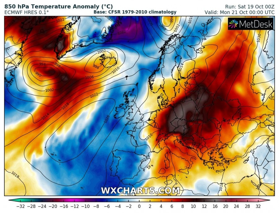
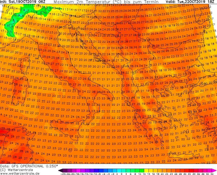
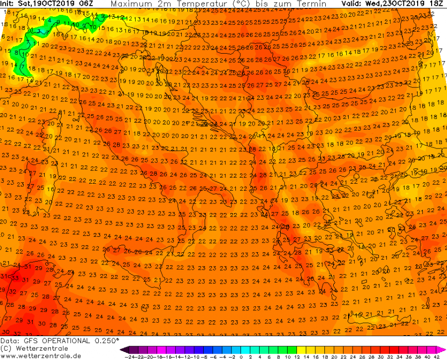
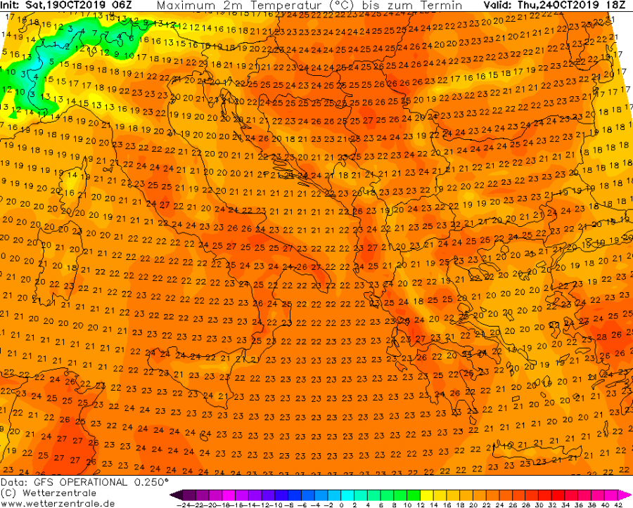
The current unusually warm pattern for mid-October is far from finished. The blocking ridge over east-central Europe should intensify and bring another week of extremely warm days for late October, with afternoon temperatures locally climbing into 26-29 °C range!
Monday, Oct 21st
The upper ridge across the eastern half of Europe and expands into the Mediterranean while deep trough persists over the SW Europe. It develops an intense SW jet-stream in between, resulting in the extreme rainfall event towards the Alps. This setup also intensifies warm advection from the Mediterranean towards central Europe and the Balkan peninsula.
Tuesday, Oct 22nd
Upper ridge over continues intensifying over the Balkan peninsula and E Europe, resulting in extreme temperature anomaly across the northern Balkans towards Poland. 850 mbar (approximately 1200 m ASL) temperatures should be 12-16 °C above normal for this time of the year.
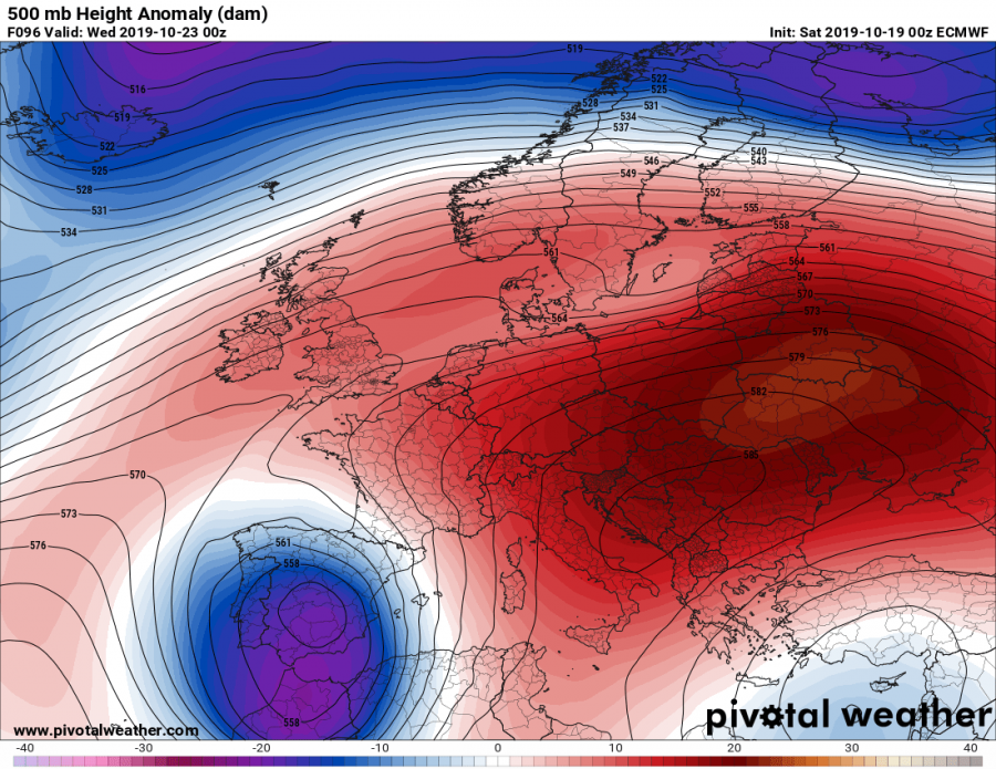
Wednesday, Oct 23rd
The similar pattern continues through mid-week while the warmest airmass advects into far ENE Europe and W Russia. The upper low over SW Europe and Iberia intensifies as well.
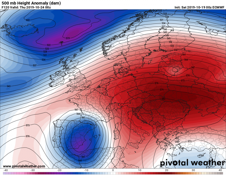
Thursday, Oct 24th
As a result of intensifying upper low in SW Europe and W Mediterranean, an extreme warm advection establishes towards central Europe and the warmth intensifies. Unusually extremely warm airmass strengthens over the Alpine region as well, pushing 850 mbar temperatures close to 15 °C above normal!
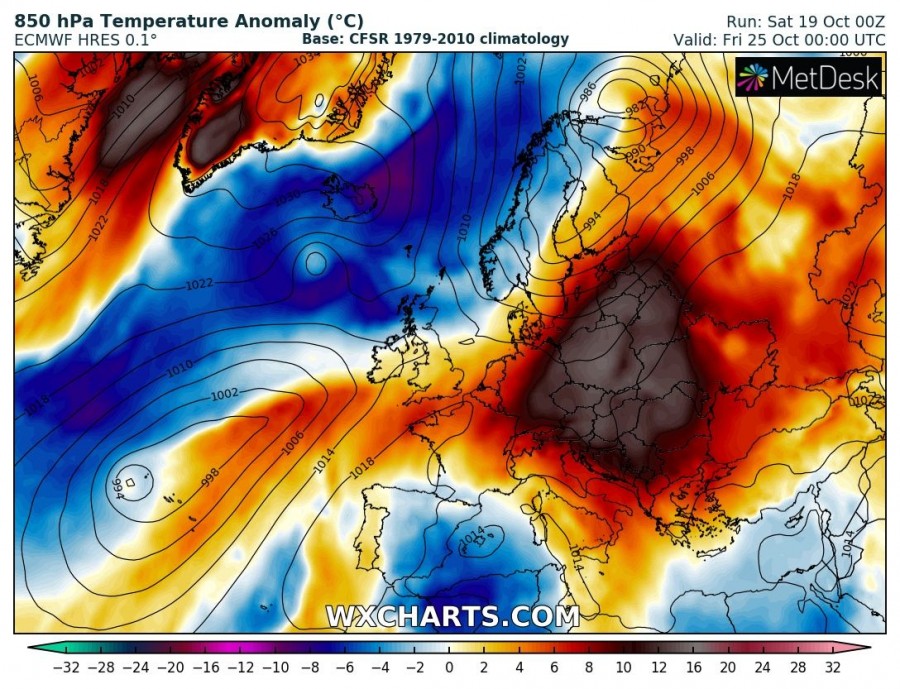
Friday & Saturday, Oct 25th & 26th
It seems likely the upper low over the W Mediterranean finally begins weakening towards the next weekend, resulting in decreased warm advection towards east-central Europe. However, strong riding persists across the eastern half of Europe and extreme warmth continues across the eastern Europe and the Balkan peninsula into the weekend.
The highest temperatures are expected the Mediterranean (Italy) and the Balkan peninsula where locally peak afternoon temperature should push into upper 20s. Would not exclude some locations might touch the ‘hot day’ threshold and reach +30 °C, especially over S Italy, Sardinia and central Balkans (e.g. E Croatia, NE Bosnia, N Serbia) if some downslope dry Foehn winds develop.
Stay tuned for additional details in the coming days!
See also:

