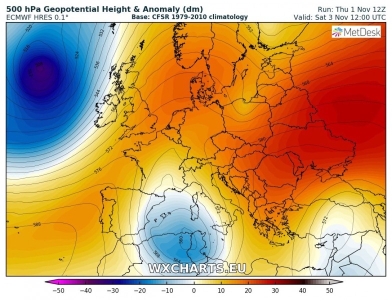
It seems the current pattern will continue to bring some extreme anomalies – likely record-breaking warmth is shaping up for the central Balkan and eastern Europe this weekend. Models are in good agreement of very warm airmass advection into the region and result in afternoon temperatures in excess of 25 °C. Some high resolution models are even trending into the upper 20s!
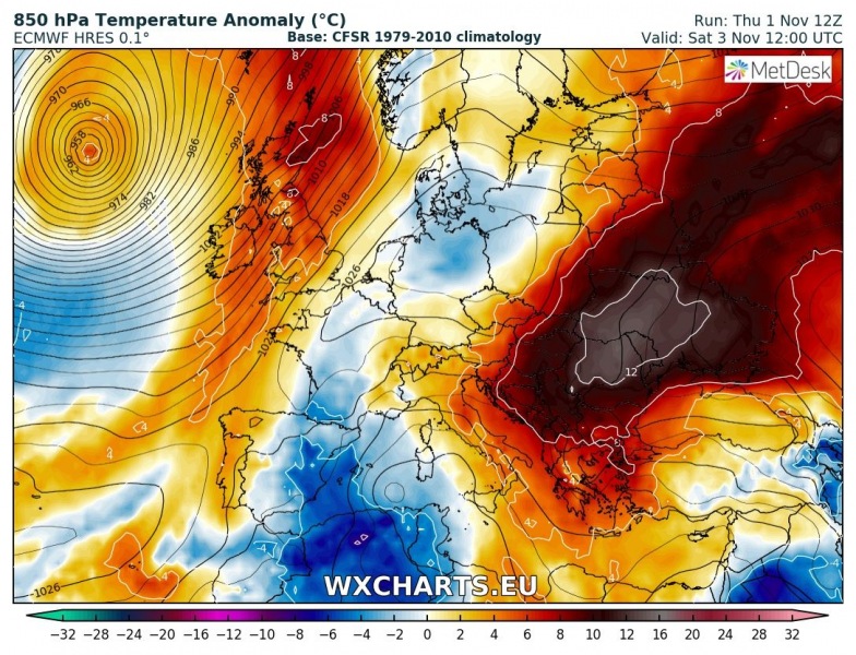
The pattern across our continent indicates an extensive ridging pattern, with a deep upper low over the Mediterranean. This should result in strong warm airmass advection into the Balkan peninsula from the warm southern Mediterranean. Based on the 850 mb temperature anomaly map, we could expect more than 10 °C warmer airmass than average.
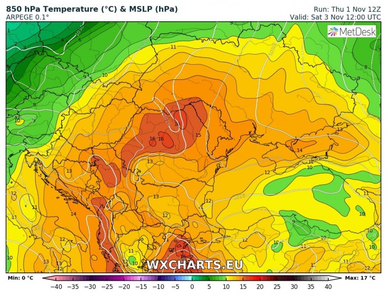
850 mb temperatures are very extreme for early November, at around 14-16 °C. The simple extrapolation for near surface temperature suggests we could may well seeing peak afternoon temperatures well in excess of 25 °C threshold!
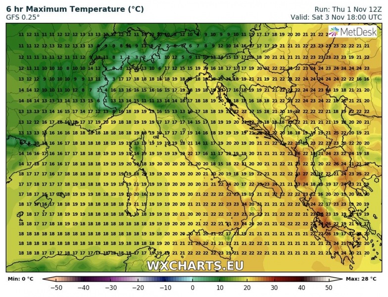
Peak afternoon temperatures on Saturday, Nov 3rd per GFS and ARW models: ARW model is indicating max values up to 27-28 °C which would likely break all-time records across eastern Croatia, northern Serbia, southern Hungary and western Romania.
We will be updating the forecast with new model data tomorrow if trends will change significantly – stay tuned!


