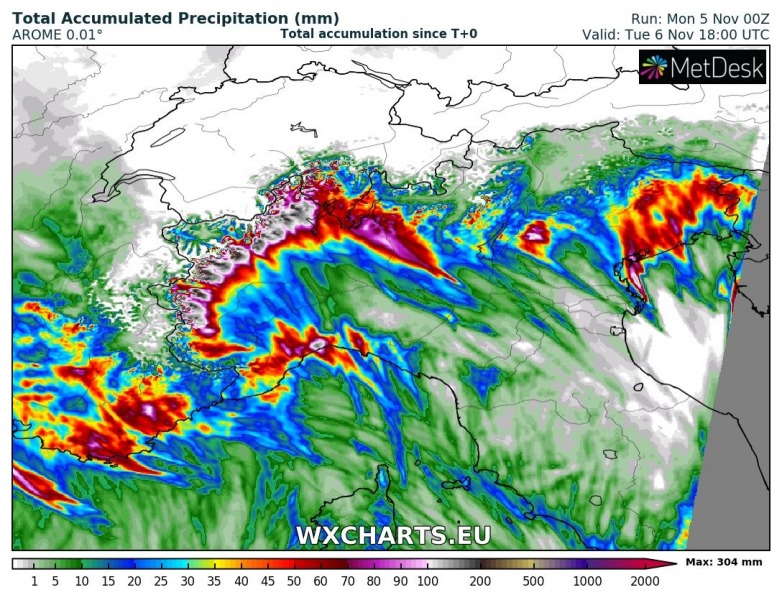
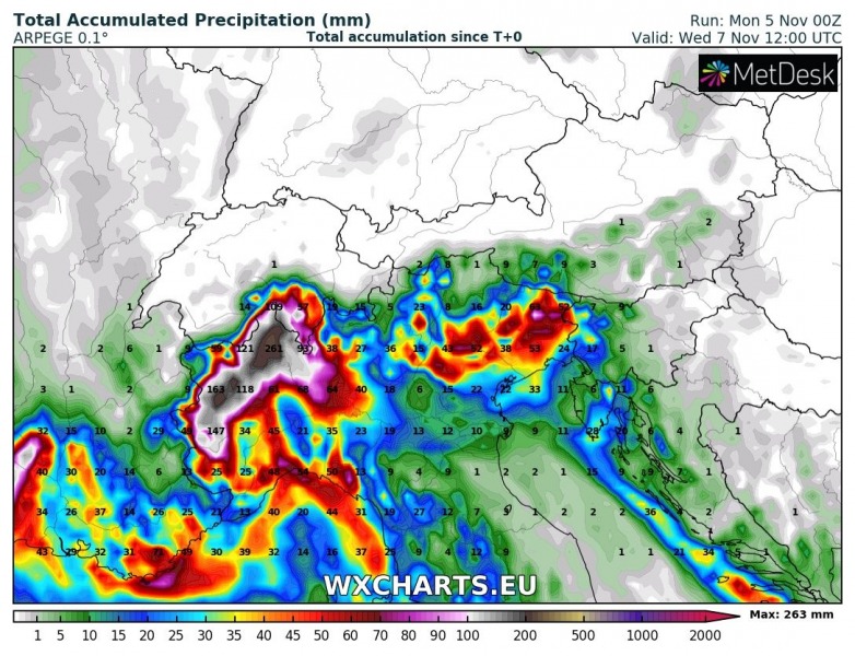
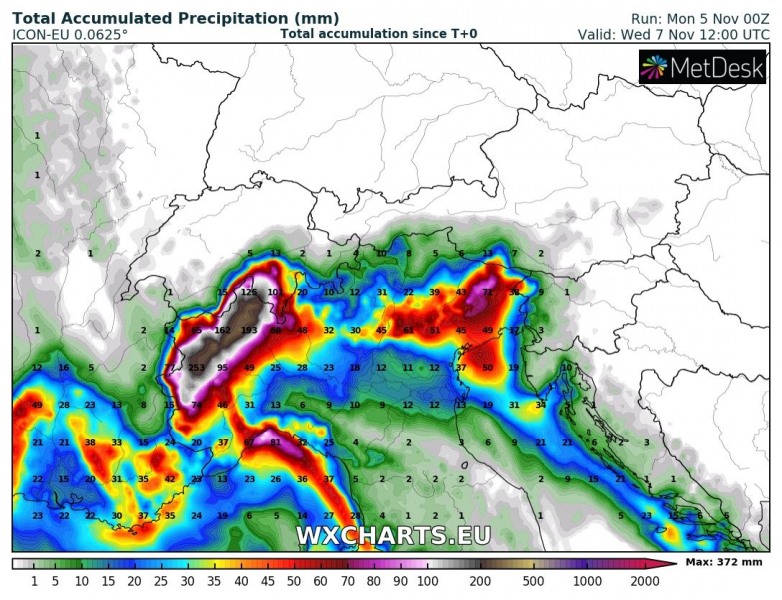
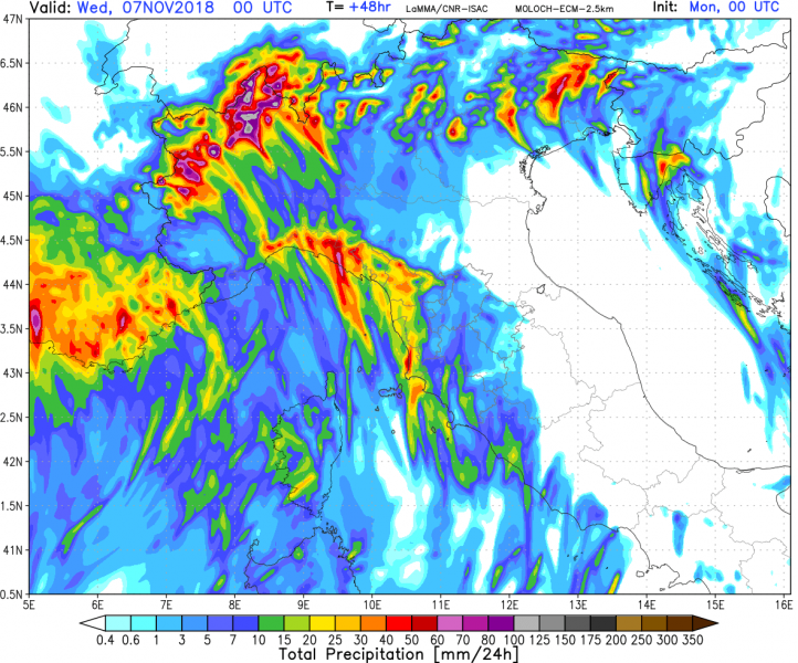
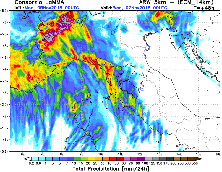
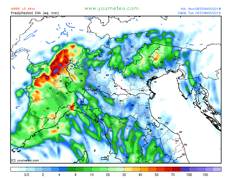
Northwestern Italy is in for yet another round of torrential rainfall over the next 48 hours. Rainfall totals of up to 200-300 mm are expected locally, and at higher elevation over 100 cm of fresh snow is expected. We take a closer look.
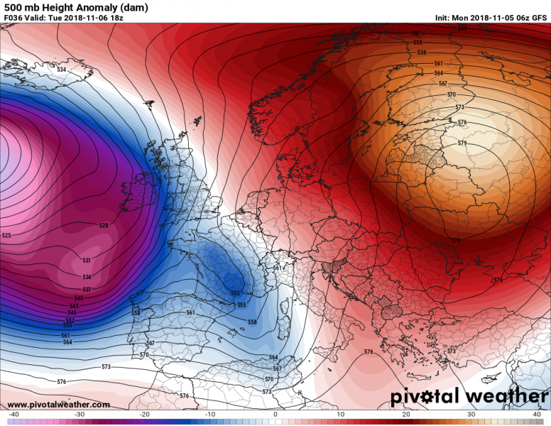
The region will be under the effects of a new cutoff low (yet another one), which will slowly move from the Iberian peninsula / western Mediterranean eastward towards Italy, slowly transforming into a longwave trough. Strong southerlies and southeasterlies will again advect warm and moist airmass from further south in the Mediterranean. It will bring another round of combined convective and orographic rainfall: the latter will be dominant, only low to moderate instability is expected. The main rainfall will occur along the southern Alpine flank in NW Italy, beginning late today and persisting until early on Wednesday. The frontal boundary with an expected squall line will pass NW Italy and the Ligurian sea likely late on Tuesday. Intense rainfall is expected, however, the severe potential of thunderstorms will likely be limited by very modest CAPE (mostly below 500 J/kg).
500 mbar height anomaly across Europe late on Tuesday. Map: Pivotal Weather.
Further significant flooding is expected, particularly as the ground is still saturated by rainfall over the past days and weeks.
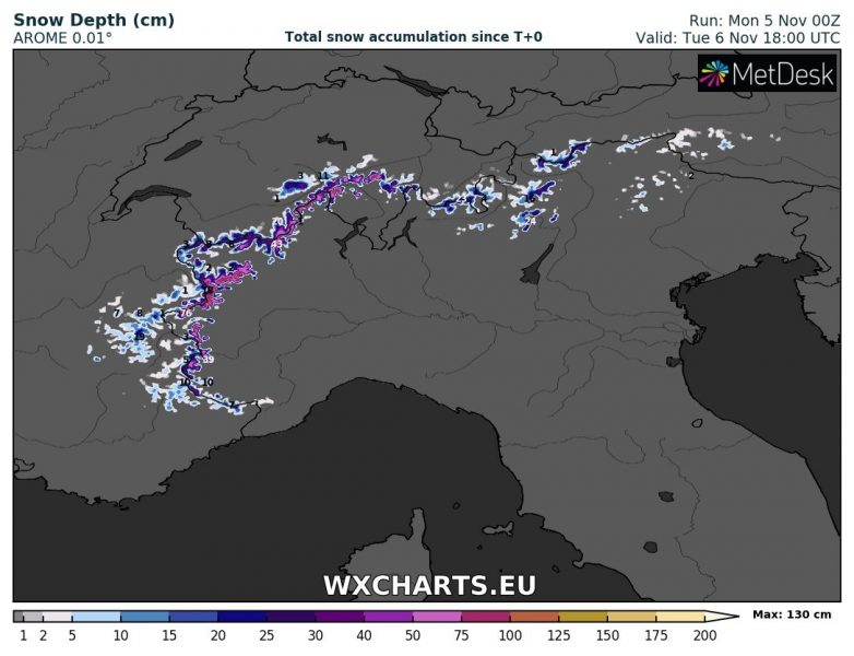
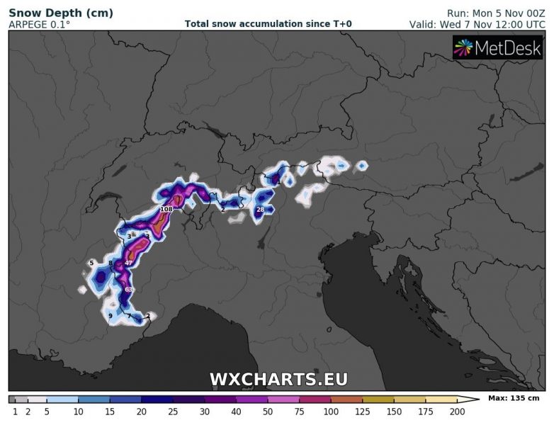
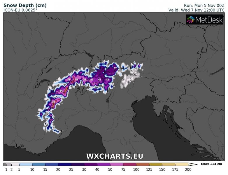
In addition, strong snowfall is expected at higher elevations. Currently, it appears snowfall will likely be above 2000 m elevation, lower where intense snow showers develop. After the passage of the low, northerlies will push snowfall in extreme NW Alps significantly lower.
Total rainfall across the region until late on Tuesday. AROME model guidance. Map: Wxcharts.eu.
Total rainfall across the region until mid-Wednesday. ARPEGE model guidance. Map: Wxcharts.eu.
Total rainfall across the region until mid-Wednesday. ICON-EU model guidance. Map: Wxcharts.eu.
Total rainfall across the region. Various model guidance. Map: Consorzio LaMMA.
24-hour rainfall totals across the region. HRRR model guidance. Map: Youmeteo.com.
Total snowfall across the region until late on Tuesday. AROME model guidance. Map: Wxcharts.eu.
Total snowfall across the region until mid-Wednesday. ARPEGE model guidance. Map: Wxcharts.eu.
Total snowfall across the region until mid-Wednesday. ICON-EU model guidance. Map: Wxcharts.eu.
