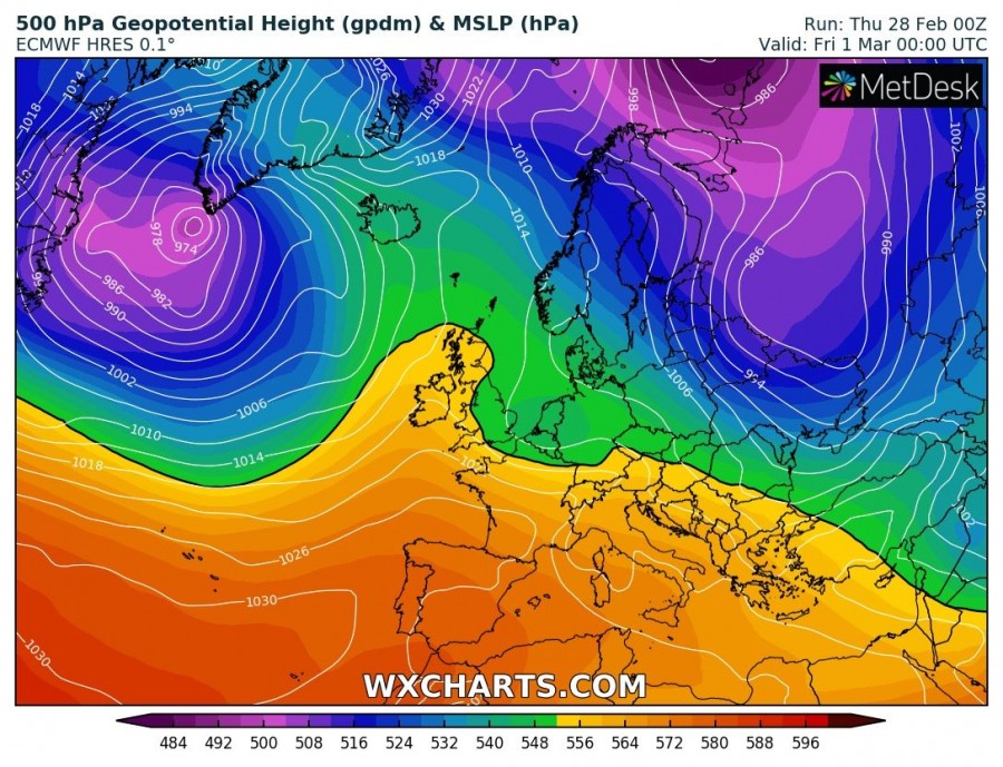
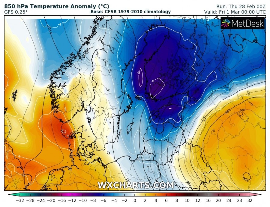
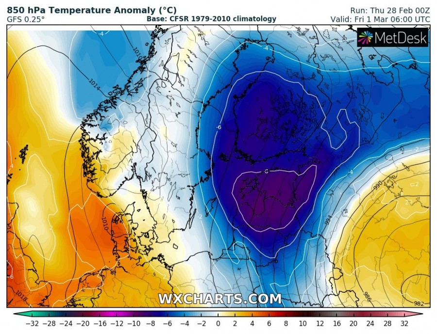
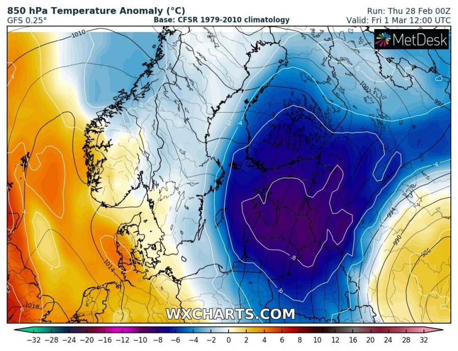
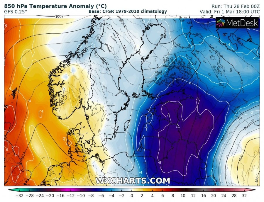
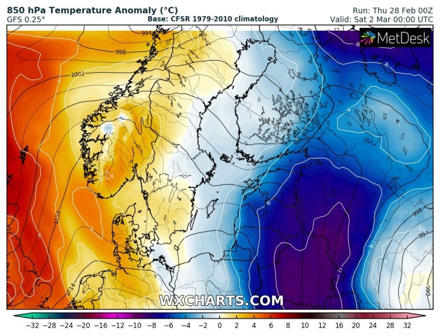
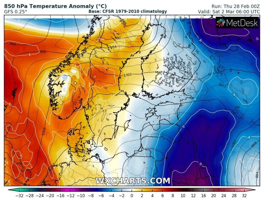
While a powerful upper ridge dominated most of Europe this week, it finally begins weakening today. A deep trough over the NW Russia intensifies and pushes much colder airmass into Fennoscandia and the Baltic region through the next 3 days.
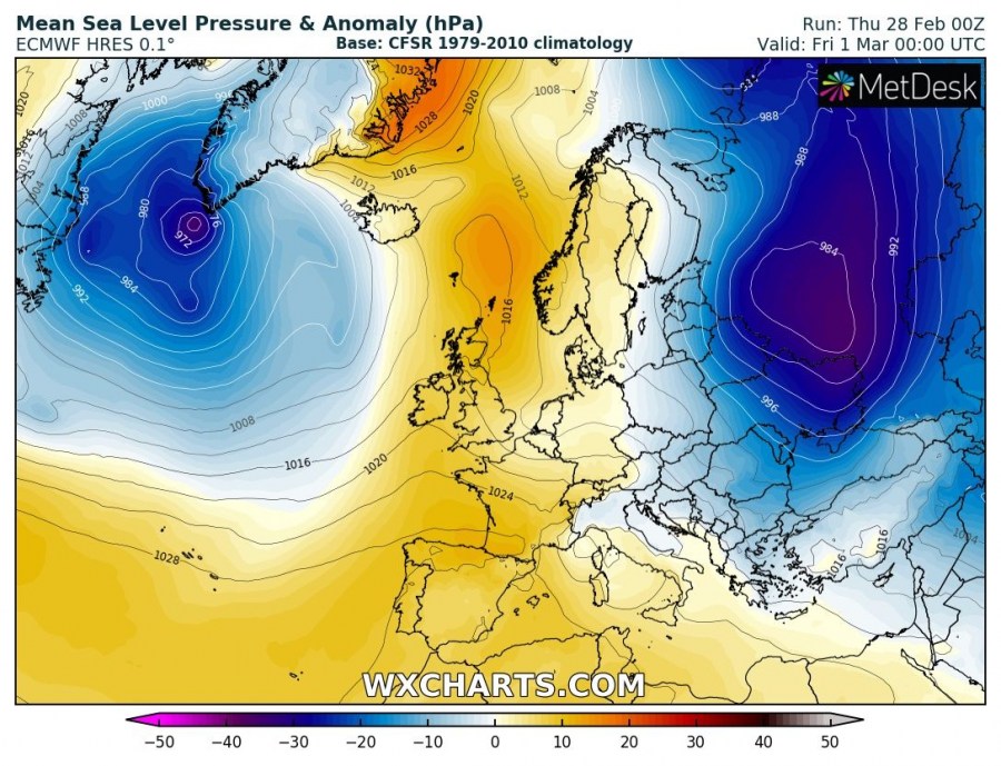
The pattern indicates a collapsing ridge across western and central Europe while a deep trough pushes across the Fennoscandia into northwest Russia. At the surface, a strong cyclone is moving into western Russia.
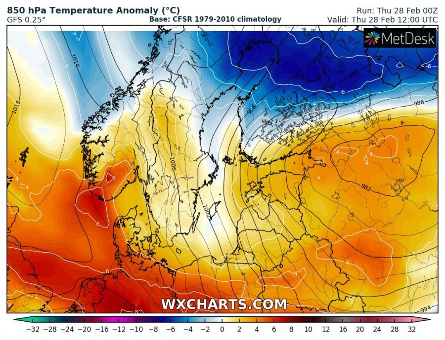
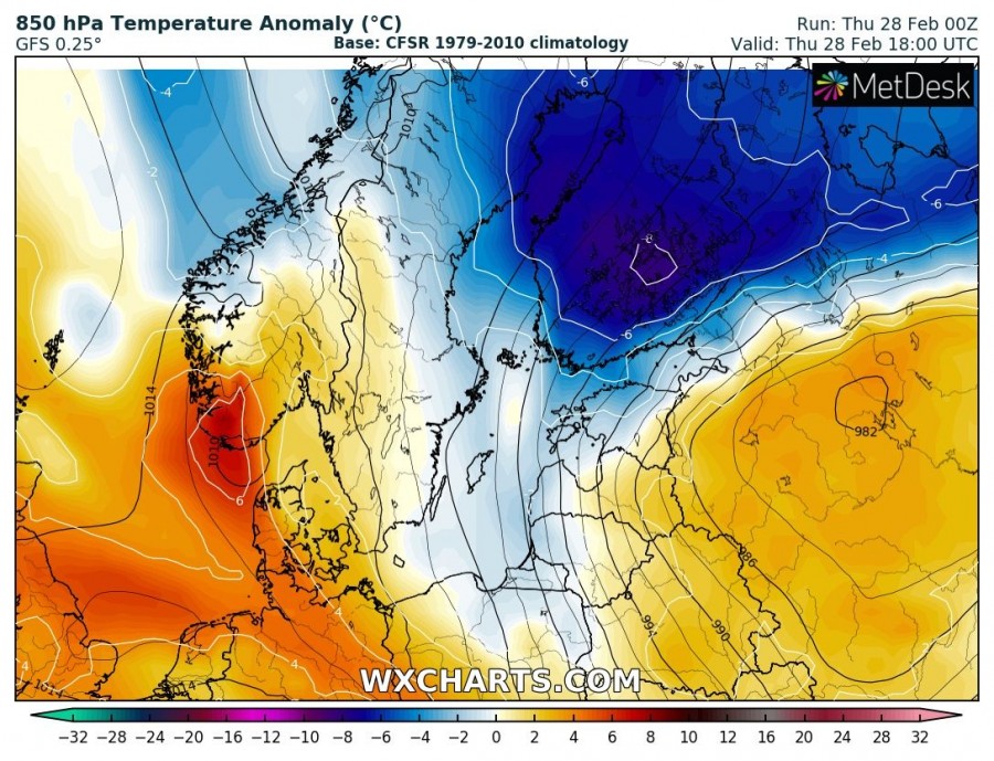
Much colder airmass advection starts across the central Finland this afternoon, spreading south towards the Baltic region as the surface cyclone continues into the western Russia. Very cold airmass spreads into south Finland this evening, Estonia, Latvia and N Belarus by Friday morning and continues further south across Lithuania and the rest of Belarus towards Ukraine later tomorrow and on Saturday, March 2nd.
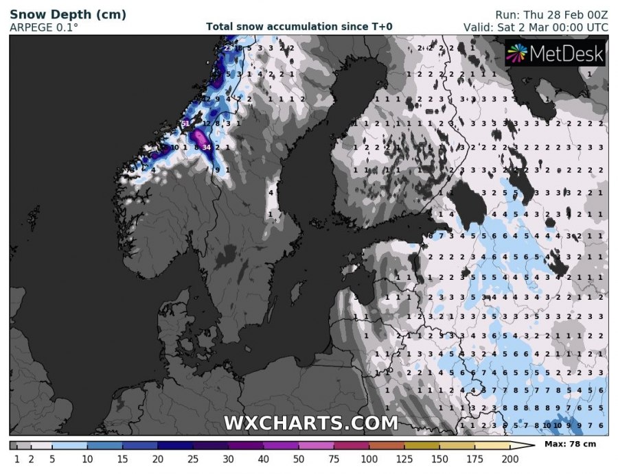
Some fresh snow is also expected across the region, but only a small amount is expected (only a few cm accumulation) due to the lack of significant moisture available with this system.
