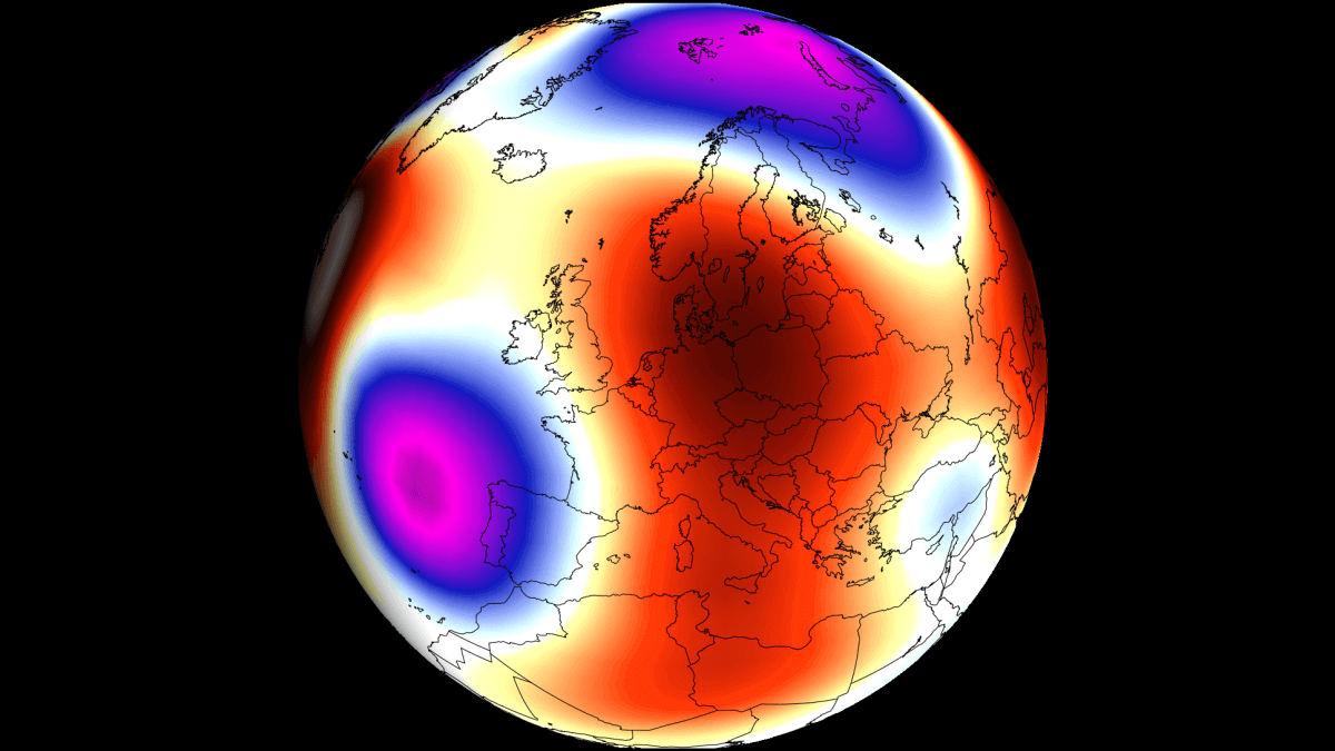
The first forecast trends for Summer 2025 are here, and they show a dynamic summer pattern in the atmosphere over Europe. After an early start with more precipitation over the continent, the middle and later parts of summer look to be drier over Europe with above-normal heatwave potential.
When trying to understand any weather season and long-range forecasts, we must realize that many global factors can influence weather patterns.
So, while we will look at the first long-term trends for the Summer, we do have to keep in mind that these are not fixed scenarios. But they will give us a general idea of what early predictions show for Summer 2025 over Europe. A separate article for the Summer 2025 forecast over North America is coming soon.
WARM SEASON TRANSITION PERIOD
Before looking at the summer predictions, we will first look at the latest forecast for Spring. More specifically, we will look at the transition period from Spring to early Summer (April-May-June).
The 3-month pressure anomaly forecast for this period indicates a low-pressure area over western and northwestern Europe. That enables a more southerly flow over western and central Europe, which also brings along moisture from the Mediterranean.
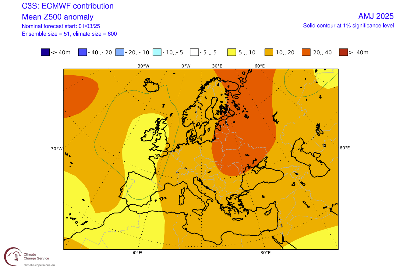
You can also see a high-pressure area building over the east and northeast. A low-pressure area over the west does help to build that high-pressure zone, with warm air transport on its east side.
Looking closer at the temperature pattern in this period, you can see the larger area of warm air transport over much of the continent. There is a lesser anomaly over the western parts due to the presence of the low-pressure area.
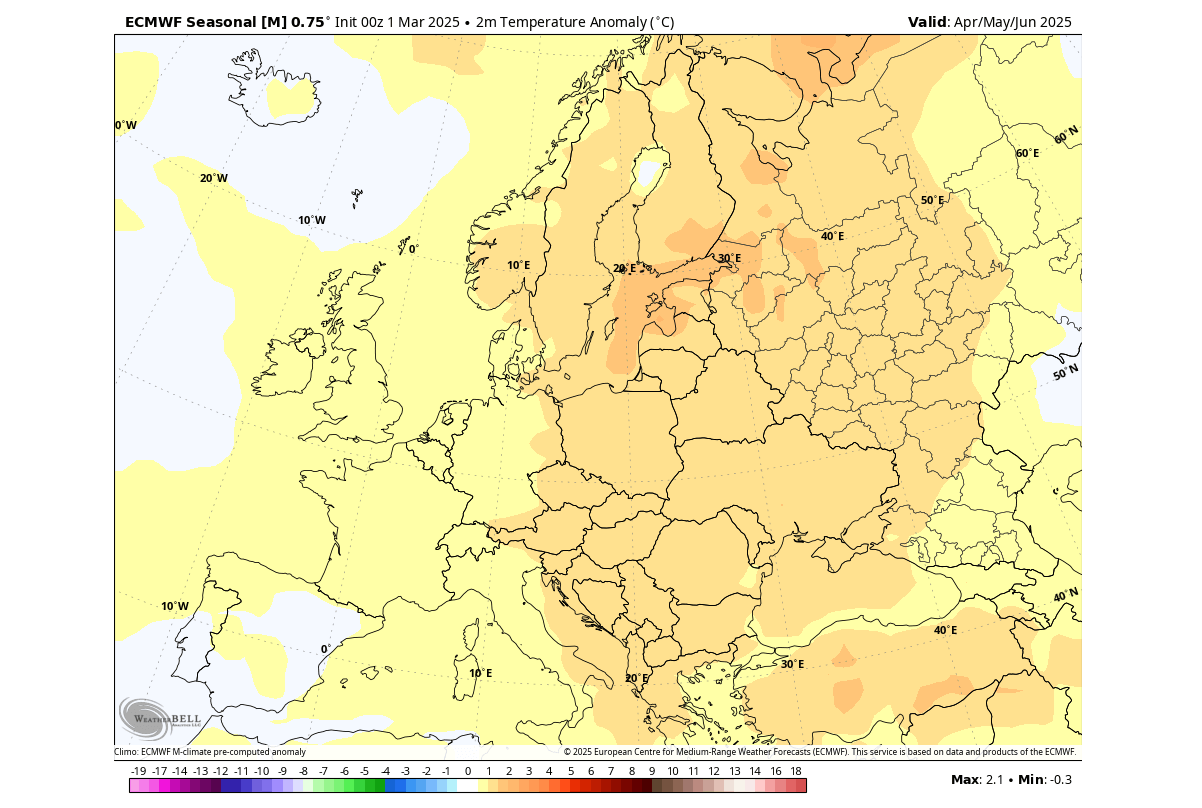
The warm anomaly over the east and northeast is due to the warmer airmass under the high-pressure area.
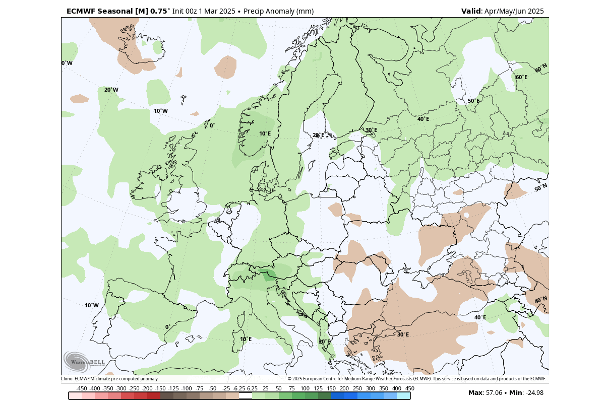
Going to precipitation, you can see a large area of Europe is forecast with above-normal precipitation. This is expected with a low-pressure zone forecast over western and northwestern Europe. A drier area is over the southeastern parts, under the expanding high-pressure area.
Overall, we can see the Spring-Summer transition will be quite vibrant across Europe, with more stable conditions forecast for mid-late Summer. We will now look at the first long-range predictions for Summer 2025 for Europe, with a month-by-month breakdown.
JUNE 2025 FIRST LOOK FORECAST
We will examine the first long-range trends from the ECMWF forecasting system. ECMWF is statistically a better long-range model, so we usually start with its forecasts for the early trends.
Generally, the ECMWF model is at the top as far as “reliability” goes. But no long-range/seasonal forecasting system can be called “reliable“. This is because we only look at trends and how the weather patterns are evolving on a large scale and over longer periods.
The forecast period we will focus on is June-July-August. This period covers the meteorological Summer and is the peak of the warm season and the warmest 3 months of the year in the Northern Hemisphere.
Starting with June, you can see the pressure pattern forecast from ECMWF below. It shows a low-pressure area indicated over the far North Atlantic and with a possible extension into northwestern Europe. A high-pressure ridge is forecast to rise over the east and up towards Scandinavia.
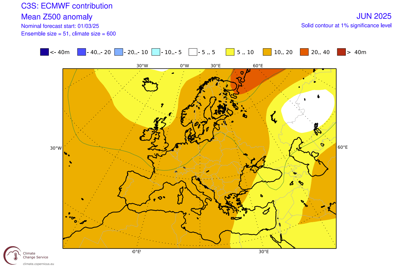
An area of lower pressure over northwestern Europe in June can mean a westerly to southwesterly flow over central Europe. That usually brings warmer temperatures and moisture, making unstable conditions over the central parts.
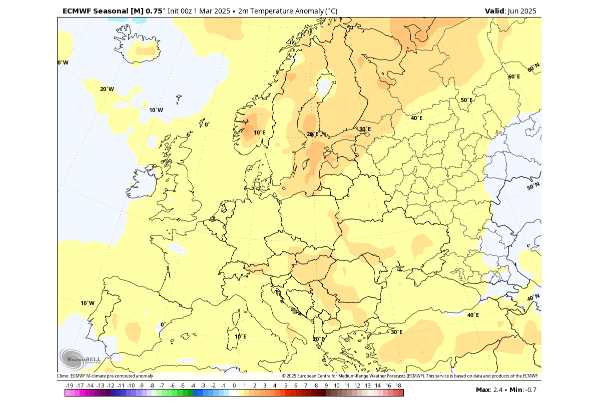
Looking closer at the June temperature pattern over Europe, we see the warmer-than-normal weather over a large part of the continent. The warmest anomalies are forecast over east-central, southeastern, and northern Europe. This would indicate a more westerly to southerly flow over the continent.
The precipitation forecast also indicates a moist flow, as you can see more precipitation over west-central, northwestern, and northern Europe. This is consistent with a low-pressure area over the North Atlantic or northwestern Europe.
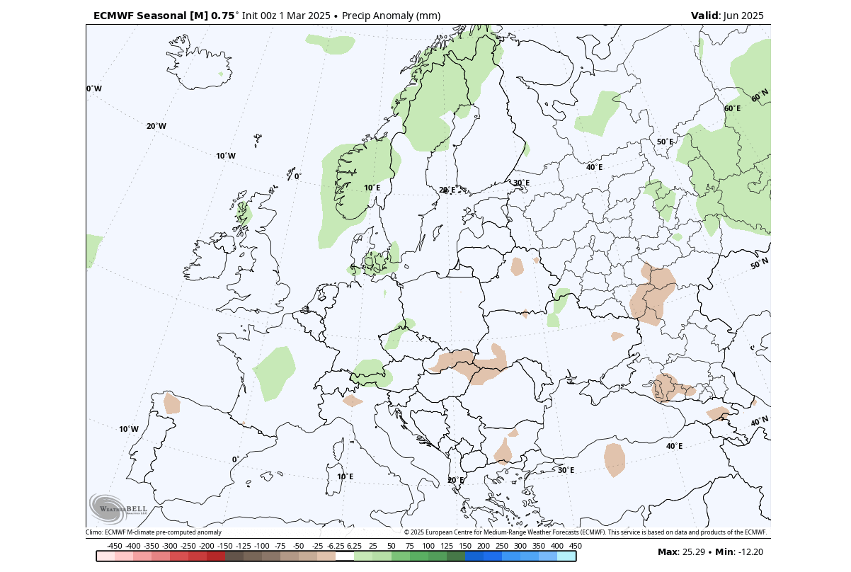
Less rainfall is forecast over the southern and southeastern parts, from where the high-pressure ridge is forecast to expand towards the north.
JULY 2025 FIRST LOOK FORECAST
July is the second month of meteorological Summer in the Northern Hemisphere and is also the month with the highest temperatures in the long-term average over Europe.
The July 2025 first pressure forecast shows a low-pressure area over far northern Europe and the far North Atlantic. It also shows a high-pressure system over the central and northern parts, which appears like a blocking high-pressure area, meaning it is longer-lasting.
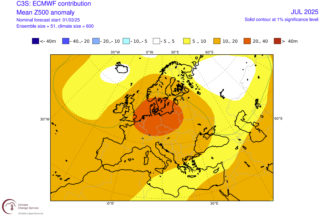
This helps to bring warmer-than-normal temperatures up from the south and less precipitation.
Looking closer at the temperature forecast first, we see above-normal weather over a large part of the continent. The warmest anomalies are forecast over southeastern and central Europe and also over some parts of the low north.
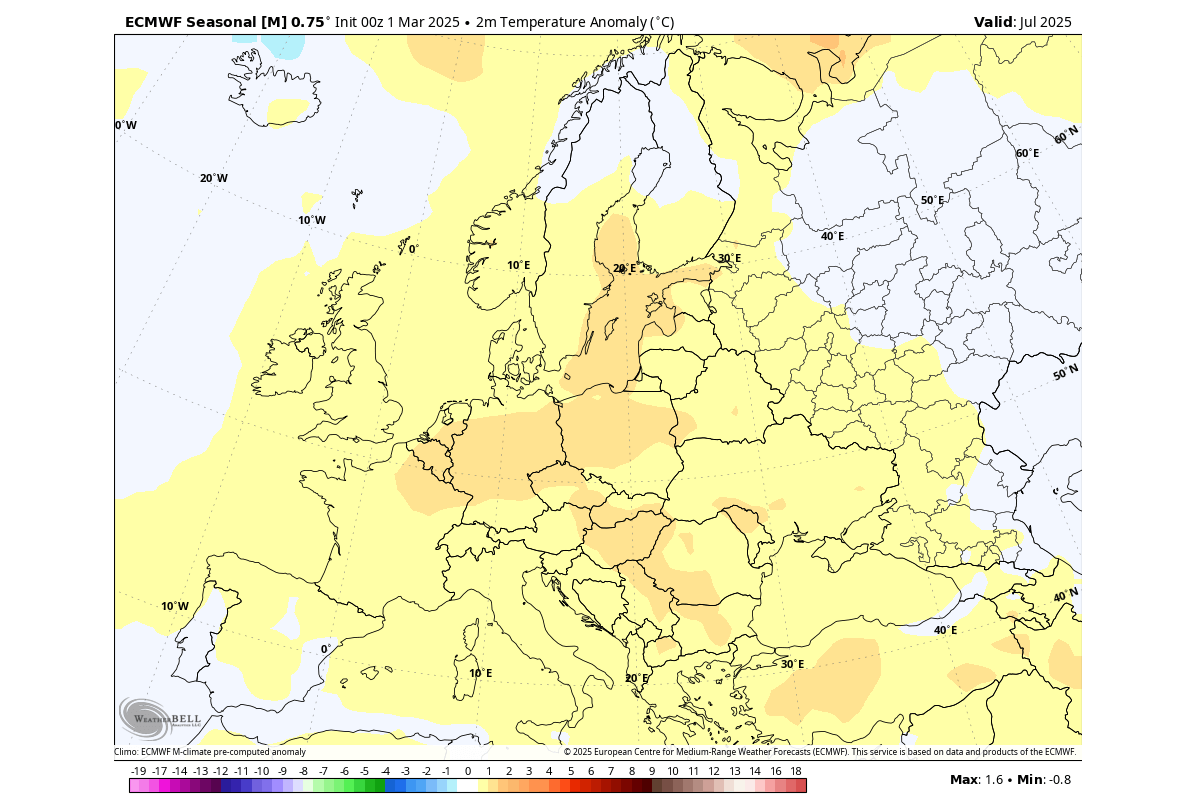
You can also see near-normal temperatures over the southwestern parts of Europe and also over the far north under the influence of a low-pressure area.
In the July precipitation forecast, you can see mostly drier conditions forecast over central and low northern parts of Europe under the high-pressure zone. But, we see wetter conditions forecast over the northern parts of the UK and Scandinavia under the westerly flow of a low-pressure area in the far North Atlantic.
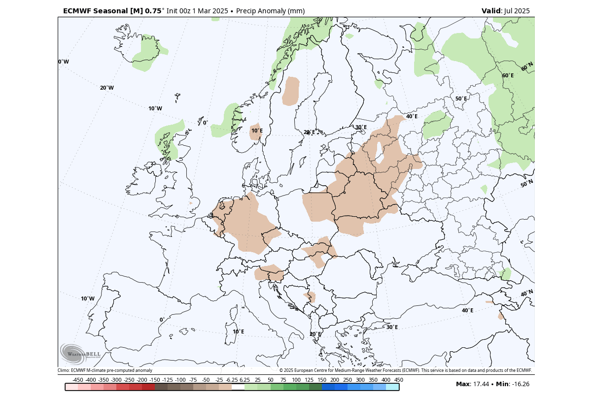
Overall, the blocking high looks to bring a drought factor over a larger part of Central Europe, with a higher potential for heatwaves than normal.
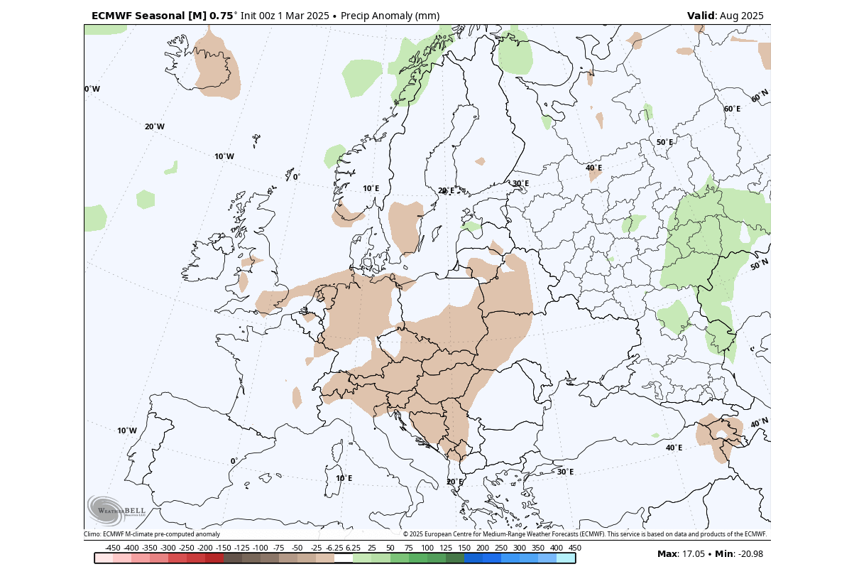
AUGUST 2025 FIRST LOOK FORECAST
August is statistically the final month of the meteorological summer season in the Northern Hemisphere. That is because it concludes the warmest 3-month period of the year, with September already seeing a drop in temperatures and the start of meteorological Autumn.
The pressure anomaly forecast for August shows a broad high-pressure zone over the north-central and northern Europe. It indicates a broad blocking and a warmer airmass over much of central and northern Europe.
A low-pressure area is indicated towards the east, which can limit the high temperatures in that region.
Looking at the temperature forecast, we see warmer-than-normal weather over a large part of the continent. Peak warm anomalies are indicated over central and northern Europe, with a strong warm airmass spreading under the blocking high pressure.
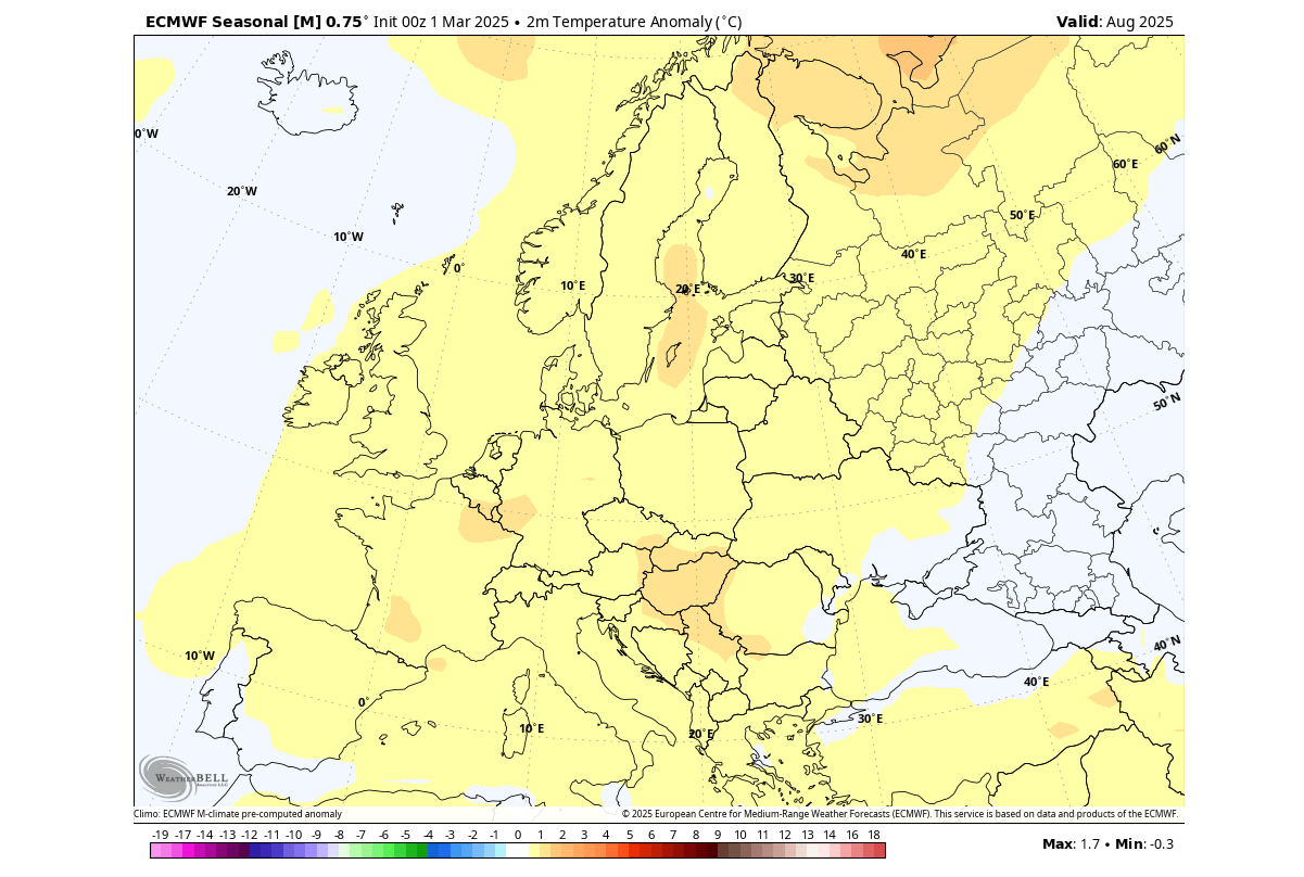
This forecast does indicate a higher potential for heatwaves in the central parts but a limited potential towards the east, due to a low-pressure area.
Going to August precipitation, we can see mostly drier conditions forecast over central Europe under the high-pressure zone. The area of less precipitation also extends into the northern and northwestern parts. More precipitation is forecast towards the east and over the far north.
To have a bit of variety in the forecast, we decided to also look at another long-range model that was recently updated, the Canadian CANSIPS.
CANSIPS SUMMER EUROPE FORECAST
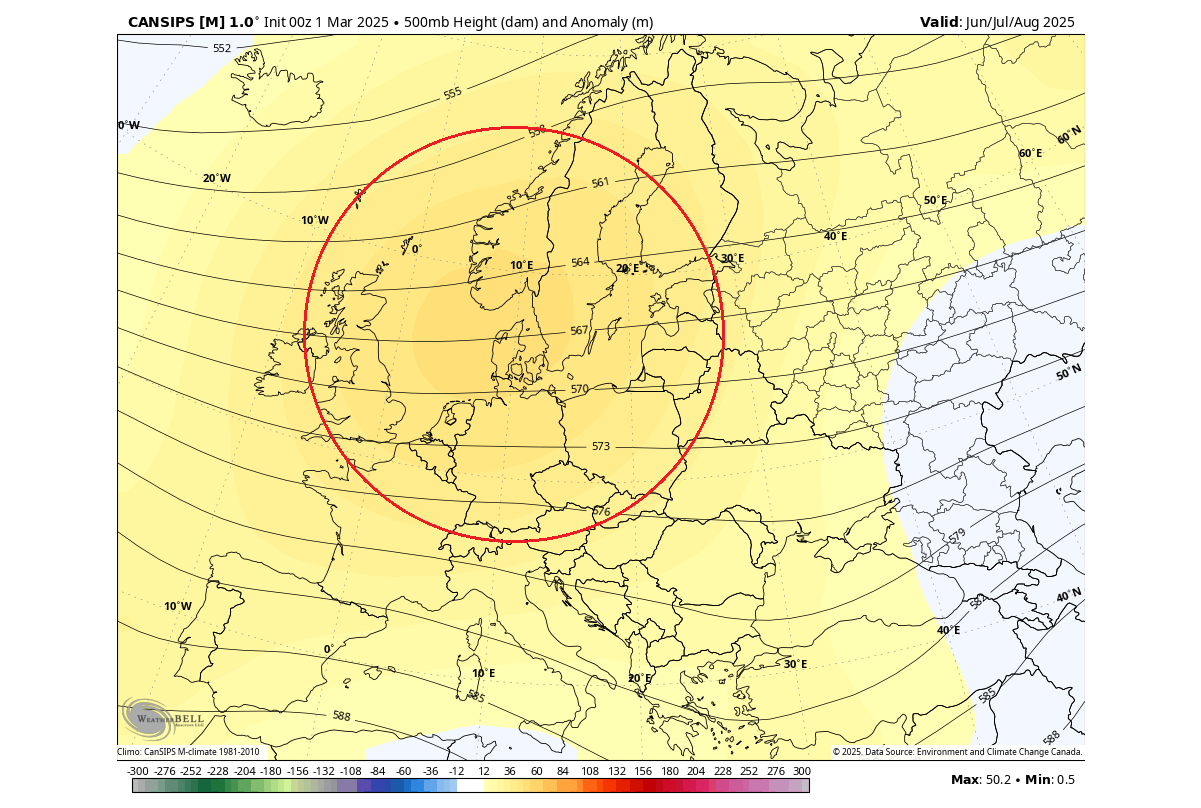
Below is the 3-month average pressure forecast for the Summer season by the Cansips model. It shows a prevailing high-pressure anomaly over north-central and northwestern Europe. While the forecast does not show it, when a high-pressure area is centered this way, it means a low-pressure zone over the southern parts and the Mediterranean.
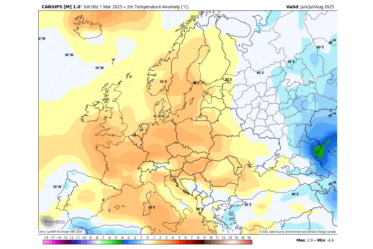
The temperature forecast for the same period shows the above-normal temperatures over much of Europe, forced by the high-pressure area. There is a cooler area forecast towards the far east, under a more northerly flow.
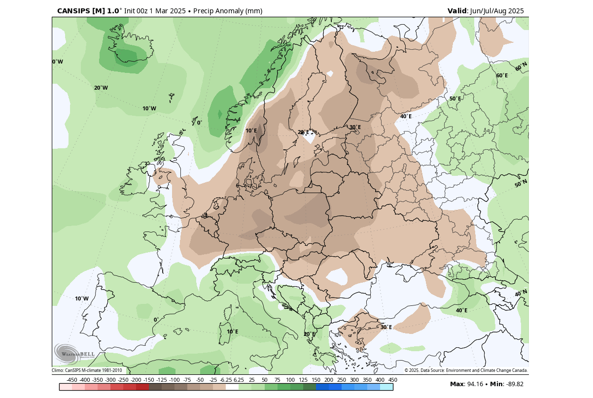
In the precipitation forecast, you can see a broad dry area of the high-pressure system. But we see increased rainfall over the south-central parts and the Mediteranean, likely due to the low-pressure zone under the high-pressure system.
Overall, both forecasts show a similar pattern, with a high potential for drought conditions and heatwaves for the middle and later parts of Summer 2025 over central and parts of low northern Europe. But this is just the first long-range forecast. So, we will update you with the latest charts and information as soon as the next forecast is available next month.
Make sure to bookmark our page. Also, if you have seen this article in the Google App (Discover) feed, click the like button (♥) there to see more of our forecasts and our latest articles on weather and nature in general.
SEE ALSO: