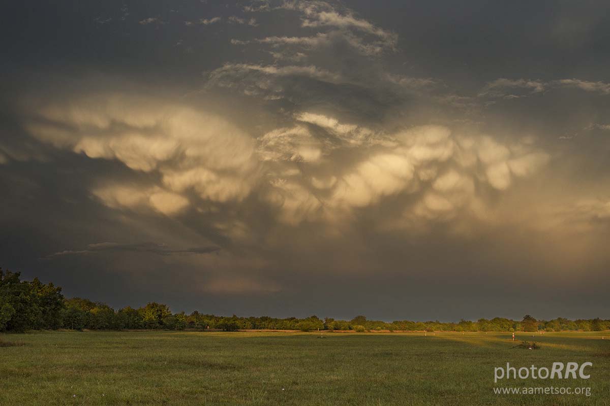
Mammatus clouds are probably the most unusual and distinctive cloud formations. They form on the underside of a thunderstorm’s anvil. Their name comes from the Latin word mamma, meaning “udder” or “breast.” They appear as pouch-like structures protruding from underneath the anvil.
Mammatus clouds are gentle downdrafts, the sinking cool air descending from the anvil that form, evolve, and dissipate over about ten minutes to half an hour. While they are generally well-understood as downdraft features, the exact formation mechanism or mechanisms are not well-constrained and are a research subject.
The WMO International Cloud Atlas classification indicates that ‘mamma’ is a cloud supplementary feature rather than a genus, species, or variety of clouds.

Mammatus clouds vary in size and definition, from small, barely recognizable features to large, extremely well-defined pouches. Even rather small thunderstorms with not particularly well-defined anvils (Cumulonimbus capillatus) often form some mammatus clouds.
Intense thunderstorms that form extensive anvils (Cumulonimbus capillatus incus) can produce enormous ‘fields’ of mammatus clouds.
How do mammatus clouds form, and what weather is associated with them?
Mammatus clouds form with large cumulonimbus clouds when cool air sinks down, forming these round, bubbly clouds. The ongoing turbulence inside the thunderstorm cloud causes mammatus to form, typically under the anvil. Aviators will avoid flying near them due to the turbulence likely to be expected in the region.
As updrafts carry precipitation-enriched air to the cloud top, upward momentum is lost, and the air begins to spread out horizontally, becoming part of the anvil cloud. The saturated air is heavier than the surrounding air and sinks back towards the earth because of its high concentration of precipitation particles (ice crystals and water droplets).
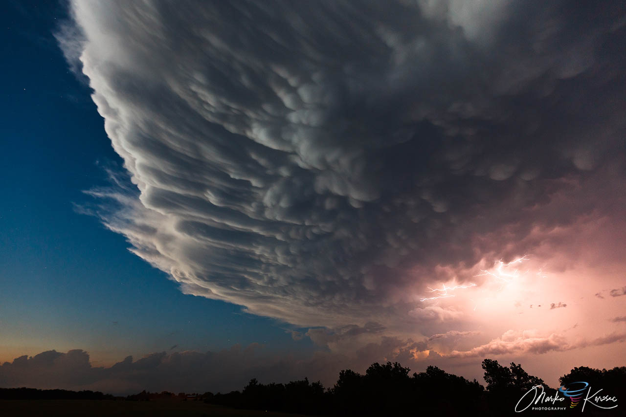
The temperature of the subsiding air increases as it descends. However, since heat energy is required to melt and evaporate the precipitation particles contained within the sinking air, the warming produced by the sinking motion is quickly used up in the evaporation of precipitation particles. If more energy is required for evaporation than is generated by the subsidence, the sinking air will be cooler than its surroundings and will continue to sink downward.
Since these clouds are associated with unstable air masses and thunderstorms, mammatus is often associated with hail, heavy rain, and lightning strikes.
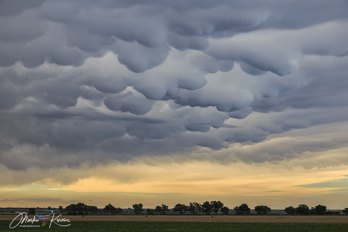
These cloud formations are best visible when the Sun is low, creating a good contrast between the thunderstorm clouds. Near sunset, huge mammatus and reddish colors often present astonishing sights.
Mammatus clouds can also be found with non-severe thunderstorm clouds, e.g., cirrus or altostratus clouds. They have also been observed to form with volcanic ash during eruptions.
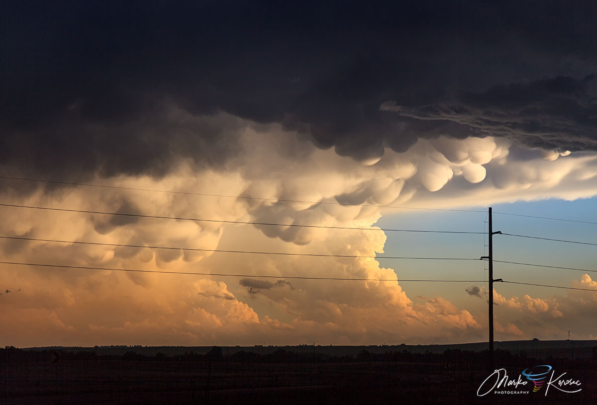
They are composed primarily of ice and can extend hundreds of kilometers in each direction. Their formations can remain visibly static for ten to fifteen or even thirty minutes at a time. They usually appear around, before, or even after (severe) thunderstorms.
Examples of spectacular mammatus cloud formations
Since pictures often tell more than words, and mammatus clouds are such formations that are often awe-inspiring, let us present some examples of these often spectacular cloud formations.
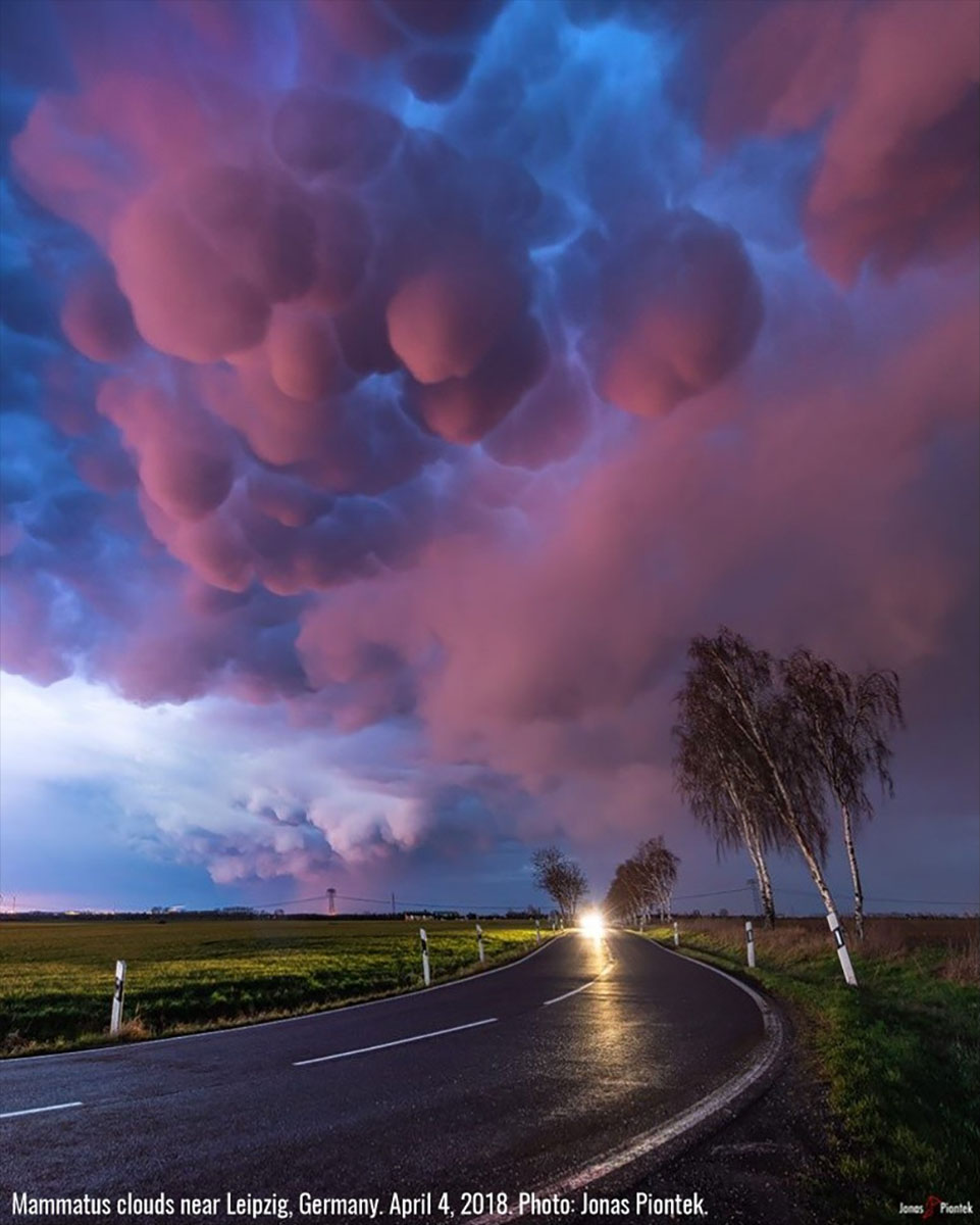
The best examples often come from the U.S., where thunderstorms can grow very large and lead to well-developed mammatus cloud displays.
Some common misconceptions
There are also some common misconceptions about mammatus clouds.
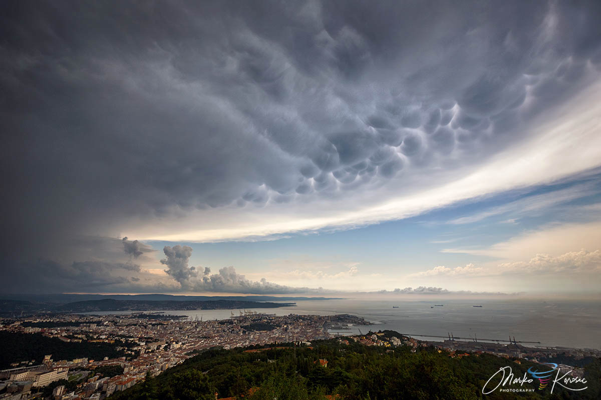
Interesting fact: Mammatus clouds have often been associated with approaching tornadoes. This is a common misconception. While mammatus clouds do form on most tornadic thunderstorms, they form on many thunderstorms in general (including non-tornadic), and there is no known direct correlation between tornadoes and mammatus clouds.
Mammatus clouds are often best seen after a thunderstorm has passed. Also, as these clouds form on thunderstorm anvils, which are much larger than the part of the thunderstorm where the worst weather happens, it may well happen that you see mammatus clouds without actually being impacted by the thunderstorm.
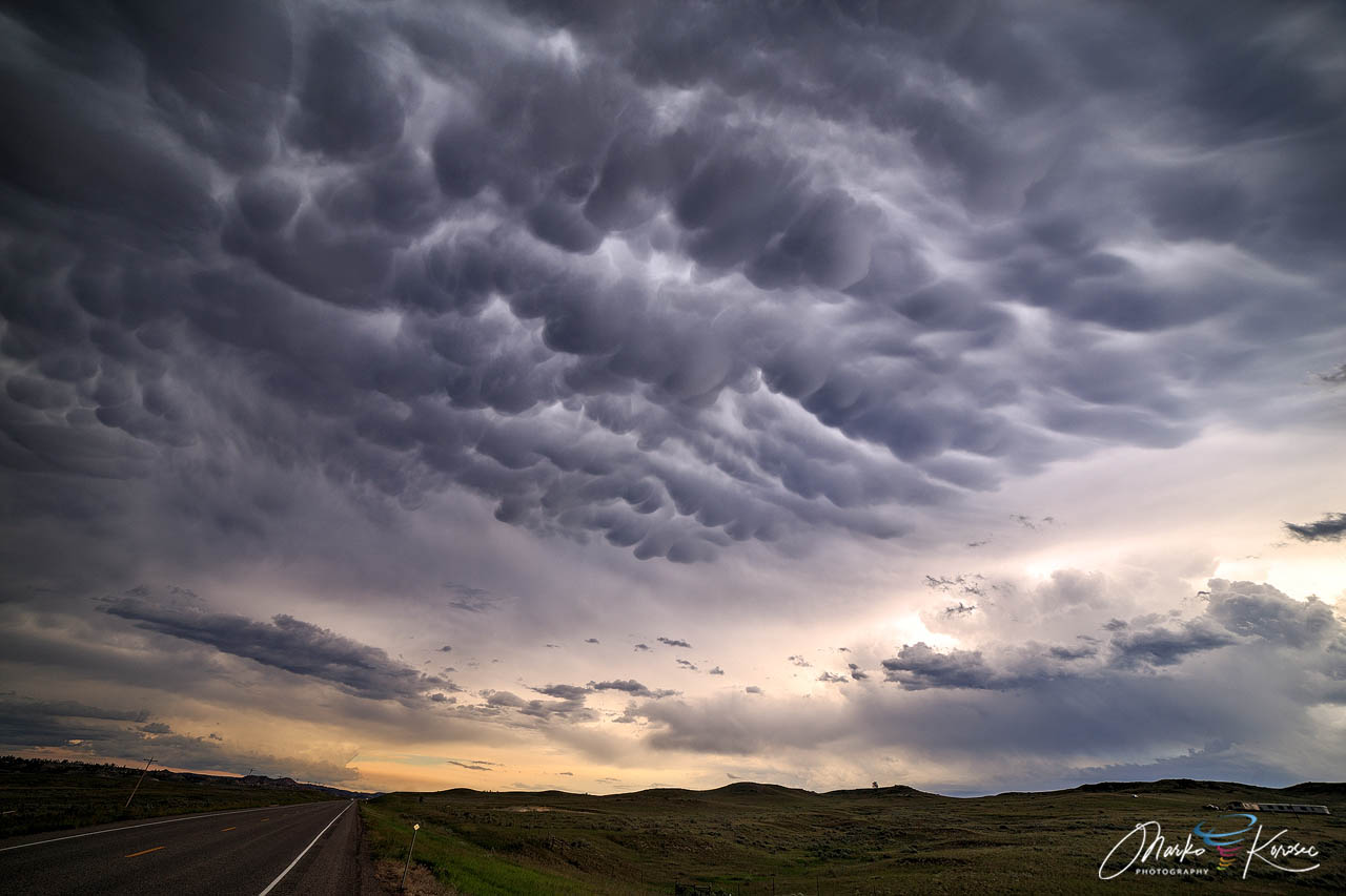
Fun fact: Contrary to popular conspiracy theories, mammatus clouds are not a recent phenomenon and were first described in 1894 by William Clement Ley.
Recap: mammatus clouds are pouch-like structures protruding from the underside of a thunderstorm anvil. They are caused by sinking cool air and may persist for several minutes. While they can be associated with severe thunderstorms, they are not a direct sign of impending severe weather.
See also: