After significant winter storms across the U.S. recently, the conditions have improved, but it remains cold. Coming up late next week, the southern lobe of the Polar Vortex will generate a much more significant, frigid cold Arctic Blast that will graze across Canada and the United States through the second half of January.
The disturbance in the Polar Vortex aloft will establish extreme cold conditions. Temperatures are forecast to plunge into a deep freeze, pushing 30-40 degrees below normal for tens of millions across the North American continent.
The frigid Arctic cold pool will first intensify across most of Canada, then spread into the United States next weekend and also reach deep South and the Gulf Coast. Brutal cold days and locally historic low temperatures are forecast.
The new weather pattern forecast to develop late the following week hints at a mighty upper-level ridge, establishing over the Northern Pacific and Alaska. This pattern results in an extensive frigid cold air mass reservoir, intensifying the polar jet streak winds between the two features.
The general flow develops a winter storm into southern Canada towards the U.S., dragging frigid temperatures in its wake and spreading far toward the south.
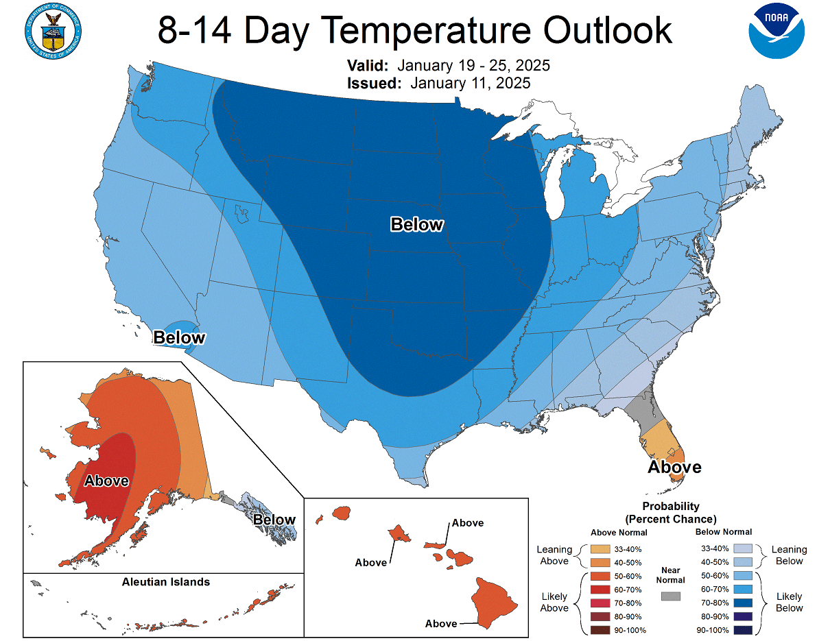
It will be much below normal throughout the second half of January, the coldest so far this season.
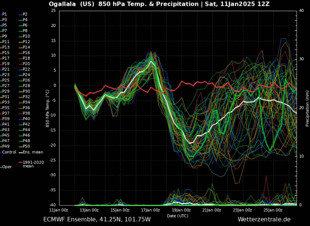
The progress of the Arctic cold pool will be rapid, as the following temperature chart over Nebraska shows. A sharp decline in temperatures will engulf both nations in a deep freeze.
An extreme temperature drop of nearly 30 degrees in less than 48 hours is forecast.
So, the progress into a more extreme cold pattern will gradually occur over western and central Canada late next week, spread across much of the United States over the weekend and early week after.
The video animation below provides a quick overview of the next 14 days. Judging by temperature anomalies, the frigid cold air mass and the coldest weather of the winter season will blast tens of millions across both countries.
Before we dig into the details of the upcoming event, we want to talk about the main trigger behind these events. The historic Arctic blasts often follow a substantial disruption of the Polar Vortex aloft.
This January, its southern lobe has shifted over North America, which will be why the cold air mass outbreak will be so intense and push far south towards the Gulf Coast.
What is the Polar Vortex?
The Earth’s atmosphere has six layers around the planet. Most of the dynamics for our daily weather occur in the lowest two layers, known as the troposphere and the stratosphere.
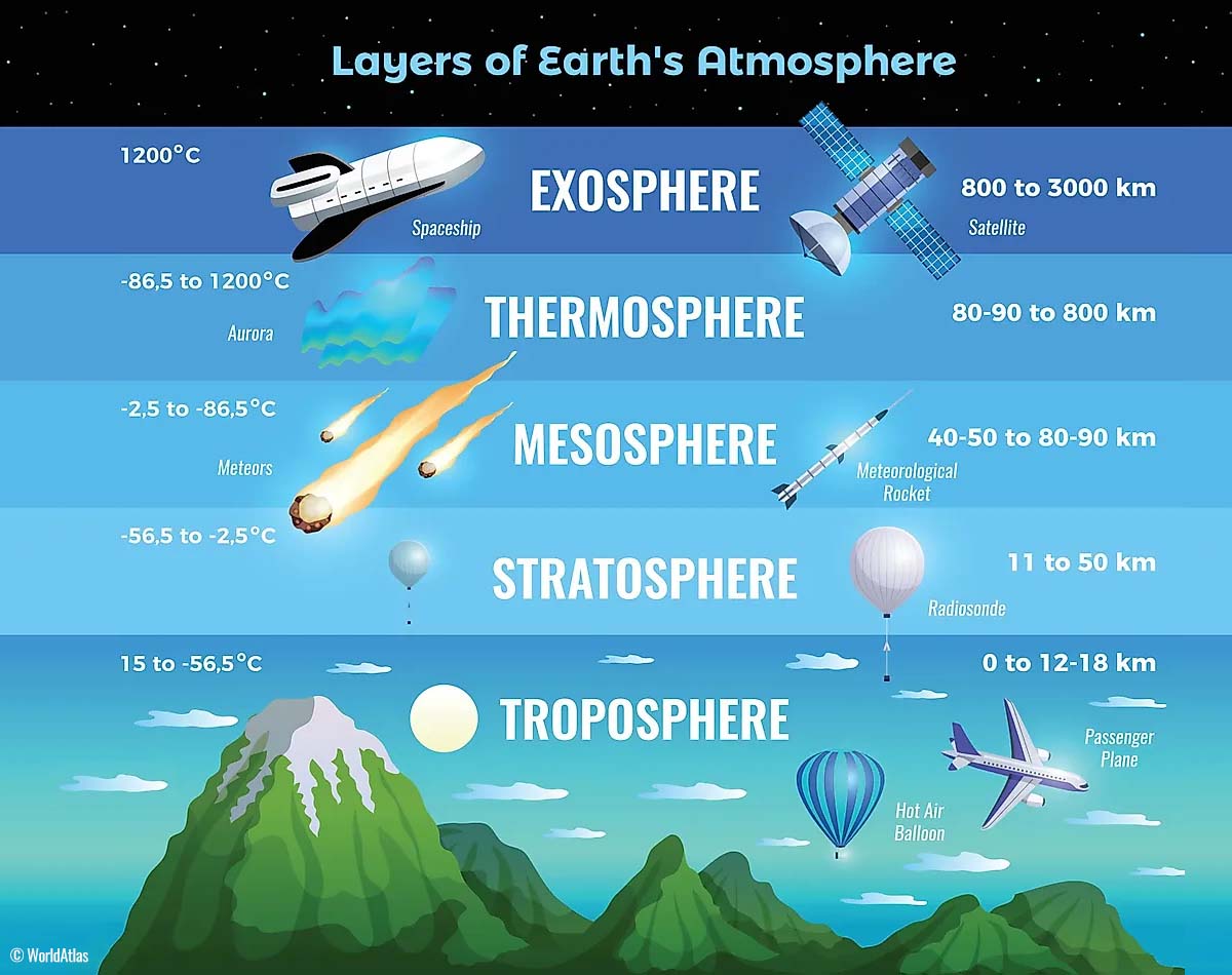
The troposphere is the closest layer to the Earth’s surface. It is about 12 km deep and extends from the ground up high into the sky. Depending on where you live, its depth varies from around 8 km to almost 20 km. The troposphere is the deepest above the equatorial region and gets much thinner above the North and South poles.
Above this layer is a much deeper one known as the Stratosphere, an 11-50 km thick layer of arid air. The stratosphere also contains the ozone layer, which protects our planet’s life against the potential impact of solar storms from the Sun or outer space.
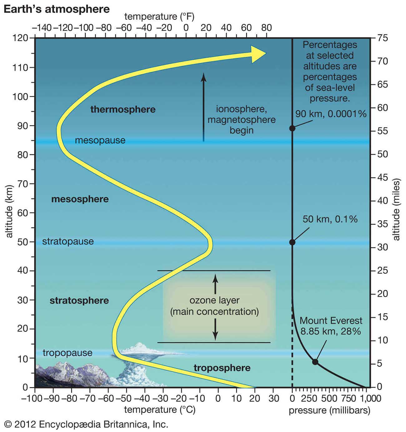
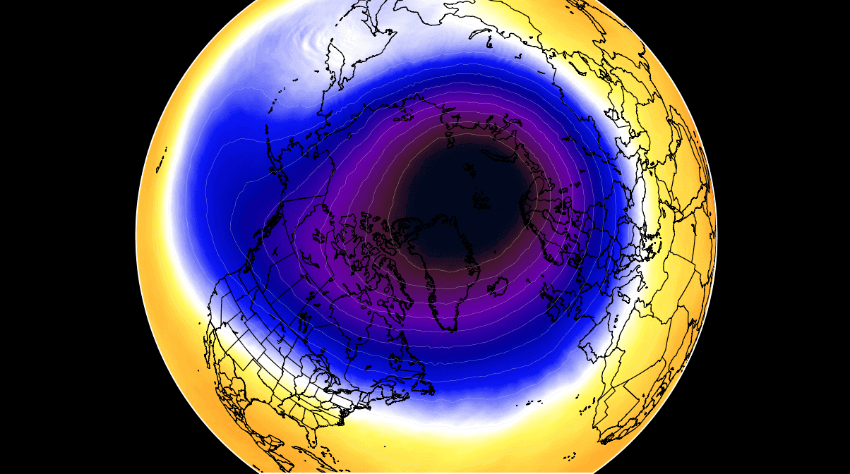
Another essential feature in the stratosphere, which makes our weather even more variable, often triggers significant large-scale and long-lasting winter weather events. This is the Polar Vortex—an enormous, tri-dimensional ring of powerful winds moving through the sky above us. The Polar Vortex is spinning around the North Pole, grazing through the air at about 20-50 km above the Earth’s surface with violent wind speed.
The troposphere and the stratosphere are crucial for our climate, as the Polar Vortex covers most of the bottom half of the atmosphere. Since the vortex extends from the middle of Earth’s troposphere into the stratosphere layer, it significantly affects winter weather across high and mid-latitudes yearly.
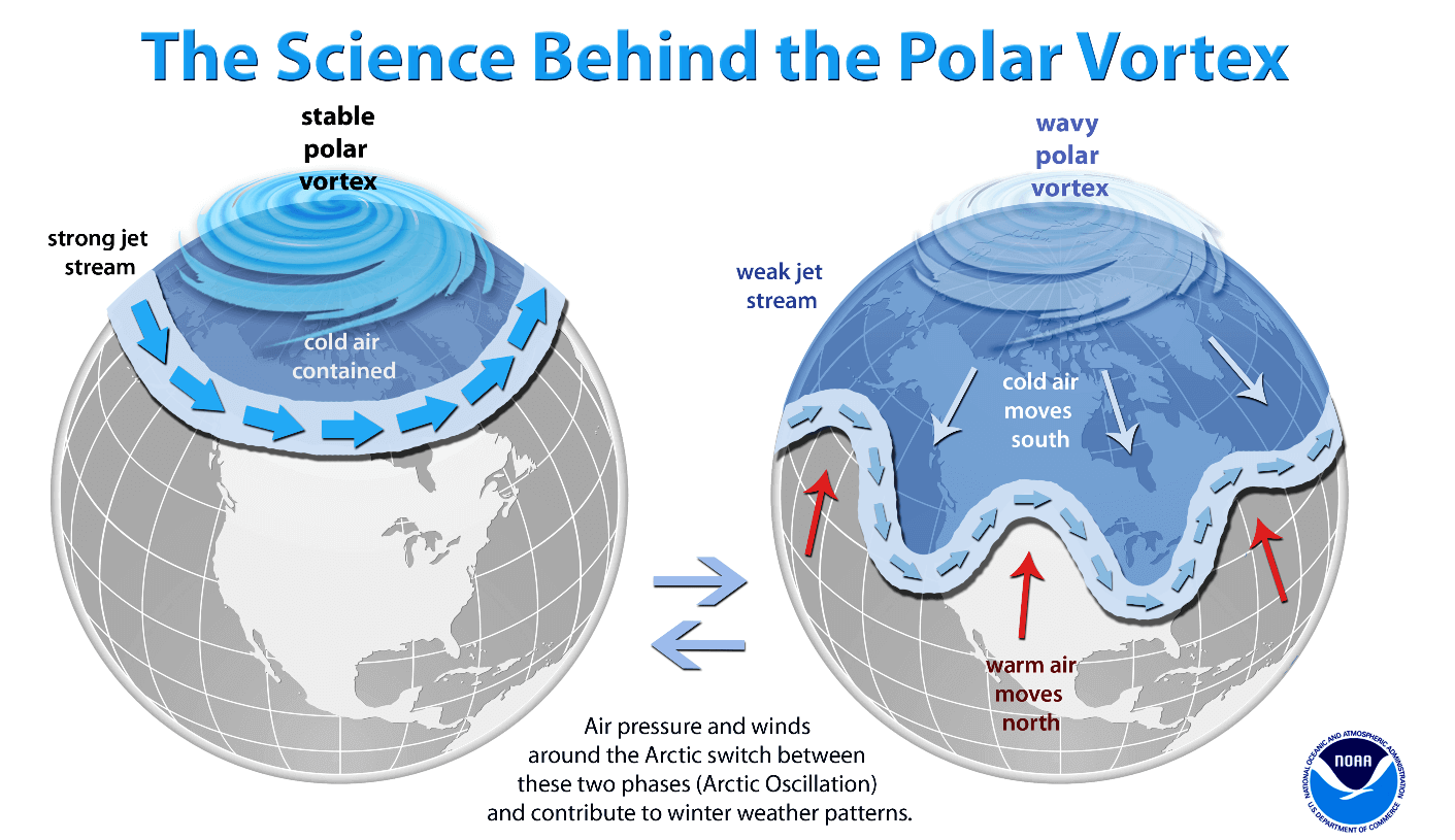
In recent years, we have experienced this in Asia, Canada, the U.S., and sometimes Europe. The vortex aloft has been significantly disrupted, and when its lobe shifts on the other side of the northern hemisphere, the extreme cold grips the North American continent.
The Polar Vortex is most substantial during winter in the Northern and Southern Hemispheres. Although it spins well above our heads, it remains closely connected with the lowest parts of our atmosphere. Thus, it influences our daily weather in many ways, as it generally functions as one sizeable hemispheric circulation.
The Polar Vortex has triggered the most intense weather systems, from frigid cold outbreaks and winter storms in Canada and the United States to Asia and Europe. Although it affects the whole Northern Hemisphere, its main impact occurs where the southern lobe of the vortex is located.
How and when does the Polar Vortex form?
Due to the Earth’s inclination, the polar regions receive much less energy from the Sun during the fall months. This causes the cooling over the northern areas to become more robust. As a result, polar nights also occur for several consecutive months, followed by days without sunlight.
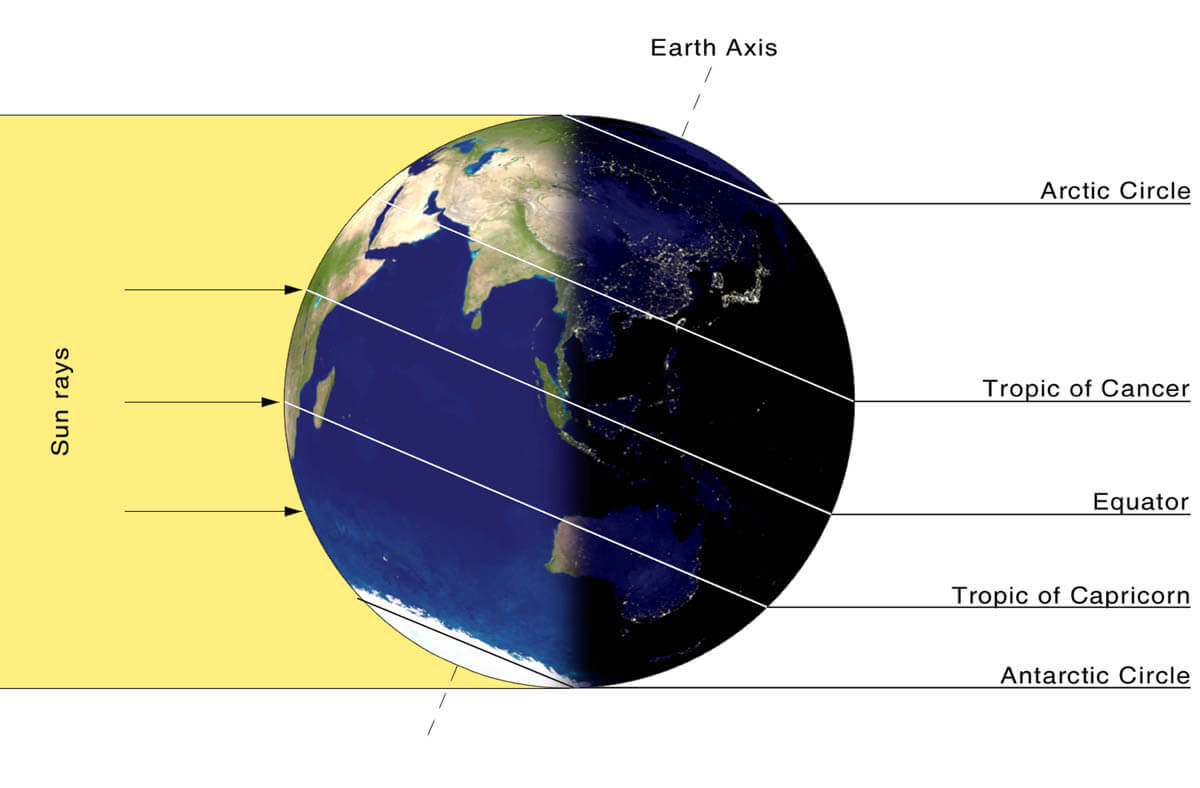
While the temperatures in the polar region are dropping into deep freeze, the atmosphere layers farther to the south are still relatively warm since they receive more of the Sun’s energy simultaneously. Therefore, the south’s equatorial layers remain much warmer than the areas farther north. So, this leads to a high-temperature contrast between them.
Cooling the polar regions also lowers the ambient surface pressure, with a similar weather process also happening in the stratosphere layer. The temperature difference between the North Pole and the equatorial areas increases across both layers. This creates a large low-pressure cyclonic circulation across the polar stratosphere, where this feature takes its famous name – the Polar Vortex.
Putting all these puzzle pieces together, the Polar Vortex is an enormous cyclone in Earth’s atmosphere. It expands across the North Pole during winter and sometimes becomes very intense, extending south to the mid-latitude regions. The same is also happening in the southern hemisphere during their winter period when the Polar Vortex intensifies around the South Pole.
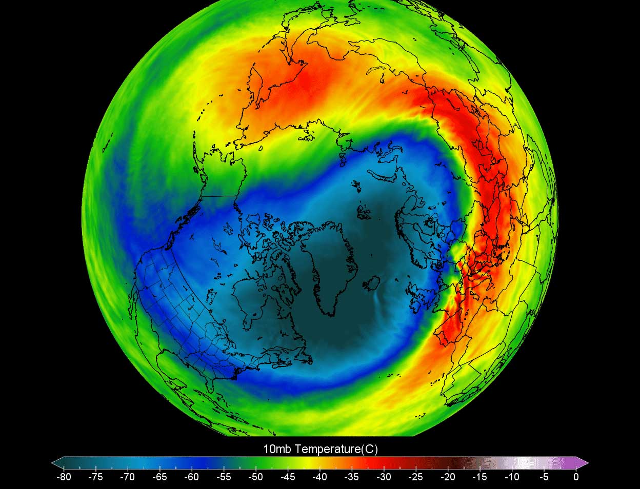
The weather model chart above hints at a typical situation when the Polar Vortex is fully established above us. It represents the pressure at around 30 km (18 miles) altitude, located near the top of the stratosphere layer during winter.
The active and strong Polar Vortex during the first half of the Winter season 2024/25 has been the main trigger behind the historic cold outbreaks over Siberia; temperatures plunged below -65 °F for several days at the beginning of January.
Meanwhile, the most intense part of the vortex, the southern lobe of the Polar Vortex, has shifted to the North American side of the northern hemisphere. This is where all the fun begins from now on.
A significant blocking High over the Pacific establishes a powerful Arctic Blast for Canada and the U.S.
The general weather pattern foreseen over North America hints at a large-scale blocking ridge developing over the North Pacific and Alaska late next week. To its east, a deep wave will develop over Canada and spread into the U.S. by the weekend. As it digs south, it will also intensify further.
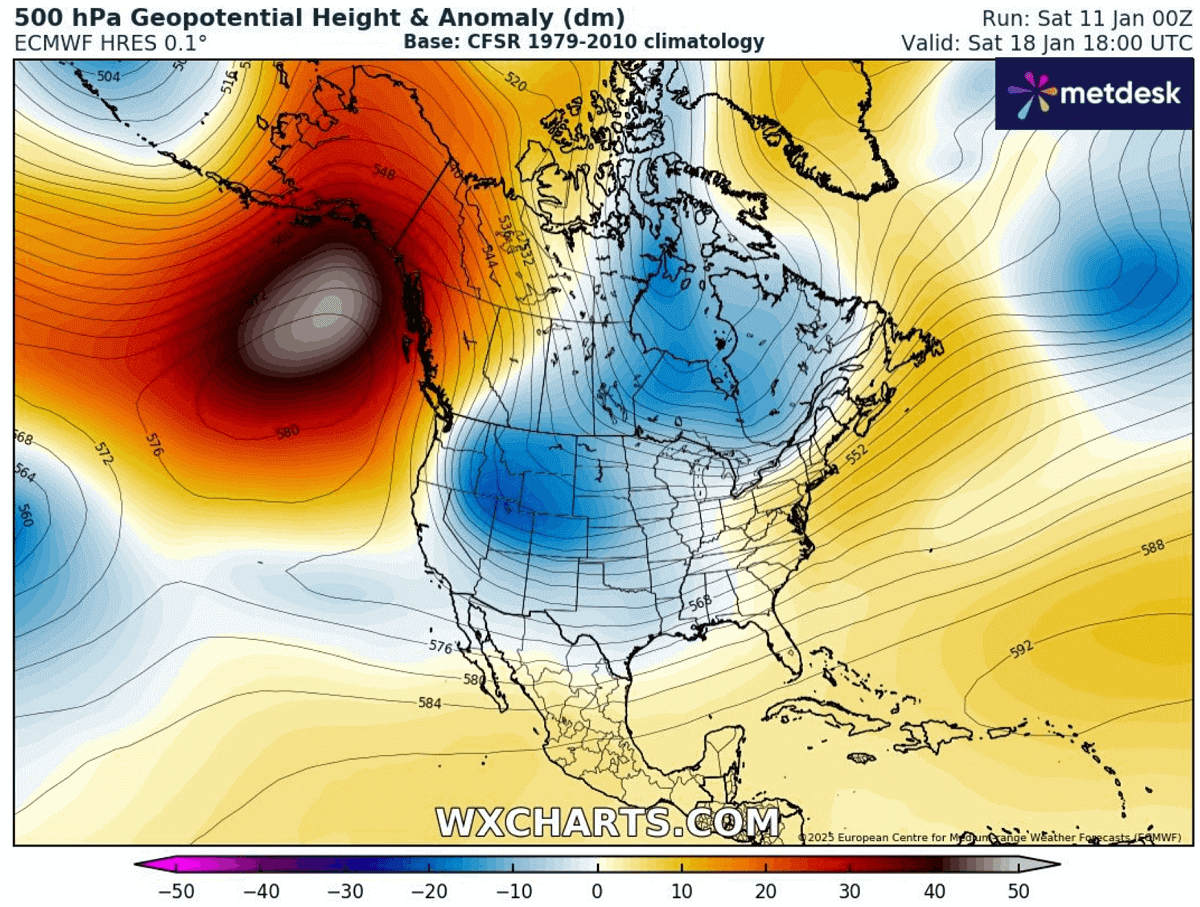
In response to significantly colder temperatures descending from the upper levels towards the surface, the surface pressure will push into extreme values. Establish an extensive high-pressure system across western Canada and the United States the following weekend.
This is a typical evolution as cold weather is denser than the warm air mass, so the pressure underneath the Arctic cold significantly rises. The following chart represents the surface pressure next weekend, with more than 1050 mbar across southern Canada and the northern High Plains.

The highest pressure is a general hint where the most potent cold develops while it gradually descends southward with time over the weekend and the week after. Temperatures will plunge into deep freeze.
The upcoming Arctic Blast will bring the most intense cold weather this Winter Season 2024/2025; frigid low temperatures are forecast.
The extensive Arctic cold pool forecast to develop over Canada late next week will remain in place for a more extended period. Over the weekend, it will gradually but rapidly advance south with the Arctic front across the U.S.
Coming from the Northwest Territories, the brutal cold first spreads across Alberta and Saskatchewan, Canada, on Friday and Saturday. It then continues south across Montana, Wyoming, and the Dakotas and reaches the Central Plains by Sunday morning as the Arctic front rapidly races towards the south.
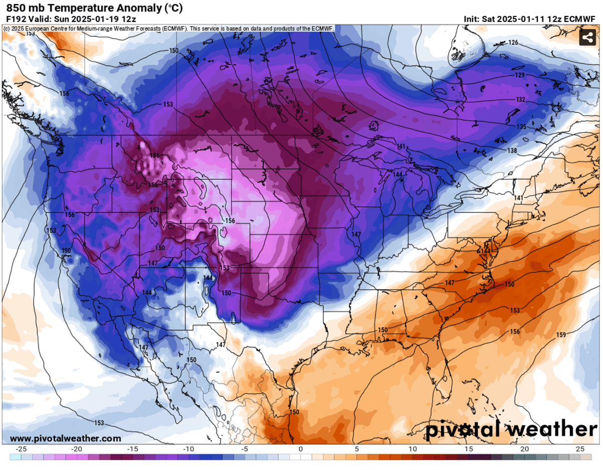
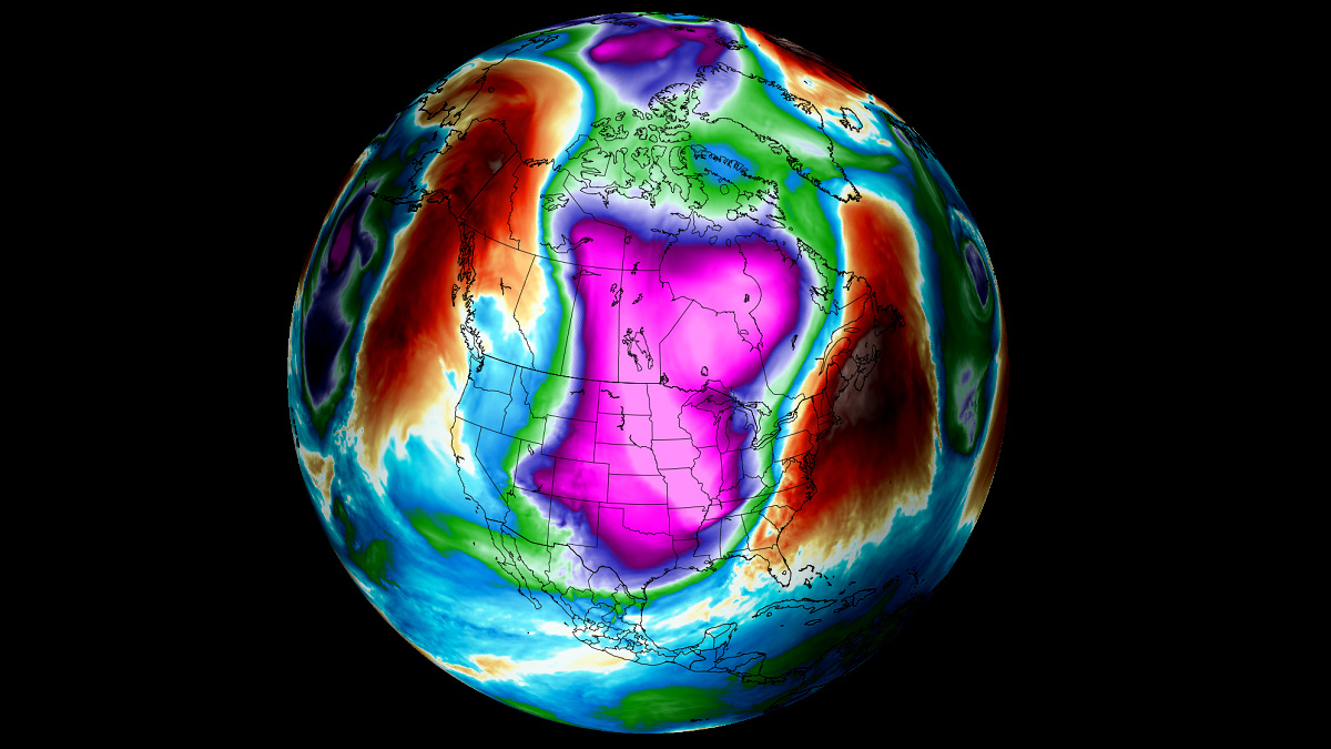
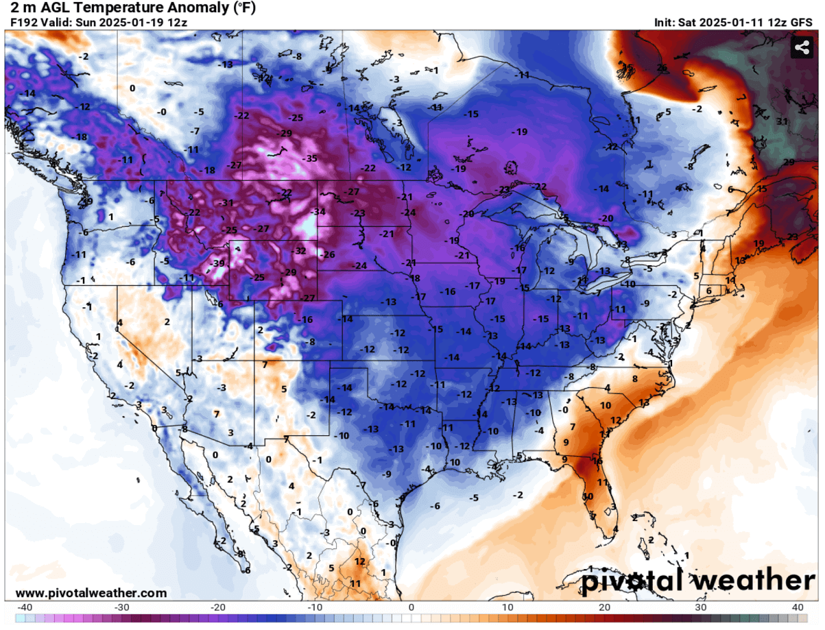
The above chart represents the 850 mbar temperature anomaly for Sunday next weekend, Jan 19th, 2025. Extremely anomalous temperatures grip two-thirds of the U.S., the most extreme across Montana, Wyoming, and Nebraska on Sunday.
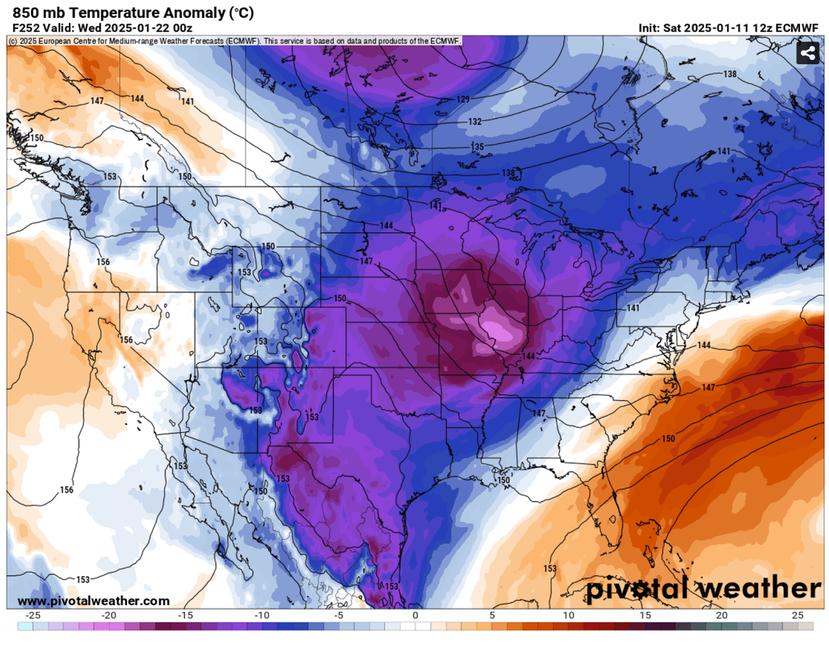
The cold pool will advance across the central U.S. on Monday and Tuesday, reaching Texas and Mexico. Since it remains extremely cold in the north, the frigid Arctic airmass will be deep and extensive, dominating a large part of the nation.
The progress of the Arctic Blast results in hazardous, frigid cold conditions across southern Canada and the north-central U.S. states from Saturday next weekend through multiple days of the week after.
Daily temperatures across Alberta, Saskatchewan, Montana, Wyoming, and Dakotas will be 25 to 40 °F below normal for mid-January, posing a high risk of hypothermia for those exposed outside for too long. Conditions will be frigid.
Temperatures will remain frigid low for days, 20 to 30 degrees F below freezing in the nighttime hours and 5-10 degrees below during the day.
Winds will not be assertive, as the high pressure will establish calm but very cold conditions. However, any wind occurring will worsen the real feel as windchill temperatures become brutally low.
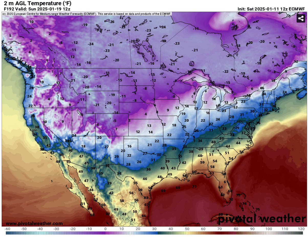
Further south, temperatures will plunge into single digits to low 10s through north Texas, reaching below freezing through the deep south Texas Gulf Coast and further east along the Texas coast to Louisiana on Tuesday morning.
While on the north, temperatures in deep freeze will remain around 10 to 20 degrees below 0 °F across the northern states through the Upper Midwest and the Great Lakes.
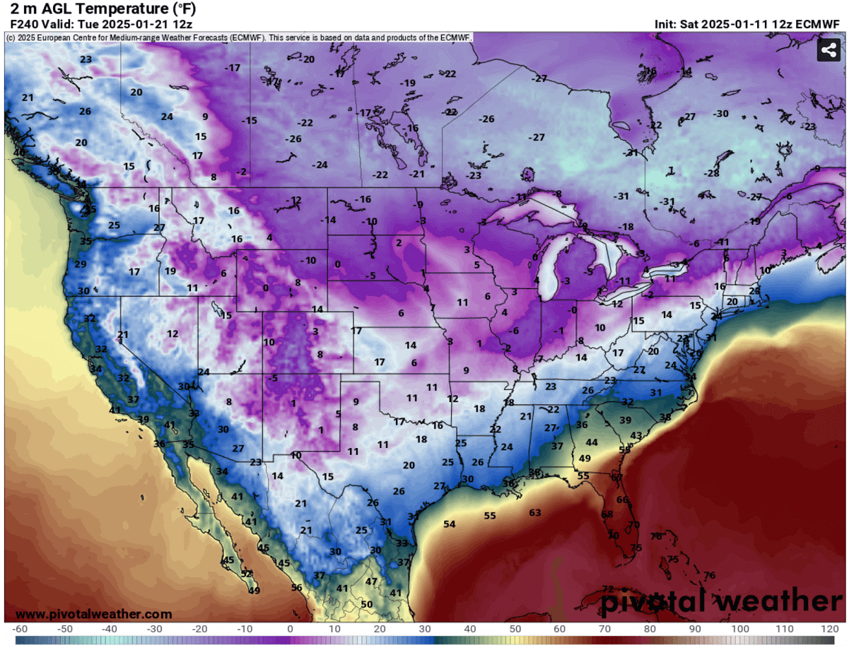
The frigid cold will also maintain across much of the Canadian plains, from -20 to -30 °F Monday through Wednesday next week.
Frigid cold likely to extend into the final week of January 2025
An extended below-extreme cold is likely thanks to a dynamic polar vortex and its persistent southern lobe across the North American continent.
The long-term projections hint that the Arctic cold pool will likely persist through the remainder of January. According to the ECMWF weather model, the upper High from the Pacific Ocean will move more east after Jan 20th, meaning the most significant Arctic cold air mass intrusions would follow for eastern Canada and the U.S.
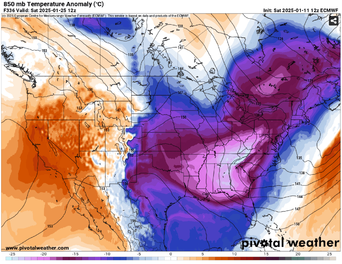
So, trends for the 10 days ahead indicate the potential for an intense upper wave to grip the eastern U.S., reaching far south, towards the southeast, and to Florida around the weekend of January 25th.
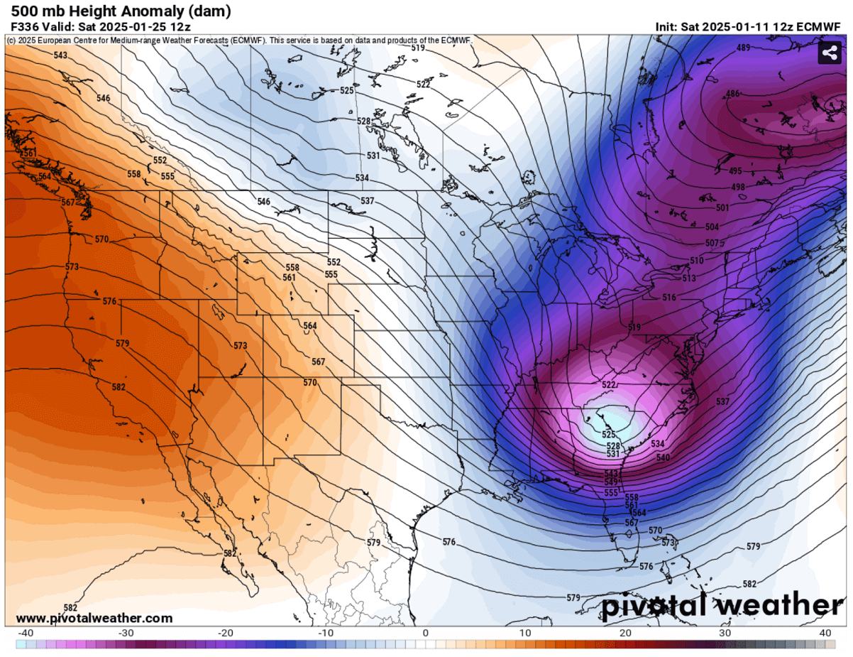
This would again respond to extreme cold weather, engulfing the country’s eastern two-thirds. Temperatures would plunge 20-25 degrees below normal for the region.
This low’s cold is particularly extreme for the Southeast U.S. and could lead to dangerous conditions. Systems like this usually bring chilly winds and combine with a winter storm, resulting in heavy snowfall, blizzards, and possible ice storms.
The following 2m temperature chart for January 25th brings the chills, as most of Canada and the Contiguous U.S. is in the deep freeze, including the pretty cold temperatures along the deep South, with temperatures in the mid-20s °F along the Gulf Coast from Texas to the Florida panhandle and the Atlantic coast.
Further north, across the Great Plains, Midwest, and Great Lakes region, there would again be an extreme, deep freeze with temperatures from -10 to -20 °F, and even colder into Canada.
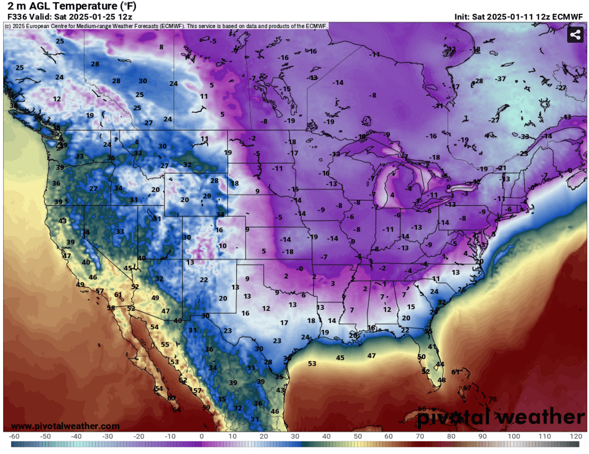
Only the desert southwest and West Coast would remain in decent warmth.
The charts above are long-term trends, which are far in advance. Still, both global weather models, ECMWF and GFS, hint at extending the extreme cold pattern until nearly the end of the month, as we discussed in our extended period outlook earlier this week (see the link below).
We are closely monitoring the evolution of the ongoing pattern and will update you accordingly. Stay tuned.
Wxcharts, Windy, and Pivotalweather provided images used in this article.
See also:
January 2025 Forecast: How long will this cold Winter period last over the United States?