September starts with a significant cold wave across North America, driven by the cross-polar flow into the continent. Temperatures will feel like October-like chills for more than 200 million people across the eastern two-thirds of the United States.
Temperatures will be 10 to 20 degrees below normal for early September. After mid-week, a large upper cold wave will dominate the eastern portion of the North American continent, causing colder temperatures to persist into the following weekend across the east and central United States. These temperatures will feel similar to those typically experienced in late October.
Much colder temperatures will also reach the South and Southeast U.S. late this week.
This will be the second cold outbreak in two weeks, but this week’s cold intrusion will be the most substantial cold air mass outbreak since last spring’s cold outbreaks across the United States.
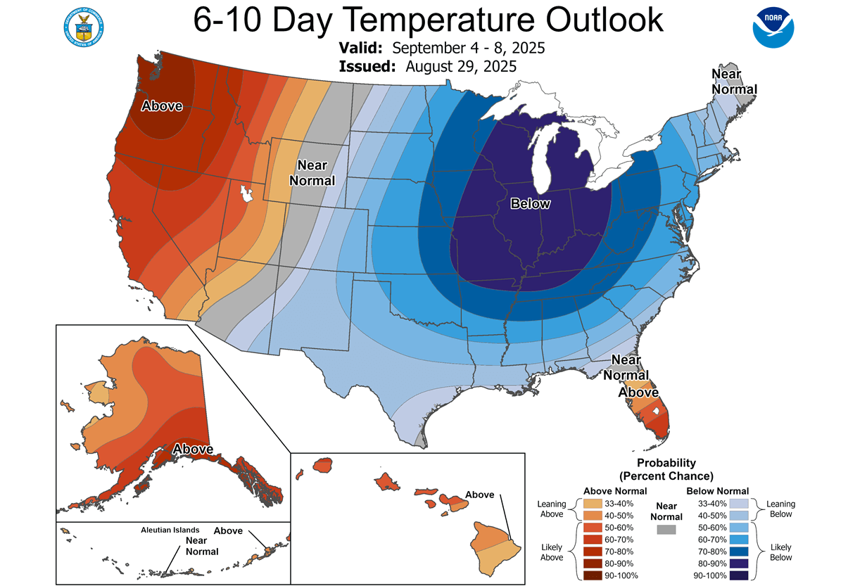
According to the CPC (Climate Prediction Center) outlook, the first week of September hints at unseasonably cold weather and a decisive break in the summer weather pattern. Over two-thirds of the Contiguous U.S. can expect below-normal temperatures from Thursday through Sunday into early next week.
The highest probability of much colder days will be over the Midwest, Great Lakes, the Ohio Valley, and the Northeast U.S.
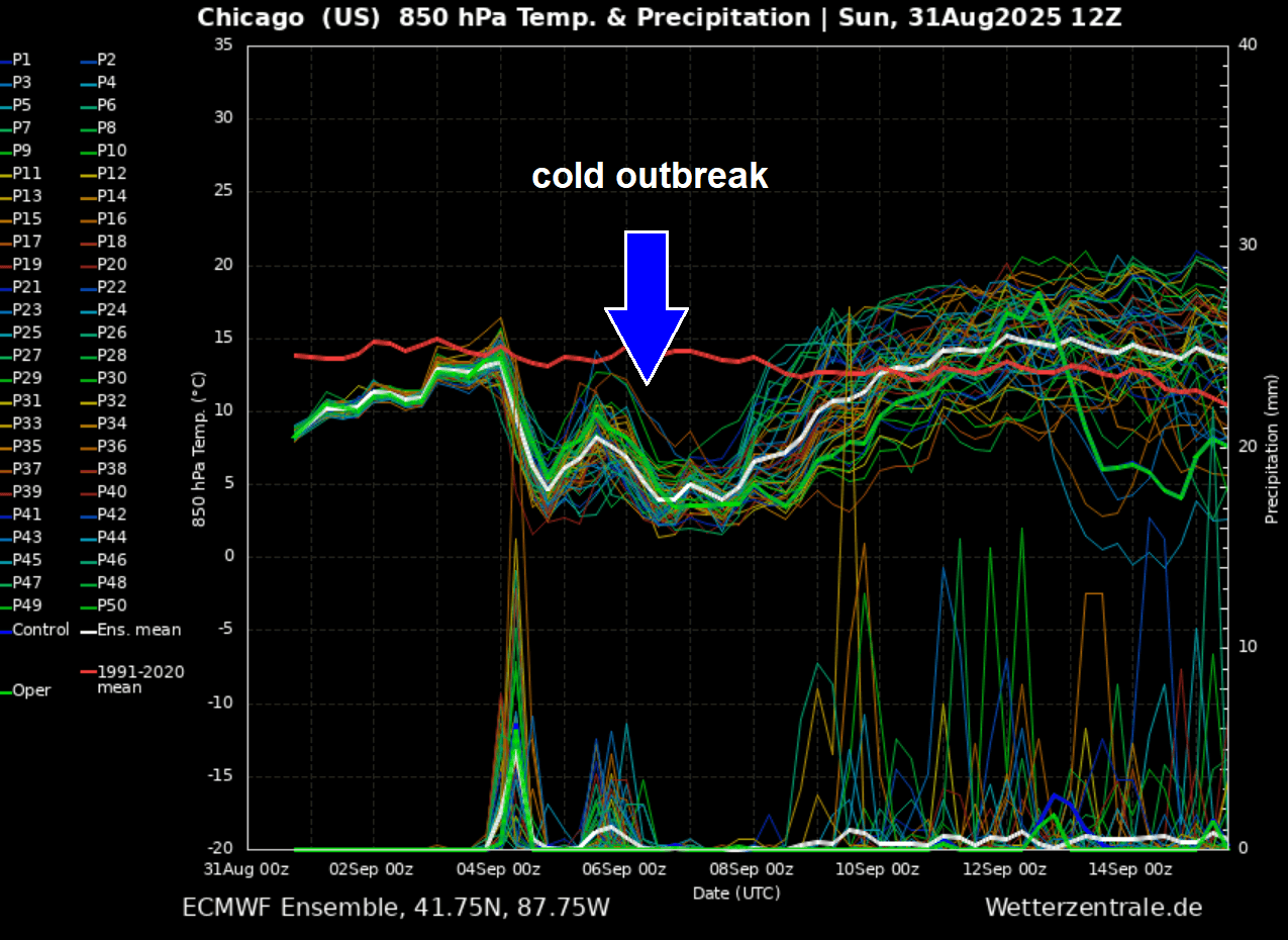
Below is the 14-day meteogram for Chicago, IL. It represents the temperature and precipitation forecast, and we can see that a long period of below-average temperatures will follow after Wednesday and end early next week.
So a cold outbreak will dive south from Canada and be pretty deep and long-lasting, 5-7 days on average for most states from the Midwest to the East Coast.
Before we discuss the evolution of the significant temperature change in detail, here is a video overview of the cold wave emerging from Canada into the United States late this week.
Starting Wednesday night, it spreads into the Northern Plains and Midwest, following into the Great Lakes and Ohio Valley on Thursday, and then reaching the East Coast and Southeast U.S. by the weekend.
Colder-than-normal weather is expected to persist until the second week of September, so the meteorological fall season 2025 starts with an unusually strong cold refreshment, bringing temperatures like late October chills.
Cross-polar flow develops a deep upper wave over southern Canada and the CONUS this week
The surface pressure patterns over the Northern Hemisphere boosted the cross-polar flow deep from the Arctic towards the south. This is helping to establish the high-pressure system far north, which helps to trigger the frontal system in central Canada.
This combination of Highs over Lows gradually builds up the meridional (northerly) flow from Canada into the U.S. this week, providing an undisturbed corridor for the cold air outbreak to spread far south across the CONUS.
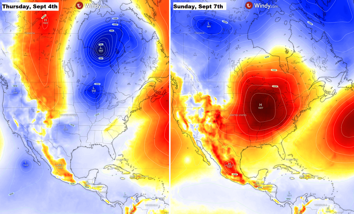
By the weekend, a strong high-pressure system will establish itself over the eastern two-thirds of the U.S., helping the cold reach the Southeast and the East Coast.
With time mid-week, the upper wave deepens and drags a much colder air mass in the higher levels from Canada into the Upper Midwest and Great Lakes, thus deepening the wave’s core. This is a typical North American weather pattern that unfolds this week.
With a high-pressure system on the west and a deep low-pressure system on the east side of the continent, this pattern is similar to those we face with massive cold outbreaks in winter and spring.
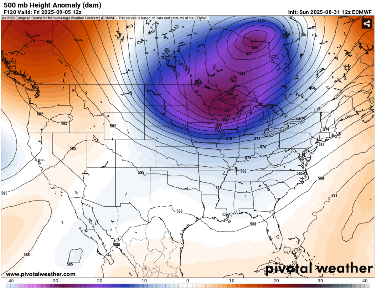
A strong temperature and pressure gradient between the High on the West and Low on the East also boosts the polar jet stream, which travels much further south than is typical for early September.
The following chart shows powerful upper-level winds rounding the core of the cold wave over the Upper Midwest and the Great Lakes on Friday, with wind speeds exceeding 130 knots at the 250 mbar pressure level.
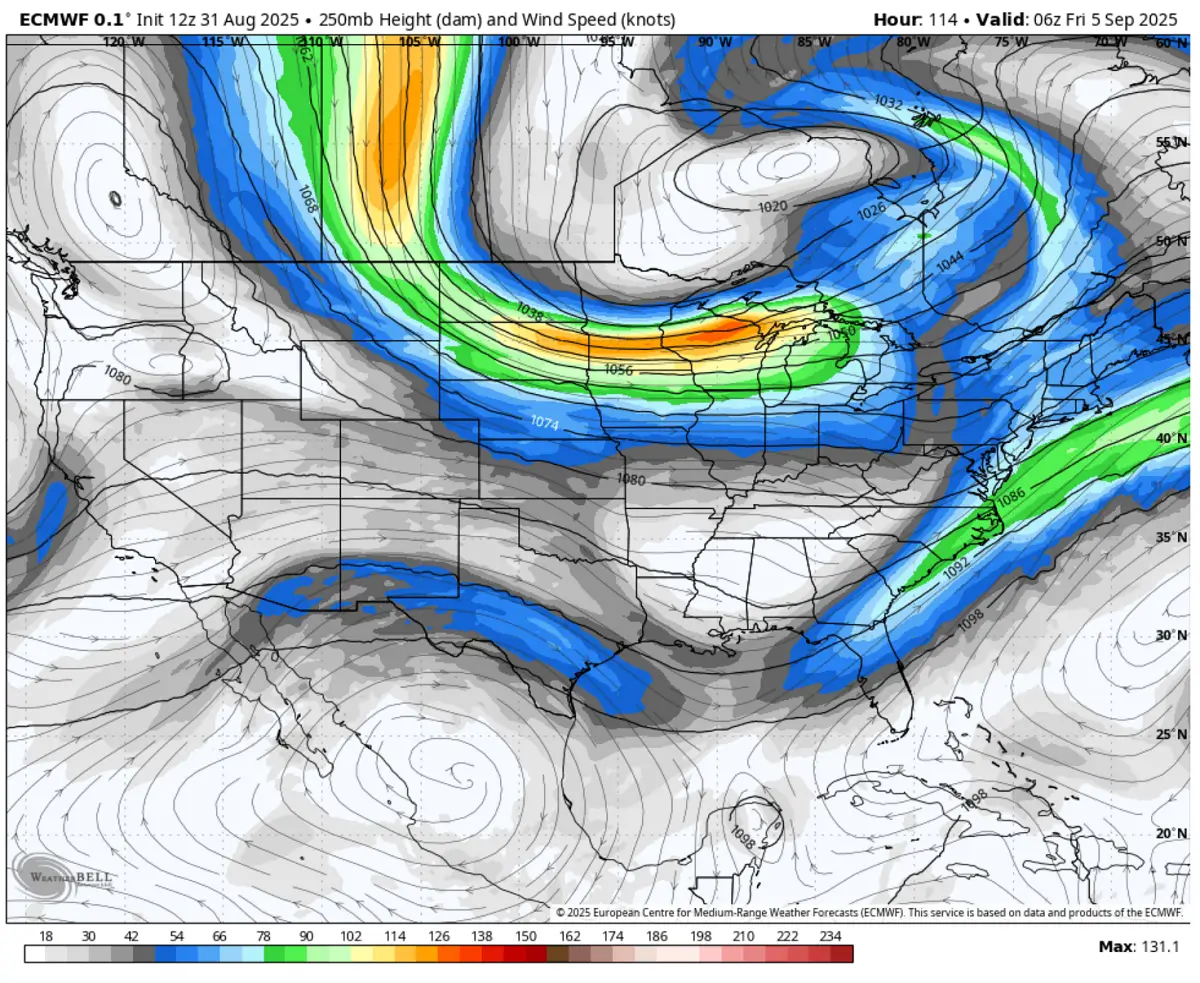
Aside note: Those travelling east by airplane in the coming days will take advantage of these strong winds aloft and have their travel times shorter than usual.
Cold outbreak refreshment starts Wednesday and continues into the following weekend
Behind the slow-moving cold on Wednesday, the cooling period starts in south-central Canada. It intensifies as it spreads towards the northern U.S. It reaches the Northern Plains and Upper Midwest early Thursday. The cold outbreak develops and gradually moves south-southeast into the following weekend.
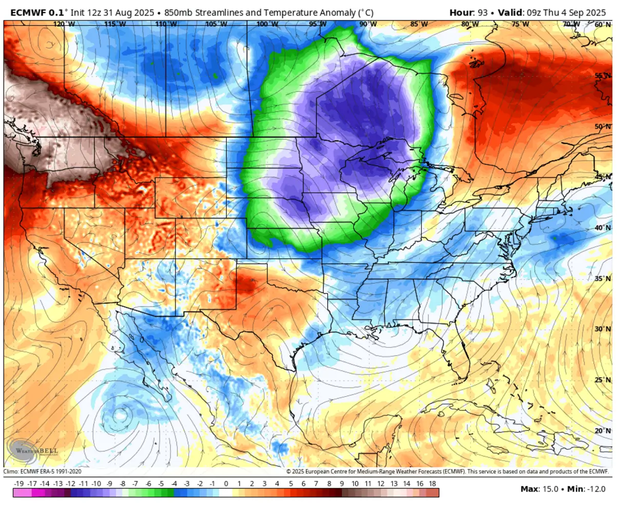
By Sunday, the cold pool core will reach far south Kansas, Oklahoma, the low/mid-Mississippi Valley, and the Southeast U.S., bringing the tens of millions into much colder weather than they have experienced lately.
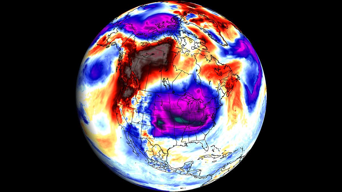
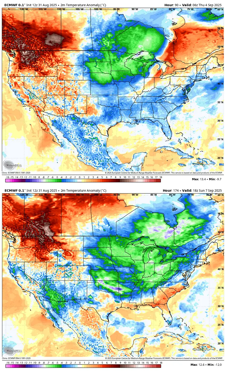
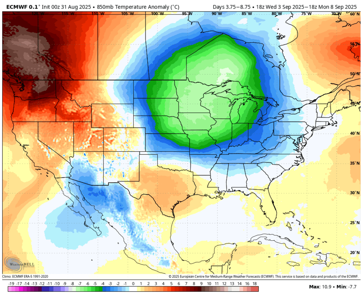
As we see on the following chart, the pool of cold air mass grows larger, covering more than 200 million people with 8-12 °C colder mid-level temperatures than usual.
These temperatures spread the surface temperatures into 10-15 °F, locally close to 20 degrees below normal for the start of September.
Most eastern two-thirds of the Contiguous U.S. and southern Canada will feel this air mass change into fall-season vibes. Temperatures will trend 10–20 degrees below the historical average for the first week of September.
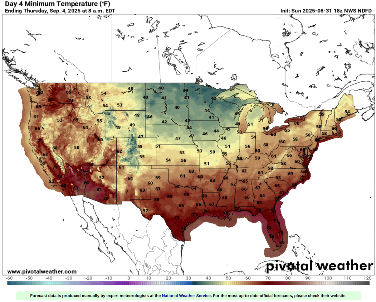
Days from Thursday through Monday morning are forecast to bring the lowest temperatures over the continent for many, as the cold wave core matures over the Midwest and the Great Lakes before the cold spreads further east into the Southeast U.S.
Temperatures will be in the upper 30s to low 40s across eastern Dakotas, Minnesota, and Wisconsin. Low to mid-50s across the Midwest and Ohio Valley. Temperatures of 60s or higher will only remain across the southern and southeast U.S. before it cools down by the weekend.
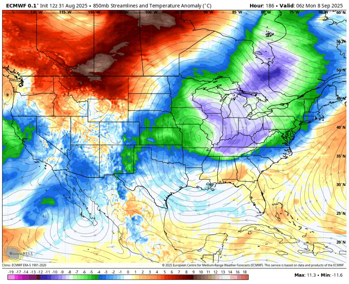
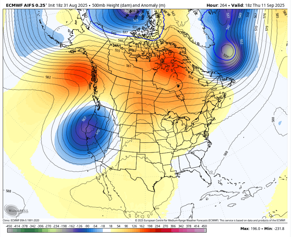
The cold pool will gradually lose strength around mid-next week as the upper wave weakens and a new blocking High with a Heat Dome gradually develops from the west and expands into the central U.S.
The Thursday chart for next week reveals that a deep trough is emerging into the West Coast and the Pacific Northwest region, pushing warmer weather into the central CONUS again. This will gradually warm the days and return temperatures to normal.
How anomalous is the upcoming cold wave? Introducing a significant temperature change from the recent heatwaves is still pretty unusual for the early Fall season. Typically, the heat persists into September. But this year, the unusually weaker Polar Vortex established the cross-polar cold in North America.
The 5-day temperature anomaly from Thursday through Monday next week shows that much of the U.S. and southern Canada will be colder than usual for this time of year. The colder air mass and strongest temperature anomalies will be over the Upper Midwest and the Great Lakes.
As mentioned earlier, this does not mean the summer weather is over. As we can see from the mid-range trends, the weather pattern suggests warmth will return towards mid-September. We are monitoring the pattern evolution and will update the forecasts once we get closer to the changes into the warmer phase.
Windy, Wxcharts, and WeatherBell provided images used in this article.
See also: