A textbook Omega-Blocking High pattern is developing across North America this weekend. It results in a record-challenging heatwave for the U.S. Midwest and Great Lakes and Ontario, Canada, as we head into the first week of October 2023. Fall season continues with very high temperatures, with quite an unusually strong heat dome for October.
Temperatures from Sunday through mid-next week are expected to be around 20-25 °F higher than normal, challenging daily records across the northern states and Ontario province. Daily High temperatures will push into 80-90 °F for several days.
It hasn’t been so warm over the Midwest and Great Lakes so late in the season for decades. Daily records over a century old will be challenged in the following days.
For instance, in Minneapolis, the record highs for early October were set back in 1897, nearly 120 years ago. Those records are held at 87 degrees F, and forecast calls in the next few days will be challenging those.
Other large cities like Fargo (ND), Des Moines (IA), Duluth and International Falls (MN), and Omaha (NE) will all see challenging temperatures. After Monday, extreme warmth for October will also follow across Ontario and Quebec, Canada. Montreal will see extreme warmth as well.
Normally, the temperatures are in the 60-70s Fahrenheit range across the Midwest and Great Lakes through early October. So, this heatwave will bring excessive heat for some later in the fall season. The reason behind this evolution is the general weather pattern developing across North America through early October—a deep Pacific low digs into Western CONUS, with a strengthening Upper High to its east.
This results in a significant warm wave spread north and east and intensifying while we head into the first week of October. Unusually high temperatures develop and reach northern states with the help of southerly flow between the two large-scale features.
This is establishing a longer period of stable and particularly warm October weather. This feature, known as the Heat Dome, intensifies a heatwave underneath. Such a specific weather pattern brings excessive heat and very high temperatures. Let’s talk about it first.
What is a Heat Dome, and Why Does It Bring Extreme Temperatures?
Let’s review the primary background feature that caused the development of major heat waves globally this year. There were particularly strong heatwave events already this fall over the United States; similar occurred in the past on both North American and European continents.
The Heat Dome is that feature that leads to these extreme heat events. Usually, the heat dome is the main and the most dominant feature of summer weather patterns on both continents. We use a heat dome term when extremely high and anomalous temperatures develop. Here is how it works and why it is important to understand it from a larger scale.
The upper-level ridge pattern, or warm air mass in the higher altitudes, is the Upper High (or blocking High). It usually forms the heat dome. This weather pattern brings high and sometimes record-challenging temperatures for the region underneath.
So, this specific term is used when a broad area of high-pressure parks over a large portion of the continent. Usually, it stays there for several consecutive days or even weeks if the event is particularly stable and extreme.
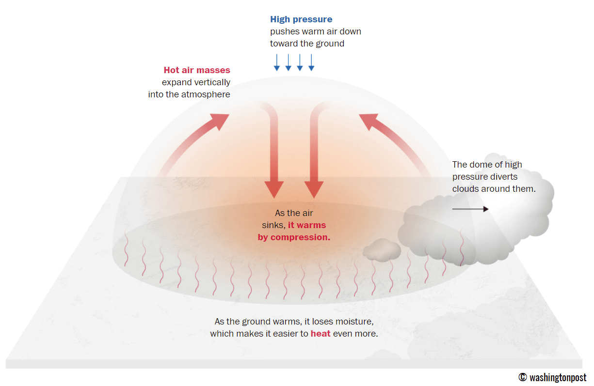
The heat dome works like a lid on a pot. The extensive dome of heat traps a significantly warmer air mass at all levels underneath, sinking layers toward the ground. Therefore, the air mass becomes dry and anomalously warm at the lowest elevations and extremely hot near the surface.
A heat wave, associated with a heat dome, creates stable weather and often arid air mass with minimal chances for precipitation or even clouds, as the sinking air parcels in the center of the heat dome result in rising temperatures. This is because the weather pattern develops a so-called Omega blocking High.
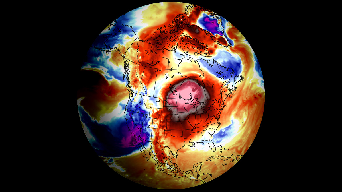
The example below is this kind of an extensive blocking pattern that developed a historic heat dome across the U.S. in mid-summer this year. If an Omega-blocking pattern develops this early October, it will engulf a large part of the continent. It has a central heat dome and a low-pressure system on each side.
Typically, drier and warmer weather produces a significantly enhanced wildfire threat due to developing drought. Or additionally worsening the ongoing, pre-existing, arid conditions. Such examples were wildfires in the Pacific Northwest and other parts of western North America in recent years or in Europe (Greece, Portugal, etc.) during the summer season.
Heat dome is often also to blame for being responsible for deadly heatwaves worldwide due to a scorching and excessive heat that lasts for a very long period. Such heat dome events brought record temperatures in many countries worldwide in 2023, extending into the fall seasons.
The daily average and maximum temperatures under the heat dome are typically significantly above normal. When the dome of heat is particularly strong, it challenges or breaks existing historical records, as we have seen globally this year. This becomes particularly striking when this feature develops during early summer or autumn/fall.
Let’s now dig into the details of developing this unusually strong fall season heatwave for the first week of October 2023.
A Textbook Omega-Blocking Pattern Develops a Heatwave Under the Heat Dome
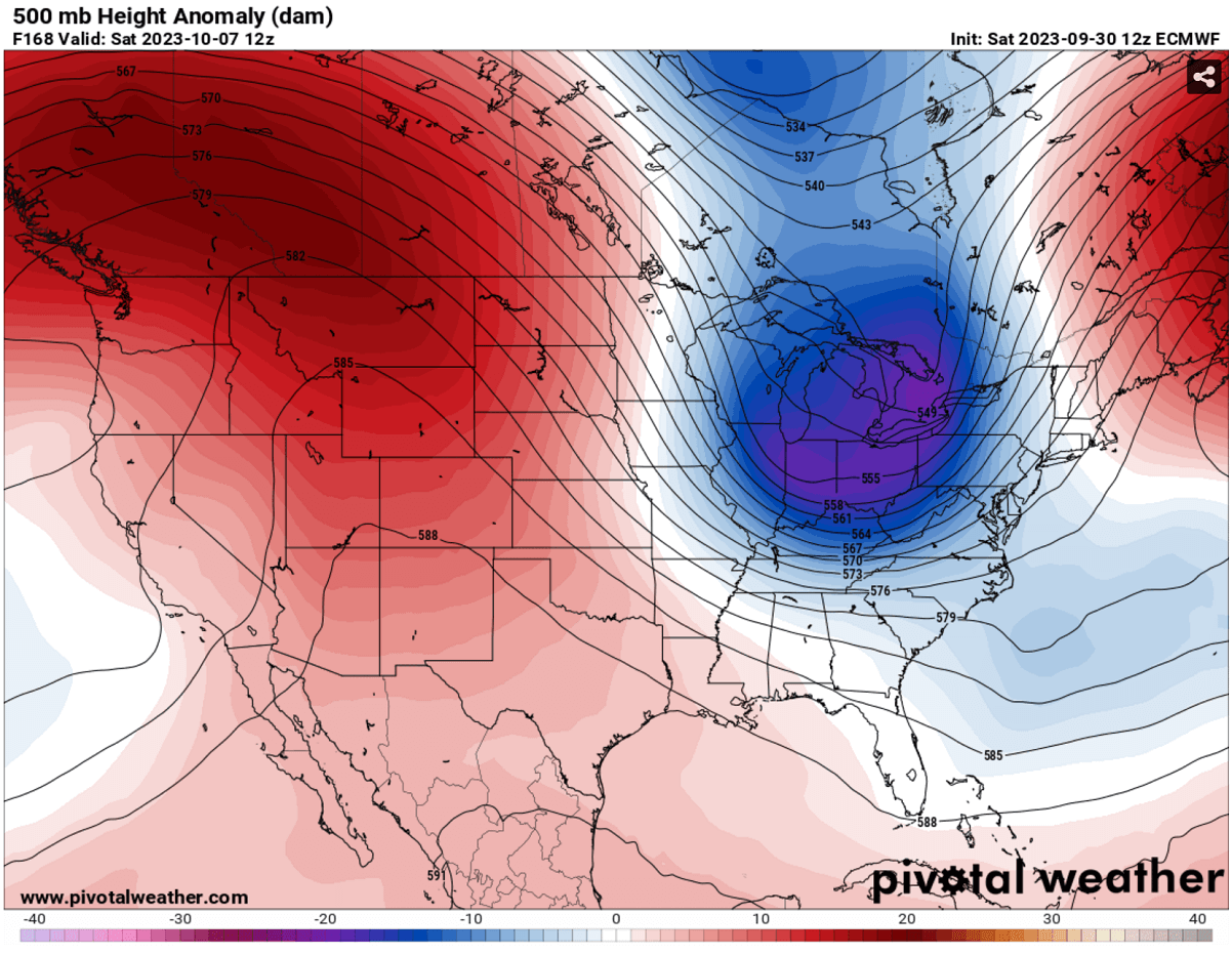
Over this weekend into early next week, the general weather situation over North America indicates an extensive blocking high. Strengthening a heat dome into the eastern two-thirds of the CONUS and southern Canada. This results in strongly anomalous geopotential heights, or, in other words, a stable period with unusually warm weather.
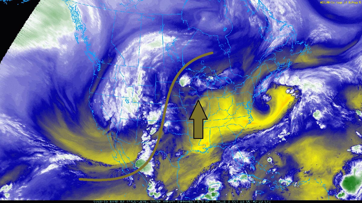
The chart below shows a textbook Omega blocking pattern developing over the U.S. and Canada. On Monday, a deep Upper Low digs into Western CONUS from the Pacific Ocean, while another low is off the East Coast.
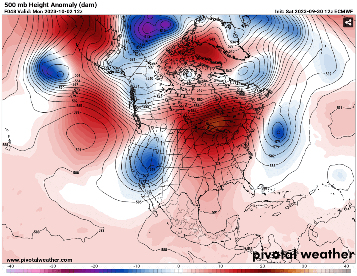
With a strengthening High over the U.S. and a deep low on the west, a south-southwesterly flow is establishing a significant warm plume across the continent. Thus, achieving a much warmer air mass in the following days gradually spread north, expanding into the Midwest and the Great Lakes and spreading across southern Ontario, Canada, throughout mid-next week.
From Sunday into Monday, an extremely anomalous air mass will develop across the northern states and Ontario. The warmest and most anomalous air mass will persist for several days, at least until Wednesday next week, gradually spreading east into eastern Canada with time.
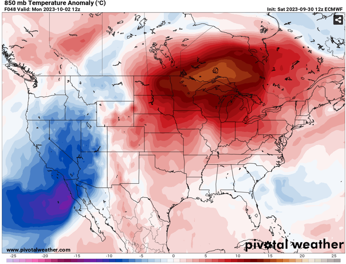
The heat dome and heatwave are forecast to peak in the Upper Midwest, Great Lakes, and southern Ontario through Monday and Wednesday. The highest temperature anomalies are forecast over Minnesota, Iowan, Illinois, Wisconsin, Michigan, and across the international border into Ontario and Quebec provinces.
This will result in daily high temperatures significantly above normal for early October and challenge the existing century-old temperature records. Temperatures could locally be nearly 30 °F above normal for this period.
On the contrary, temperatures will be below normal in the west under the Upper Low moving onto the Rockies.
Daily High Temperatures could be record-challenging for the Upper Midwest, Great Lakes, and Ontario, Canada
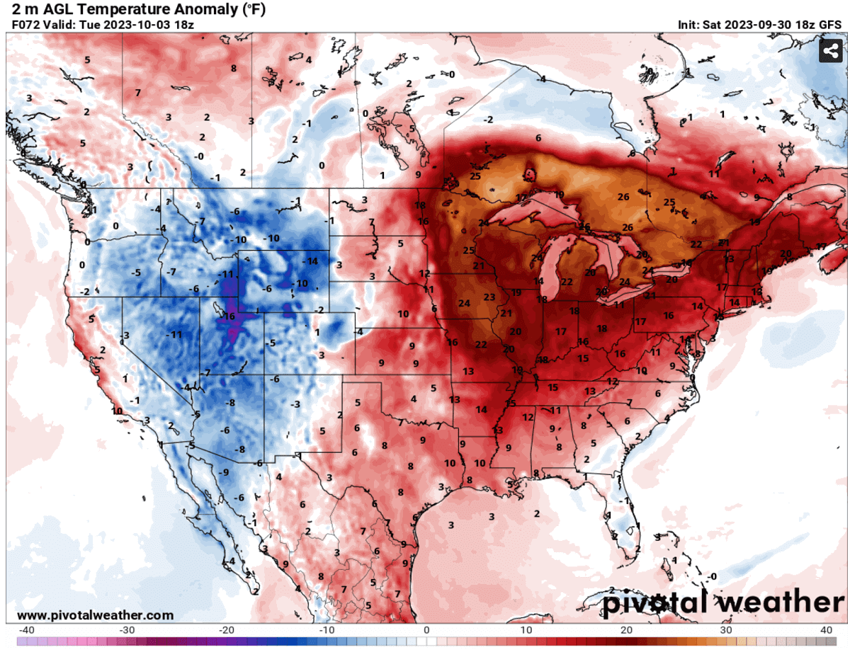
With an expansion of the warm plume into the northern states, starting Sunday, temperatures will significantly increase over the Midwest and Great Lakes first. Then, as the heat dome strengthens from the south, much warmer temperatures will spread into Ontario and Quebec, Canada.
Daily minimum temperatures across the Dakotas, Iowa, and Minnesota will not fall below mid-60s. That is very high and could be record-breaking, as normally, such temperatures are observed daily highs in early October for the Midwest.
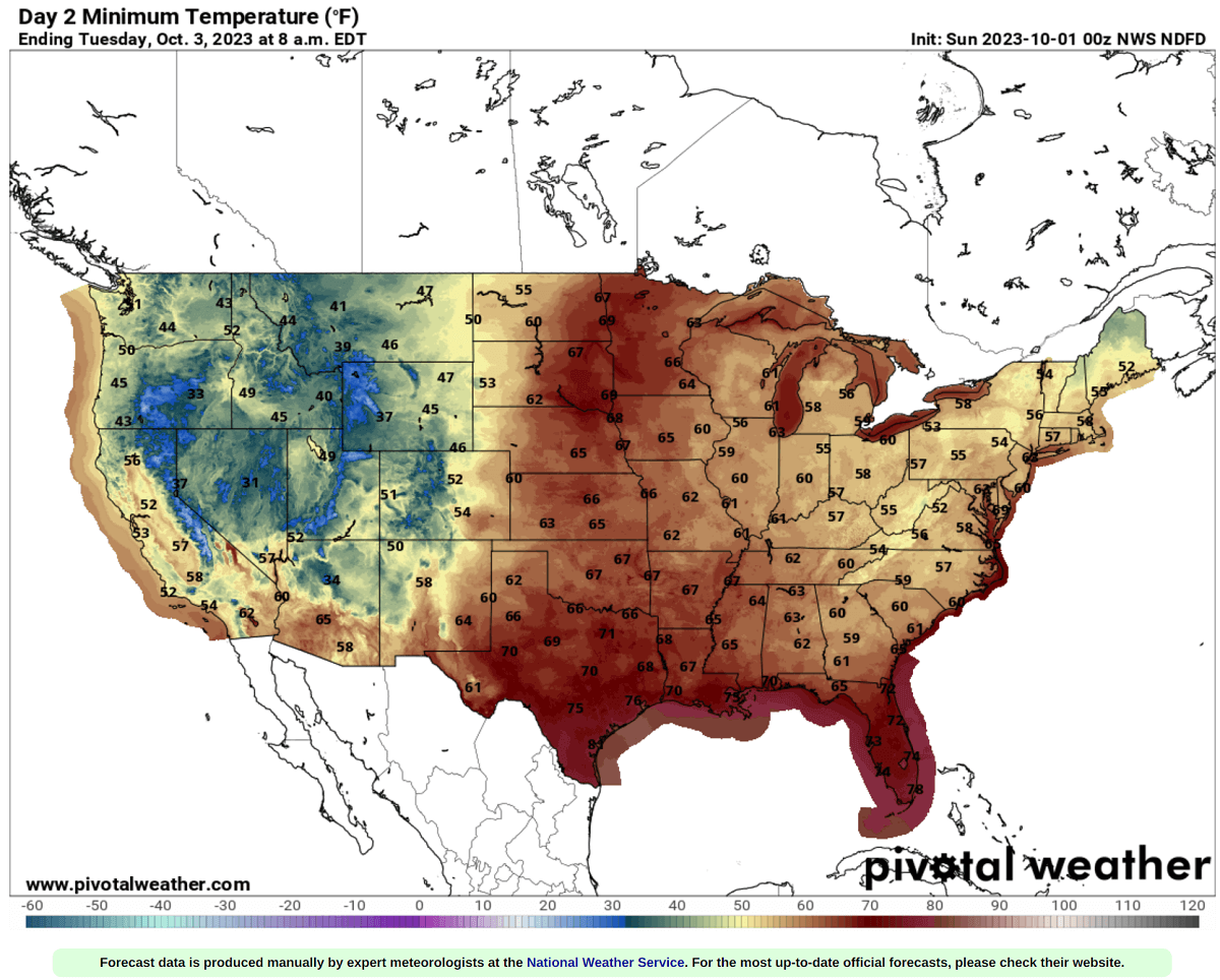
On Monday and Tuesday, the maximum temperatures are forecast to be in the upper 80s to low 90s across the Midwest and upper 70s to mid-80s over the Great Lakes. Low 80s are forecast for southern Ontario and Quebec on Tuesday through Thursday as heatwave strengthens more.
Higher temperatures will also develop south across the southern CONUS; low to mid-90s are forecast across the south-central Plains and the low-/mid-Mississippi Valley.
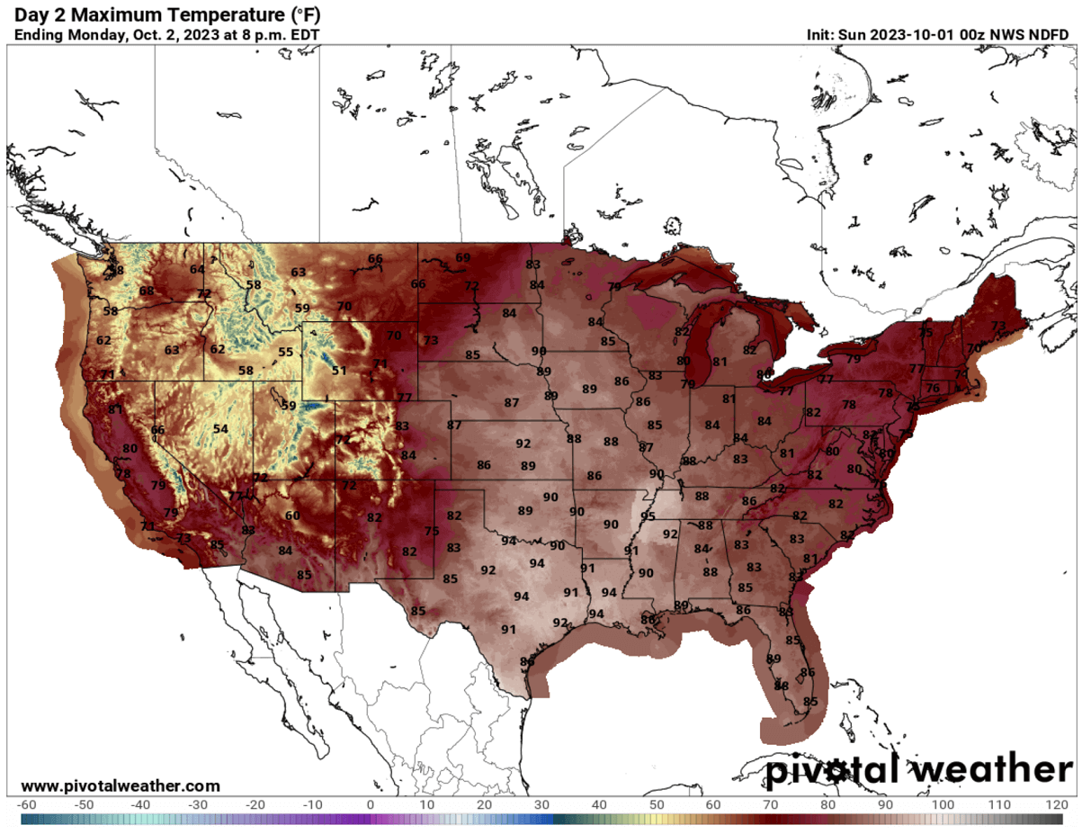
Unusually warm weather will be spread across the eastern two-thirds of the country as we head into the first week of October, similar to southern Ontario and Quebec. Low to mid-80s are forecast for the East Coast as well.
A Weather Pattern Change To Arrive Towards the Weekend, Heatwave Replaced with Colder Temperatures from the North
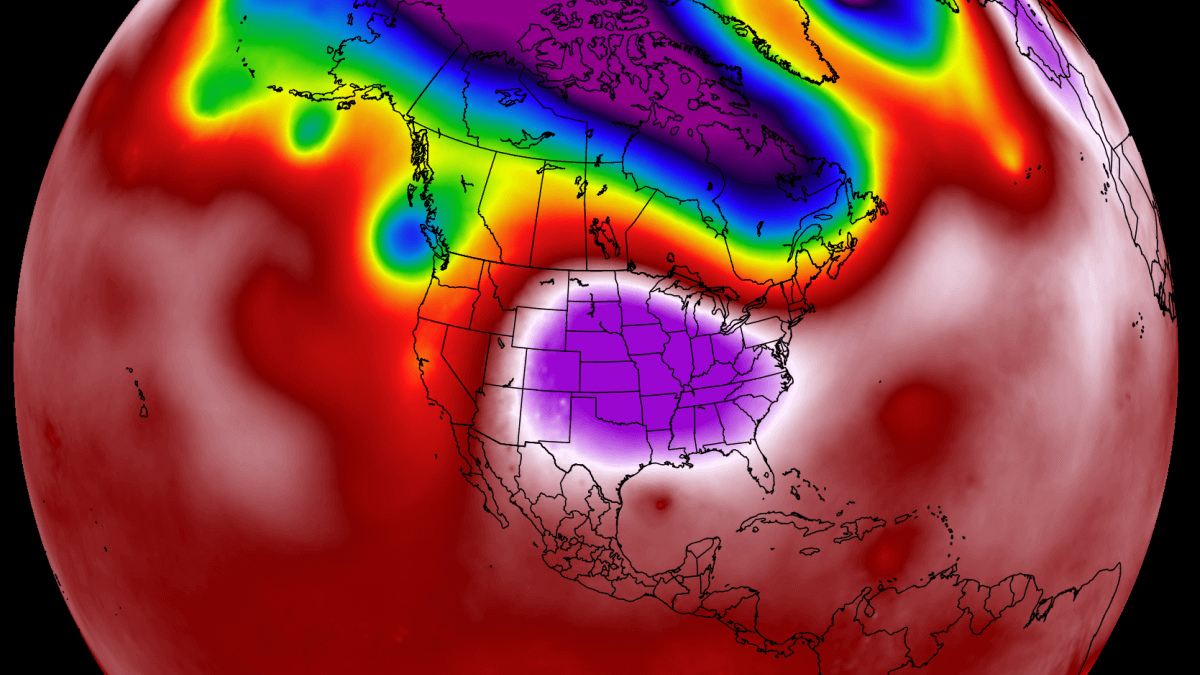
In the chart below, we are reviewing the mid-range trends across North America. The general weather model consensus agrees that a pattern flip will likely follow late next week into the weekend, with a deep low digging south into the eastern US from Canada. At the same time, a strong blocking High develops for the Pacific Northwest.
A large heat dome established over the western CONUS and Pacific Northwest would bring anomalously warm temperatures for several days into the region. The chart below shows the dipole weather pattern: a blocking High on the west and a deep Low on the east.
Although this forecast is almost a week in advance, the consensus is trending into this solution on both global weather models, ECMWF and GFS. So, around the next weekend, warmth will re-establish in western states but switch to colder weather for the central and eastern United States.
The temperature anomaly forecast for next Saturday hints at more than 10 °C (25 °F) colder temperatures for the northern and central Plains, Midwest, mid-Mississippi Valley, and later on Ohio Valley and towards the East Coast.
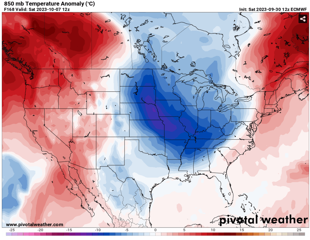
Temperatures on the west will be 5-10 °C above normal, even warmer across western Canada under the core of the heat dome.
Below is an impressive overview of the weather situation, a Meteogram for Thunder Bay (Canada) along the international border. The chart reveals how rapid temperature increase is forecast this early October from around 10 °C at 850 mbar level (or 4000 ft altitude) to around 20 °C. This will be more than 15 degrees above normal.
Thus, maximum daytime temperatures will be in the low to mid-80s across Minnesota, Wisconsin, and Michigan. Even higher, into the low 90s across Iowa, Illinois, and Arkansas on Tuesday.
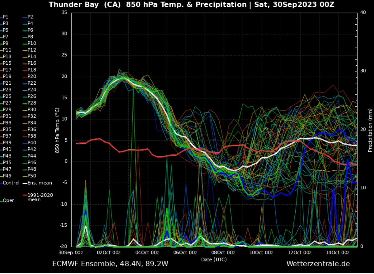
After this significant heatwave, a rather sharp decline is seen as temperatures at this 850 mbar level drop from 20 °C (68F) to nearly -5 °C (23F). That is quite an intense cold refreshment, with around 45 degrees Fahrenheit temperature drop until the next weekend.
If these conditions are verified, after record-high temperatures for early October, the first Arctic cold blast of this fall season could follow from Canada into the United States.
We will monitor the general pattern evolution as we head into the next week and will keep you updated. Stay tuned.
The Health Risks During A Heatwave
During an extended period of very warm weather, generally surpassing 100 °F, it is physically challenging and presents an enhanced risk for health.
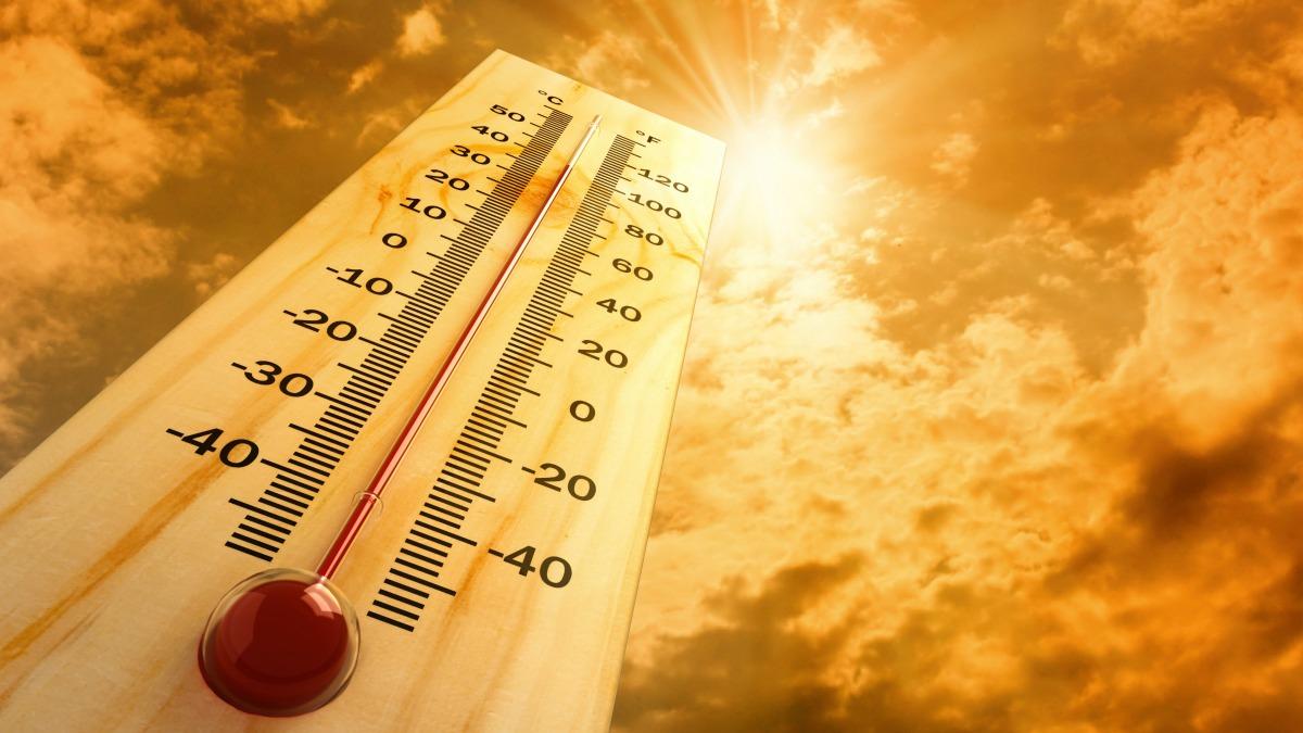
Hot weather, particularly in extended periods and a heatwave – is uncomfortable but presents a significant health risk.
Who is most at risk?
Scorching hot weather is uncomfortable for most people. The following groups are particularly threatened by the very high temperatures we encounter during heat waves:
- elderly people aged over 75 years
- babies, young children
- people with chronic/long-term health conditions, such as diabetes, respiratory disease, circulatory disease
- People who are obese
- People taking certain medicines
- people who work outdoors, in hot/poorly ventilated areas, or engage in physical activity in hot weather
- socially isolated people
- people who are not acclimatized to hot weather, such as tourists from northern countries
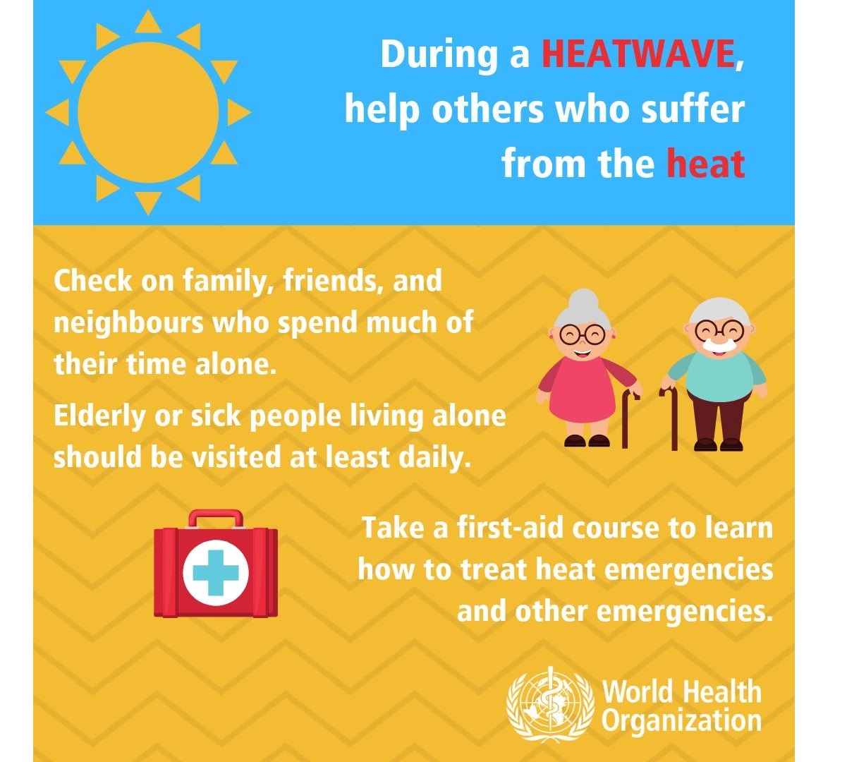
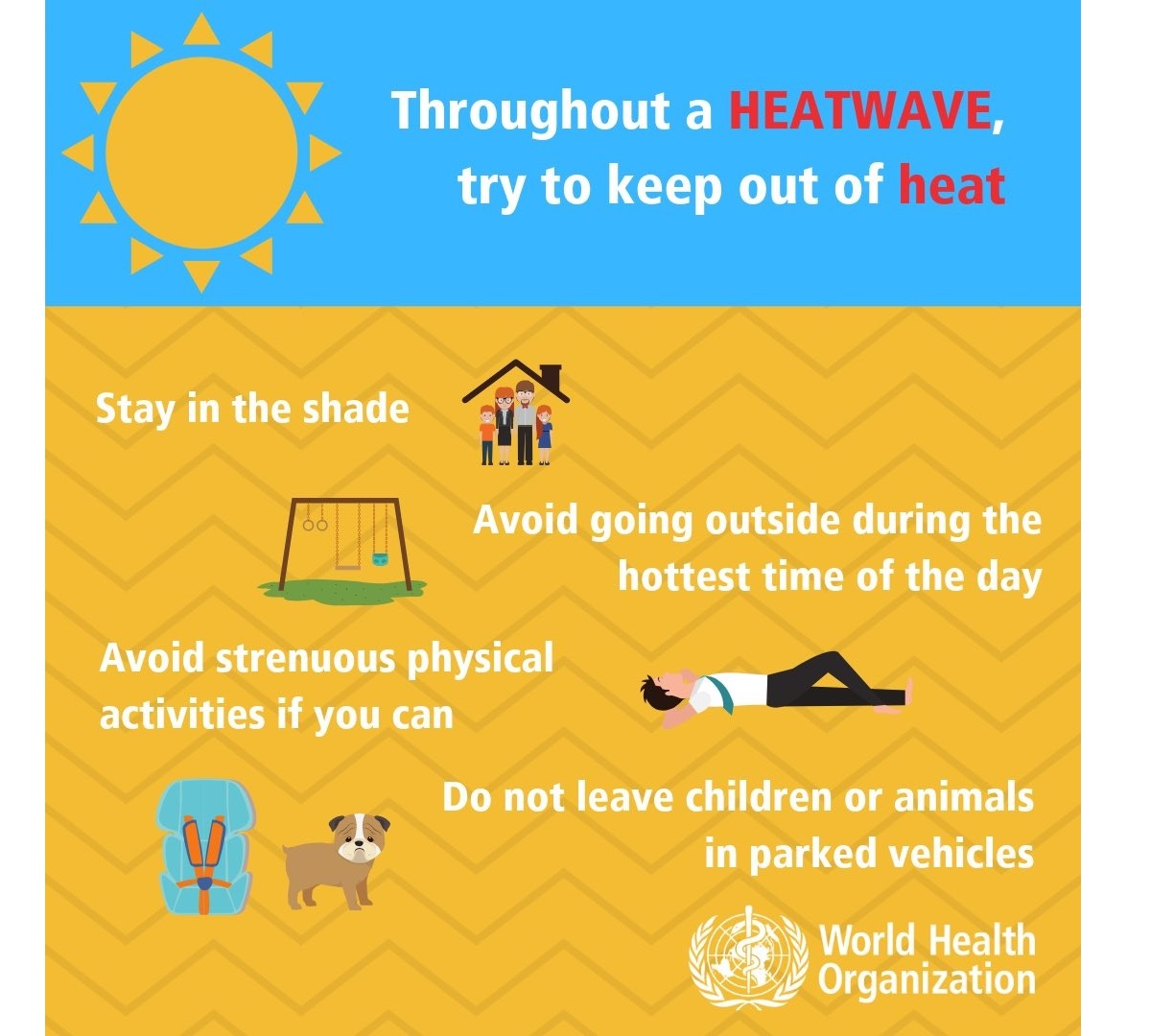
Always stay cool, hydrated, and healthy in scorching hot weather
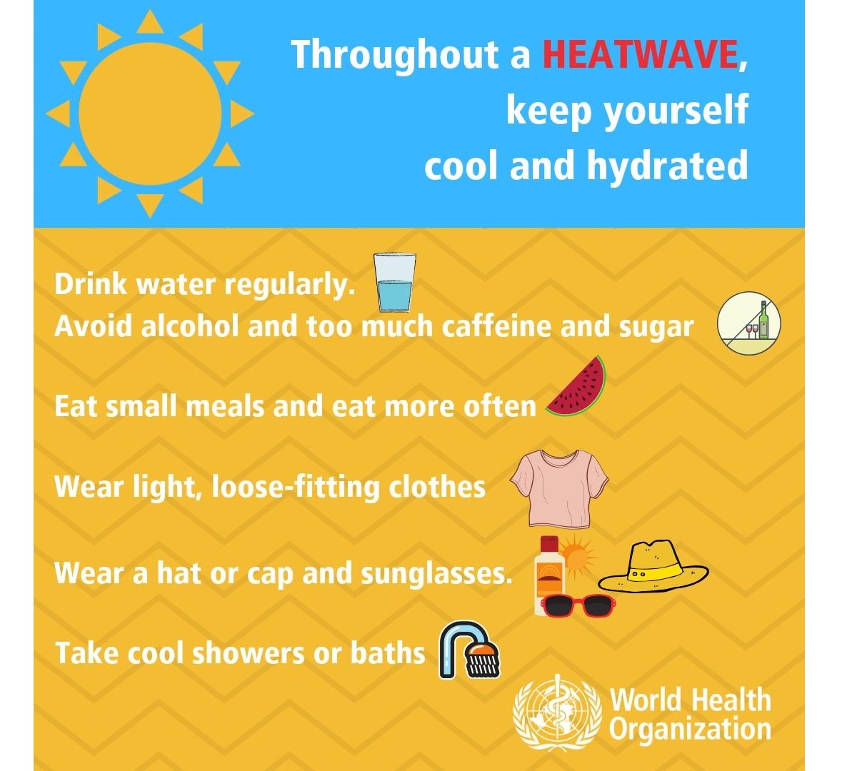
Staying hydrated is one of the most crucial things during extreme heat. Consider taking these precautions and measures to stay healthy in scorching weather:
- Drink plenty of water! – A human’s body cools through sweating; on a sweltering day, an adult may lose up to several liters of water. Keep drinking water, and avoid drinking alcohol, hot drinks, and drinks with high sugar content, as they can worsen dehydration. A regular intake of water is a good way of preventing dehydration.
- Keep your body cool; stay out of the sun if possible. Eat small meals, preferably fruit and salads. Wear light-colored and loose clothing made from natural materials like cotton. Take a cool shower or a cold bath if you feel hot. Also – keep your workspace and living space cool. If you do not have air conditioning, shut the curtains and blinds during the day. Stay in the coolest room, and avoid using the stove and oven as much as possible. If your home gets too hot, go to a cooler place – a library, shopping center, cinema, or swimming pool.
- Keep your food safe! – Keep food that needs refrigeration adequately stored! Food spoils rapidly at high temperatures, and you may risk food poisoning if the food is not stored correctly.
- If you need to go out in the sun – protect your skin and use proper sunscreen and clothing to avoid sunburns. Cover your head correctly.
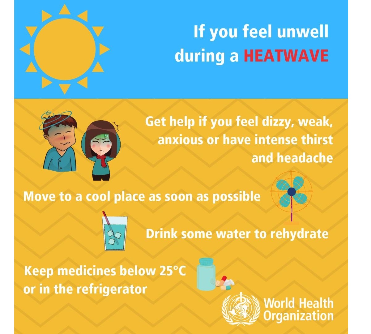
- Know your body and have a plan – Ask your doctor if you have any health conditions that may increase the risk of heat-related illness. Call and consult with your doctor if you are feeling unwell. Call emergency help (know the number!) if you feel unwell!
Common heat-related illnesses with symptoms: What to do if it happens?
WHO considers these symptoms’ descriptions and treatments below as informative only – consult with your doctor for details and professional advice:
Dehydration
Dehydration occurs when the body loses too much water to maintain normal functions. Symptoms include dizziness, tiredness, irritability, thirst, dark yellow urine, loss of appetite, and fainting. Drink plenty of water or diluted fruit juice. Avoid coffee, alcohol, and sugary drinks. Move to a cooler space to cool off. If you feel unwell, call your doctor or emergency room.
Heat rash
Heat rash is an itchy rash caused by excessive sweating. Move to a cooler, dryer environment, and keep the affected areas dry. Hydrating creams may make the condition worse. Consult with your doctor.
Heat cramps
Heat cramps happen during strenuous activity when the body sweats and loses water and salt. Heat cramps manifest as muscle pains or spasms. If this happens, stop all activity, move/lie down in a cool place, and raise your legs slightly. Drink water or diluted juice. Have a cool shower or bath, and apply ice packs. Refrain from returning to strenuous activity for several hours. If heat cramps do not subside, seek medical help.
Heat exhaustion
Heat exhaustion is the condition in response to losing excessive amounts of water and salt due to dehydration. Symptoms include heavy sweating, pale skin, fast and weak pulse, fast and shallow breathing, muscle weakness or cramps, tiredness and weakness, dizziness, headache, nausea or vomiting, and fainting.
If heat exhaustion occurs, the body needs to be cooled and rehydrated by moving to a chilled place, lying down, having a cool shower or bath, and placing cool packs under the armpits, groin, or back of the neck. Rehydration should be done by taking small amounts of cool fluids. Medical help is advised if symptoms do not abate within an hour.
Heat stroke
Heat stroke happens when the body temperature reaches 105 °F (or 40.5 °C), a severe and life-threatening condition! Immediate first aid in lowering body temperature is critical, and an immediate call for an ambulance!
High relative humidity during a heatwave can also significantly affect the body, as it becomes physically challenging for people working outside. After high rainfall events, strong heating will help evaporate the soaked grounds, resulting in higher humidity than normal.
We use a Heat Index chart to represent the real feel of scorching hot temperatures in combination with the high humidity. The following graphic indicates the real feel of temperatures based on the temperature and humidity.
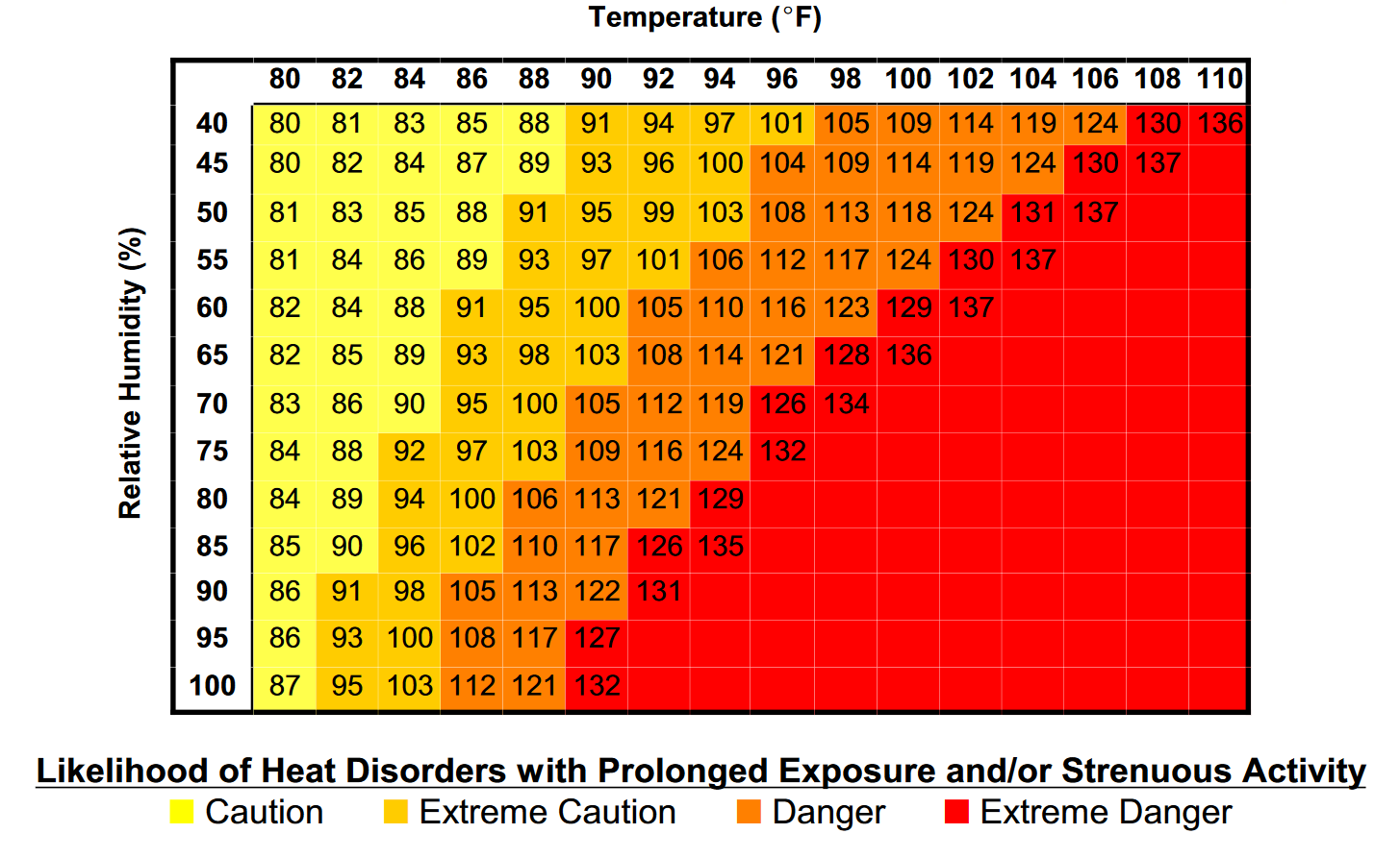
As we see, when air mass has a temperature around 90 °F, humidity below 60 percent is much less challenging than once the humidity is very high, e.g., above 80 %. Thus, the real feel temperature would be above 105 degrees Fahrenheit.
With even higher temperatures close to 110 °F, such sweltering hot air becomes hard to handle with even lower humidity, 50 to 60 percent. That brings the Heat Index to an extreme, 120-130 °F.
Stay safe!
Wxcharts, Pivotalweather, and WHO provided images used in this article.
See also: