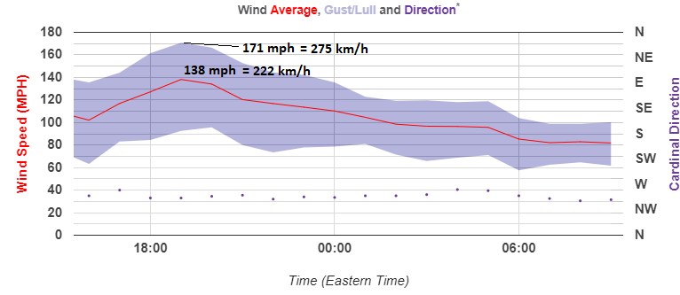
An exceptional event occurred over the Mt. Washington observatory in the state of New Hampshire, United States yesterday, Feb 26th. An incredible windstorm has brought a new all-time February record for the location where the peak wind gusts reached an impressive 171 mph / 275 km/h! The average speed through the whole day was 110 mph = 177km /h!
The pattern supporting such an incredible event was characterized by a strong ridge over the south/west US while a very deep trough/cyclone was traveling across the NE US and Canada. This resulted in the intense pressure gradient between both systems and brought a very strong northwesterly jet stream over the region.
The last 24-hours graph reveals the highest 1-hour average wind speed was 138 mph = 222 km/h. Yes, that is equal to solid Category 4 hurricane strength! Peak gust in that time was an incredibly impressive 171 mph = 275 km/h!
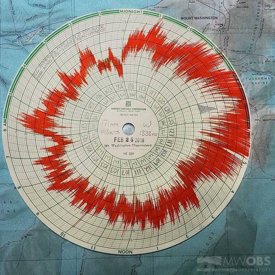
Here is yesterday’s Hays Chart from the Mt. Washington observatory, revealing an exceptional wind diagram of this extreme wind event. Notice how part of the graph (4 hours) has actually gone off the scale/chart!


