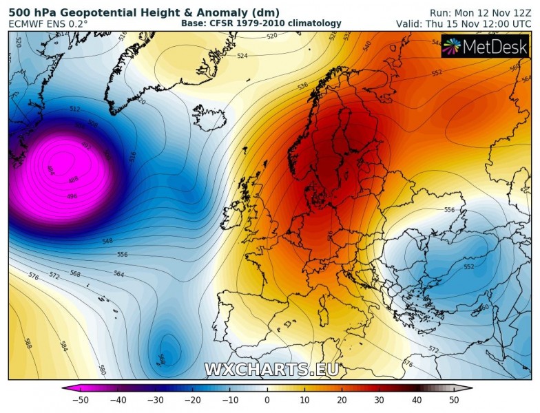
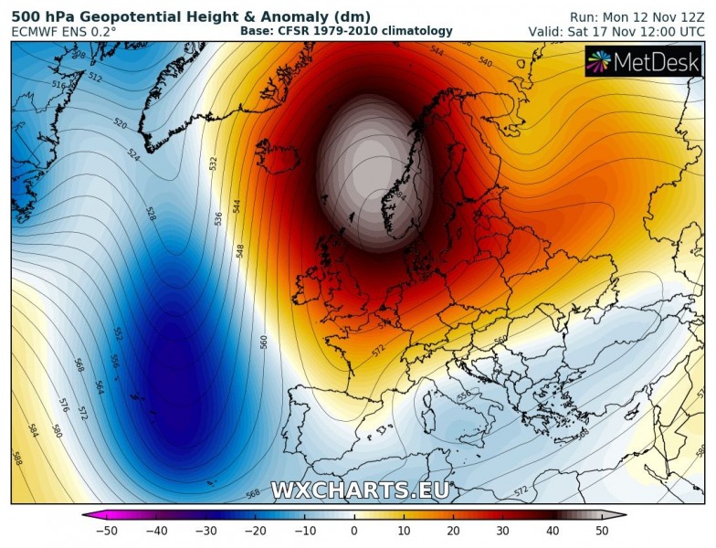
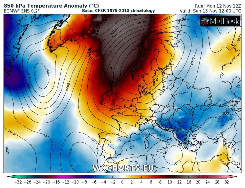
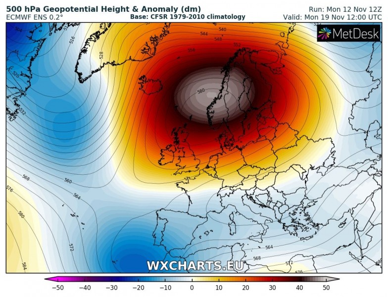
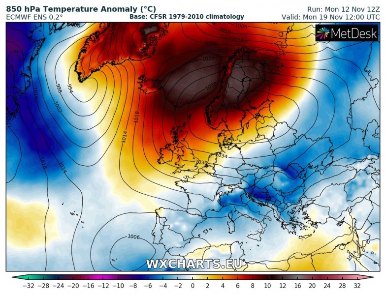
A weekly overview across Europe indicates some changes in the overall pattern can be expected, but it should remain unsually warm for much of Europe. Especially the Arctic region will experience and extremely strong upper ridge and much above normal temperatures, while cold advection takes places across the east-central Europe and Balkan peninsula towards the weekend. Some dynamic rainy weather is expected across the Iberian peninsula and SE Mediterranean.
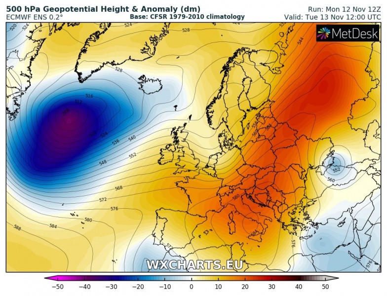
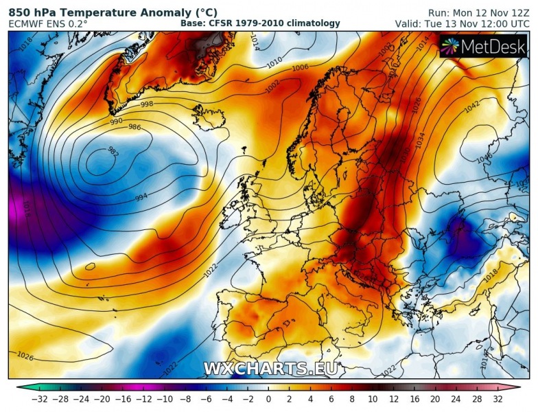
Tuesday, Nov 13th
An upper ridge extends across much of Europe, centered over the Mediterranean region and Balkan peninsula into NE Europe. This results in very warm autumn weather across this part of Europe. An upper low moves from SW Russia towards the Black sea and pushes cold airmass towards the west.
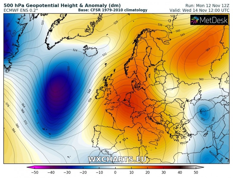
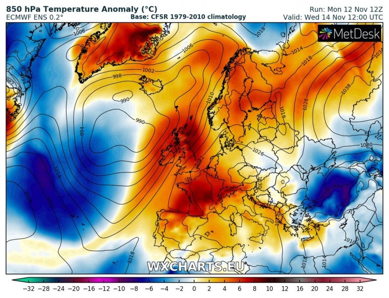
Wednesday, Nov 14th
The upper ridge collapses across the NE Europe while it strengthens across the west-central Europe, this results in much warmer weather pushed towards the west. The upper low over the Black Sea and Turkey expands and strong cold advection overspreads the region.
https://www.severe-weather.eu/calendar-2019/
Thursday, Nov 15th
The upper ridge from west-central Europe moves into the northern Europe while the upper low over the SE Europe maintains its strength and pushes cold airmass towards the southern Balkan peninsula. A very deep trough / cyclone develops over the N Atlantic, causing the upper ridge to translate towards the Arctic region as well. Much warmer airmass advects into Scandinavia.
Friday, Nov 16th
An upper ridge now dominates the northern Europe while a very deep trough / cyclone remains over the N Atlantic and advects very warm airmass into the Arctic region (including Iceland). The warmth across Scandinavia strengthens while the upper low with very cold airmass remains over the Balkan peninsula and SE Europe.
Saturday, Nov 17th
The upper ridge over the Arctic region significantly strengthens and a powerful warm advection takes place across Scandinavia and N Atlantic; more than 10 °C warmer than average airmass is pushed there! Cold airmass associated with the upper low over SE Europe continues towards west and spreads across the central Mediterranean as well. The trough over the N Atlantic moves towards the south and nears SW Europe.
https://www.severe-weather.eu/calendar-2019/
Sunday, Nov 18th
An extreme upper ridge dominates the Arctic region with unusually intense positive anomaly of both geopotentials and mid-level temperatures. An extensive and very strong high pressure system maintains over the N Europe. Cold advection over the S Balkan peninsula gradually weakens. The N Atlantic trough transforms into an upper low while it moves near the SW Europe towards Morocco. Lower geopotentials develop over the Mediterranean as well.
Monday, Nov 19th
An extreme upper ridge remains over the Arctic region and N Europe with extremely warm airmass over the region as well. Cold weather remains over the Balkan peninsula and SE Europe. The upper low remains over the SW Europe and brings some colder weather there as well.
We will have more details on separate events through this week – stay tuned!
