New round of snow for southern UK tonight and early tomorrow, some more snow for Scotland and a sprinkling for Ireland. Let us take a look at the latest model guidance.
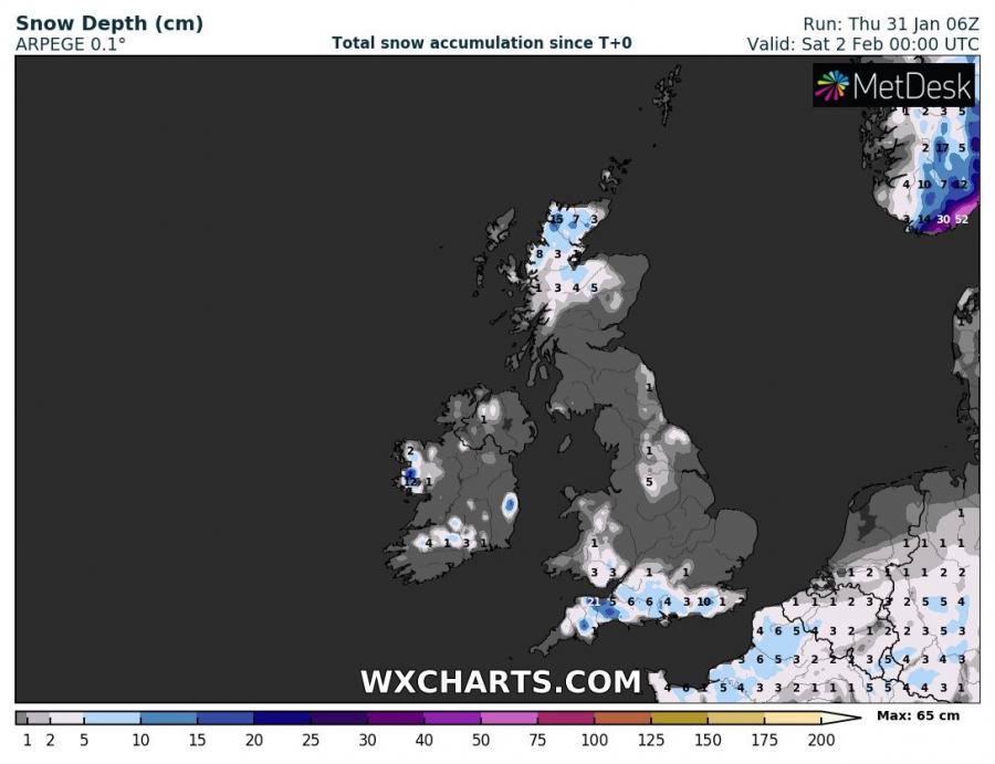
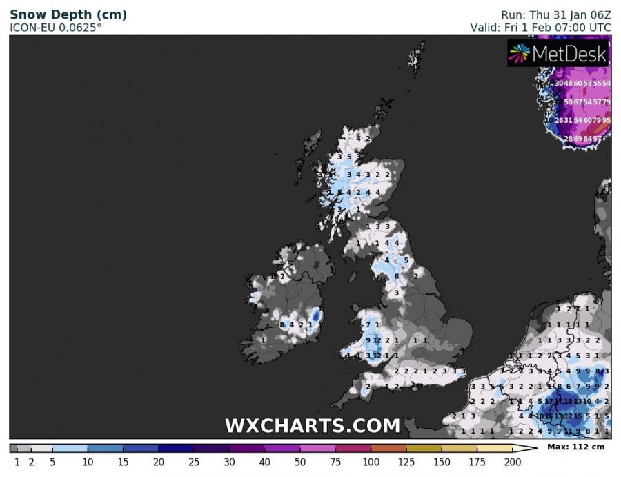
Models agree on snowfall for southern England, parts of Wales and parts of Scotland. Southern England will likely get a maximum of 5-10 cm of fresh snow, locally potentially more. Parts of Scotland will see up to 10-15 cm. Possible sprinkling in northern England and likely sprinkling of snow in parts of Ireland.
Total snowfall across the British Isles and Ireland until early on Saturday. Up to some 10 cm of snow in south UK, locally possibly more. Pretty significant snowfall across northern Scotland and a sprinkling in some places in Ireland. ARPEGE model guidance. Map: Wxcharts.eu.
Looking at HIRLAM model guidance, it agrees well with ARPEGE. Significant new snow across parts of Scotland, pretty good snowfall across southern England and parts of Wales and a sprinkling across Ireland. Also new snow across N France, BeNeLux and NW Germany. Big time snow in south Norway. Map: Wxcharts.eu.
Fresh snowfall across the British Isles and Ireland in ICON-EU model guidance, valid early Friday morning. More snow for Wales and some snow also for northern England. Map: Wxcharts.eu.
High-resolution AROME model guidance for snow depth across England, Wales and Ireland late Friday afternoon. Map: Wxcharts.eu.


