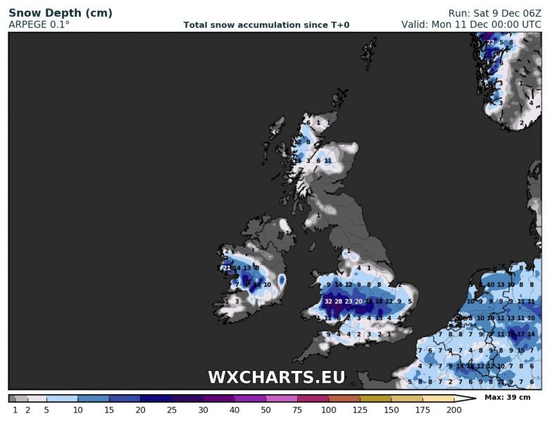
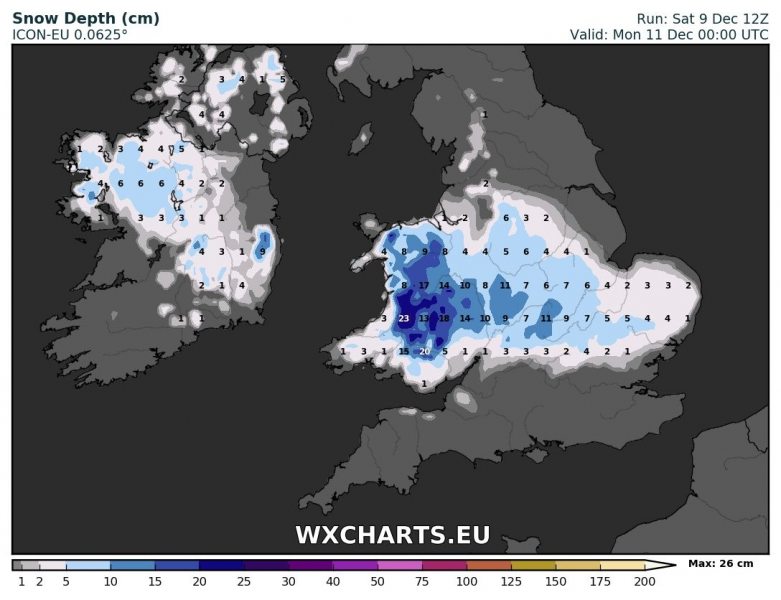
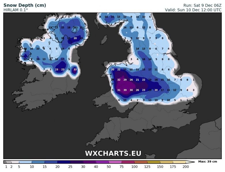
Rapid deep cyclogenesis will take place during the night and tomorrow over Ireland and the British Isles. Cold mid levels will combine with strong advection of humid low-level airmass, resulting in significant snowfall across parts of Ireland and the UK. Various models are in very good agreement for snowfall across Ireland as well as Wales and central England.
Up to 10-15 cm of snowfall seems likely for parts of central Ireland. Wales will see up to 15-25 cm of snow, locally possibly more. Central England will likely see up to 10 cm snow. Depending on the track of the low, some snow may fall also in southern England, as far south as Somerse, Wilthire, northern Hampshire and Surrey.


