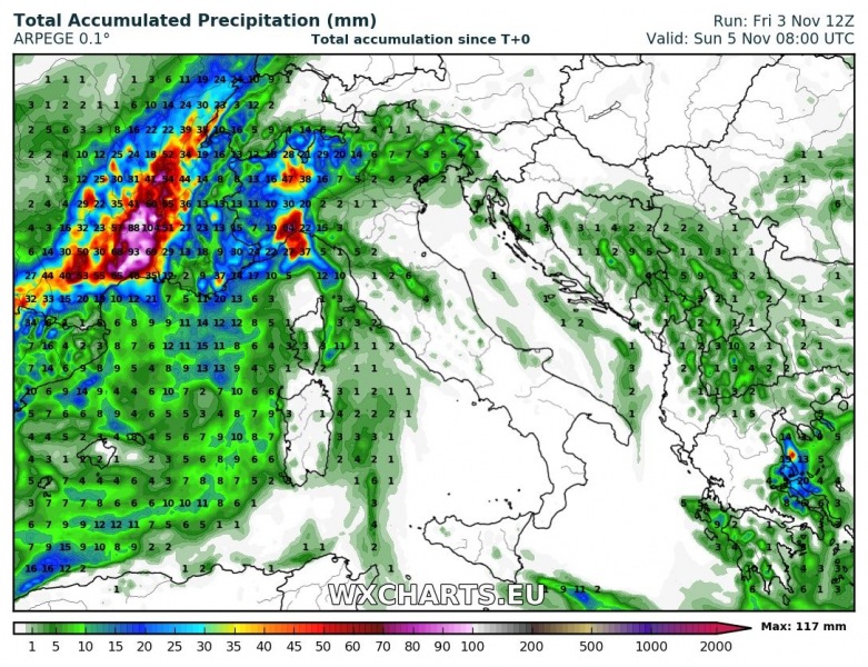
Major rainfall is expected for parts of southern France tomorrow, with cumulatives locally reaching 200 mm / 24h. Expect enhanced threat of major flash flooding.
High-resolution ARPEGE model guidance for total rainfall in north-central Mediterranean until Sunday late morning. Map: Wxcharts.eu.
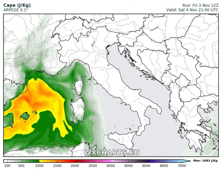
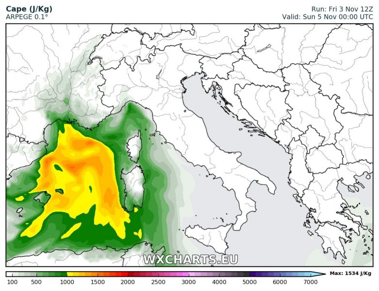
The deep trough over the Iberian peninsula and western Europe transitions into a cutoff upper low over the weekend, affecting the western Mediterranean. A surface low will develop off the east coast of Spain and rapidly deepen while moving ENE towards the coast of S France. Ahead of the frontal line considerable instability will develop, with up to 1000-1500 J/kg MLCAPE indicated by various high-resolution models. Strong low level southerly winds coming onshore across S-SW France and undergoing forced lift will cause persistent orographic rainfall. Rainfall cumulatives will locally reach and possibly exceed 200 mm / 24h through Sunday morning. There will be significantly enhanced threat for flash flooding.
High-resolution ARPEGE model guidance for MLCAPE (convective instability) late on Saturday and early on Sunday. Map: Wxcharts.eu.
Moderately strong shear across the region will result from the 40-50 kt southwesterly mid-level (500 mbar) jetstream overspreading the region and strong southeasterly to easterly surface winds. With deep-layer shear up to 30-50 kt and SREH3 in 150-300 m2/s2 range, the environment will be supportive for rotating updrafts. Main threats with discrete thunderstorms will be intense rainfall, however, marginally large hail threat will also be enhanced. Strong low level shear and helicity, combined with relatively steep low level lapse rates will considerably enhance waterspout/tornado threat.
Stay tuned for details tomorrow!


