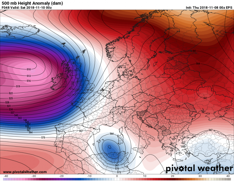
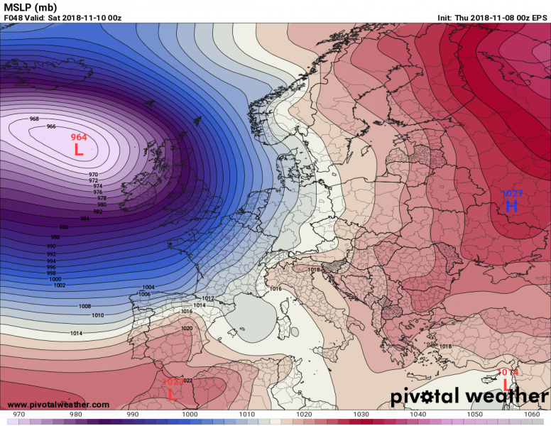
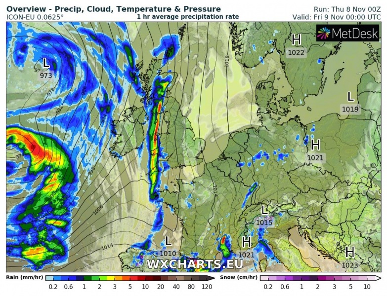
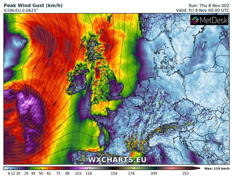
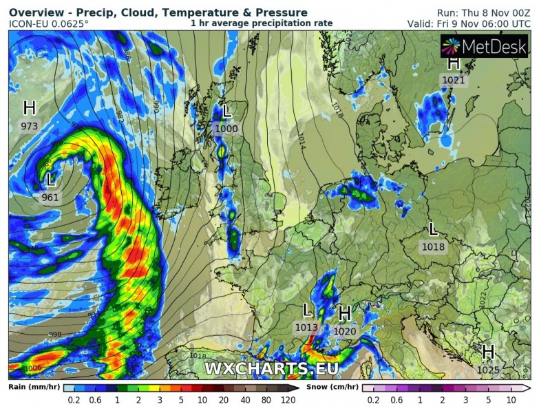
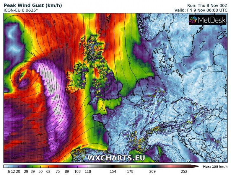
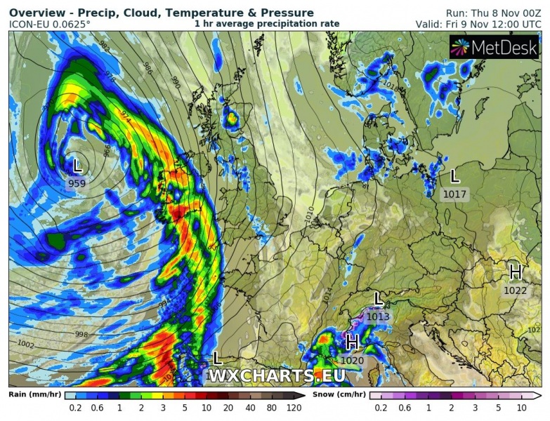
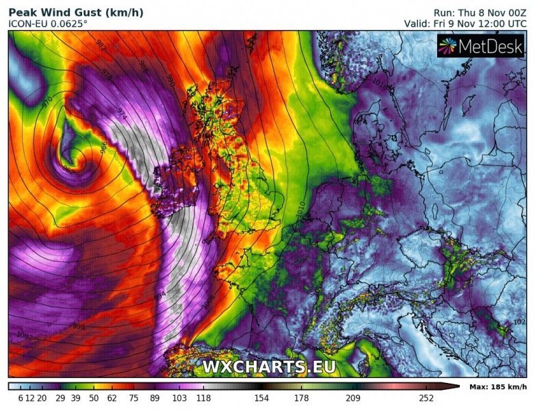
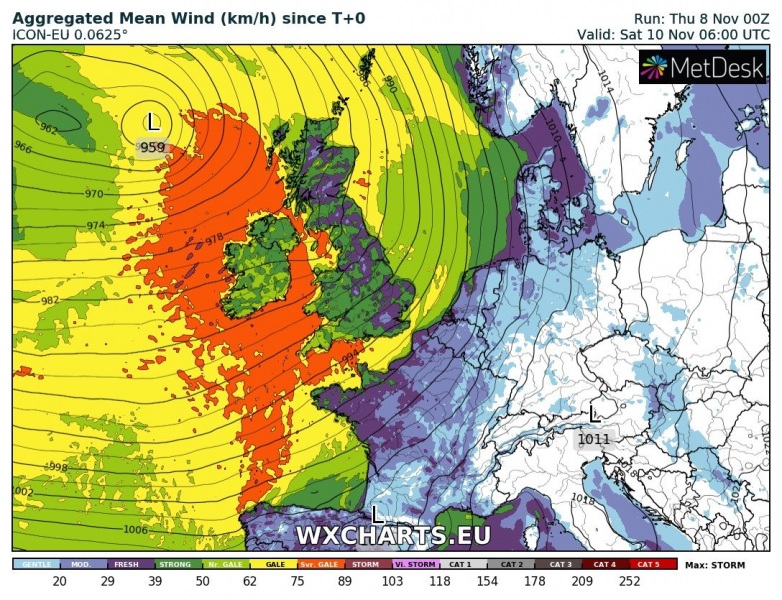
Western Europe is in for another potentially dangerous windstorm tomorrow, Friday, November 9th. A deep cyclone will have developed over the N Atlantic and it gradually moves towards Ireland and continues just west of British Isles. The associated cold front pushes across the region and brings severe to extremely severe wind gusts and excessive rainfall.
The pattern is characterized by a persisting blocking ridge across the ENE Europe while a very deep trough with the associated surface cyclone pushes from the N Atlantic into western Europe. A strong pressure and temperature gradient ahead of the low suggests a very strong wind field will develop.
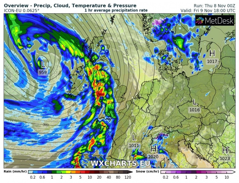
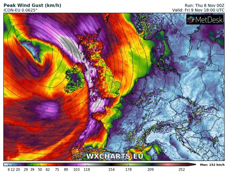
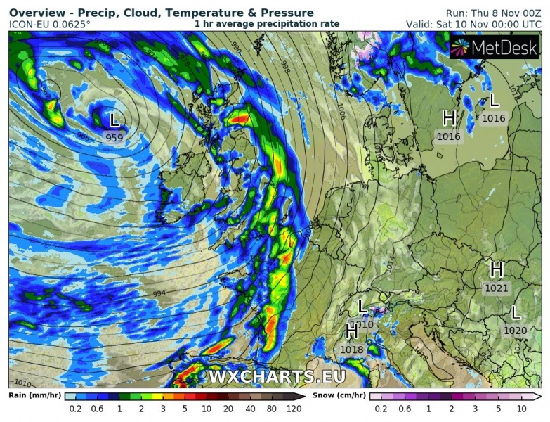
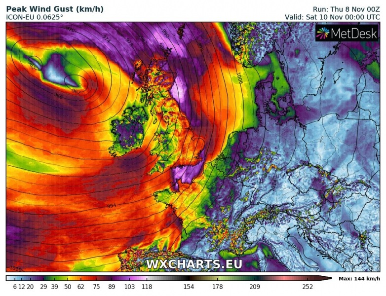
6-hour sequence of the main frontal boundary moving across western Europe. Front brings heavy rain squalls and gusty winds, peak gusts will locally be in excess of 140 km/h.
Friday, November 9th, 00 UTC
Friday, November 9th, 06 UTC
Friday, November 9th, 12 UTC
Friday, November 9th, 18 UTC
Saturday, November 10th, 00 UTC
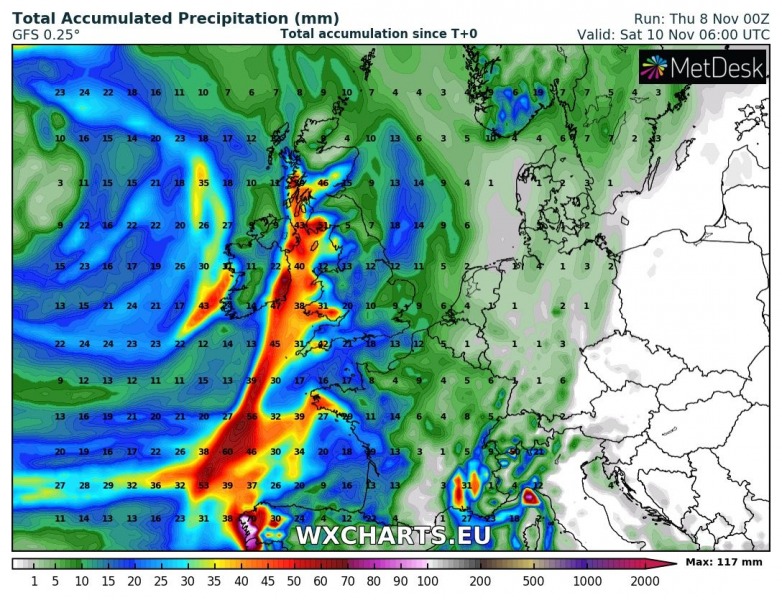
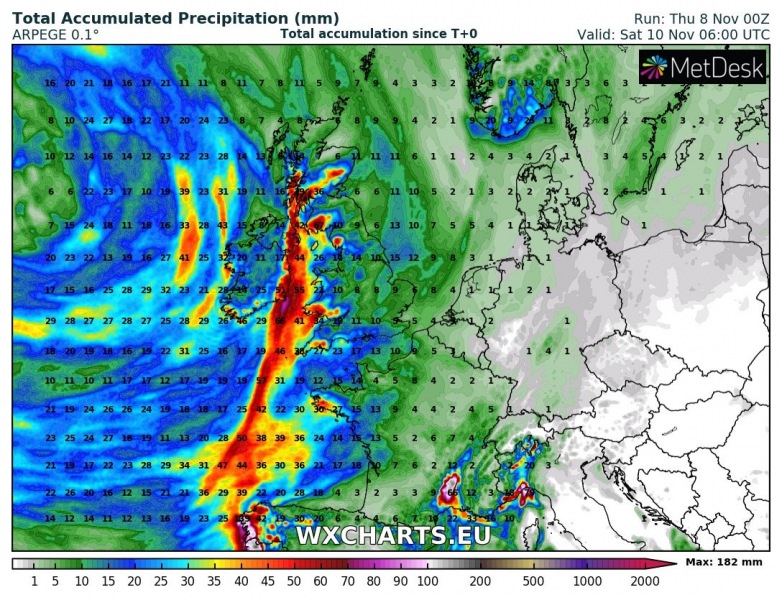
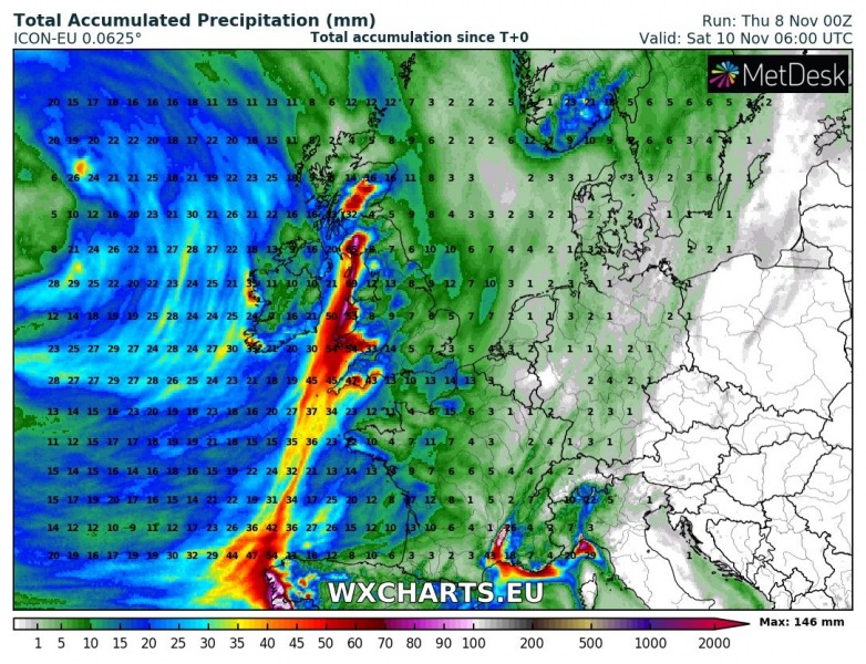
An excessive rainfall event will be associated with the cold front and could locally bring 70-90 mm of rainfall in a 24-hour period. Especially across Wales, NW parts of England and south Scotland. Attached are GFS, ARPEGE and ICON-EU maps.
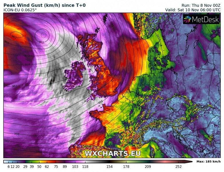
Peak gusts and Aggregated mean wind per ICON-EU model – locally gusts up to 180 km/h are possible, especially over the higher terrain and at more exposed locations. Wind damage is possible, together with high waves along the coast of SW England, Wales and S-SW Ireland.
Stay alert for dangerous conditions and stay tuned for further discussions on this event!
http://www.severe-weather.eu/calendar-2019/
