The latest long-range forecasts for Spring 2026 show a likely impact of the La Niña collapse on the seasonal weather over Europe. A low-pressure tendency is forecast over the continent and a high-pressure zone over the far north, which is also a common signal for La Niña springs in Europe, as seen in past data.
The meteorological Spring season lasts 3 months and covers the March-April-May period. This is the transition period from Winter to Summer, so a wide range of weather dynamics can be expected.
The oceanic La Niña collapse event is playing a visible role this season. While it is usually difficult to isolate a direct La Niña signature over Europe, we can see an atmospheric response in the latest model data. In this article, we will look at how these global weather drivers are shaping the European spring transition and what the latest forecasts show for the upcoming season.
Winter 2025/2026 so far: Verifying the Forecast for Europe
We are currently still in the winter season, so before jumping into the spring forecast, we can look at how the winter has gone so far and how well the long-range forecasts captured it. That can give us an idea of how well the seasonal trends can be forecast.
Below is the latest temperature anomaly analysis for the past 60 days from CDAS data. It shows a cold anomaly over northern, northeastern, and east-central Europe. Warmer-than-normal temperatures prevailed so far over the west-central and southern parts.
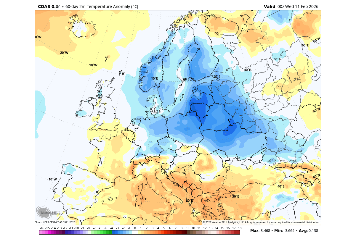
Looking at the winter temperature trend forecast released early November, it showed a potential corridor of lower temperatures, over the central and north-central parts, and extending to the northeast. This is somewhat verified, as the cold anomaly seen above this arrives from the northeast and reaches into a similar central area.
The precipitation analysis so far shows a drier winter over central and northern Europe. More precipitation was detected over the southwestern and southern parts, creating a very high contrast between drier and wetter conditions over Europe.
But there is a stratospheric warming event currently starting in the stratosphere, and is forecast to play a role in the weather development in late February and March, shaping the early meteorological spring.
March Outlook: The Stratospheric Warming and its Early Spring Impact
A Stratospheric Warming event is a rapid rise in temperature and pressure in the stratosphere. This causes the disruption of the Polar Vortex, and over time, it causes a disruption in the lower levels of the atmosphere, impacting the weather patterns.
The real extent of the stratospheric warming event is usually revealed by the temperature anomaly, which shows just how much warmer the stratosphere has become. Below is the forecast for the stratosphere at the 10mb level (30km/18.5miles height). It reveals a strong stratospheric warming wave, with temperatures peaking over 40 degrees C above normal.
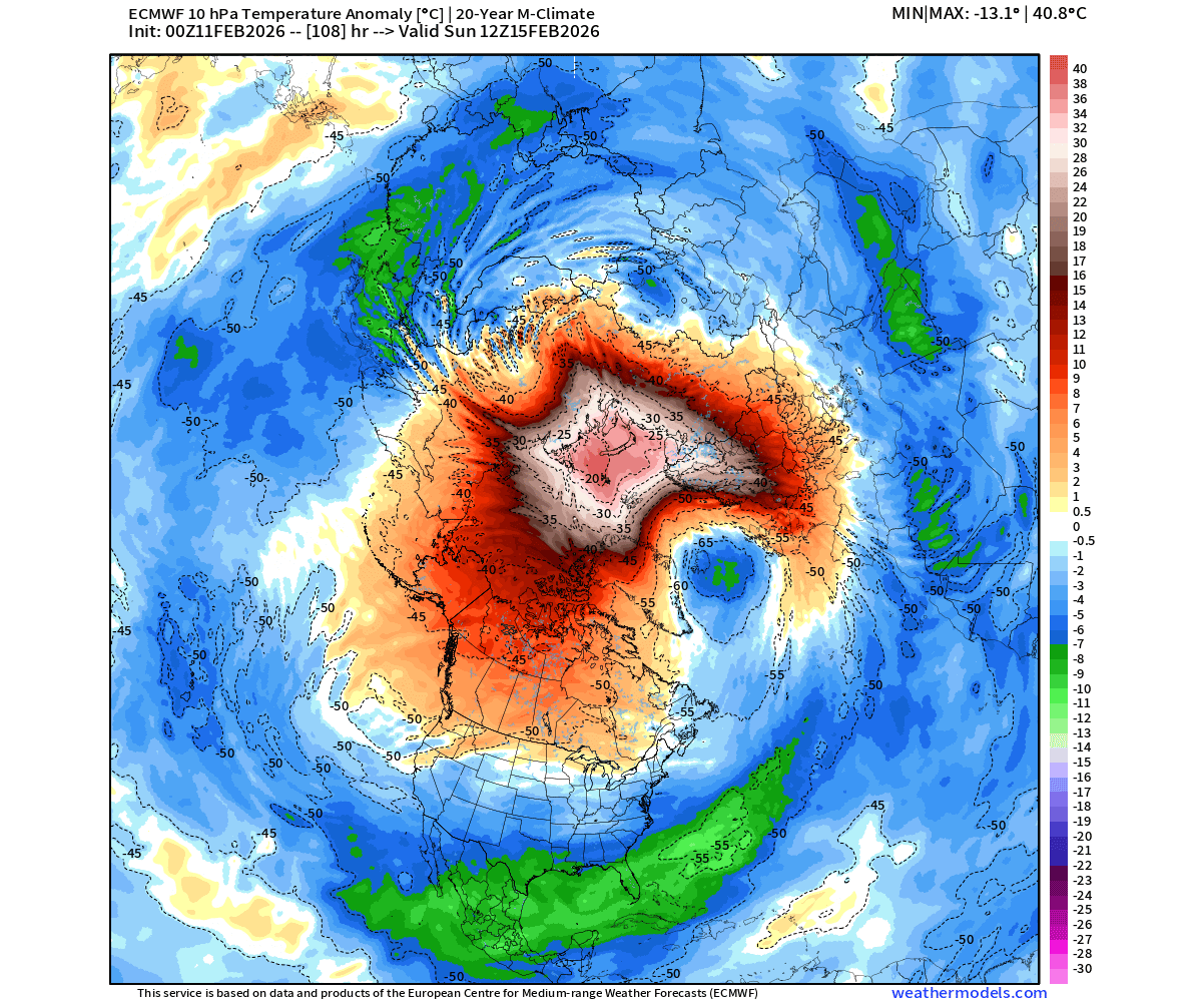
The pressure and temperature anomalies in the stratosphere indicate a stratospheric warming event, which typically has a downward impact with some delay.
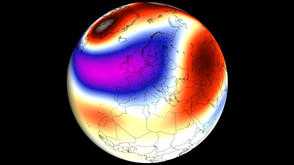
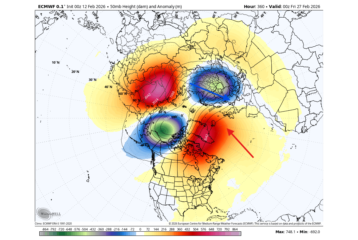
The forecast image below shows the pressure anomaly forecast for the lower stratosphere at the 50mb level (20km/12.4 miles). You can see two high-pressure areas of the strato-warming, creating a split Polar Vortex core, with one core pushed close into the European sector. This supports a northerly flow at surface levels for the northern, central, and western parts of Europe.
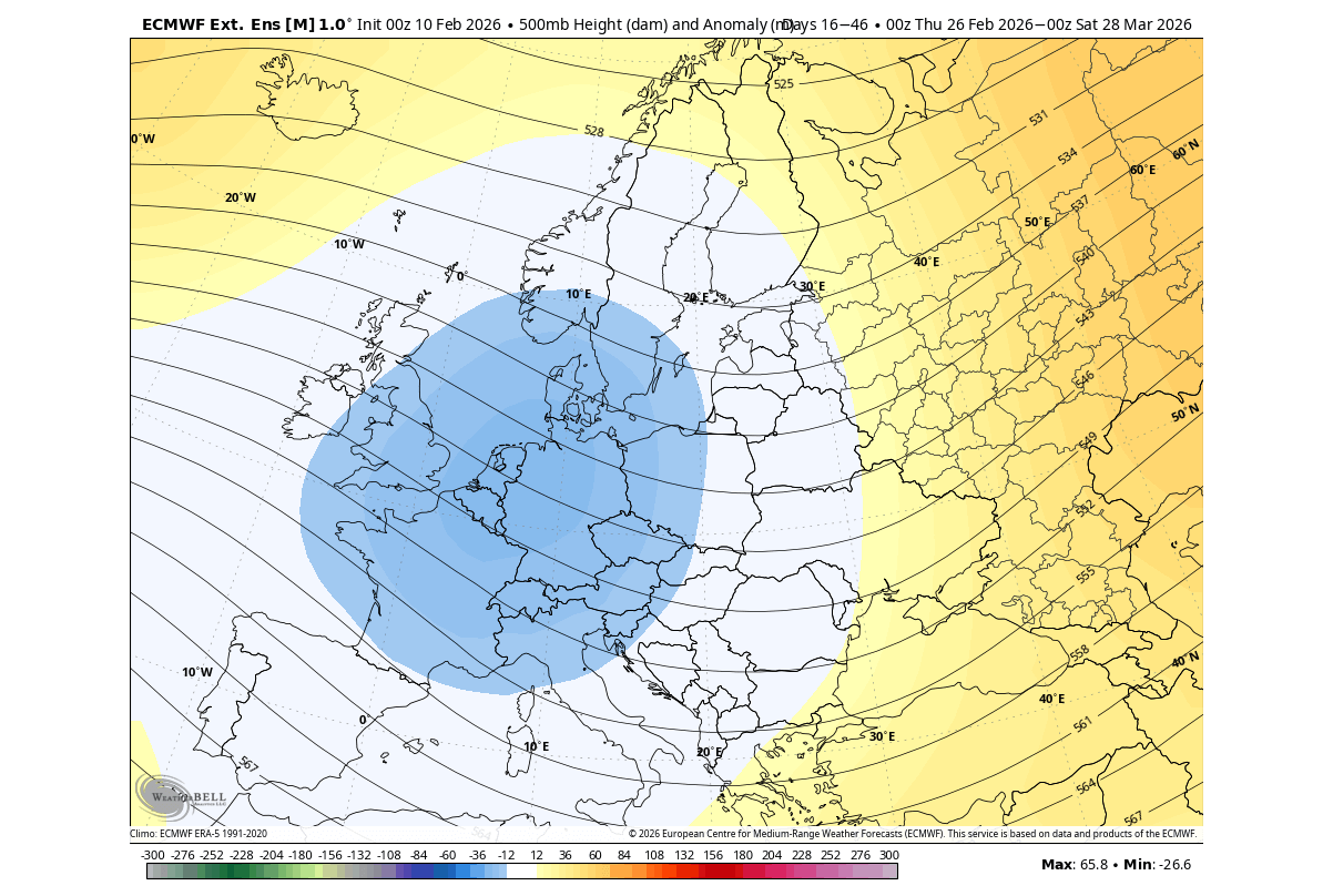
Below is the extended-range ECMWF forecast trend, and it shows the pressure anomaly for the late February-March period. You can see a high-pressure over Greenland. This enables a low-pressure zone over west-central Europe, creating an unsettled weather pattern over the continent.
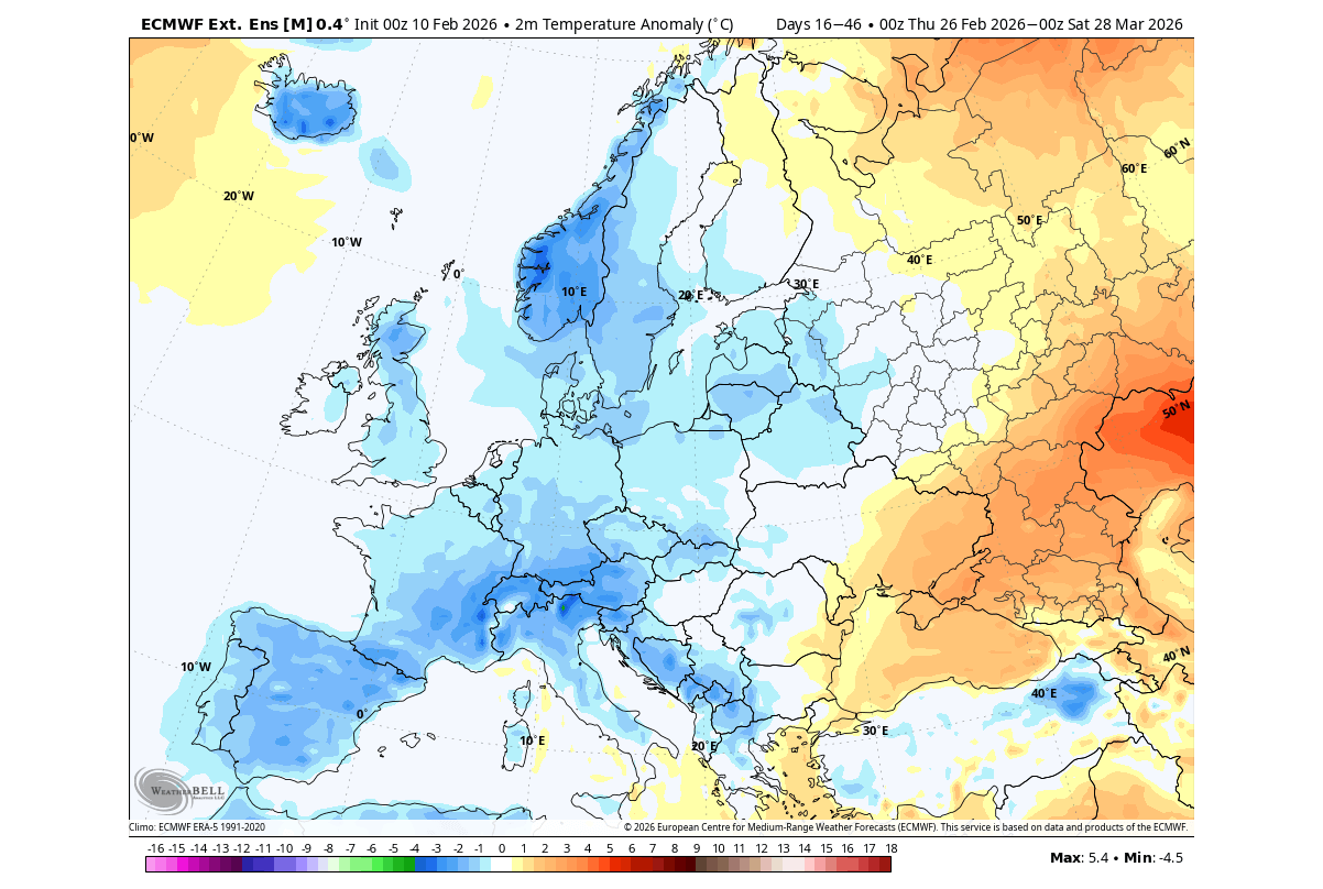
The temperature anomaly for the same period shows below-normal temperatures over the western, central, and northern parts of Europe, brought in by the low-pressure zone. The nature of this airmass is not pure Arctic in nature, so freezing temperatures are not expected at this time, but this is still a trend forecast, which usually shows weaker anomalies at this range.
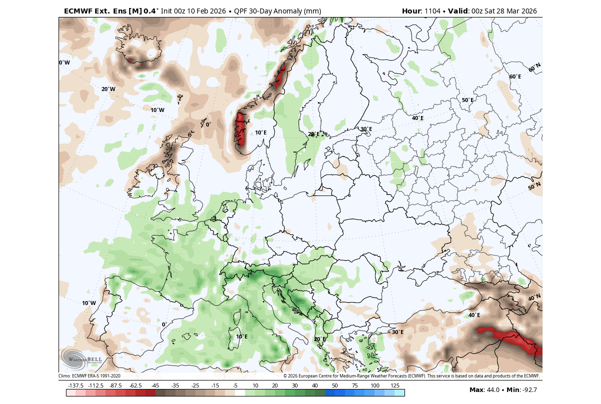
A low-pressure zone also brings more precipitation into western, central, and southern Europe, as seen in the 30-day precipitation forecast trend below. A low-pressure system spins counterclockwise, so that means it brings increased moisture from the Atlantic and the Mediterranean.
But in the long-range picture, March and also Spring weather patterns overall are expected to be under the influence of a large-scale shift in the Pacific Ocean, impacting the whole global weather system.
The La Niña Collapse: A Global Oceanic Reset and its European Signature
La Niña is just a name for cold ocean temperatures in the tropical Pacific Ocean. The actual ocean-atmosphere system is called ENSO (El Niño Southern Oscillation). This ocean area alternates between cold and warm phases, with each phase producing different global weather patterns.
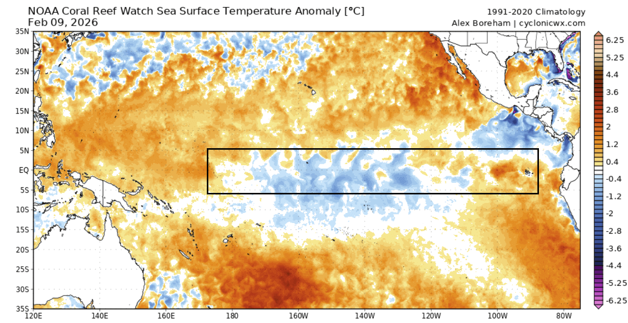
The latest ocean analysis below shows the main ENSO region that we currently watch. You can see weaker (leftover) cold La Niña anomalies in the central area, getting dissolved from both sides to the east and west. A warmer anomaly is starting to establish in the eastern parts, forecast to spread to the west. Image from Cyclonicwx
This is much better seen in the video below, which shows the last 30 days of ocean temperature changes in the ENSO region. You can see a healthy La Niña event at the start, and how rapidly it has been dissolving in recent weeks.
But while the La Niña dissolves, a new phase is already seen in the long-range forecasts, causing a major shift in the global weather system in 2026. Looking at the latest long-range forecasts, we can see a clear indication of the end of La Niña and a rapid transition into a new El Niño event as soon as Summer.
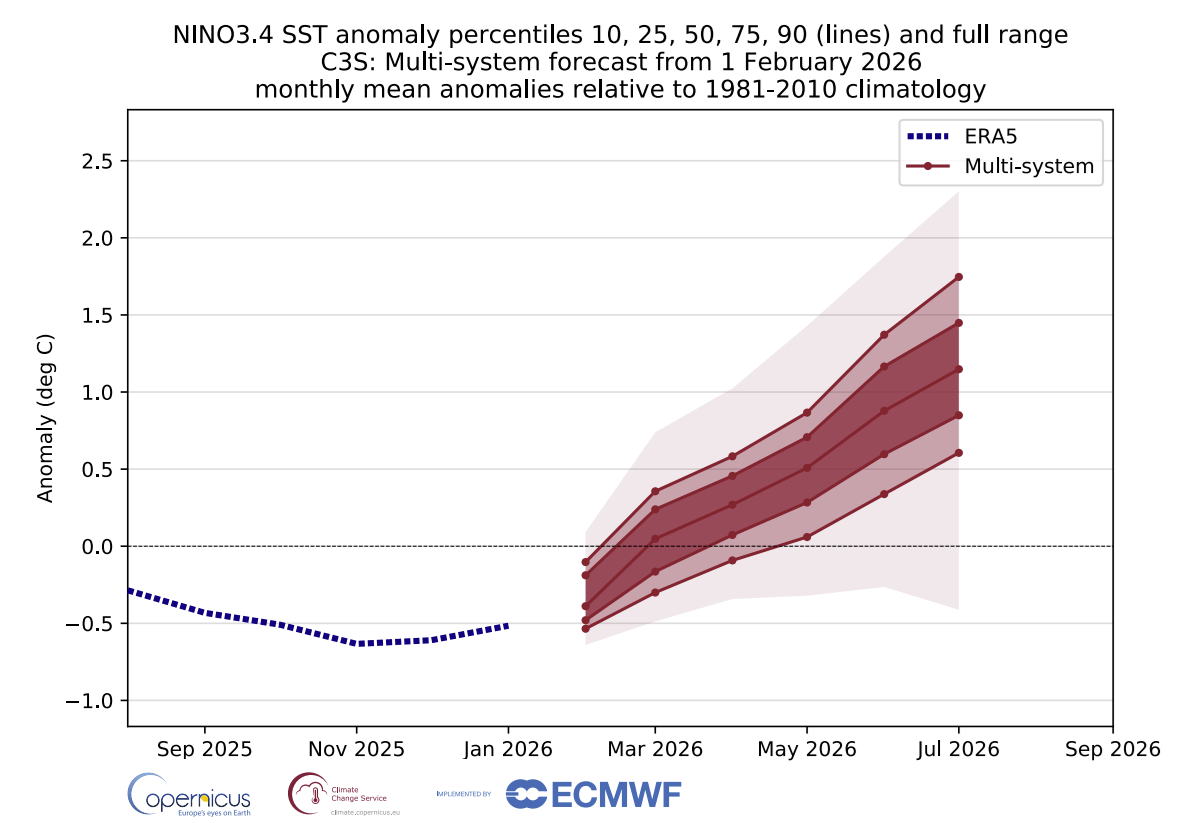
Below is the newest ENSO multi-model outlook from the C3S forecast system. You can see the end of the cold La Niña anomaly, with a rapid transition into a new El Niño (above +0.5) by summer. This is a combined forecast from multiple long-range models, increasing the forecast confidence. This means that most forecasts agree on the rapid emergence of a 2026/2027 El Niño event.
For this reason, we decided to look at some past data to find years with a similar shift from a weak cold ENSO phase into an El Niño. We found several such years in the past, and we merged them together to get the temperature pattern in such rapid transition years.
Unlike over North America, the La Niña does not have a direct impact on the weather patterns over Europe. But when looking at a combination of past years, we can still see in the idea of the weather trends that can occur in a similar global weather situation as in 2026.
Below is the pressure anomaly for the meteorological Spring seasons in the past La Niña-El Niño transition years. It shows a low-pressure tendency over Europe, with a high-pressure zone over the northern parts and over the southwest.
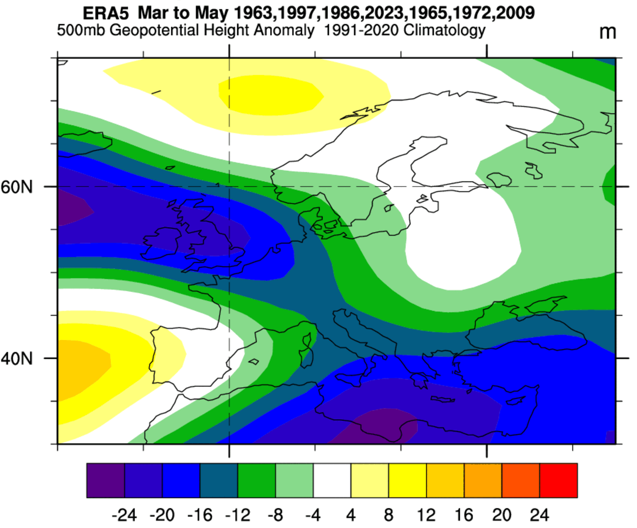
The temperature analysis for the same years and season shows a lower temperature tendency over Europe. This comes from the lower pressure over Europe and a high-pressure zone over the north, enabling a more northerly flow from the northeast.
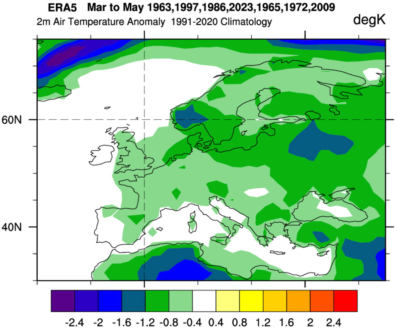
Here, we have to add that some of these years are from the past decades, which naturally exhibit a colder signal. But the overall pattern is clear, with the tendency for lower than normal Spring temperatures over Europe in such events, at least in the northern and central parts, and perhaps to the west.
We can now look into the latest long-range forecasts to see if this signal actually appears over Europe for Spring 2026.
Spring 2026: ECMWF Latest Long-Range Data
For this forecast, we focused on the two main (or most used) seasonal models: the ECMWF and UKMO.
All these forecasts show an average picture over three meteorological Spring months (March-April-May) and show the prevailing weather patterns.
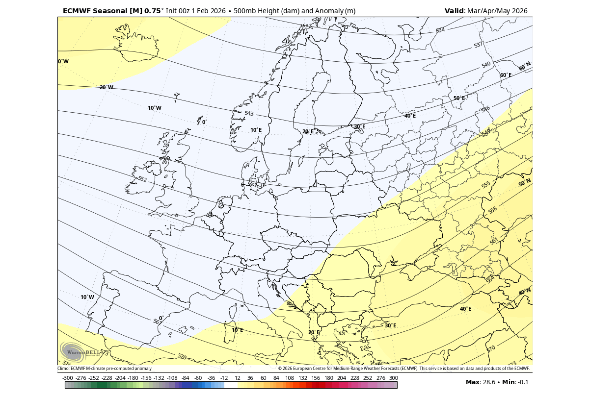
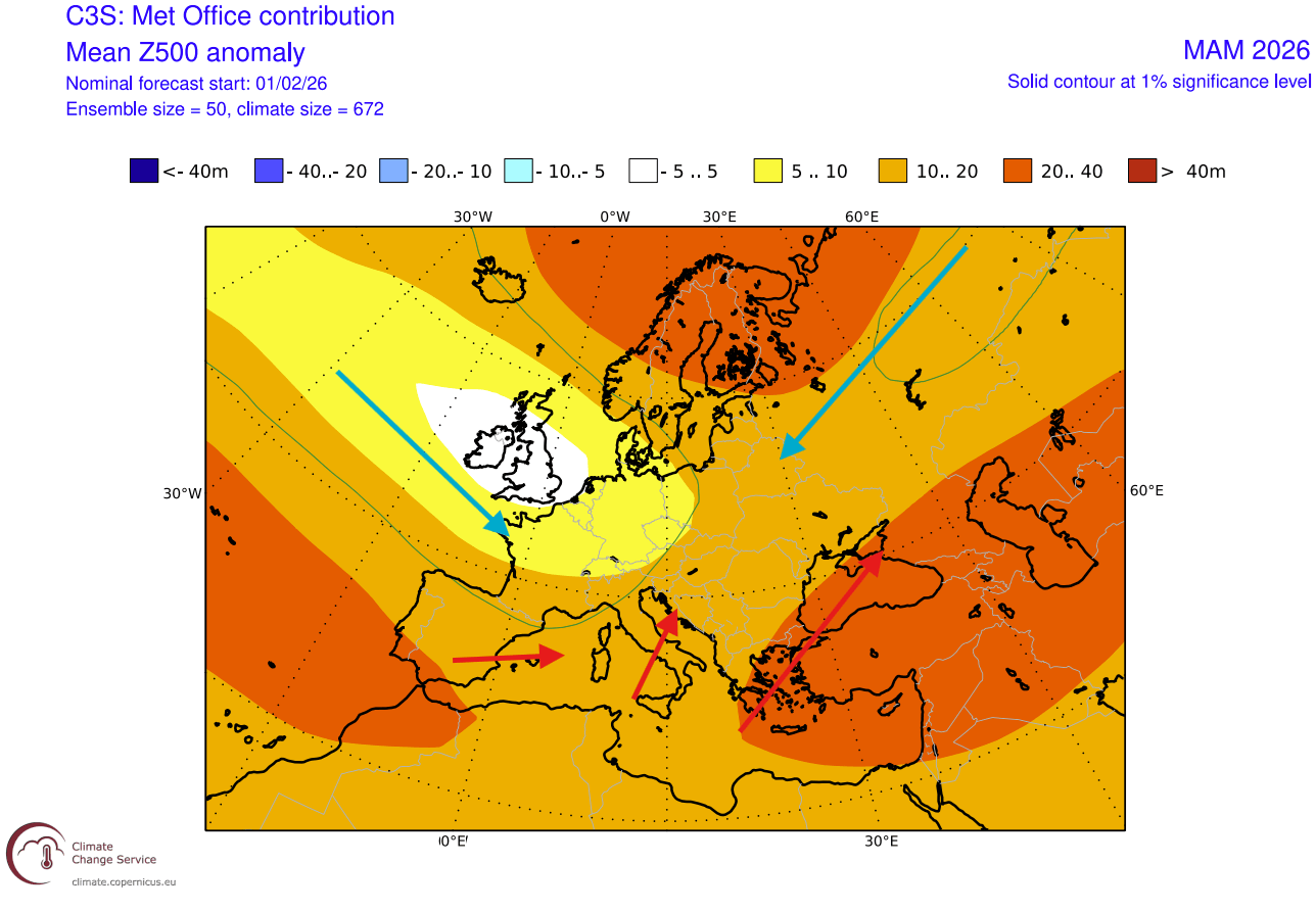
The pressure pattern forecast from ECMWF below shows a general high-pressure signal over the North Atlantic and southeastern Europe. But a low-pressure tendency exists over the central and western parts, similar to the La Niña years analysis above. This forecast is pretty strongly averaged, as it is a 3-month average, so it shows weaker pressure signals.
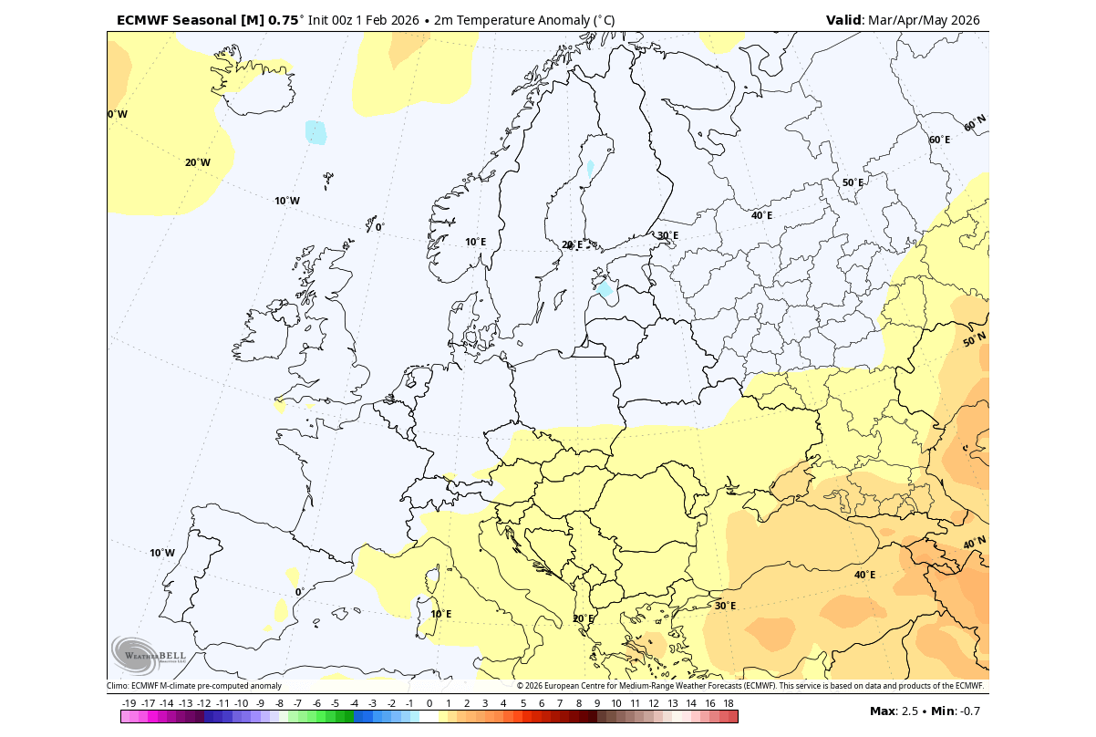
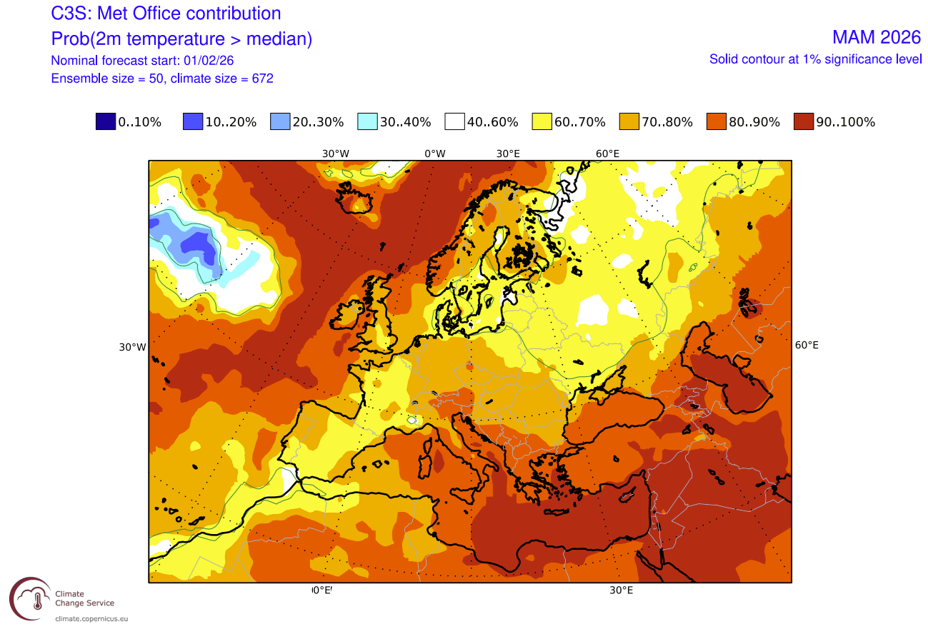
As a result, the temperature anomaly forecast shows warmer temperatures towards the southeast, but we see a normal to below-normal trend for western, north-central, and northern parts of Europe. This is the result of the lower-pressure tendency over central and north-central Europe.
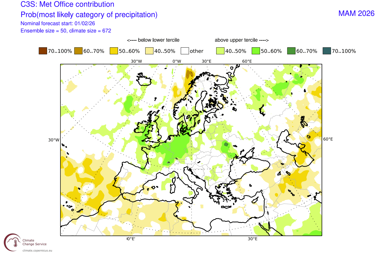
Precipitation-wise, Europe is forecast to have more precipitation over the majority of the continent, which signals an unsettled Spring season. This is to be expected given the low-pressure anomaly over Europe, as it also brings more moisture into the continent.
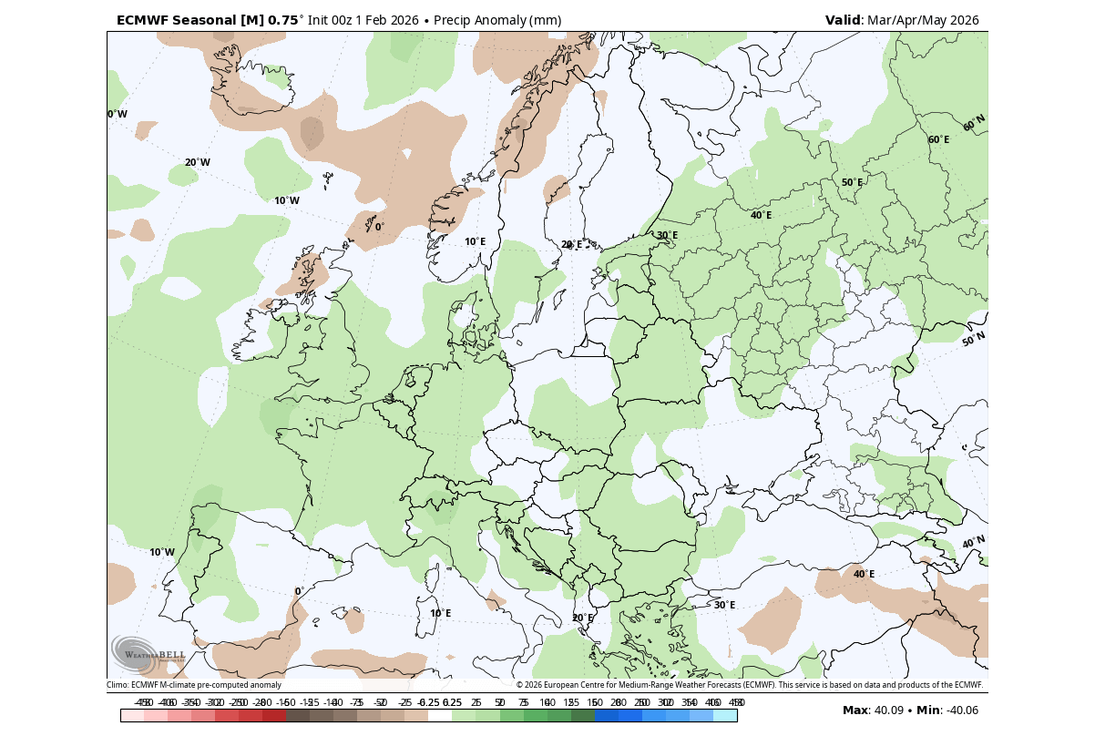
In combination with lower-than-normal temperatures, this also affects the snowfall potential for early Spring. Overall, the Spring seasonal pattern looks very similar to the analysis of past rapid La Niña collapse years we saw above.
Comparing Models: The UKMO Spring 2026 Forecast for Europe
In addition to the ECMWF, we often use the UKMO model from the United Kingdom Met Office. This way, we can compare results, and if both models show a similar forecast, that means a higher confidence in the accuracy of the expected weather pattern overall.
The UKMO model shows a somewhat similar forecast to the ECMWF. It shows a high-pressure zone towards the southeast and to the north. And it shows a low-pressure area over the UK, pushing into central parts. This is also similar to the analysis of past La Niña collapse/transition years.
The temperature forecast shows the above-normal temperature potential over the southern and far northern parts of Europe. But the combination of a low-pressure area reaching into central parts and a high-pressure zone over the north can support northeasterly flow events, with a cooler airmass entering Europe, along with an Atlantic airmass from the northwest.
Looking at the precipitation forecast, we see mostly above-normal precipitation over the continent, especially over central and north-central parts, due to the local impact of a low-pressure zone. Less rainfall is forecast over the southwest, in an expanding high-pressure area.
The combination of a cooler airmass and increased precipitation will also impact the early-season snowfall potential, which can still surprise across the northern, central, and eastern parts of Europe.
Spring 2026 Snowfall Predictions for Europe
Since Spring is a transitional period between the coldest and the warmest part of the year, it means there is still some snowfall potential in the first half of the season.
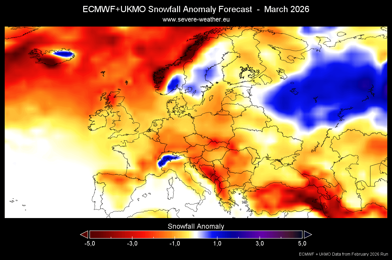
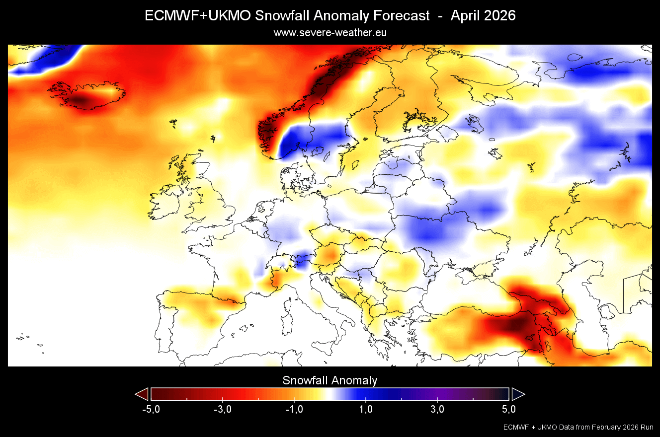
Below is the combined ECMWF+UKMO snowfall forecast for March, which shows lower-than-normal snowfall for the first spring month. But this is a different forecast than the extended range trends we saw for March earlier, above, and have recently trended cooler due to the stratospheric warming event.
But we can see an interesting forecast for April, which shows normal to above-normal snowfall in north-central Europe and towards the north and east. This can indicate a deeper low-pressure area in April over the central parts, with a high-pressure tendency to the north, creating a northeasterly flow.
We will keep you updated on the developing weather trends in the coming seasons, so bookmark our page. Also, if you have seen this article in the Google App (Discover) feed, click the like button (♥) there to see more of our forecasts and our latest articles on weather and nature in general.
The main forecast images in this article are from WeatherBell maps using a commercial forecaster license.
Don’t miss:
Stratospheric Warming 2026: The Polar Vortex Meets an Atmospheric Wave over North America