A La Niña watch has been issued by NOAA, after cooling was detected in the tropical Pacific, with more cooling expected during Fall as trade winds strengthen. Direct weather impacts on Winter 2025/2026 are expected across the United States and Canada, but a major reversal into an El Niño is starting to show for 2026.
Both La Niña and El Niño are two different phases in the same area of the Pacific Ocean, with profound impacts on global weather.
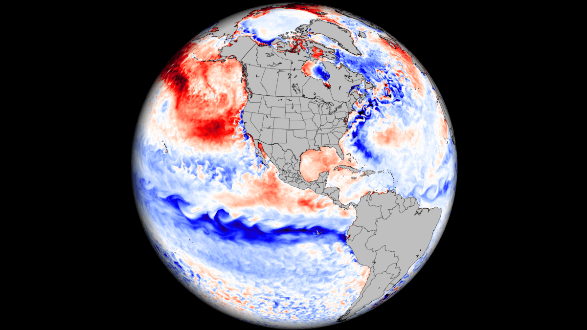
We will first look at the developing Pacific anomalies above and below the ocean surface, the forecast for the upcoming months, and also the first clear signs of an El Niño coming in 2026, which could be a big event.
ENSO AND GLOBAL WEATHER
The La Niña is a cold phase of the ENSO phenomenon, which stands for “El Niño Southern Oscillation.” This is a region of the Pacific Ocean that periodically shifts between warm and cold phases. Typically, there is a phase change around every 1-3 years.
Each phase (cold/warm) usually develops between late summer and Fall and lasts until Spring. But some events can last up to two or three years, as we have seen in some of the past winters.
The cold phase is called La Niña, and the warm phase is El Niño. Besides the temperatures, one of the main differences between the phases is the pressure patterns they develop, seen below as high (H) and low (L) pressure zones in the Pacific.
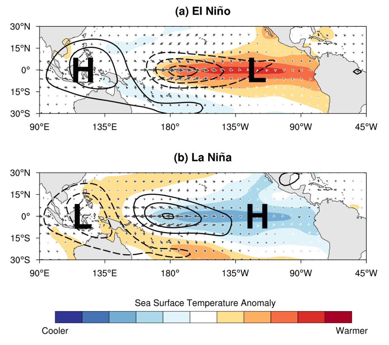
The pressure over the tropical Pacific is lower during an El Niño, with more rainfall and storms in this region, and less precipitation over the far western tropics.
During a La Niña, pressure rises over the region, creating stable conditions and less rainfall over the equatorial Pacific. Pressure changes from both phases translate into global circulation over time, affecting seasonal weather over both Hemispheres.
Each phase significantly influences tropical rainfall, pressure patterns, and the complex connections between the ocean and atmosphere. The image below shows the circulation pattern of a cold phase, which is forecast to influence the upcoming Winter season.
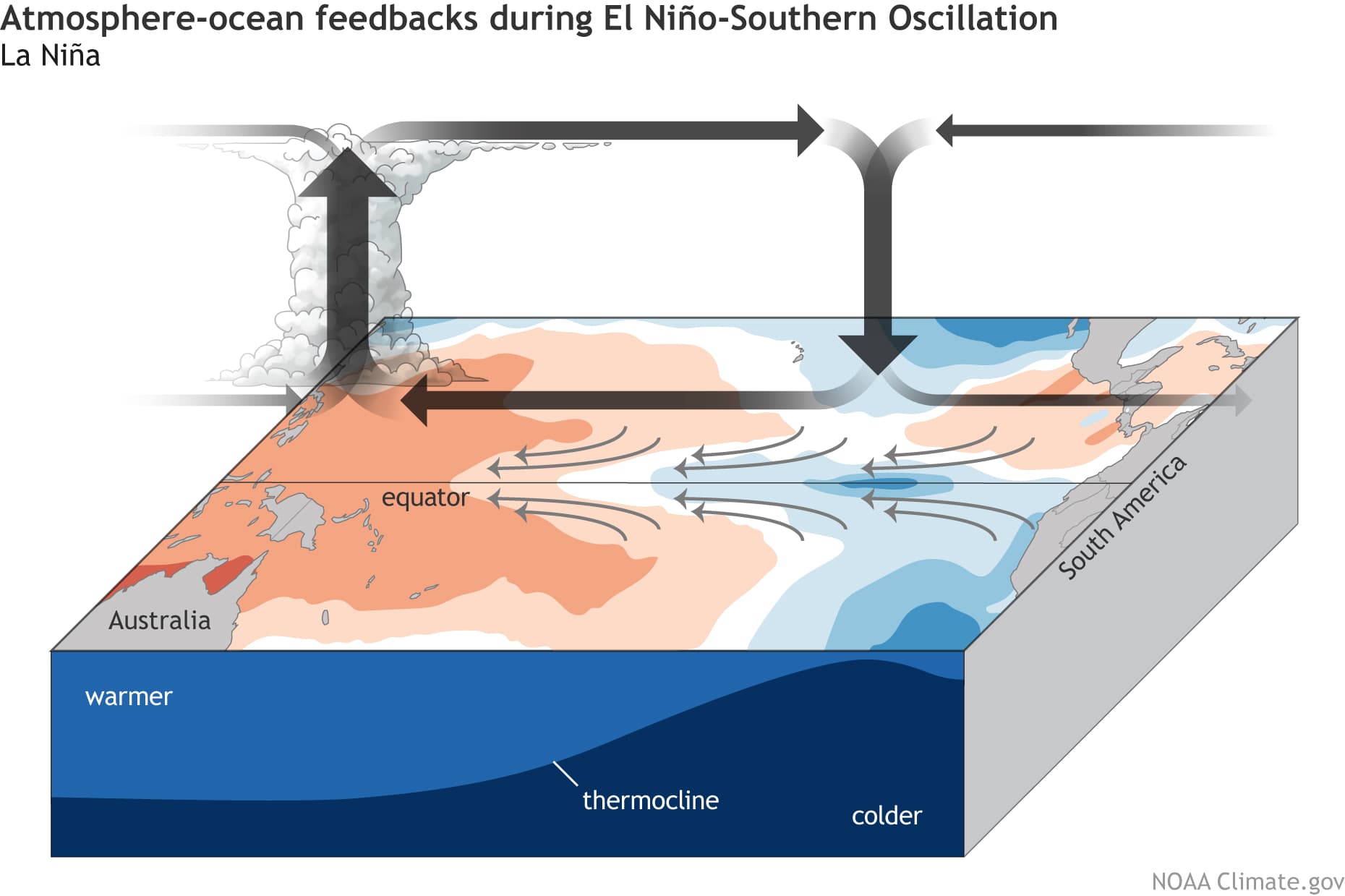
By impacting or changing this so-called Walker Circulation, ENSO significantly changes tropical rainfall and pressure patterns. This impacts the ocean-atmosphere system, which expands the ENSO influence globally, shaping the Winter temperature and snowfall patterns over North America and other regions.
We are currently in a neutral phase, coming out of a weak La Niña from the last Winter. But we are already starting to see the ocean and the atmosphere preparing for a new La Niña event, which prompted the Climate Prediction Center (CPC) to issue an official watch.
COOLING IN THE PACIFIC
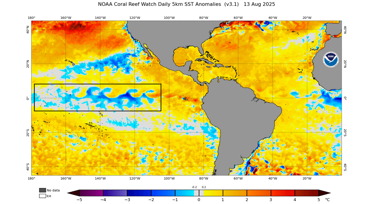
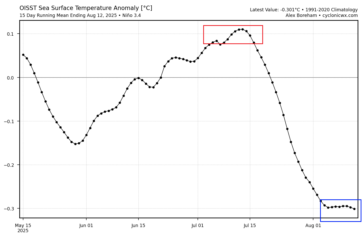
Below is the latest ocean temperature anomaly from NOAA CRW, and you can see a wave of cool anomalies in the marked ENSO area. This is neither a proper cold nor a warm phase, but based on the recent development, the cooling was getting stronger, giving a clear indication of what is to develop.
We also produced a video below, from the latest ocean data. The video shows changing ocean anomalies in the past 30 days, revealing how ocean surface temperatures are changing with the trade wind, and the recent cooling of the central ENSO region.
The graph below shows the 90-day ocean temperature anomaly for the main ENSO 3.4 region. It properly shows and confirms the recent cooling observed across the area. A 0.4° drop was recorded in the past month alone, pushing the anomalies well into the cool-neutral phase, at least for now.
Anomalies under the ocean surface are also very important in this development. The image below shows the ocean temperature anomaly by depth. A large cold pool is visible in the east-central Pacific Basin, extending to depths of around 180m (600ft). This is created by a process called “upwelling”. As the name suggests, this process brings colder, deeper waters up from the depths, creating a large cold anomaly.
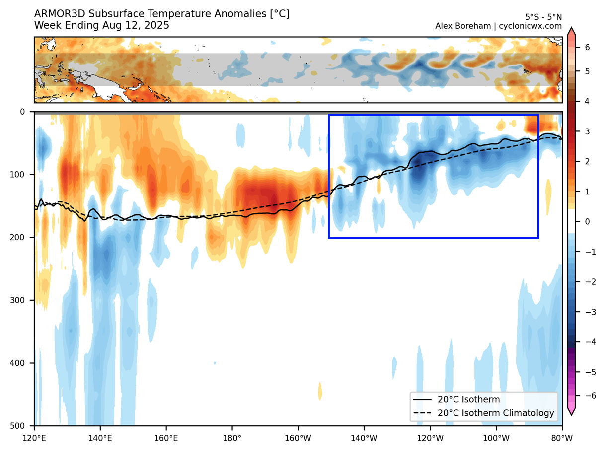
Based on this analysis, we can say that a cold ENSO signature is starting to appear in the Pacific, not just at the surface but also below.
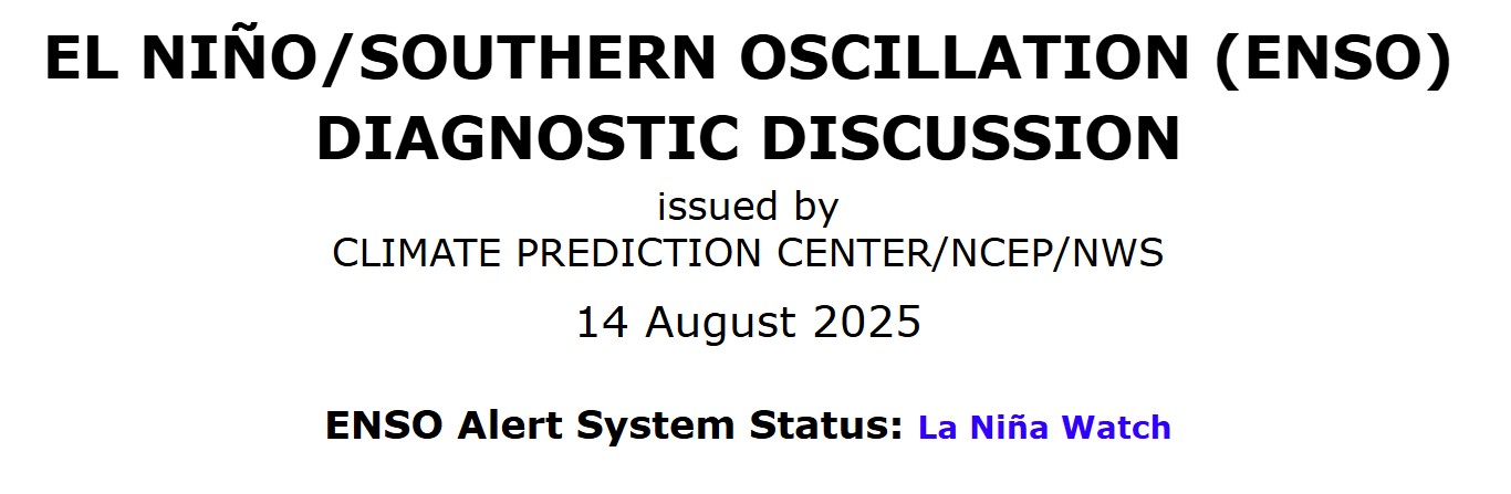
All these changes have prompted CPC/NWS to release an official La Niña watch for the 2025/2026 season. Below is their official notice, where they also added: “ENSO-neutral is most likely through the late Northern Hemisphere summer 2025. Thereafter, a brief period of La Niña conditions is favored in the fall and early winter 2025-26 before reverting to ENSO-neutral.”
Their statement and outlook are also supported by the latest long-range forecast data.
SEASONAL OCEAN FORECAST
The latest round of long-range forecasts clearly shows the spreading cold anomaly for late Fall. Their atmospheric solution also shows an impact on the global weather patterns. We covered this in our first Winter 2025/2026 forecast with more details, linked at the bottom of the article.
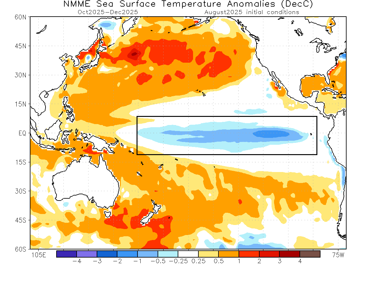
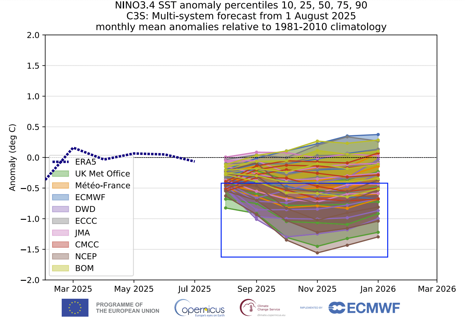
Below is the latest ocean temperature forecast for autumn and early winter from the North American NMME model. You can see an area of cold surface anomalies over the tropical Pacific, indicating that a weak to moderate La Niña event will be active.
The long-range ensemble forecasts below show the forecast for the main ENSO region. The average forecast from all the calculations falls within the colder phase threshold, with a high number of calculations well within the La Niña margins. This was a visible step a bit further into the cold phase compared to the previous run.
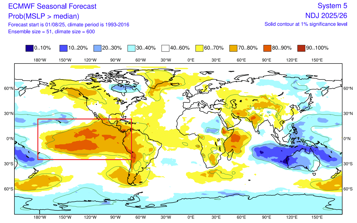
Looking at the atmospheric forecast for Fall, you can actually see the amplified high-pressure anomaly over the ENSO regions. There is a low-pressure anomaly over the Maritime Continent, which in total indicates a stronger Walker Circulation and a clear signature of an active La Niña mode in the atmosphere.
But even looking at the shorter range, we can see a very clear sign that more cooling is coming in the near future. The image below shows zonal (west-east) wind anomalies over the tropical regions, indicating a large easterly anomaly over the Pacific.

This tells us that stronger easterly trade winds are forecast. Strong trade winds push the surface waters west, creating a strong upwelling effect that we mentioned earlier. Upwelling brings the cooler, deeper waters to the surface, creating a cold anomaly on the ocean surface.
LA NINA AND WINTER PATTERNS
The most common effect of a cold ENSO phase (La Niña) is usually a strong blocking high-pressure system in the North Pacific. That redirects the polar jet stream down over the northern United States and southern Canada.
The image below shows the jet stream redirection during a La Niña Winter, and the resulting weather patterns that develop over the United States and Canada.
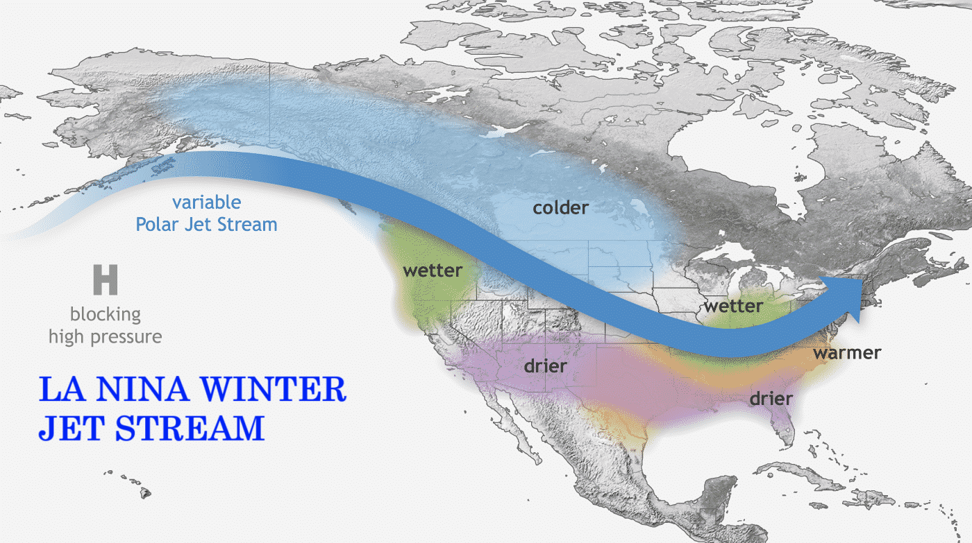
The displaced jet stream brings colder temperatures and winter storms from the polar regions down into the northern and northwestern United States. Warmer and drier winter weather prevails over the southern states during an El Niño, but the Midwest and the Northeastern United States will have the greatest impact.
Looking at the temperature analysis from the data for past weak La Niña winters, you can see the cold anomaly area under the jet stream in western Canada and the northwestern United States. Negative anomalies extend over the Midwest and also reach into the central and eastern states.
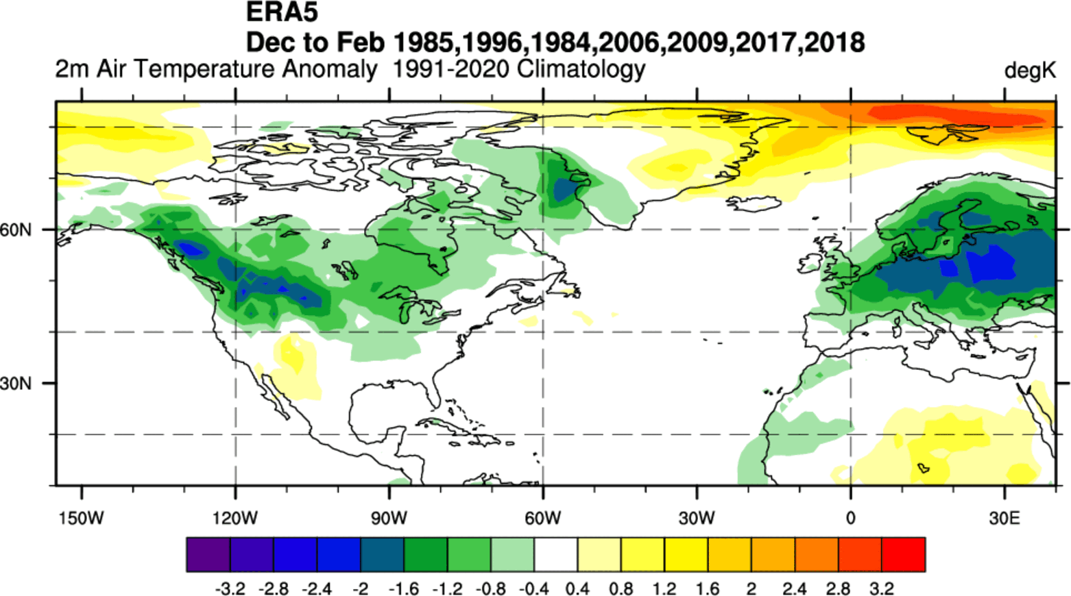
Warmer-than-normal weather and mild winter conditions are expected in the southwestern and southern United States. The main winter weather dynamics usually develop between these warm and cold anomalies in the Midwest and the east-central United States.
With the change in the jet stream, La Niña also significantly affects snowfall potential over North America, as pressure systems take off differently.
As the colder air is more accessible to the northern United States and southern Canada during a La Niña winter, this increases the snowfall potential if moisture is available. In the image below, you can see the average snowfall pattern for all La Niña years.
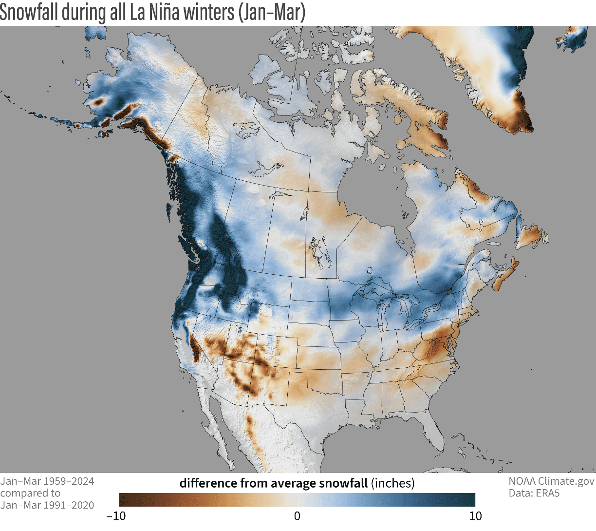
You can see above-average snowfall across much of the northern United States and southern Canada. Peak snowfall is usually also observed across the higher elevations of the Pacific Northwest. But in other areas, states like Minnesota, Wisconsin, Michigan, New York, Vermont, and northern Pennsylvania stand out with more snowfall in such winters.
But the La Niña is not expected to become really strong or long-lasting. The latest forecasts show a very clear El Niño signature well into next year.
EL NINO 2026 RISING
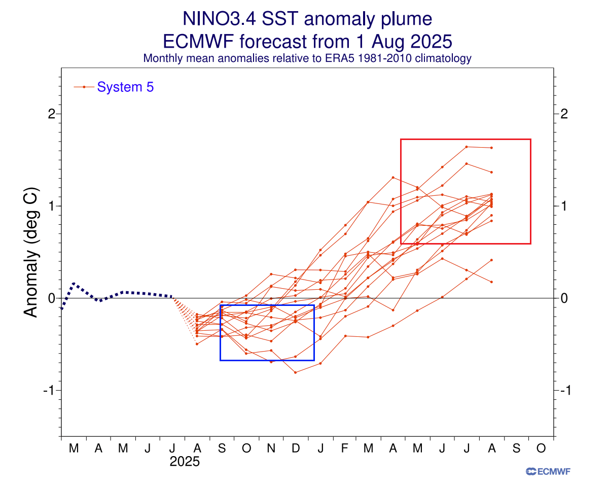
The first hint of a possible El Niño is already visible in the latest ECMWF ocean forecasts for extended range. These are just calculations that show the likelihood of a certain ENSO event being active.
Long-range ensemble forecast below shows the forecast for the main ENSO region. The La Niña conditions (-0.5 or lower) will disappear during the next spring. But the extended forecast shows a lot of ensemble members moving into the warm anomalies and also well above the 0.5 threshold of the El Niño event.
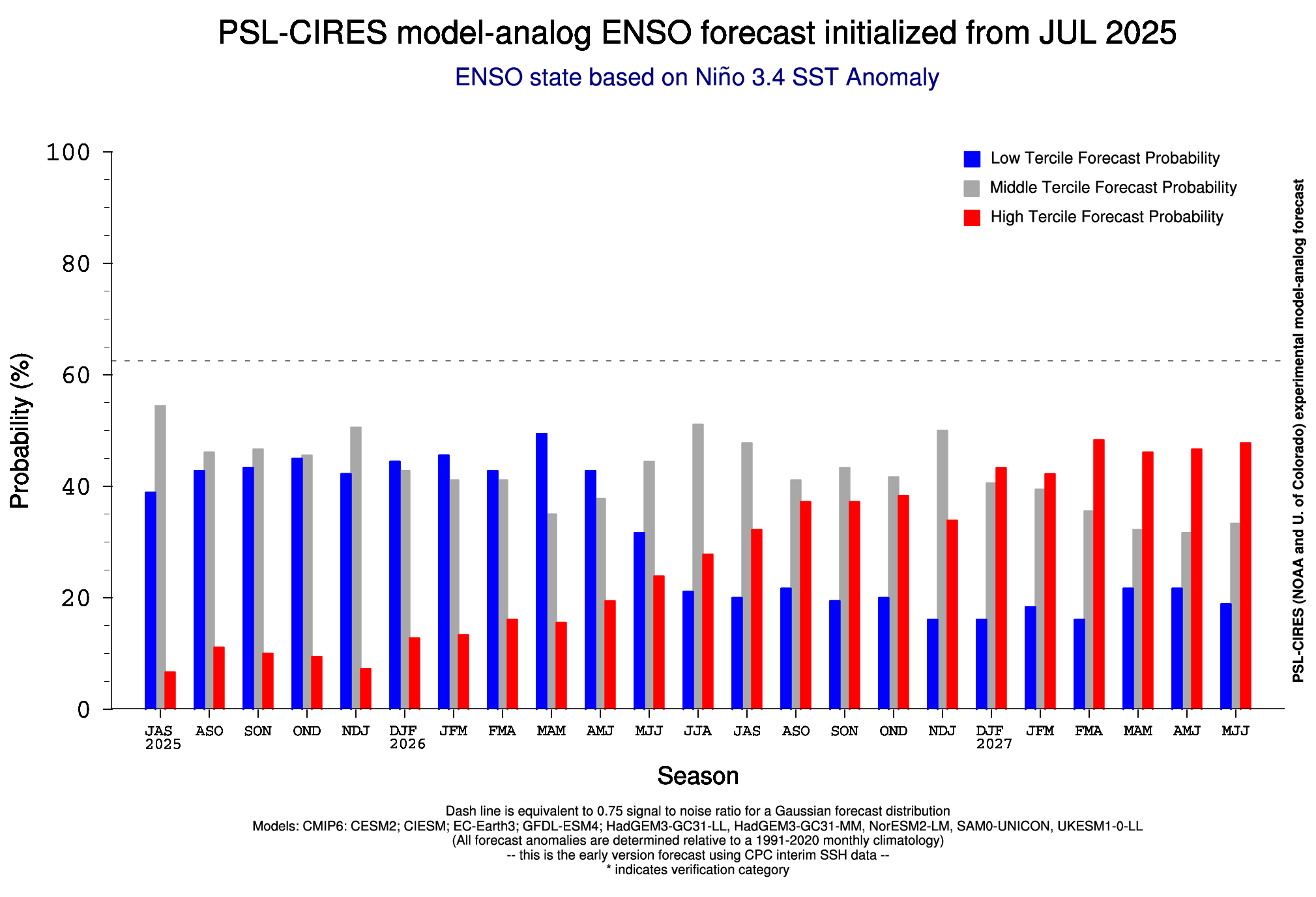
Below is also an extended analog forecast by the PSL for the main ENSO region. It shows the high cold phase probability going towards this winter. But a weakening of the cold phase is forecast, with El Niño event chances greatly increasing in mid 2026 and increasing even higher in 2027, perhaps indicating a double or a “Super El Niño”.
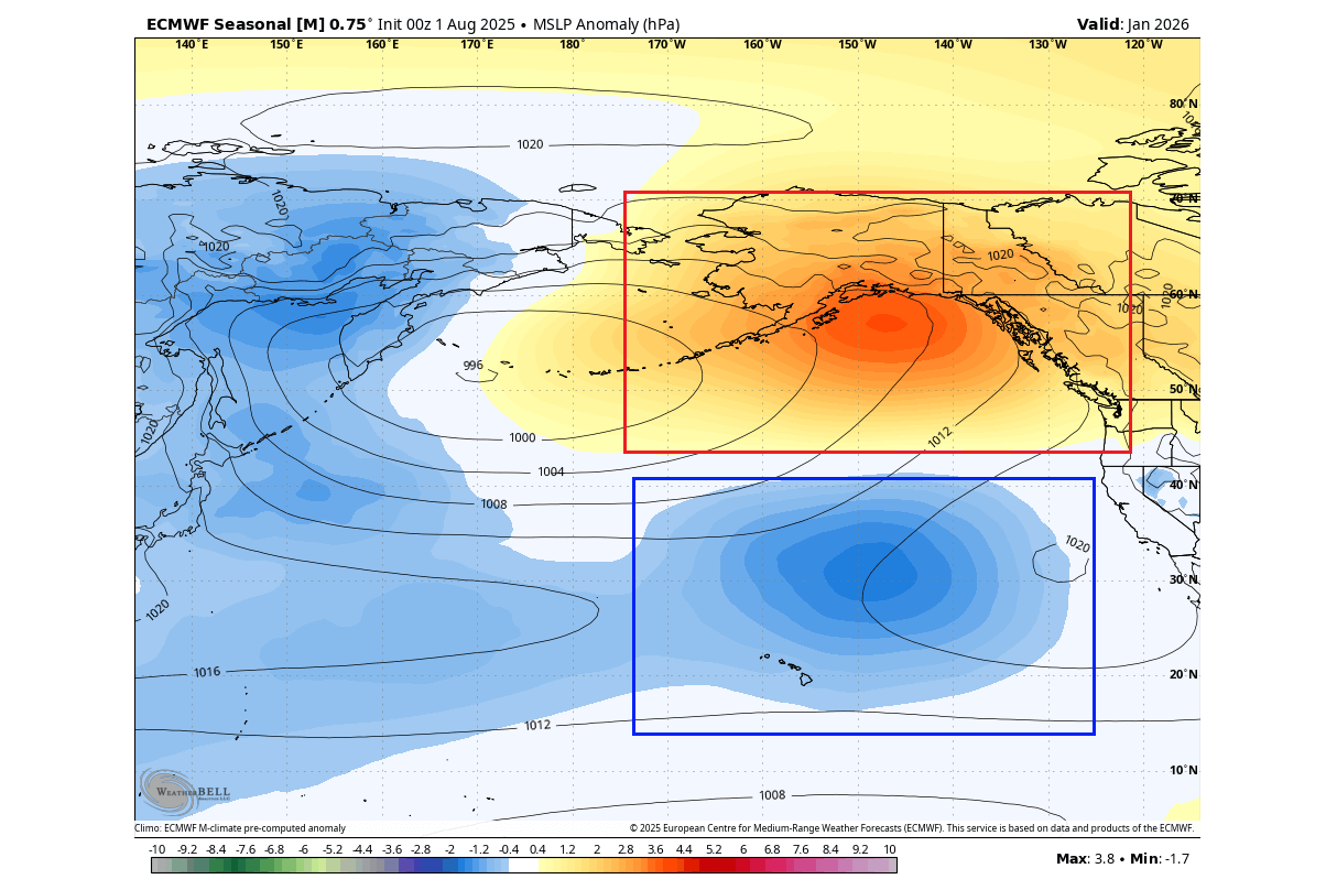
Another sign of the El Niño development next year is shown to us by the atmosphere itself. Below is an image from a study by Vimont et al. (2002) on how specific North Pacific pressure patterns precede El Niño events. Below is the expected pressure pattern a few months ahead of El Niño events.
As you can see, the main predictor pattern is a high-pressure system in the far North Pacific. Under that system is a low-pressure area, driving westerly winds across the equatorial Pacific, limiting upwelling and enabling warm ocean anomalies.
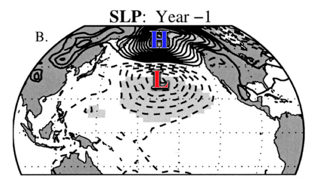
The EMCWF pressure forecast for January shows a very similar pattern. A strong surface high-pressure system with an underlying low-pressure area. This raises confidence for a proper El Niño event developing next year, which could be stronger than the one in 2023.
One great thing about long-range forecasting is not to figure out what the temperature will be 6 months from now in a nearby town at noon, as that is impossible. But we can observe and interpret the various signals provided by the oceans and the atmosphere that can tell us a story of what is to come.
So, what would an El Niño event mean for the weather patterns, especially in Winter?
EL NINO IN THE ATMOSPHERE
The most typical pressure effect of an El Niño is a low-pressure area in the North Pacific. That usually extends and strengthens the subtropical jet stream over the southern United States.
Before going into winter weather, we can look at an important global image. Below is the crop yield impact of the El Niño and its effect on food production. This shows how big an effect the El Niño has by changing the pressure and rainfall patterns.
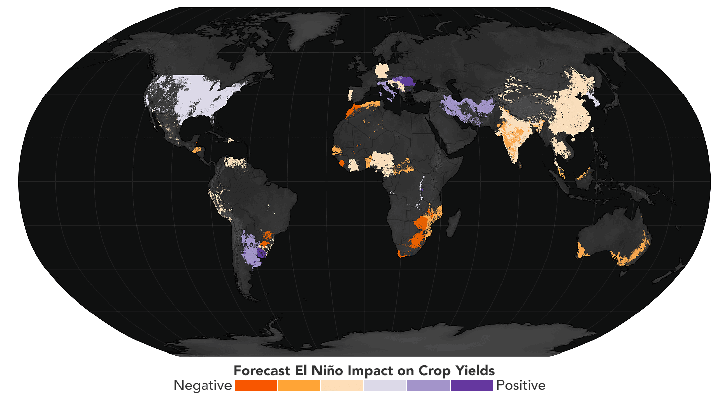
While a lot af areas show a strongly negative impact on food production, some areas do benefit from an El Niño. What stands out is a large part of the United States, which shows a slight to moderate positive impact on crop yields.
As for winter weather, below you can see the average position of the jet stream during El Niño winters and the resulting weather patterns over the United States and Canada. A stronger Pacific jet stream can be seen across the southern United States, creating an amplified low-pressure track.

A stronger subtropical jet stream brings lower pressure, colder temperatures, and more moisture to the southern United States. If enough cold air is available, this combination also increases the snowfall potential across the central and eastern United States in an El Niño winter.
Temperatures have a major role in snowfall potential. The image below shows snowfall anomalies during El Niño winters. Some areas with more snowfall during an El Niño include the eastern United States, the southern United States, and the central and upper Plains.
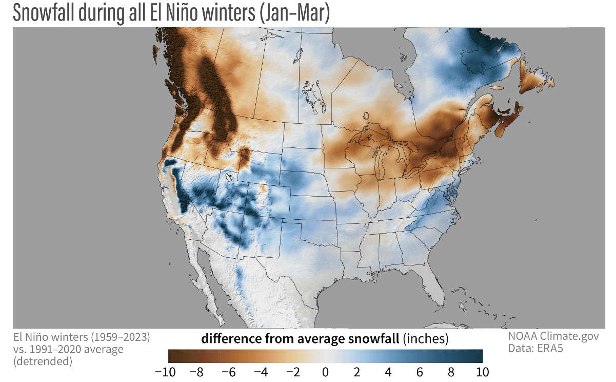
This is mainly due to low-pressure systems trailing across the southern United States. More moisture increases the chances of snowfall in the southern half if enough colder air is available.
Less snowfall is usually seen in an El Niño winter across the Ohio Valley, the upper Midwest, the northern Rockies, and the Pacific Northwest.
Actual snow amounts are always limited in the southern United States because temperatures must be cold enough for snowfall. For that reason, there is usually much more snowfall during an El Niño in the higher and colder elevations of the southwestern United States.
This is essentially just an analysis of specific past winters. But just like 1+1 equals 2, we can also see in the weather how a combination of certain global factors can produce a similar winter season more than once.
But before we get to the El Niño, we wrote a more in-depth article on the La Niña and Polar Vortex impacts this upcoming Winter: Winter 2025/2026 First Forecast
We will keep tracking the latest global weather patterns and forecasts, so be sure to bookmark our page to stay updated. If you found this article in the Google App (Discover), tap the ♥ or star to see more of our weather and nature coverage in your feed.