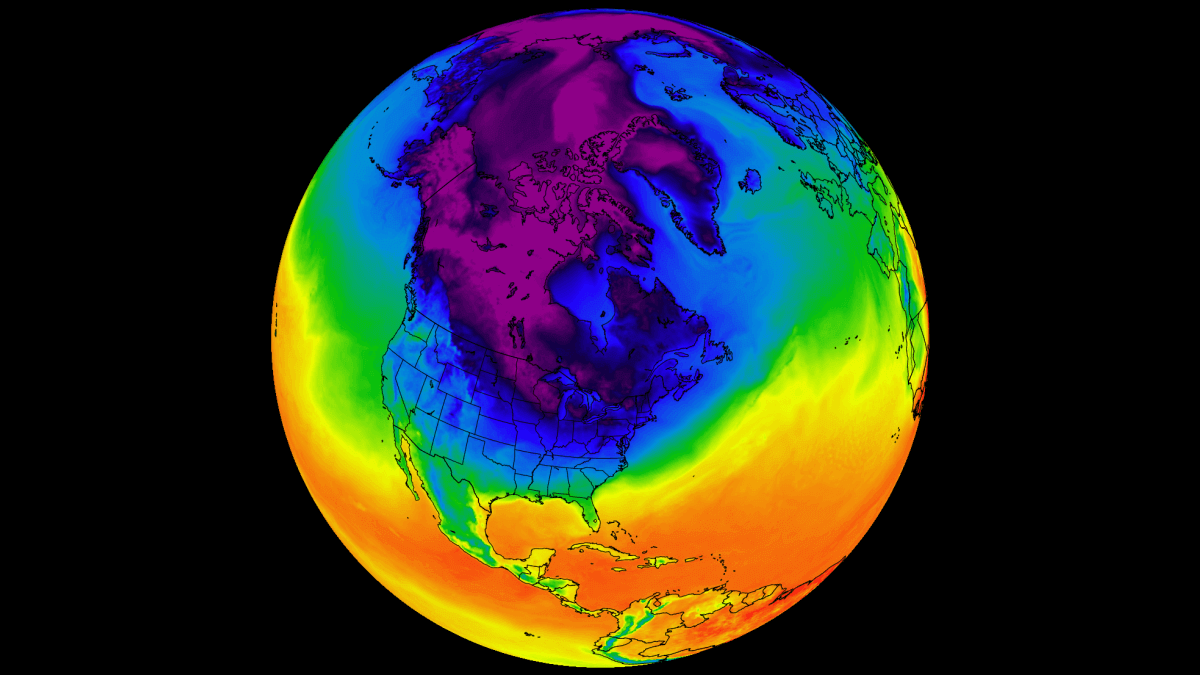
Early forecast trends have emerged for the Christmas weather patterns, and they look really interesting. What stands out is a strong Polar Vortex core over North America, affecting both sides of the Atlantic. This has a significant impact on the odds for a snowy Christmas across the United States, Canada, and Europe.
At this range, we use ensemble forecasting systems, which blend many model runs into a single outlook. This is perfect for discovering weather trends in the coming weeks.
In this article, we will look at the first trends and weather development around the Christmas holidays. You will also see why the 2025 holiday season is likely to be colder if you live in the United States or Canada, thanks to a strong Polar Vortex core over North America.
LONG-TERM CHRISTMAS SNOWFALL
Extended forecasting tools are only useful if you know what to look for. In this article, we are going to look at the early Christmas snow trends and what is the probability of snow during the holidays.
But before we look at the latest forecasts, we will take a quick look at just how common a white Christmas really is across the United States and Europe. The map below shows the historic probability of having at least 1 inch (2.5 cm) of snow on the ground on Christmas Day.
Over the United States, the biggest probability for a white Christmas is over the Rocky Mountains and the mid-elevations of the west, across the northern Plains and the Midwest, and the northeastern United States. Probability quickly diminishes as we head towards the south.

Historically, the Northeastern United States has a 50-60% chance of snow on Christmas Day, with higher probabilities in northern areas such as upstate New York and Maine. Over the Midwest, we have states like Minnesota and Wisconsin with an even higher historical probability of a snowy Christmas.
The Rocky Mountains and higher elevations have the highest likelihood of snow on Christmas Day. The southern half of the country typically has below 20% chance of seeing snow on Christmas. But events like the Polar Vortex can significantly change the look of this map.
Across Europe, you can see the highest probability in the north, decreasing towards the south, but remaining high at higher altitudes. This is, of course, strongly connected to colder air, which is found in the northern parts and at higher altitudes.
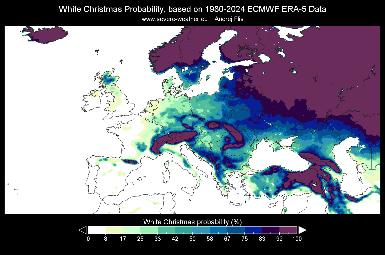
But these maps are just averages of the past 40+ years, and each Winter season and each year has its own weather pattern that can greatly change the actual snowfall outcome.
We are still early in the season, so it is important to note that different parts of the forecast carry different confidence levels. So, before we go into the actual weather forecasts, we need to understand the limitations of the current forecast range.
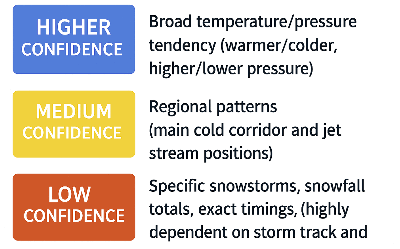
This is why the early forecasts work best only as a general pattern trend, while the most reliable Christmas snow details are usually found within the final week.
And in the 2025/2026 season, a rare pattern is already emerging in the first holiday forecasts.
A POLAR VORTEX SPLIT
A big game changer for the 2025 Holiday season is the stratospheric Polar Vortex. In the next two weeks, it is expected to undergo a split event, sending one of its cores into North America.
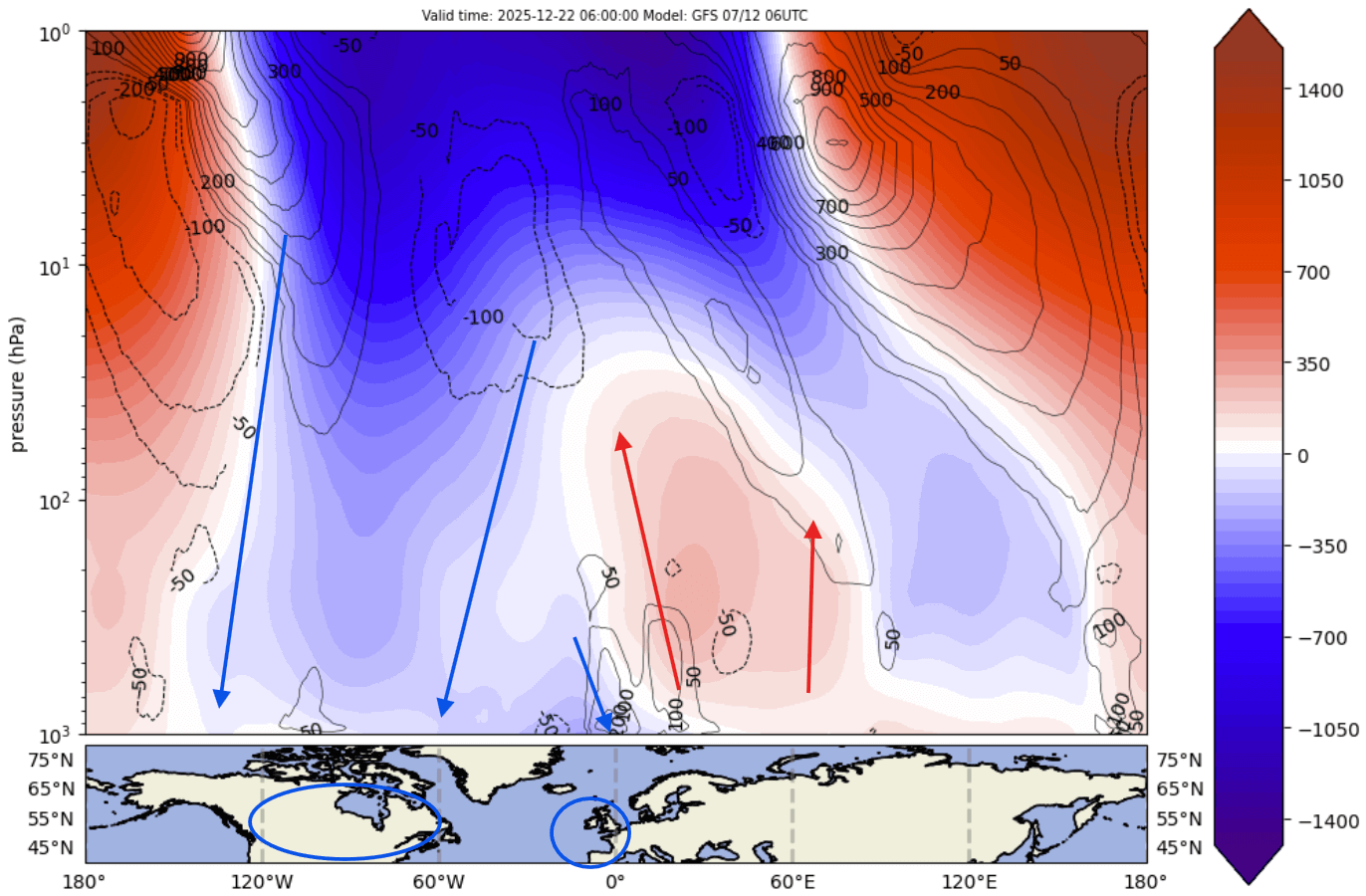
If we look at the Polar Vortex pressure forecast just before Christmas, the disruption is very obvious. This map shows the lower stratosphere at the 50 mb level (20km/12.4 miles), with the inner core of the Polar Vortex partially split into two areas. This is caused by the strong high-pressure systems from below, pushing into the Polar Vortex, just like squeezing a balloon.
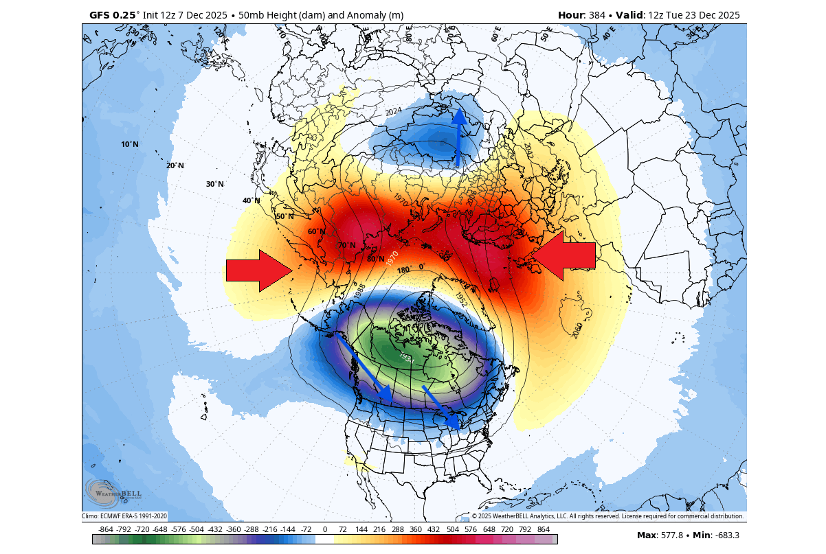
As the image shows, these are quite strong anomalies in the stratosphere. You can start to see the actual separation of the inner cores, with the stronger one remaining over North America, creating a low-pressure zone.
A Polar Vortex split occurs when the high-pressure waves from below start to push upwards. The resulting low-pressure anomaly over Canada can bring significant cold and snow to wherever it moves, while enabling a warmer pattern further downstream.
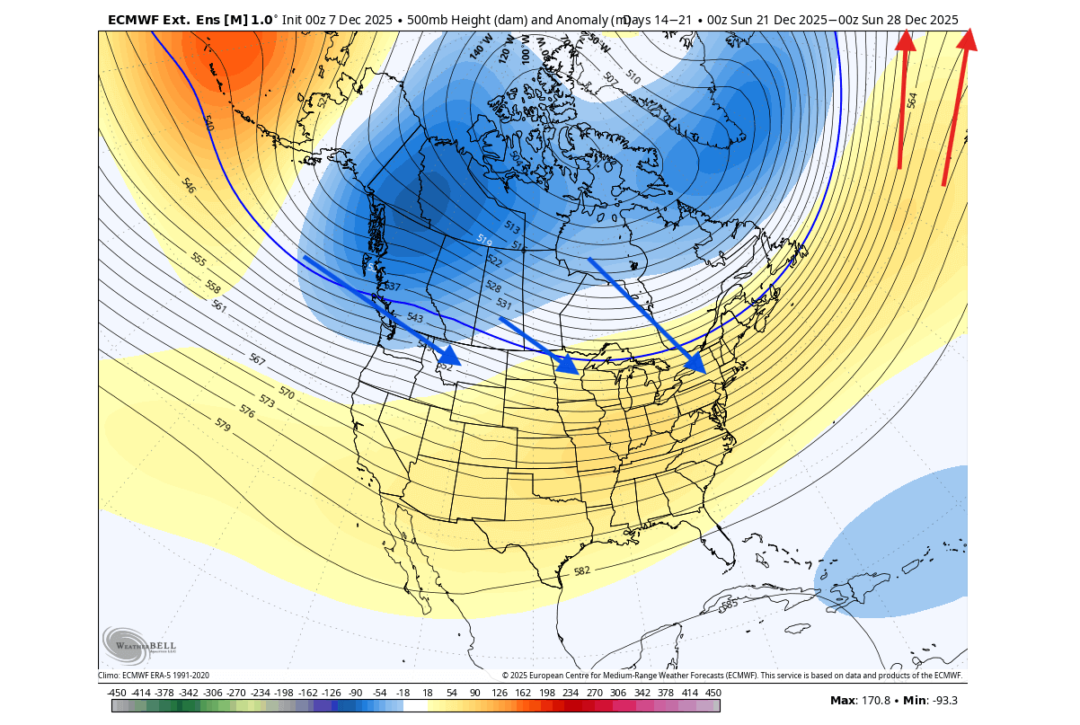
The atmospheric forecast image below shows the Polar Vortex pressure anomaly by altitude from the surface to the top of the stratosphere. You can very clearly see the split lower cores into two “legs”, and you can also see that the main connection point of the upper Polar Vortex is over North America.
The actual pressure forecast for Christmas week shows a strong low-pressure zone over Canada, which is actually the Polar Vortex core itself. This supports a stable northerly cold flow, bringing colder air into the United States and southern Canada. Across Europe, there are also some changes on the horizon, but so far, there are no signs of a deep cold flow.
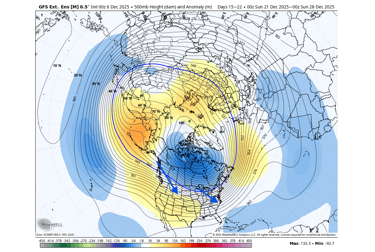
This pattern is already starting across North America and is currently bringing a series of cold air waves into the northern, central, and eastern United States. At the same time, Europe is under a mild weather pattern downstream, as expected.
Below is a video that shows the medium-range temperature forecast for the United States and Canada. It reveals how the cold air will come in multiple waves, driven by the Polar Vortex core.
But how will this pattern translate into surface weather for the 2025 Christmas holidays?
EARLY LOOK AT CHRISTMAS WEATHER
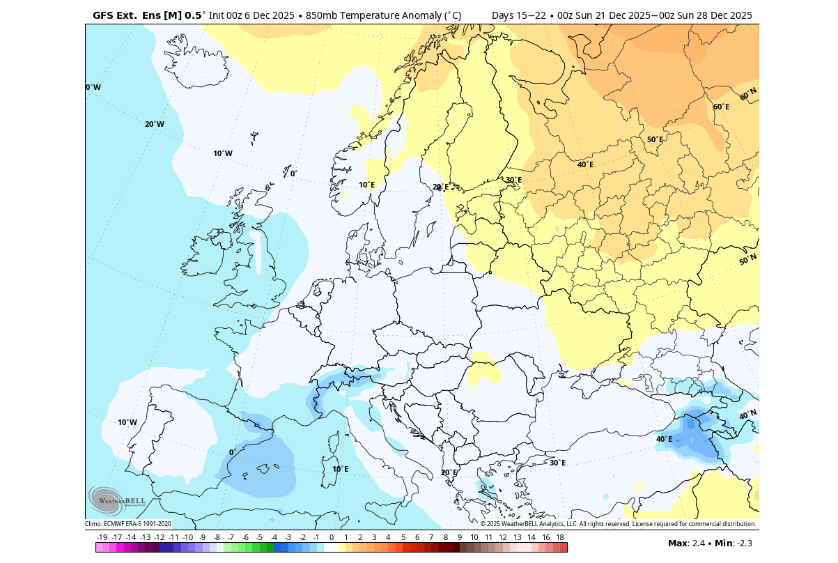
Looking at Europe, the Christmas temperature trend does look to bring cooler temperatures into the western parts, with the warmth pushed further out. But with the broad low-pressure area over North America, it limits the actual cold potential, so this is not a proper polar airmass, but more of an easterly cooler flow.
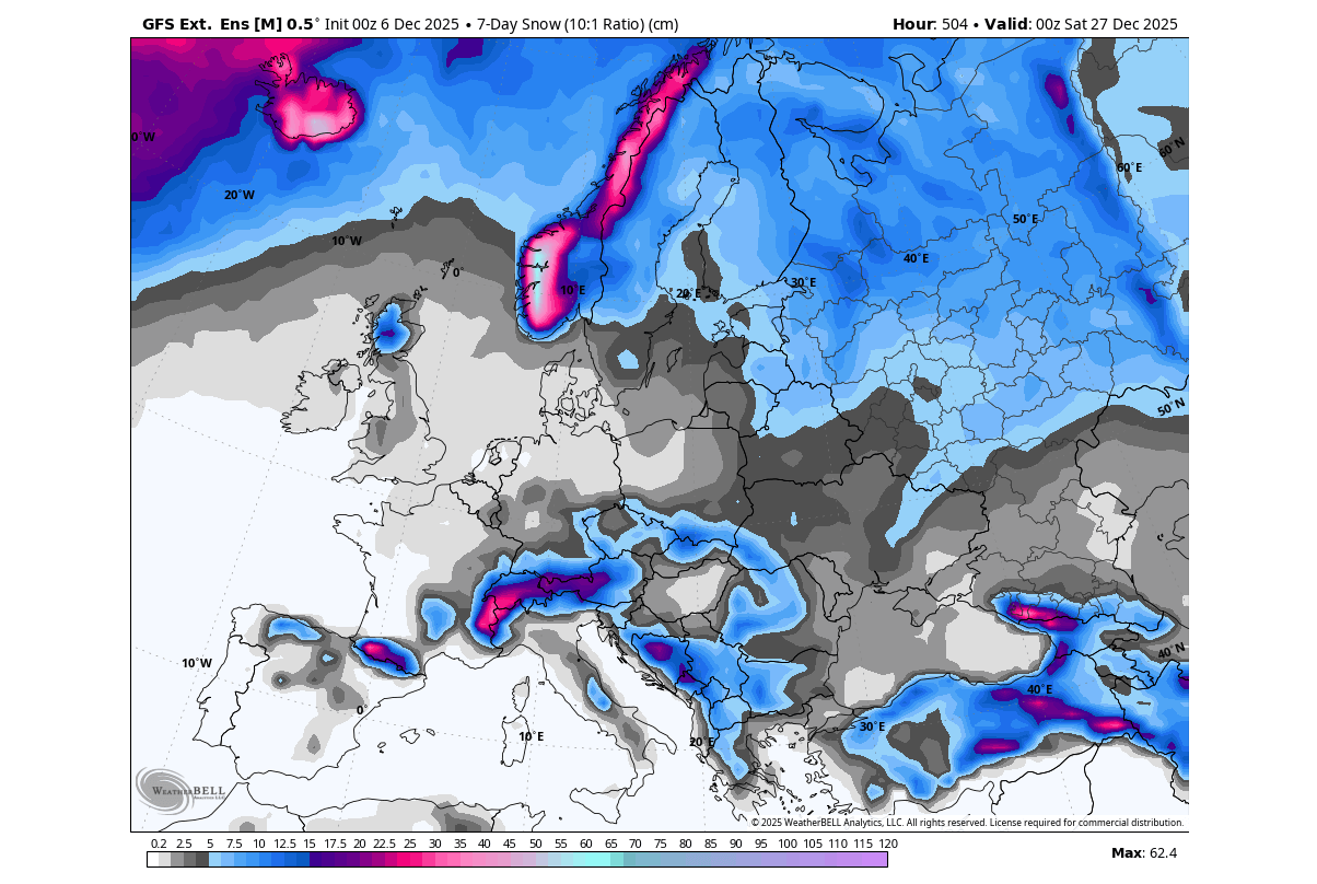
The snow trend does show some snowfall in the Christmas period, with the main area being over the northern parts, with lower temperatures. The second area of interest is over central Europe, where some snowfall could approach the lowland, not just the elevations.
In North America, you can see the broad cold air anomaly across the east. This is the result of the Polar Vortex, a low-pressure area over Canada, creating a northerly flow of cold air. The Christmas temperatures are forecast to be colder than normal over the northern, central, and eastern United States and southern Canada.
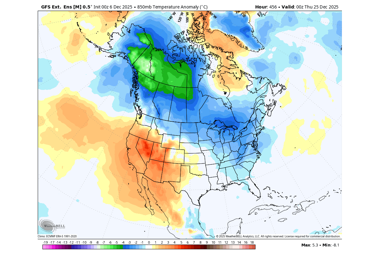
A great example of a possible scenario can be found in some of the individual forecasts in this range. This is no fixed scenario, but just a single forecast that shows the potential of this pressure pattern, with polar cold spreading across the United States. This would bring widespread snow across the southern and eastern half of the United States, with sufficient moisture.
With a weather pattern like this around Christmas, it increases the chance for air traffic delays or cancellations across the northern and eastern United States. We will keep you updated on the latest forecasts, but a cold air event like in the image above could require booking an earlier flight or traveling a day earlier.
Looking at the actual 7-day snowfall trend centered around Christmas, there is good snow coverage across the entire northeastern U.S., the Midwest, across the Rockies in the west, and also across the Appalachians. There are indications of snowfall for the northern Plains, but at this range, we are just looking at the most obvious areas for now.

So, to summarize this forecast, it shows the highest white Christmas probability around the Great Lakes, interior Northeast (Upstate NY, VT, NH, ME), and higher elevations of the central/northern Appalachians (WV into PA/NY, higher terrain).
Medium probability areas are those with proper/sufficient cold, but need good timing with moisture to produce snowfall. These include the Upper Midwest, interior Mid-Atlantic (higher elevations of PA/MD/VA), and the Northern Plains (ND/SD into northern NE, depending on cyclone position).
The lowest probability of a white Christmas, for now, is across the deep South and the Gulf Coast, across Florida, and in the lower elevations of the Southwestern United States.
But these forecasts are from just one model, and for a better idea at this range, we usually have to use at least two weather forecasting systems.
ECMWF CHRISTMAS WEATHER FORECAST
The ECMWF forecasting system is usually regarded as very good, and often excels at finding proper patterns in the long-range noise. But it appears to be underestimating the potential for cold this season.
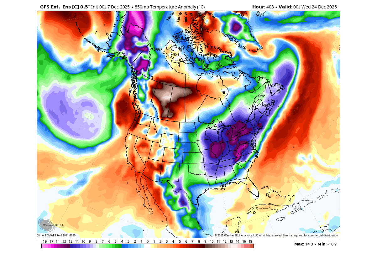
Below is the pressure forecast from this model, centered around Christmas. You can see the same Polar Vortex core over Canada, which enables a steady cold northerly flow into the United States. Downstream, you can see the milder Atlantic flow directed towards Europe.
The main difference here from the previous forecast is the stronger high-pressure ridge over the eastern United States. While this would limit snowfall potential, it is very likely that it will be weakened or even removed once the period gets closer.
You can see this in the image below, which shows the ECMWF forecast trend for the WPO Pacific pressure pattern. Each line is a separate model run, and you can very clearly see how each new forecast is trending more negative. This means the model is greatly underestimating the cold pattern and creating a stronger ridge farther out.
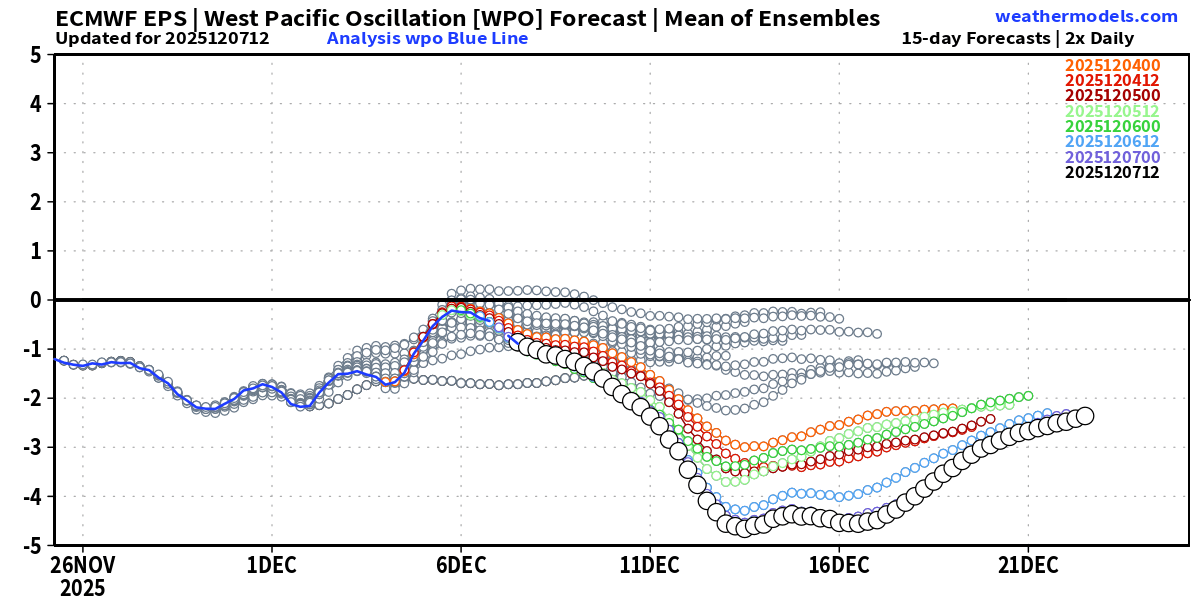
The WPO pattern, when negative, enables a colder air spill over southern Canada and the northern, central, and eastern United States. So the lower it goes, the higher the cold potential across the United States, except in the Southwest.
Over North America, the cold air supply for the holiday week remains over western Canada, with a spread into the upper Midwest and the northeastern United States, as well as eastern Canada. The best snowfall potential is limited to the northern third of the United States and into Canada, but as seen above, the cold spread is very likely underestimated at this range for now.

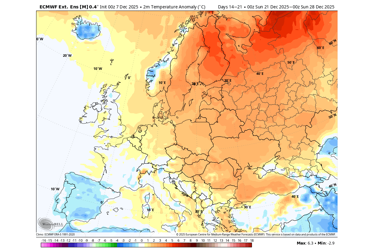
Since the pressure pattern over North America also impacts the downstream development, we can also see quite warmer temperatures over much of Europe. There are cooler temperatures forecast over the southwest, but that is due to a local low-pressure zone, and not actual polar cold.
But just as the pattern over the United States is expected to correct in the coming days, we will also see how that will impact the development downstream towards Europe.
Overall, for Christmas snowfall, a lot depends on the availability of cold air, which is indicated across the United States in the current forecasts and trends considered. But for snow, we also need moisture, and that will be easier to forecast as the period slowly approaches.
We will keep you updated on the global weather pattern development, so make sure to bookmark our page. Also, if you have seen this article in the Google App (Discover) feed, click the like or follow button there to see more of our forecasts and our latest articles on weather and nature in general.