The unusually early disruption of the Polar Vortex has brought deep Arctic troughs into the Atlantic, resulting in the flip weather patterns over Europe. In other words, a more active North Atlantic means zonal flow returns, with warmer, more moist air masses spreading across the continent. Multiple intense storms are forecast for Western Europe as December starts.
While the weather has been quite cold over the past few weeks, Europe is now heading into a warmer period for at least a week or two. Following the substantial Polar Vortex disruptions, patterns over North America towards the Atlantic have developed a corridor of deep troughs, resulting in more zonal flow towards the European continent.
The recent model guidance suggests that deep troughs and surface lows will dominate the North Atlantic through early December, helping to establish southwesterly warmer flow into Europe. Therefore, wintry weather conditions are postponed for a while.
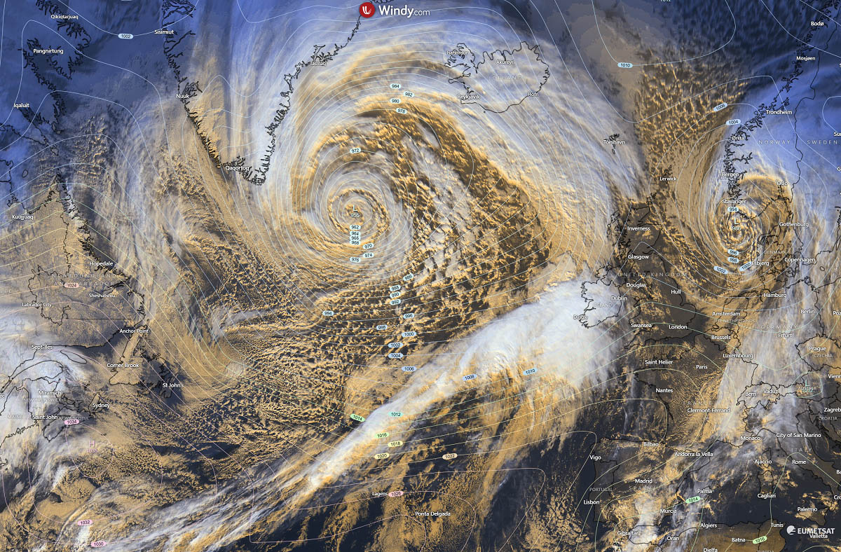
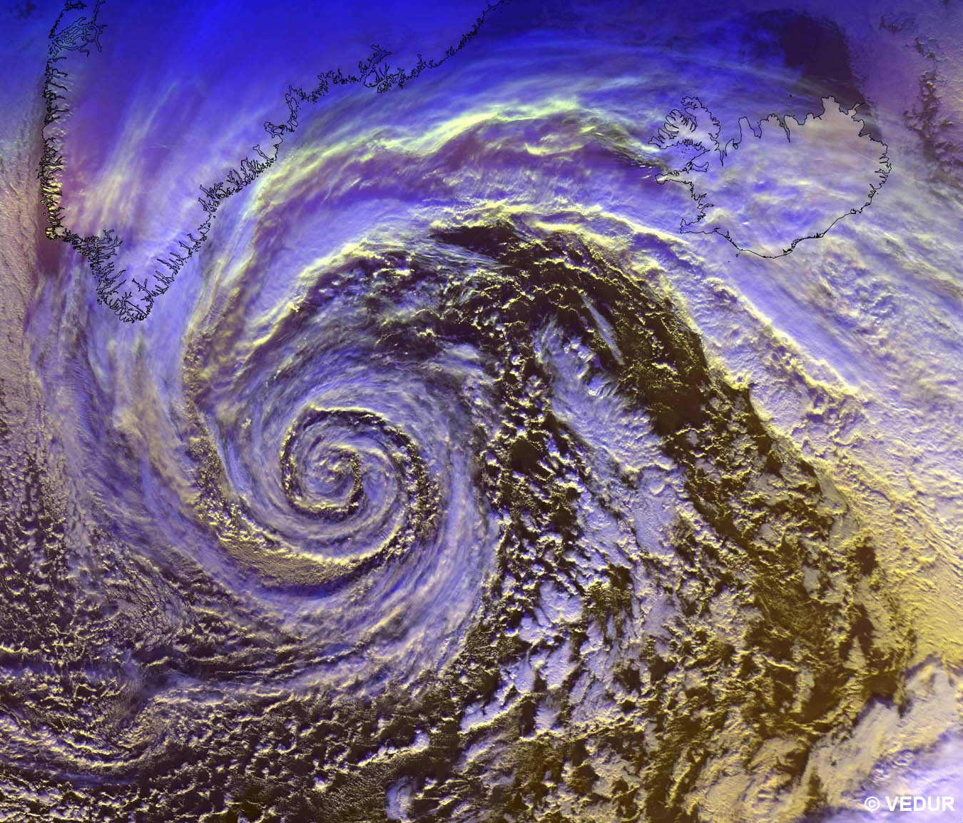
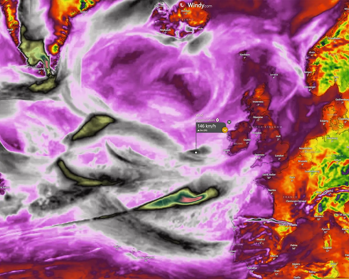
Looking over the satellite image across the North Atlantic and Europe on Sunday, revealed an impressively large and deep surface low, located south of Greenland and southwest of Iceland. Its central pressure is around 950 mbar, with a huge wind field and a frontal zone towards western Europe.
We can also see a decaying low moving from the North Sea into southern Norway, bringing unsettled weather with heavy snow into interior Norway and Sweden.
This significant low will shift east early this week, with more intense systems to follow throughout the week and into the following weekend. The patterns over the Atlantic will remain dynamic and powerful.
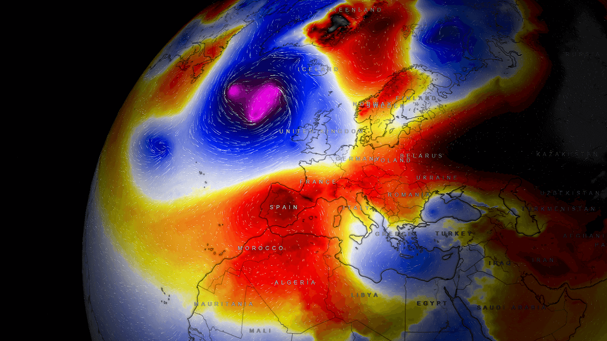
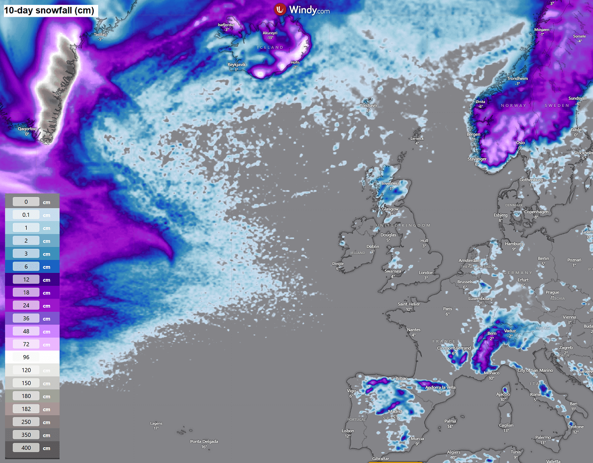
Attached below is an overview of weather patterns over the Atlantic and Europe for the next 10 days, showing multiple Atlantic storms blasting into Western Europe. While further east, warmer, more stable weather persists over the continent.
Before we discuss the details of the upcoming weather pattern dynamics, we want to consider the primary trigger behind the more active periods over the Northern Hemisphere in the winter months. The intense Arctic blasts into the Atlantic often follow a disruption of the Polar Vortex aloft and lead to intense surface lows, resulting in unsettled weather conditions for Europe.
What is the Polar Vortex?
In simple terms, the Polar Vortex is the broad winter circulation over the northern and southern hemispheres.
The Earth’s atmosphere has six layers. Most of the dynamics of our daily weather occur in the lowest two layers of the atmosphere: the troposphere and the stratosphere. The troposphere is the layer closest to the Earth’s surface. It is about 12 km deep and extends from the ground up high into the sky.
Depending on where you live, its depth varies from around 8 km to almost 20 km. The troposphere is deepest over the equatorial region and becomes much thinner over the North and South poles.
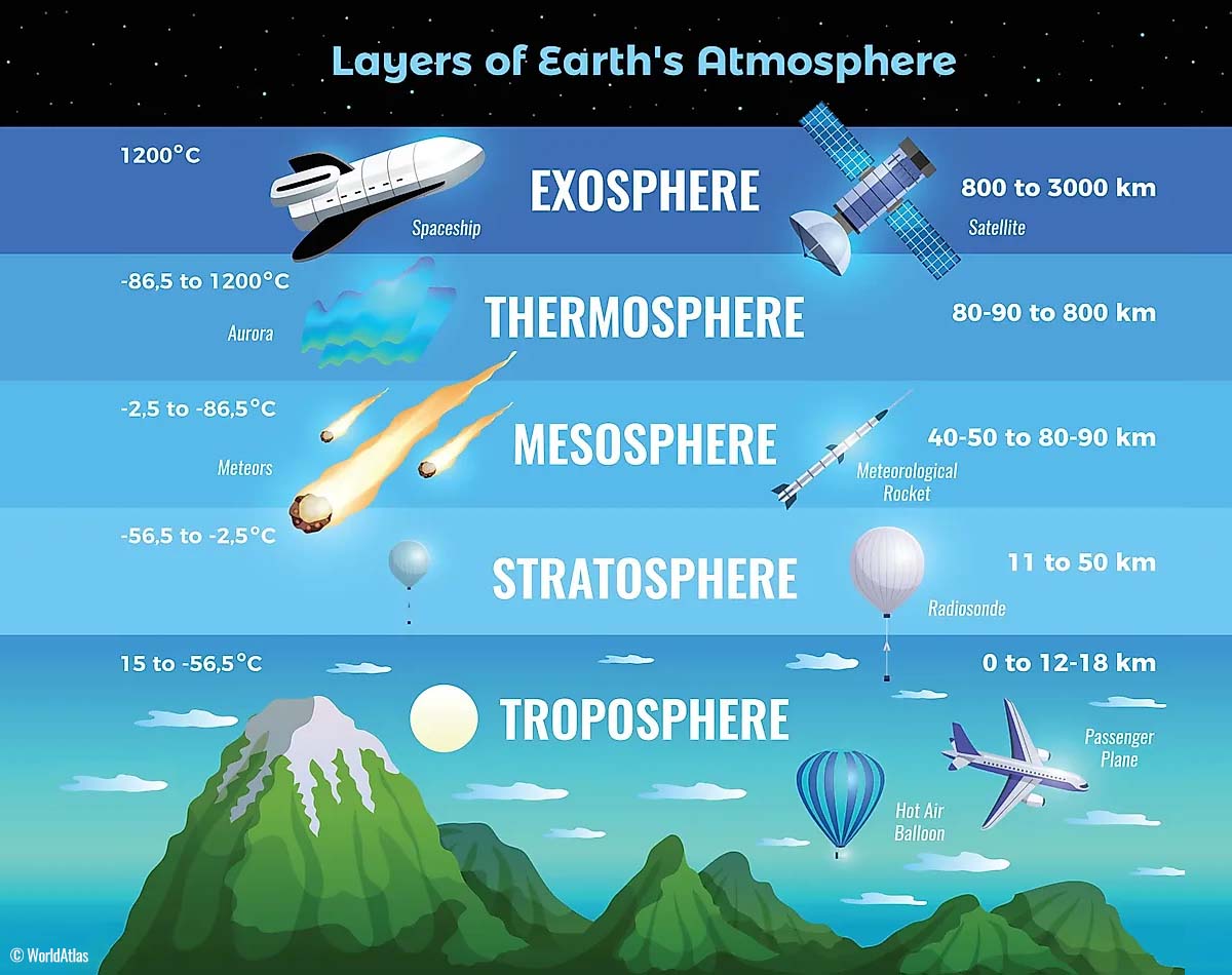
Above this layer is a much deeper one known as the Stratosphere, an 11-50 km thick layer of arid air. Another essential feature in the stratosphere, which makes our weather even more variable, often triggers large-scale, long-lasting winter weather events.
This is the Polar Vortex—an enormous, tri-dimensional ring of powerful winds moving through the sky above us. The Polar Vortex is spinning around the North Pole, grazing through the air at about 20-50 km above the Earth’s surface with violent wind speeds.
The troposphere and stratosphere are crucial for our climate. The Polar Vortex covers most of the bottom half of the atmosphere. Since the vortex extends from the middle of Earth’s troposphere into the stratosphere layer, it significantly affects winter weather across high and mid-latitudes yearly.
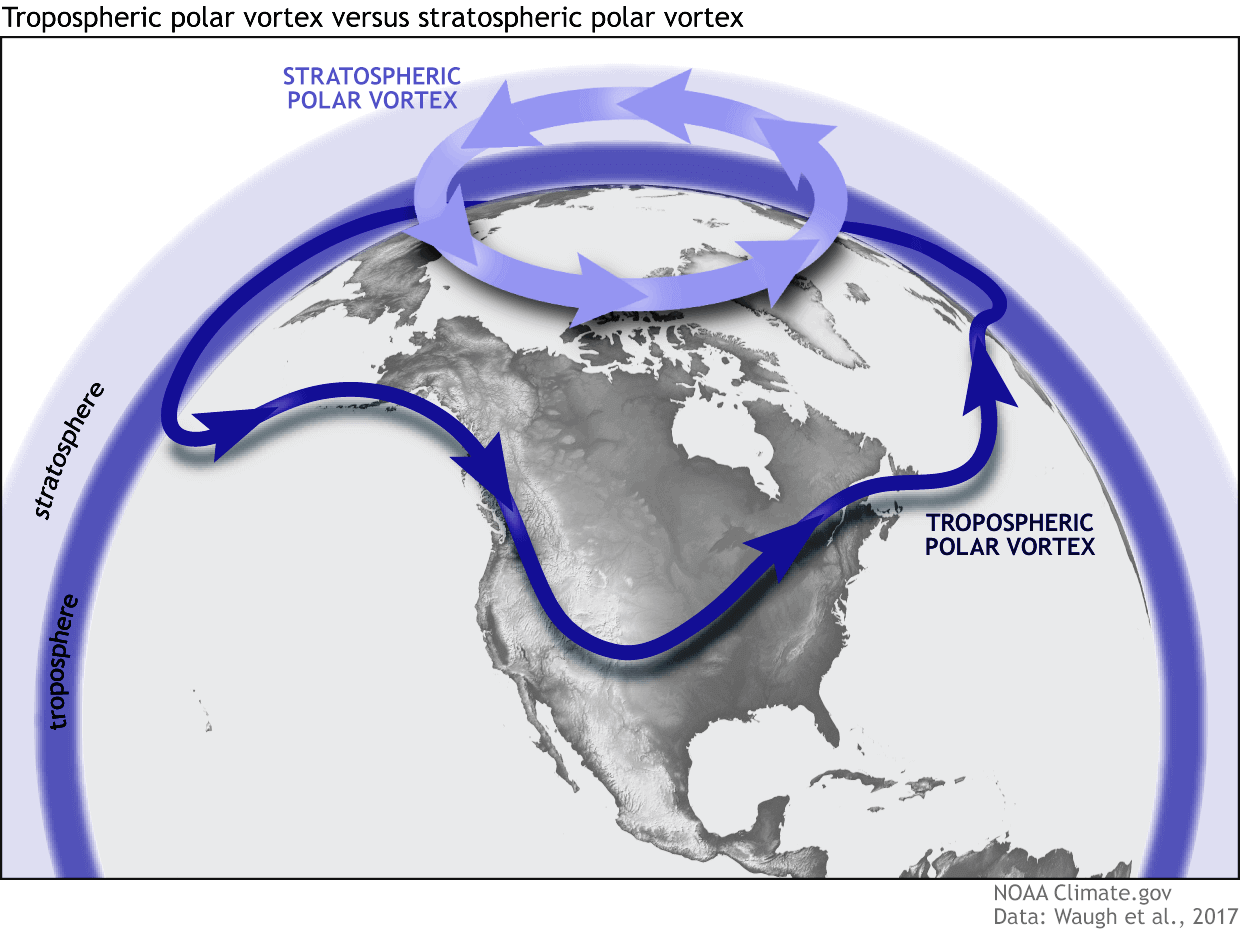
As shown in the image above, we monitor two atmospheric layers during wintertime: the troposphere and the stratosphere. The first is the lowest layer, and the second is at a higher altitude. The Polar Vortex rises through both layers, but with different strengths, shapes, and impacts.
For this reason, we separate the entire Polar Vortex into an upper (stratospheric) and a lower (tropospheric) part. When the Polar Vortex is strong, it traps colder air in the polar regions, preventing its escape and creating milder conditions for most of the United States, Europe, and other mid-latitudes.
Below is an example of how a disrupted Polar Vortex brings cold polar air into the United States and Europe.
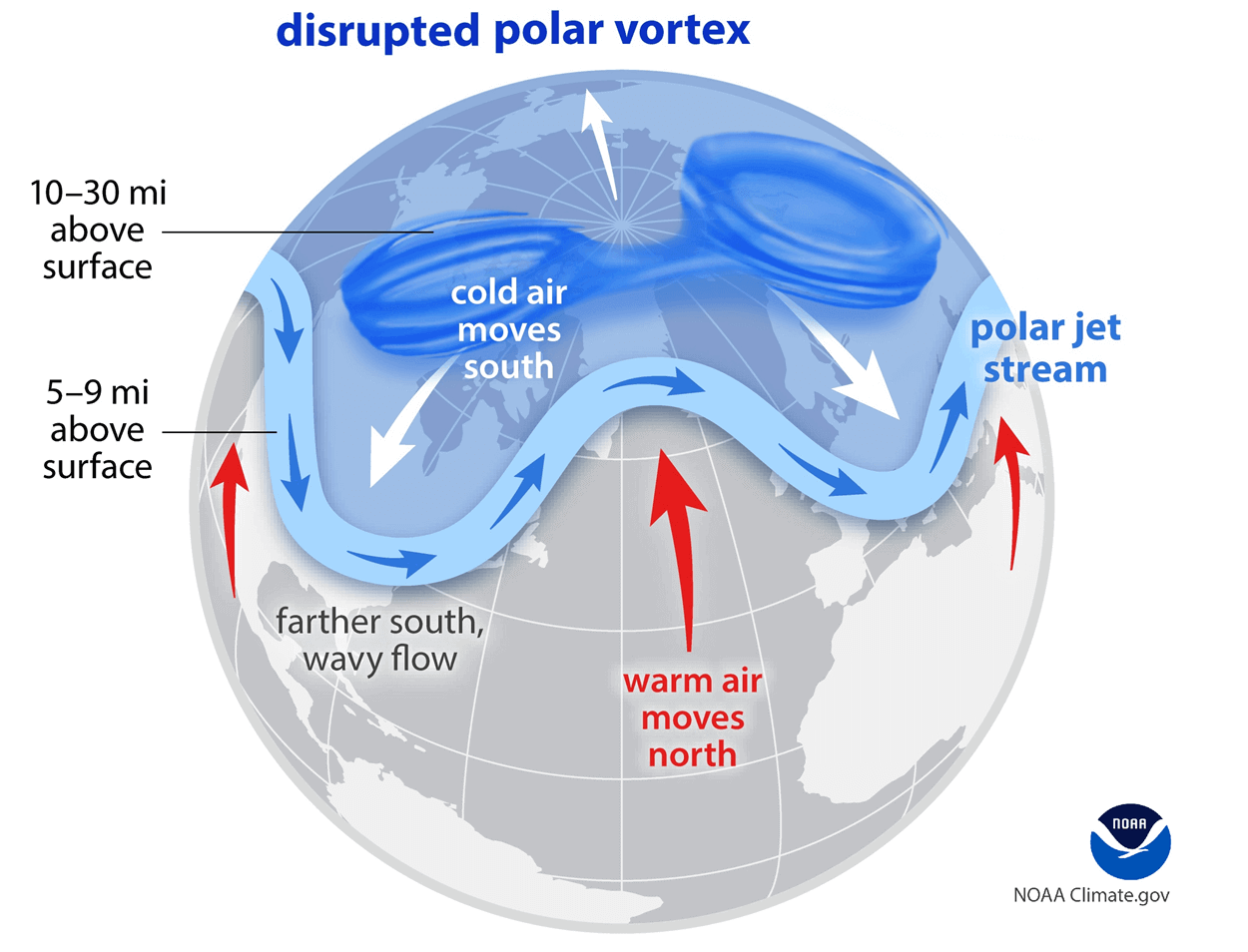
But when the Polar Vortex gets disrupted or even entirely collapses, it can’t fully contain the cold air, which can now easily escape from the polar regions towards the mid-latitude regions.
The dynamic North Atlantic continues as December starts
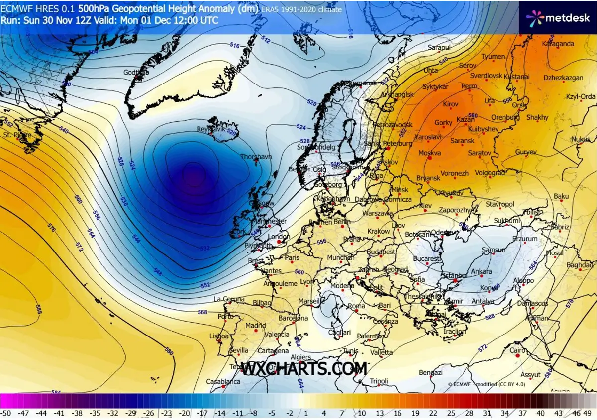
The general weather picture over the North Atlantic and Europe for the first week of December establishes deep troughs on the west and ridging to the east. Strong blocking High will dominate eastern parts of the continent and western Russia, while large troughs will dominate Western Europe and the Atlantic.
This means that the flow across Europe will be west-southwesterly, with an open corridor of zonal flow delivering and maintaining a moist, warmer air mass over the continent.
How the zonal flow is gradually establishing was already well-seen on Sunday’s water vapor satellite presentation. We can see a broad baroclinic zone expand across the North Atlantic, with a strong ridge over the Azores and a deep low near Greenland.
This is a typical west shift pattern, with persistent zonal flow developing.
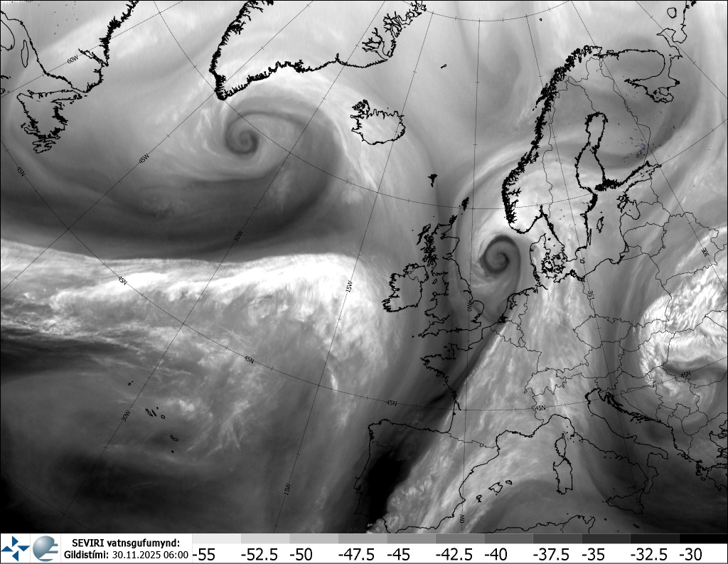
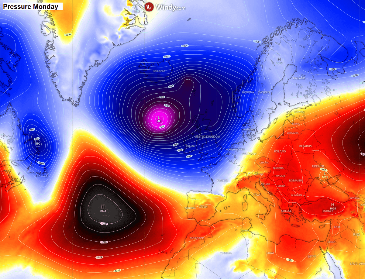
The main deep low south of Greenland on Sunday had an astonishing core, with textbook cyclonic bands around it. The central pressure bottomed near 950 mbar, producing violent winds and high waves.
The system continues to slide east-southeast on Monday, approaching Western Europe while gradually weakening.
So, the pressure forecast for the Atlantic and Europe on Monday hints at how large the low will be, while the strong Azores High lies to its south.
Over Europe, the surface high-pressure system keeps the weather stable and warm. Just by looking at the isobars (lines connecting points of equal pressure), the flow over and towards Europe is zonal, from the west-southwest.
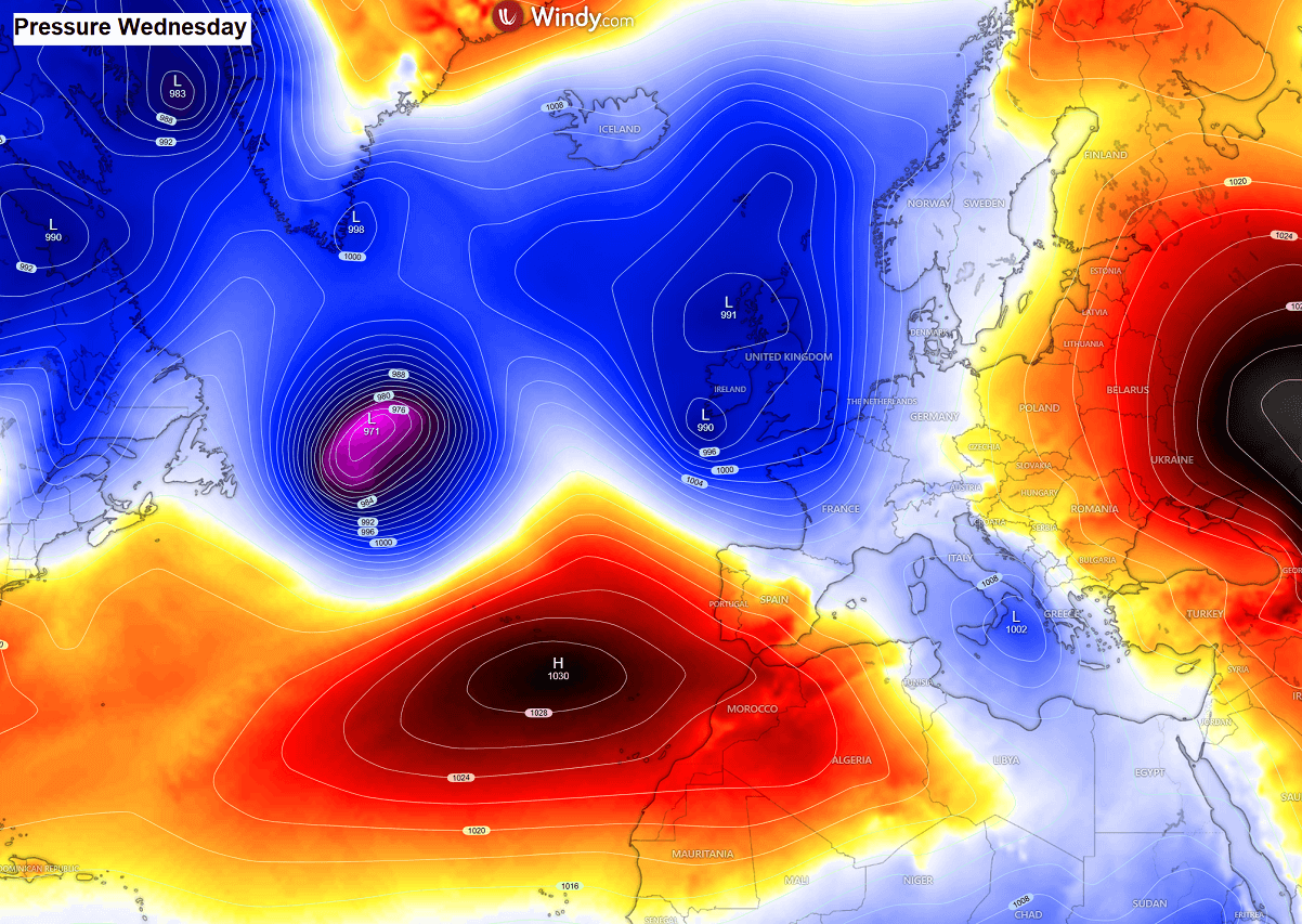
Through mid-week, a small secondary low ejects a weak disturbance towards the Alps and the Mediterranean, temporarily disturbing the stable pattern.
This is due to the so-called locked-in pattern presented, meaning we have a blocking High over Eastern Europe and Russia, and another High over the Azores. So, in between, an open corridor is established from the Atlantic into the central part of the European continent.
The pressure forecast for Wednesday perfectly shows how the zonal flow dominates the weather this week, with more deep lows forming over the Atlantic as intrusions of the Arctic cold air mass emerge from Canada and the Labrador Sea into the warmer ocean.
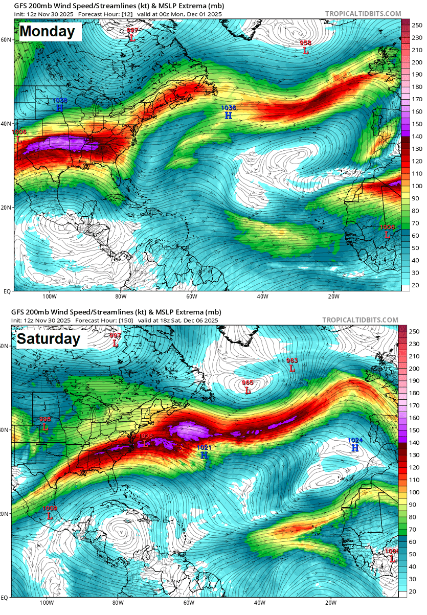
The jet stream across the North Atlantic will be strong throughout the week, giving airfare travelers heading west to east an advantage. Turbulent journeys, however.
So we can see the zonal flow fully establishes through the second part of the week. And it will likely extend into the following weekend and the week after.
Towards the weekend, the southwesterly flow over Europe becomes even more pronounced as multiple powerful troughs form over the North Atlantic, allowing the Azores High to elongate and expand across the southern half of Europe, connecting with the eastern European ridge.
In short, this means the mind’s moist, autumnal period will establish itself. Also, bring more rain events and very low snow chances, except in the high mountains.
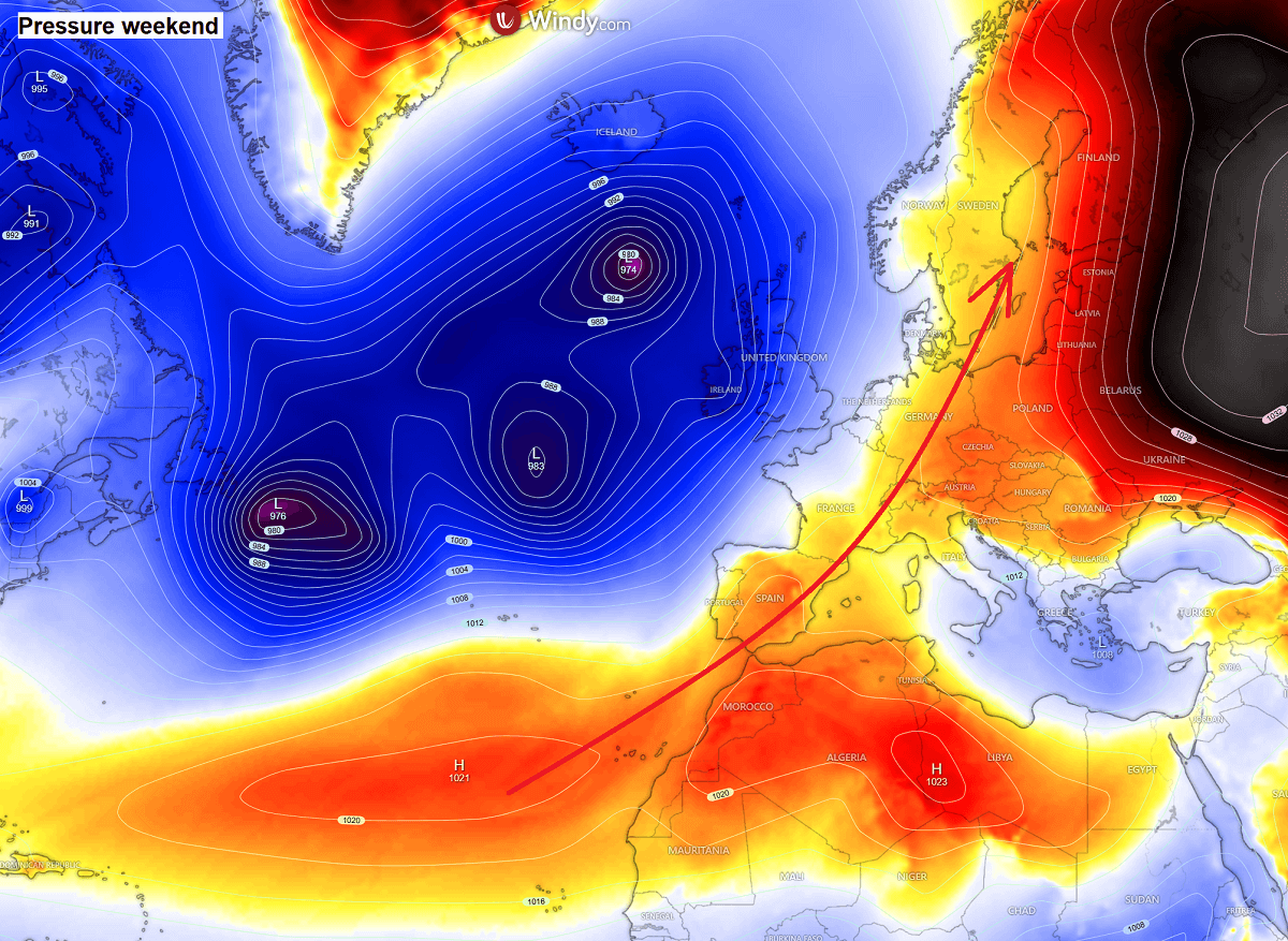
Until these patterns reverse and flip, there are no significant changes or more wintry-like weather foreseen for Europe.
Warmth and moist air mass return over the European continent
As a result of the significant lows dominating the North Atlantic and ringing over the European continent, warmer weather will overspread most of the continent around the following weekend.
The temperature will be around 5-10 °C above normal for early December.
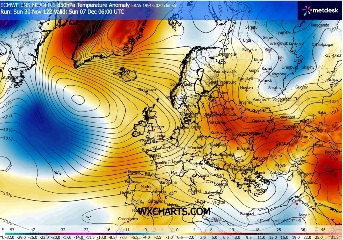
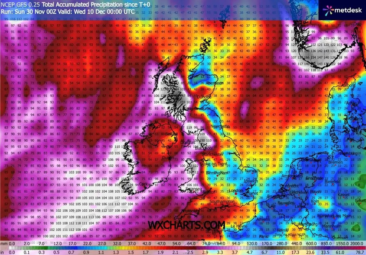
West-southwesterly flow from the sbutropical Atlantic into Europe will deliver heavy rainfall, primarily where the flow supports orographic precipitation. This is especially pronounced in Ireland, the UK, France, Spain, and Portugal.
Some areas could see 150 mm or more over the next 10 days, increasing the potential for local flooding.
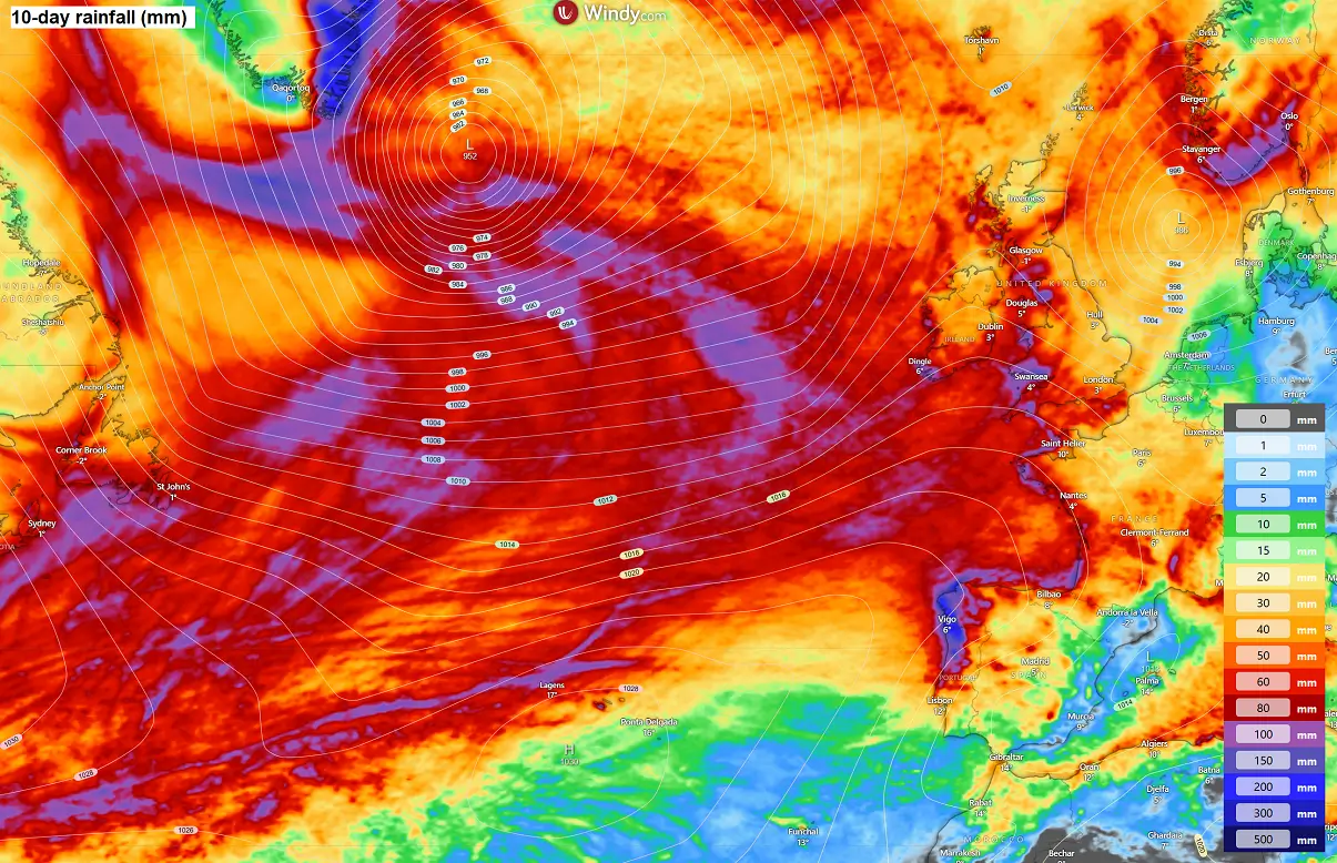
Looking closely at Ireland and the UK, we can see the highest rainfall is forecast for western and southern Ireland, as well as for Wales and the southwestern and northern parts of the UK. And indeed, the Scottish Highlands are forecast to receive close to 200 mm of rain over the next 10 days.
A lot of rain is also forecast for southern Norway, a typical region when southwesterly flow is established, as the moist air mass from the North Sea results in abundant rainfall (and snowfall inland).
So, the first week of December will bring unsettled weather conditions into Western Europe, thanks to multiple frontal systems emerging from the Atlantic. Some of the lows will bring intense Atlantic storms, blasting gale-force winds and significant wave heights towards the western coasts of Portugal, France, Ireland, and Scotland.
While it is hard to predict how close to the European land the deep low cores will arrive, it is advised to monitor local meteorological agencies for possible alerts of dangerous weather conditions in the coming days. As some lows develop intense wind fields, they will produce hurricane-force winds.
To conclude, the upcoming period of 7-10 days or more is unfavorable for winter weather, meaning the chance of snow will be minimal to non-existent.
There will likely be more snow for the higher Pyrenees and Western Alps, as well as southern Norway and central Sweden. But the rest of the continent will experience milder weather through early December.
We continue to closely monitor the evolution of the progressive patterns across the North Atlantic and Europe as December starts. Following the unusually early and significant disruption of the Polar Vortex aloft this winter, conditions are prone to rapid changes in the coming weeks.
Stay tuned for further updates.
Windy, TropicalTidbits, and Wxcharts provided images used in this article.