A new winter storm will set the stage for another snowstorm event early next week, with a new pack of snow that will blanket areas recently impacted by the storm Hernando.
From Sunday through Tuesday, a fast-moving Alberta Clipper winter storm will race from the Midwest to the Mid-Atlantic, travelling along the southward-surgeing frigid Arctic cold pool, beneath the southern lobe of the Polar Vortex aloft.
The Clipper storm is a system fueled by a fresh surge of Arctic air mass diving south from Canada into the US. These storms typically form in the lee of the Canadian Rockies (Alberta) and quickly move across the northern United States towards the East.
These systems are not fueled by high moisture or other winter storms, so snow amounts are less impactful but can still disrupt travel. They are followed by extreme cold air masses, characterized by a massive drop in temperature.
We are tracking a potentially impactful storm system that will barrel across parts of the nation this Sunday and Monday, leading to travel disruptions with a wintry mix of snow and ice. As the lobe aloft dips south, it brings another deep freeze plunging southeastward from Canada into the U.S. in the following days.
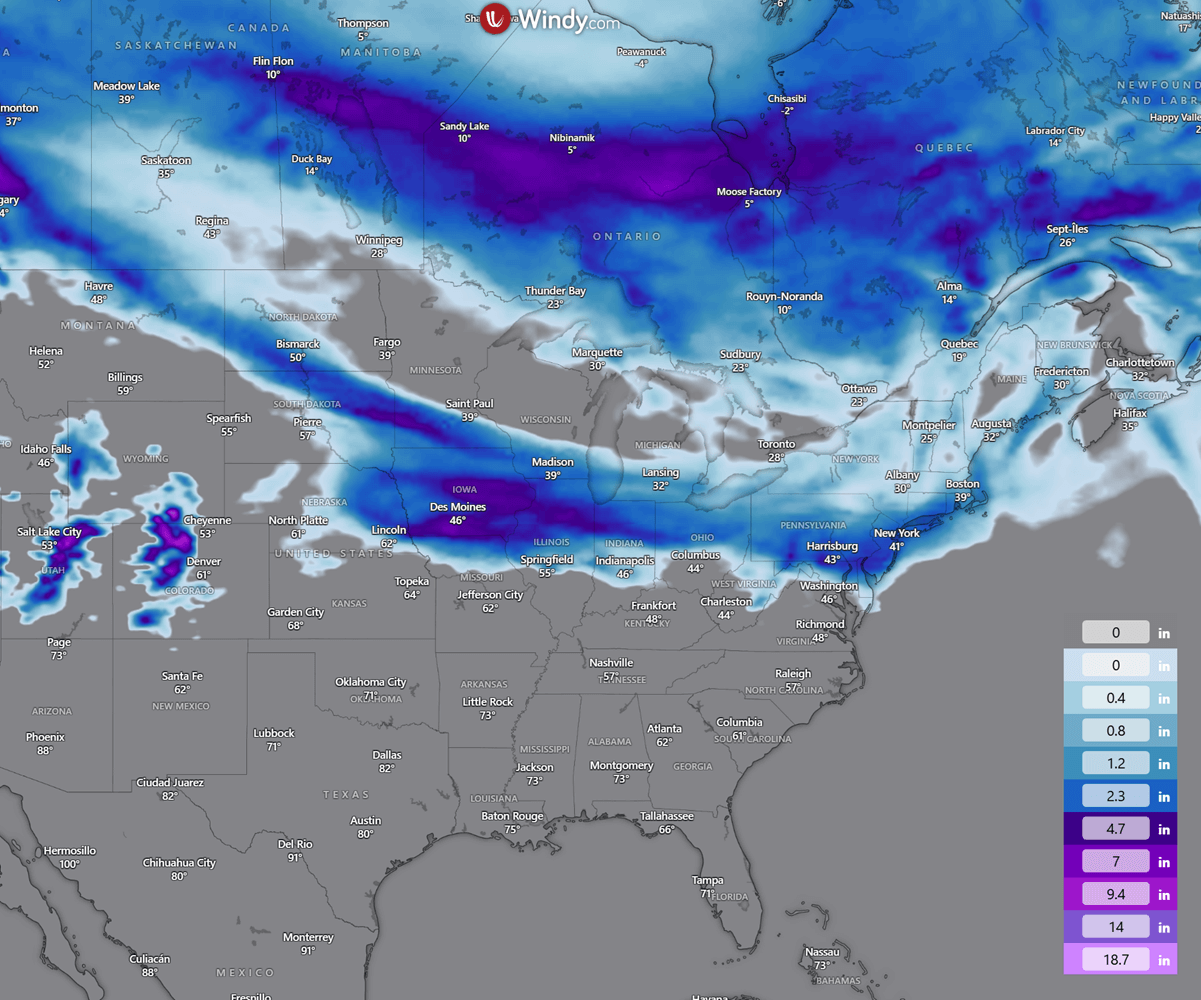
The storm will impact areas from Chicago and Detroit to New York City and Philadelphia, with Monday morning rush-hour travel disrupted by fresh snow and locally ice or freezing rain.
The intensifying polar jet stream will keep the Arctic high over Canada strong, locking the Great Lakes and the Northeast in a deep freeze through mid-week, resulting in cold temperatures for the first month of the meteorological spring.
Before we dig into the details of the impactful new Winter Storm, it is essential to understand the background mechanisms governing the Polar Vortex. It remains the primary driver of rapid weather changes and intense Arctic outbreaks across Canada and the United States during winter or early spring.
What is the Polar Vortex?
Earth’s atmosphere has six layers. Most of the dynamics of our daily weather occur in the lowest two layers of the atmosphere, the troposphere and the stratosphere.
The troposphere is the layer close to Earth’s surface. It is about 12 km deep and extends from the ground up high into the sky. Depending on where you live, its depth varies from around 8 km to almost 20 km. The troposphere is deepest over the equatorial region and becomes much thinner over the North and South poles.
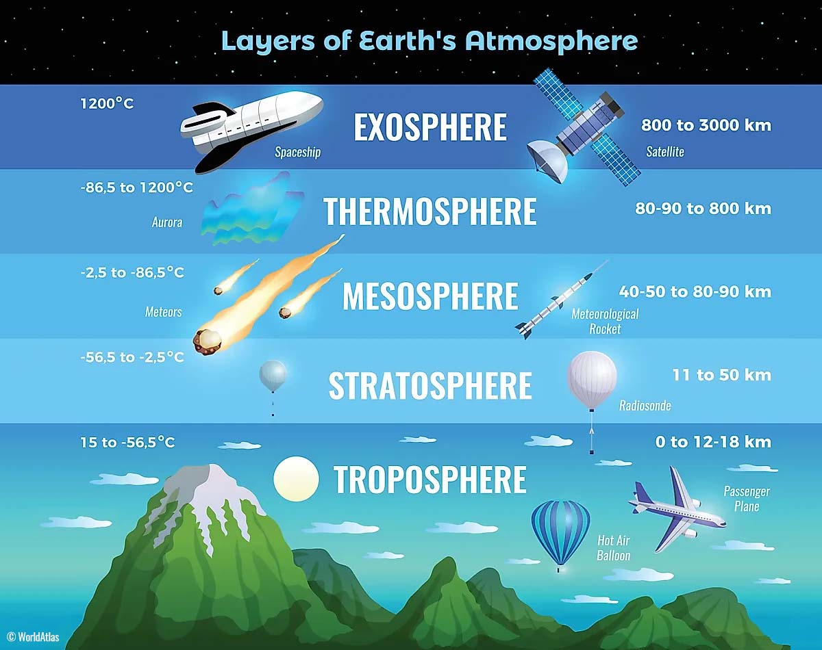
Above this layer is a much deeper one known as the Stratosphere, an 11-50 km thick layer of arid air. Another essential feature in the stratosphere, which makes our weather even more variable, often triggers significant, large-scale, long-lasting winter weather events.
This is the Polar Vortex—an enormous, tri-dimensional ring of powerful winds moving through the sky above us. The Polar Vortex is spinning around the North Pole, grazing Earth’s surface at about 20-50 km, with violent wind speeds.
How and when does the Polar Vortex form?
Earth’s inclination means the polar regions receive much less energy from the Sun during the fall months. This makes the cooling over the northern areas more robust. As a result, polar nights can last several consecutive months, followed by days without sunlight.
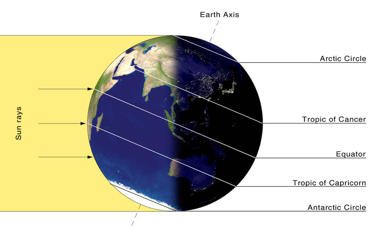
While temperatures in the polar regions are dropping into a deep freeze, the atmospheric layers farther to the south are still relatively warm because they receive moSun’s the Sun’s energy at the same time. Theresouth’she south’s equatorial layers remain much warmer than the areas farther north, leading to a high-temperature contrast.
Cooling the polar regions also lowers the ambient surface pressure, and a similar weather process occurs in the stratosphere. The temperature difference between the North Pole and the equatorial areas increases across both layers.
This creates a large, low-pressure cyclonic circulation across the polar stratosphere, which gives it its famous name—the Polar Vortex.
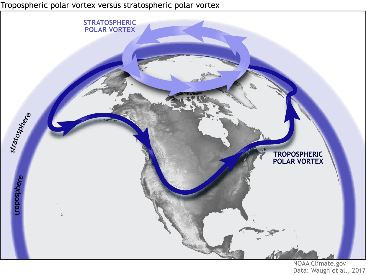
As shown in the image above, we monitor two atmospheric layers during wintertime: the troposphere and the stratosphere. The first is the lowest layer, and the second is at a higher altitude. The Polar Vortex rises through both layers, but with different strengths, shapes, and impacts.
For this reason, we separate the entire Polar Vortex into an upper (stratospheric) and a lower (tropospheric) part. When the Polar Vortex is strong, it traps colder air in the polar regions, preventing its escape and creating milder conditions for most of the United States, Europe, and other mid-latitudes.
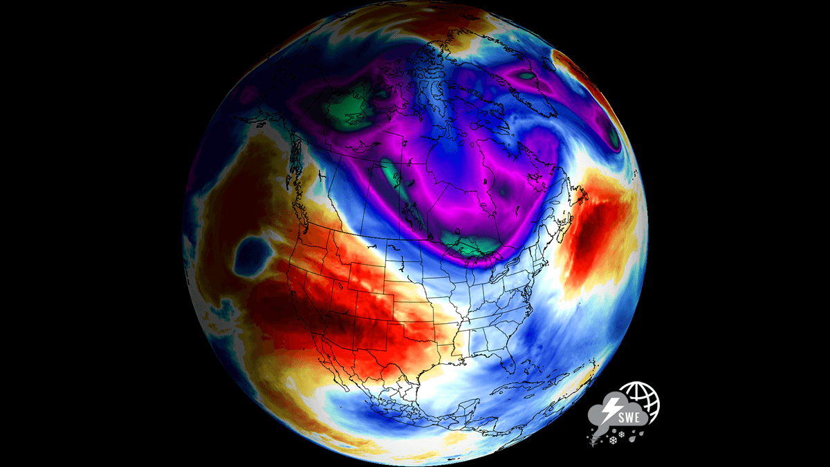
But when the Polar Vortex gets disrupted or even entirely collapses, it can’t fully contain the cold air, which can now easily escape from the polar regions into the United States or other mid-latitude regions. Below is an example of how a disrupted Polar Vortex brings cold polar air into the United States and Europe.
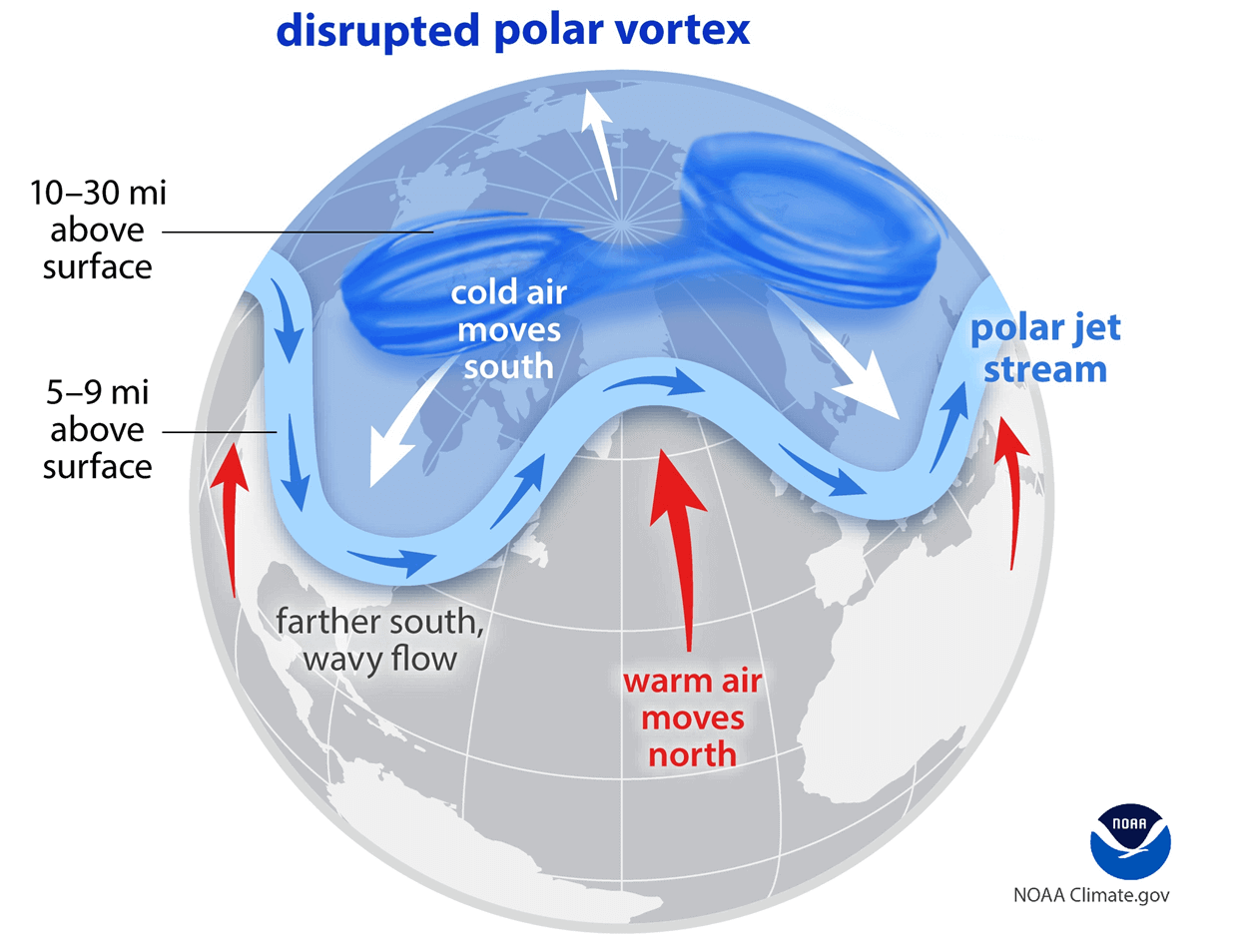
We have experienced this in Asia, Canada, the U.S., and sometimes Europe in recent years. The vortex aloft has been significantly disrupted this season, and when its lobe shifts away from the North Pole, the extreme cold grips the North American continent.
Another Arctic cold pool surge south from Canada sets the stage for a new winter storm
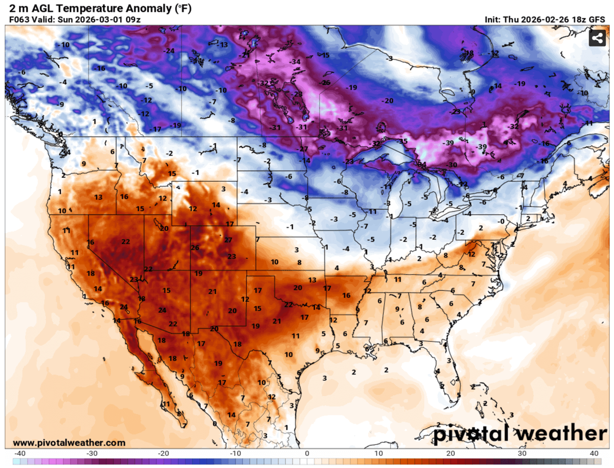
An active pattern remains in place across North America, with a new deep cold wave surging from across Canada into the Northeast U.S. as the southern lobe of the Polar Vortex digs south over the weekend through early next week. Blocking high dominated the south and west.
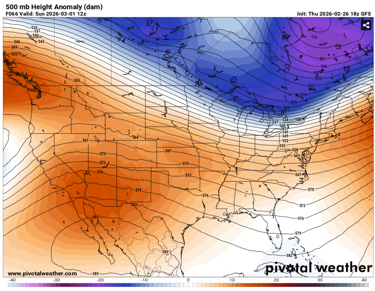
With strong blocking High over the Southwest US, there’s a strong pressure and temperature gradient present between the two large-scale systems. This results in a powerful jet stream, as judged by the tight lines on the chart above.
This helps the Arctic air mass to keep surging south, while areas further south and west remain much warmer. High-temperature contrast develops across the nation.
The arrival of a much colder air mass also strengthens the surface pressure, centered over Ontario and the Great Lakes from Sunday through Monday.
A typical occurrence when a Calliper storm usually develops.
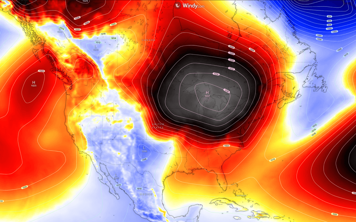
This High helps the Arctic cold air mass maintain and spread southward, with a sharp temperature gradient across the Midwest, the Great Lakes, and the Northeast U.S.
With the clash of Arctic cold and the warmer south, an Alberta Clipper storm is triggered, setting the stage for a rapidly moving system towards the Midwest on Sunday.
A fast-moving Clipper storm brings new snow from the Midwest through the Mid-Atlantic early next week
This is quite a typical development when we have a surging cold air mass over Canada, affecting the northern tier of the U.S. These patterns are lacking high moisture from the deep south, so the winter storms become fast-moving as they run on the strong pressure gradient along the polar jet stream on the edge of the Arctic surge.
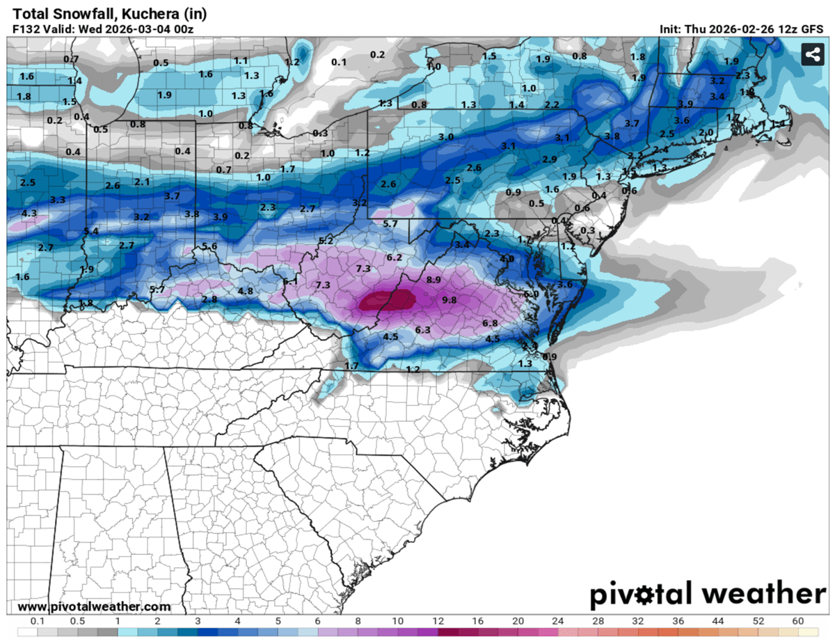
A Clipper storm is expected to develop a dry-snow swath from the Dakotas across the Midwest to the Ohio Valley, reaching the Mid-Atlantic on Monday. The latest model guidance suggests the highest snow should develop over the Midwest, with Iowa possibly receiving 4-8″ of fresh snow with this system.
Since these systems are fast-moving, it is often hard to predict their impact with wintry precipitation. However, snow is typically much drier, mixed with strong winds, resulting in blowing snow.
Some models suggest the Mid-Atlantic region could see significant snow, particularly in Virginia and West Virginia, with more than 10 inches possible on Monday. A few inches of fresh snow should also blanket areas from NYC to Boston, where a historic Winter Storm Hernando has recently impacted.
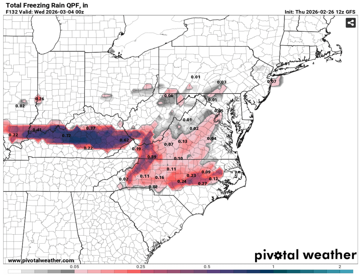
Note that the surface temperature surge and contrast will be intense along the Arctic surge, and some weather models hint at a possible ice storm and freezing rain from Kentucky to Virginia and North Carolina.
It will not be a significant amount of freezing rain, but”up to 0.5″ of ice can locally develop.
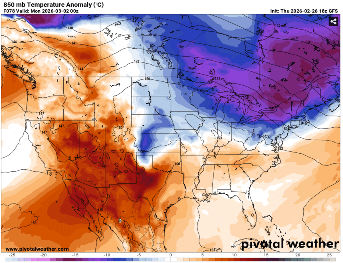
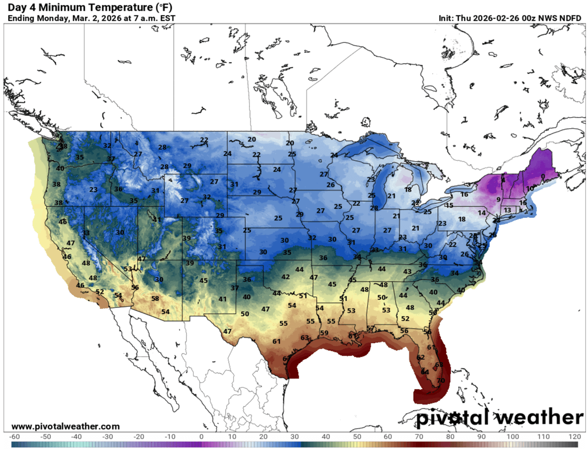
The new Arctic cold pool will bring a particularly cold start to March, the first month of the meteorological spring 2026. Monday lows will be in the 20s across the Midwest to the Ohio Valley, with mid-10s across the Great Lakes and the Northeast U.S.
It will remain much warmer further south, with lows in the 40s and 50s on Monday, then conditions warm up after midweek.
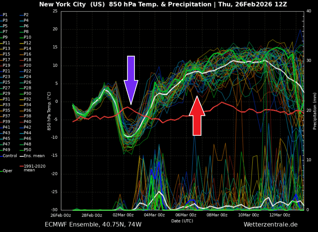
Looking ahead, conditions will gradually improve as March starts. Attached below is a 14-day meteogram chart for New York City, revealing the short-term Arctic cold from Monday through Tuesday.
Followed by a much warmer period beginning late next week, with temperatures surging much above the usual.
Spring is arriving fast, and so will the warmer temperatures and the first potential severe weather systems the following week. The mid-term trends suggest a more dynamic weather will return to the south, so we will keep monitoring and update the outlooks as the pattern evolves. Stay tuned for further updates.
Windy, PivotalWeather, and Wxcharts provided images used in this article.
See also: ”
Major Winter Storm Hernando: An Explosive Bomb Cyclone Targeted the Northeast