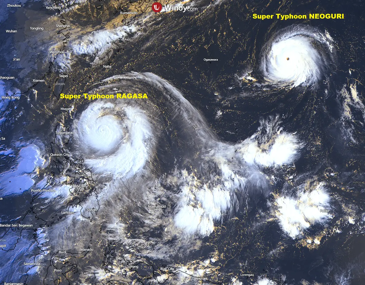
Tropical activity over the Western Pacific has ramped up this week. Right now, two monster tropical cyclones, Ragasa and Neoguri, are ongoing. Both have rapidly intensified into Super Typhoon status, with Category 4 winds, and are expected to gain further strength and reach the maximum strength of a Category 5 equivalent storm.
While Super Typhoon Neoguri will remain far from any land interaction, the greatest concern is with the Ragasa, which is forecast to graze across the northern part of the Philippines on Monday and then head towards Hong Kong on Tuesday. It will remain an extremely powerful Pacific storm.
The early Sunday morning visible satellite image revealed that both typhoons are very large and undergoing rapid intensification. They support winds up to 120 knots and the central pressure in the 940s.
The Neoguri storm remains slow-moving and drifting northwest, while Super Typhoon Ragasa is tracking west-northwest and fast-approaching the northern Philippines and its islands.
Both storms went through explosive phases this weekend, following the unusually warm oceanic waters of the Western Pacific, a trend in anomaly observed in recent years. Strongly anomalous waters support more rapid strengthening of tropical cyclones, leading to their higher peak intensity.
The animation below indicates how Ragasa and Neoguri have experienced rapid strengthening over the past 24 hours.
Let’s examine the region’s ongoing conditions, the forecast tracks, and the impact of both storms.
Above normal sea water temperatures across the tropical western Pacific
The sea temperatures across the western tropical Pacific remain extremely high this month, with water temperatures reported from 30 to 32 °C. They are slightly cooler once the 36 °N latitude starts around central Japan and northward.
These high water temperatures lead to higher dewpoints and high energy near the surface, so the convective storms ingest this volatile air mass and support explosive thunderstorm activity.
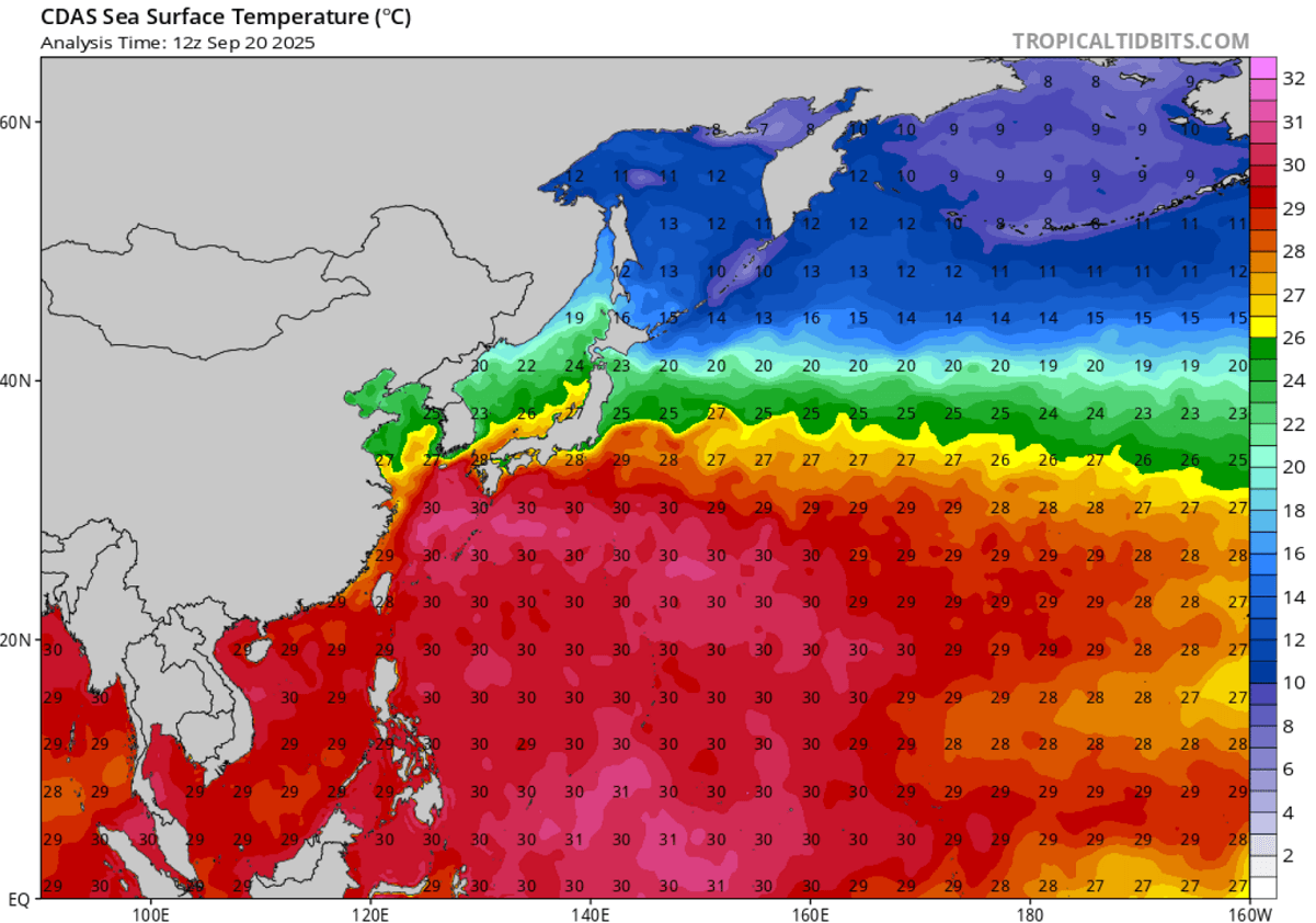
Sea surface temperatures are about 2-3 °C above the usual for late September in the region, and they are even warmer around Japan and to the east.
Notice that sea waters are extremely anomalous to the east of Japan, with even more than 5 °C above the long-term average.
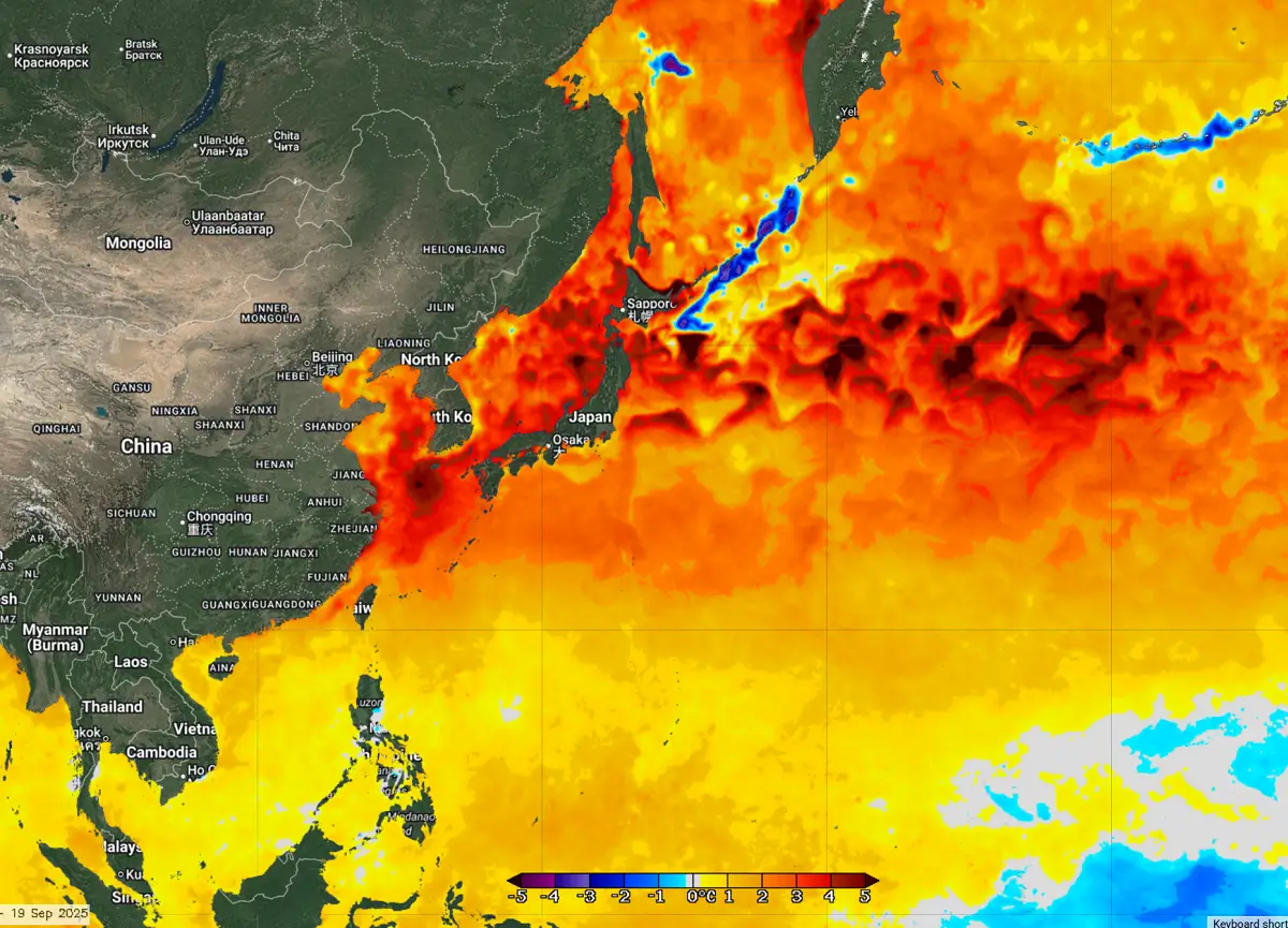
Any tropical system that emerges into these hot waters gains strength and power. This is precisely what has happened with Super Typhoons Ragasa and Neoguri.
Super typhoon Ragasa
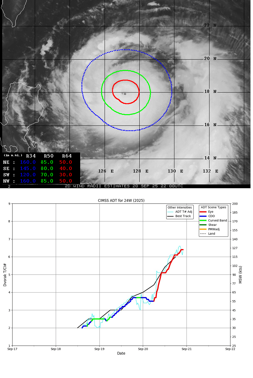
The automatic satellite analysis of the Super Typhoon Ragasa indicates that the estimated peak winds are near 125 knots, which aligns with the 6.5 Dvorak intensity. This is a Super typhoon status of a Category 4 storm.
The most intense winds are extended 30-50 miles around the core across all the quadrants, meaning the storm’s wind field is symmetrical and expanding. Tropical-storm-force winds extend up to 85 miles from the eye.
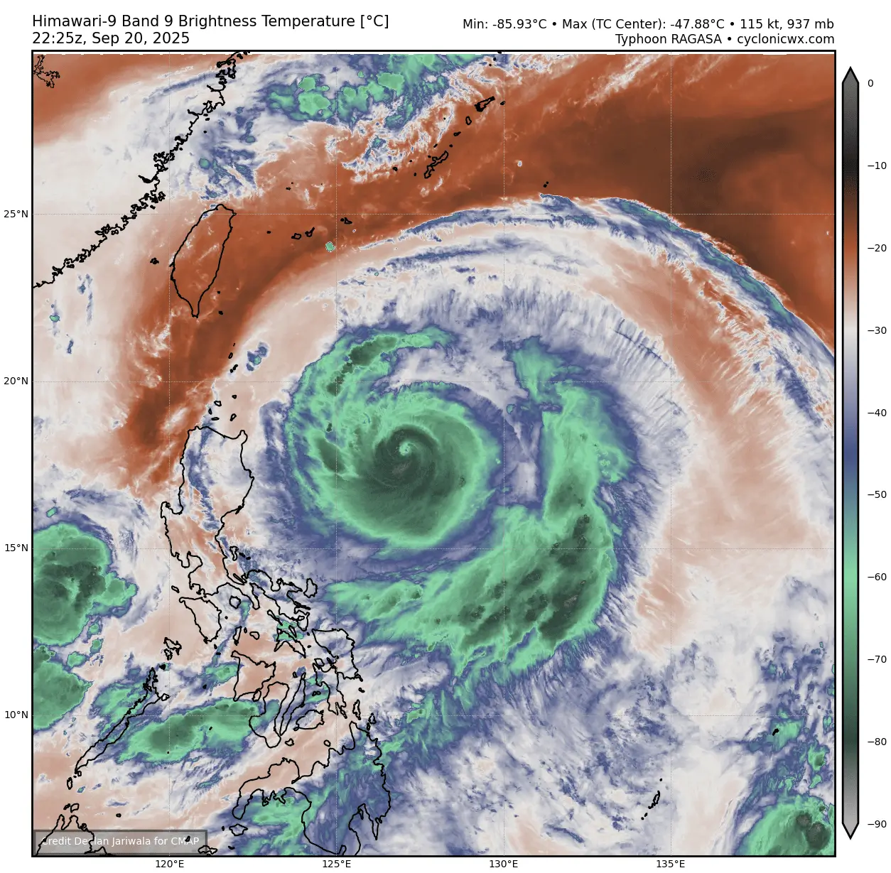
The water vapor satellite shows how impressively large Ragasa already is. In addition to the typhoon’s whole structure, Taiwan and the Philippines are relatively small.
By Sunday night, Ragasa will continue tracking west-northwest and rapidly organizing and intensifying towards Category 5 strength.
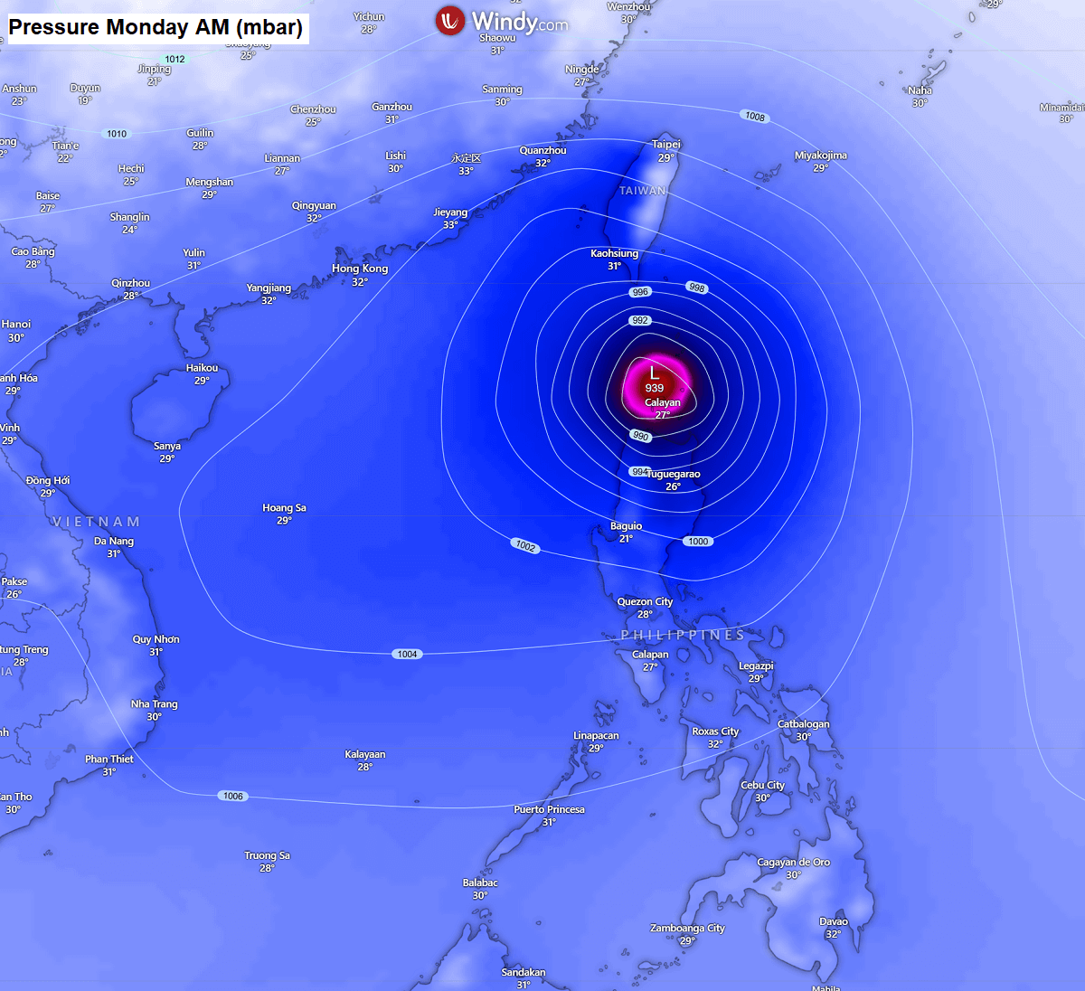
The most likely scenario involves Ragasa crossing the northern skirts of the Philippines’ largest island, Luzon, and the archipelago to its north. Violent, destructive winds, storm surges, giant waves, and flooding rain will blast the region.
According to the weather models, the worst will miss Taiwan, although high waves and currents will affect the southern portions of the country and coastal areas.
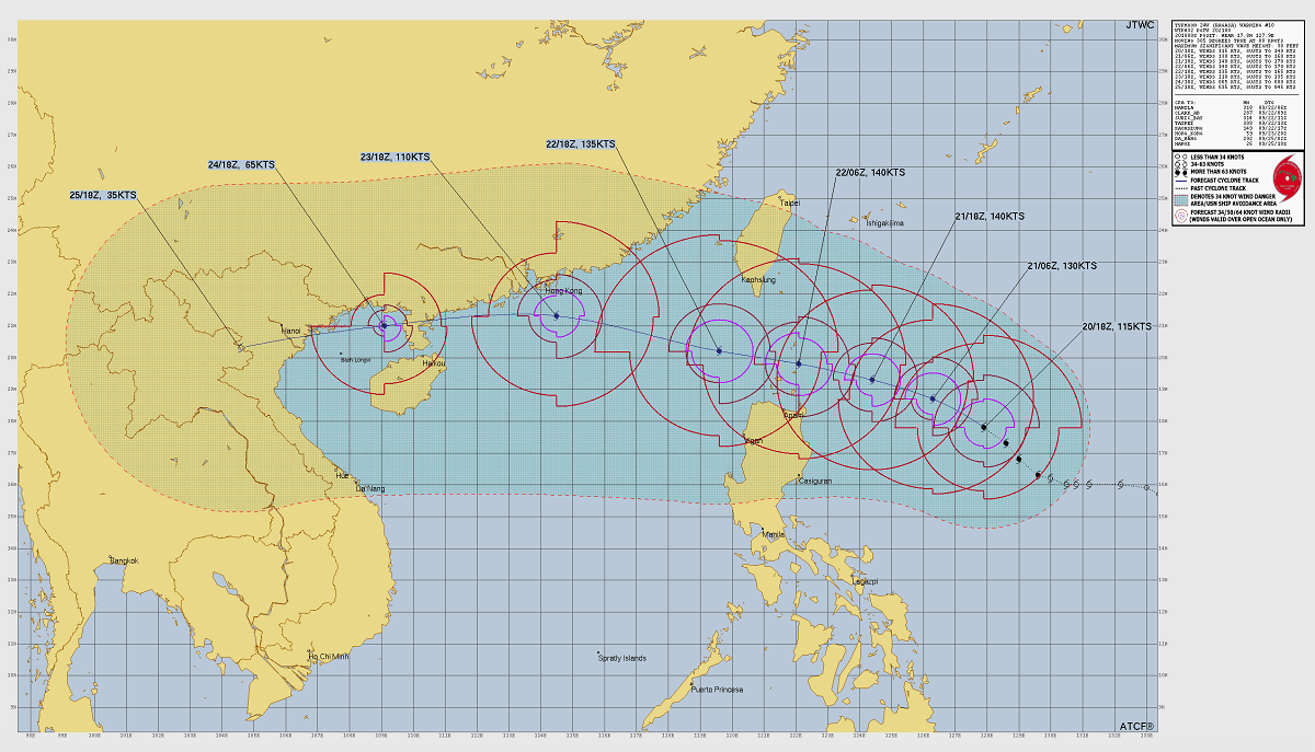
Once Ragasa ejects the Philippines, it will remain a potent storm of Category 5 intensity, tracking towards Hong Kong by Tuesday. It may become a significant threat to the area as predictions do not weaken the storm until landfall in China.
Ragasa is set to deliver a destructive impact to the northern Philippines, then head for Hong Kong
Here is a close-up model view of Super Typhoon Ragasa on Monday as it tracks along northern Luzon and the islands. A potent impact is expected.
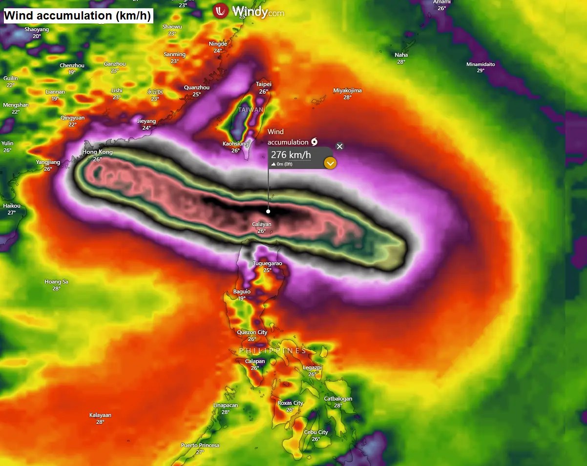
The wind field will be large, likely extending hurricane-force winds up to 100-120 miles around the eye.
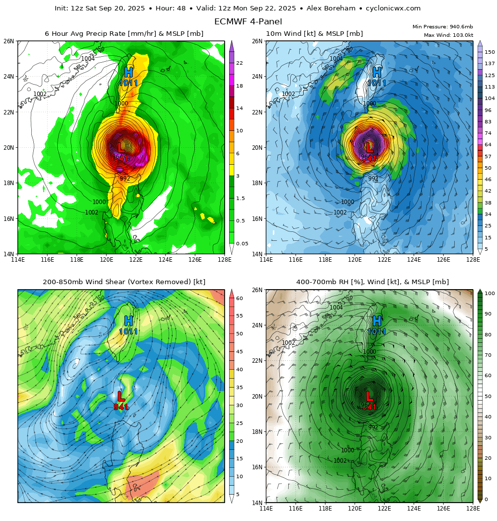
The central pressure could be below 930 mbar, although the weather models are hardly accurate in forecasting this.
This is most likely due to the predicted small eye. So, the pressure gradient will be extremely tight.
Low pressure and tight gradient support destructive winds, gusting above 200 mph or 320 km/h.
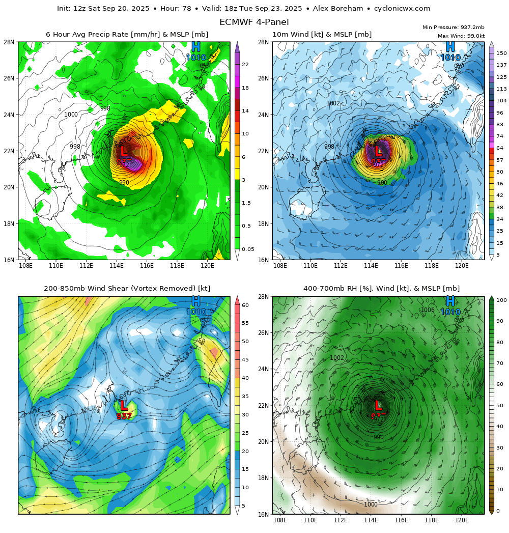
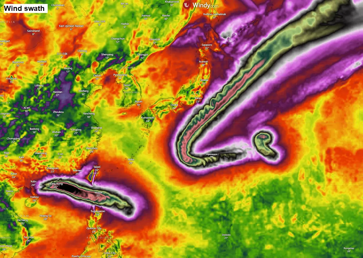
The following chart indicates the likely swath of the most severe winds, reaching Hong Kong by Tuesday.
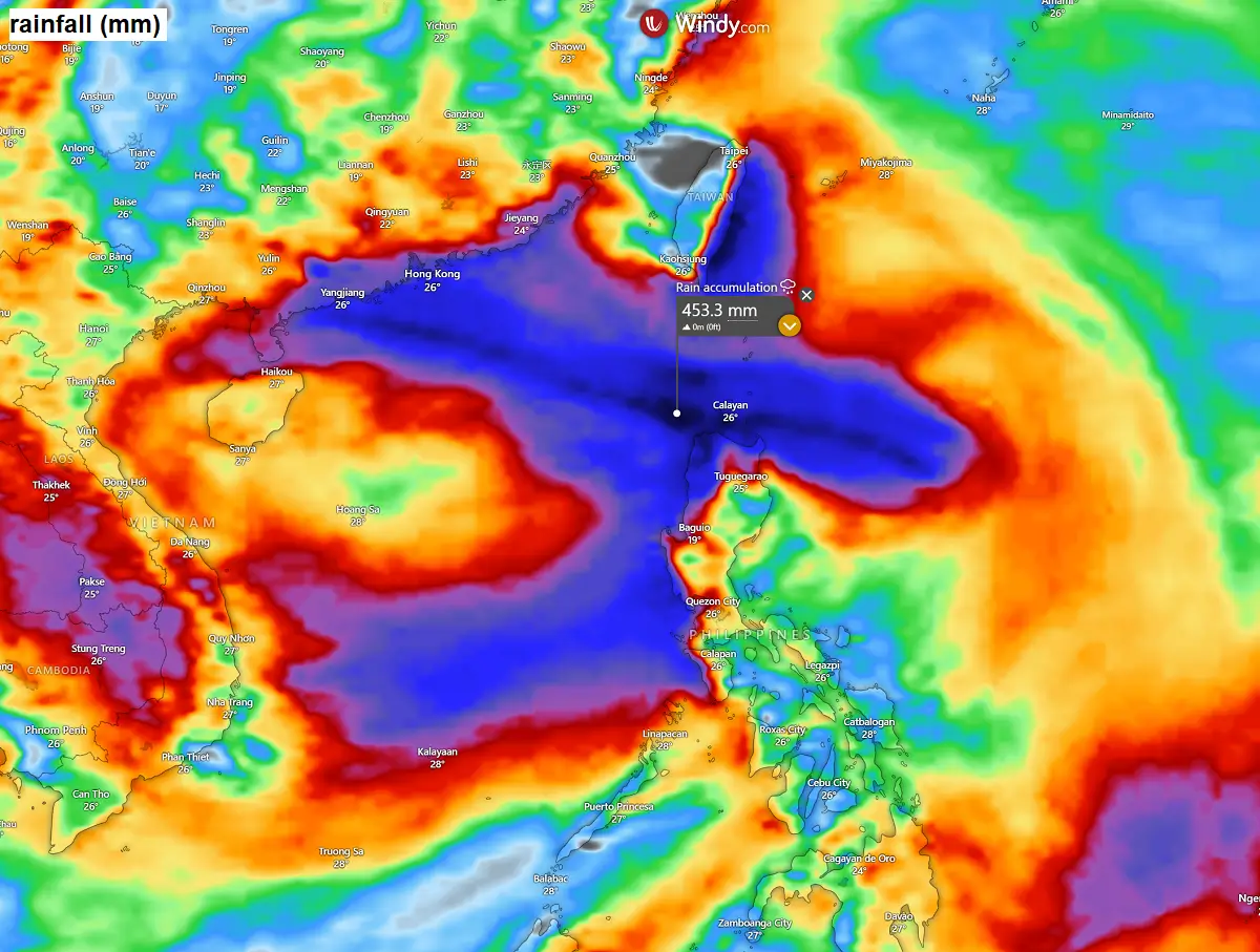
Usually, the most robust thunderstorms with intense rainfall and downpours surround the eye, following the most extreme activity in the eyewall.
This is also where the most significant rainfall is expected. Some weather models predict that 400-500 mm will likely fall along its path.
So, by Tuesday, Ragasa will be near Hong Kong, and its forecast intensity is becoming a significant concern for the area.
Most weather models predict that Ragasa will remain at Super typhoon strength, with at least Category 4 winds and a central pressure still around 940 mbar.
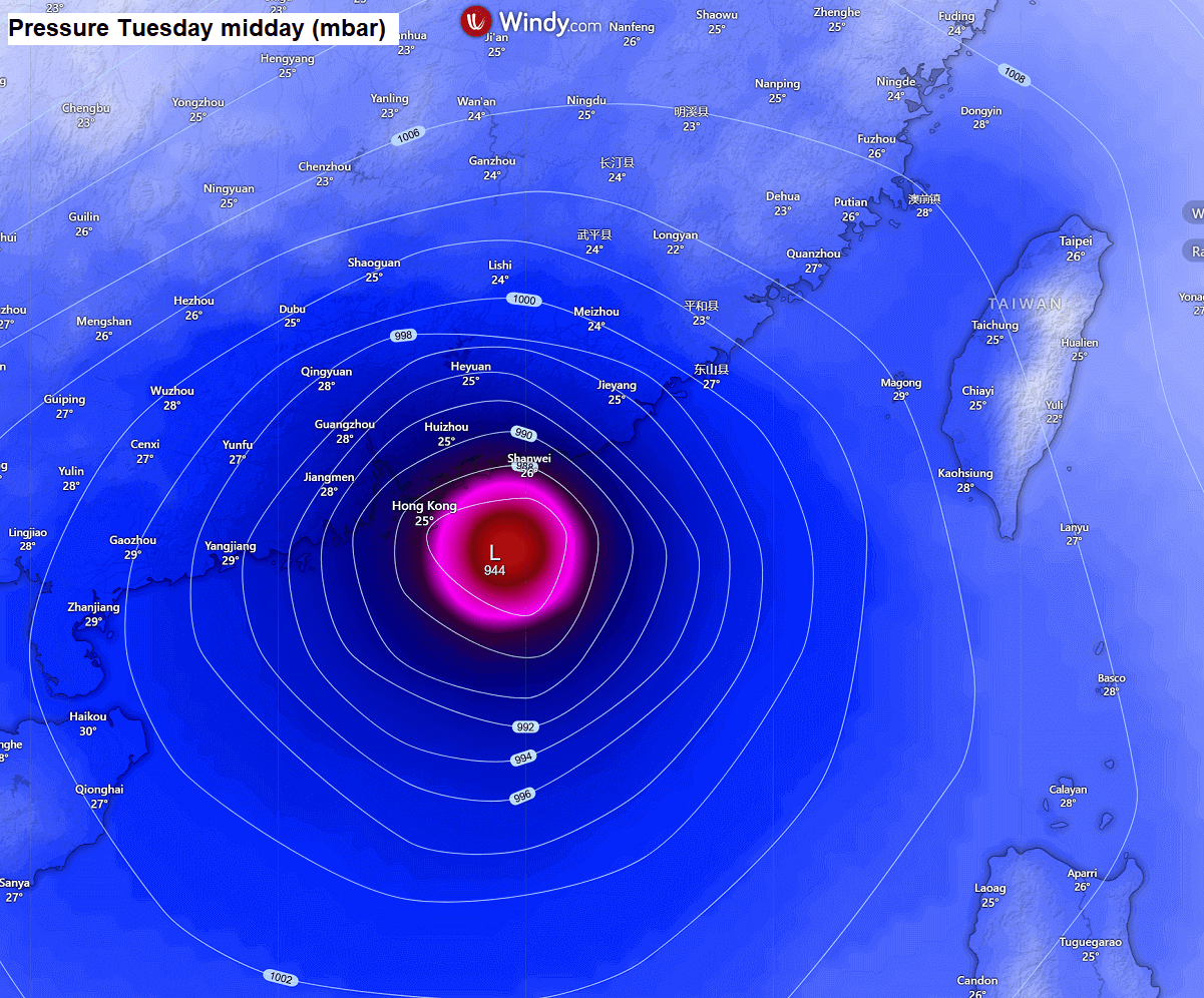
This is the latest wind forecast for the Hong Kong area on Tuesday. The central pressure is forecast to be even below 940 mbar as per the ECMWF model, which is extremely dangerous if it verifies.
This could devastate China’s coast, especially Hong Kong, with high storm surges, torrential rain, and violent, destructive winds.
Once the storm’s eye reaches the coast, it will begin its rapid weakening phase while tracking due west by mid-week.
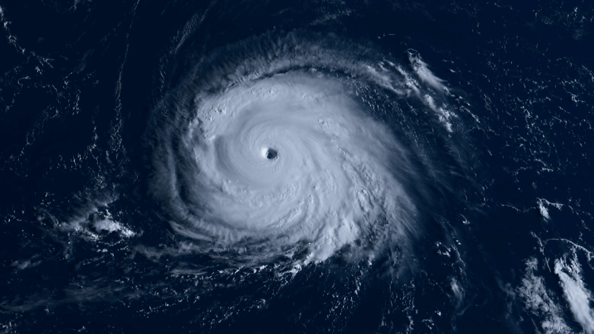
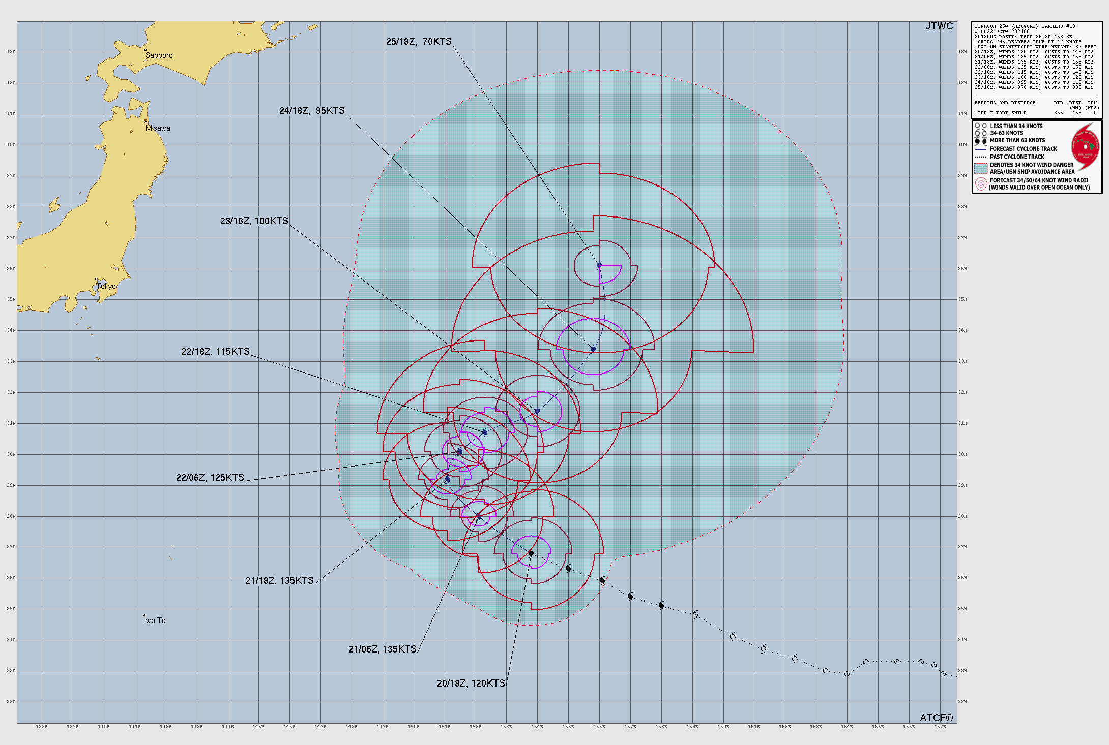
Super typhoon Neoguri
The other intense storm, Super Typhoon Neoguri, remains over the open waters southeast of Japan. Moving over the hot Pacific waters, it keeps intensifying this weekend and will soon reach its maximum Category 5 strength.
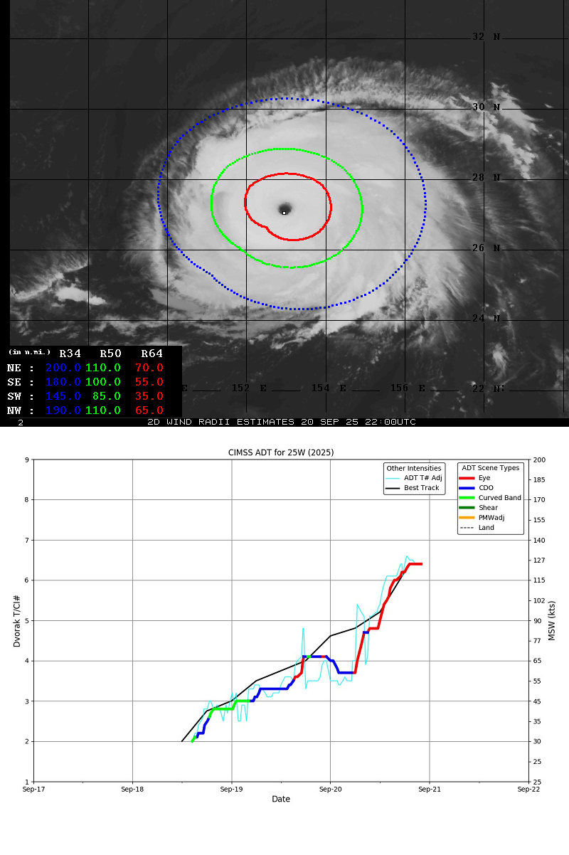
The advanced Dvorak satellite analysis indicated peak wind gusts are near 130 knots, with a Dvorak T number of 6.5. We can see the steep intensification over the last three days.
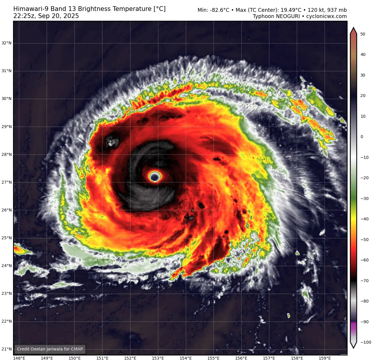
The Infrared satellite scans reveal a very powerful and large eyewall surrounding the huge eye. This indicates that the storm has completed the eyewall replacement cycle and is strengthening further.
The cloud tops are icy, reaching nearly -83 °C. The estimated central pressure is 937 mbar.
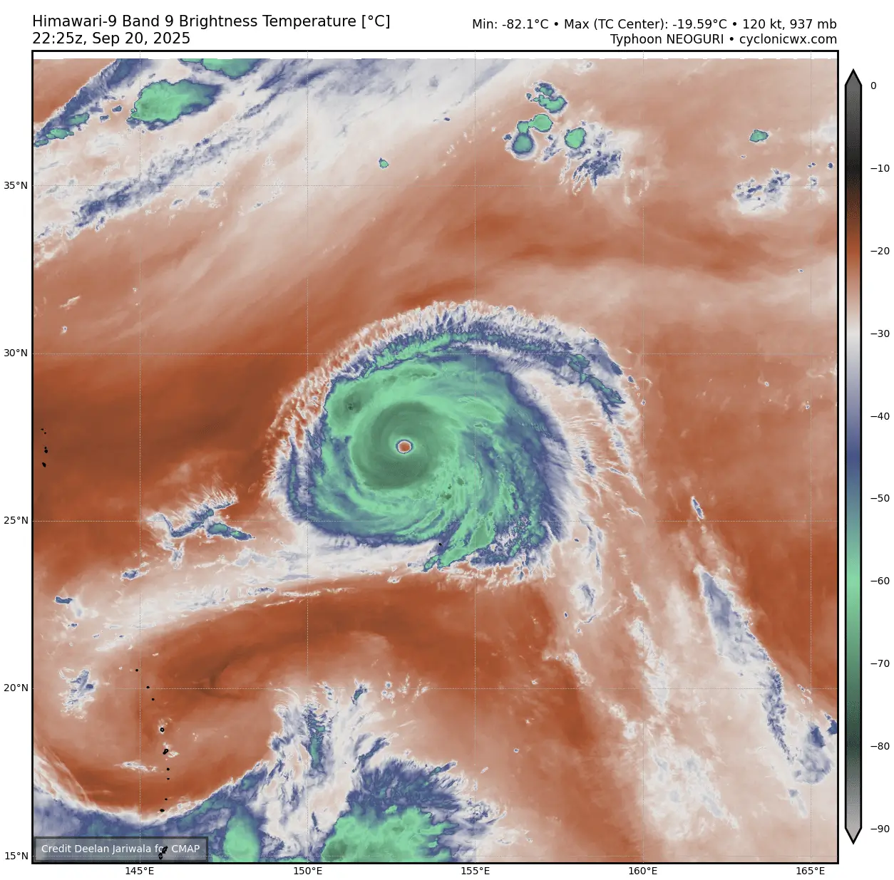
Here’s an impressive view in the water vapor spectrum: a large and compact typhoon. No land areas are anywhere close so we can admire the storm’s majesty without any land or property impact anytime soon.
Super Typhoon Neoguri became the strongest tropical cyclone in the western Pacific this season, 2025. The season has been relatively slow and weak, although 19 storms and eight typhoons have already occurred. However, none have reached Super Typhoon strength until now.
The future track of Super Typhoon Neoguri brings it further northwest for another 24 hours, when it will peak around 135-140 knots. This is a very powerful Category 5 equivalent storm.
Then, on Monday, the storm makes a sharp north-northeast turn and continues its northeast track while gradually losing its strength through mid-week.
Here are the accumulation tracks of both typhoons over the next week to give us a broad wind forecast picture.
The Super Typhoon Ragasa blasted across the northern Philippines archipelago on Monday, reaching Hong Kong by Tuesday. Meanwhile, the Neoguri turns northeast and passes to the southeast of Japan late next week.
Residents across northern Luzon, the islands, southern Taiwan, and the China coast, and the Hong Kong area should stay at maximum alert for the potential devastating impact of storm surge, violent winds, and flooding rain on Monday and Tuesday, possibly even Wednesday, along the China coast.
Windy, CyclonicWX, and Tropical Tidbits provided images used in this article.
See also: