This Wednesday, September 10th, 2025, a hazardous weather situation is forecast across part of the Northern Mediterranean region. Moderate instability and sheared environments combine for widespread thunderstorm activity with extreme flooding potential. High rainfall accumulations are expected.
This will be the fourth high-risk flooding event for the North Mediterranean region over the last two weeks. The first occurred on August 24th, the second on August 28-30th, and the third followed the previous week, on September 2nd.
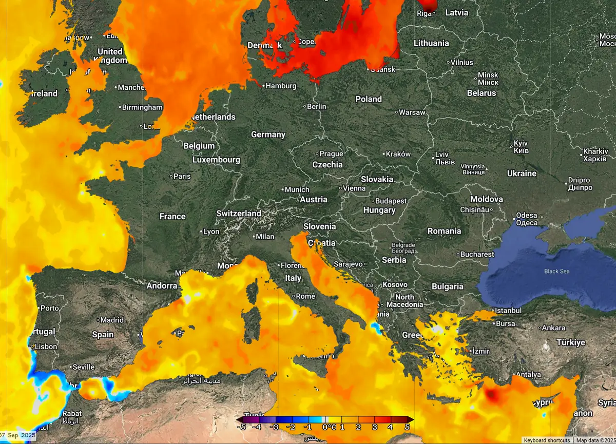
The Mediterranean region’s well-above-normal temperatures help fuel these unusually intense rainfall events. As we have seen with all these past events, precipitable water (PWAT) goes into extremes, striking close to 50 mm, which is why there are torrential, monsoonic rainfall events, dumping historic amounts of rain in 12-24 hour periods.
The upcoming event this Wednesday, September 10th, will be similar again, supported by widespread forcing mechanisms within the jet stream winds aloft.
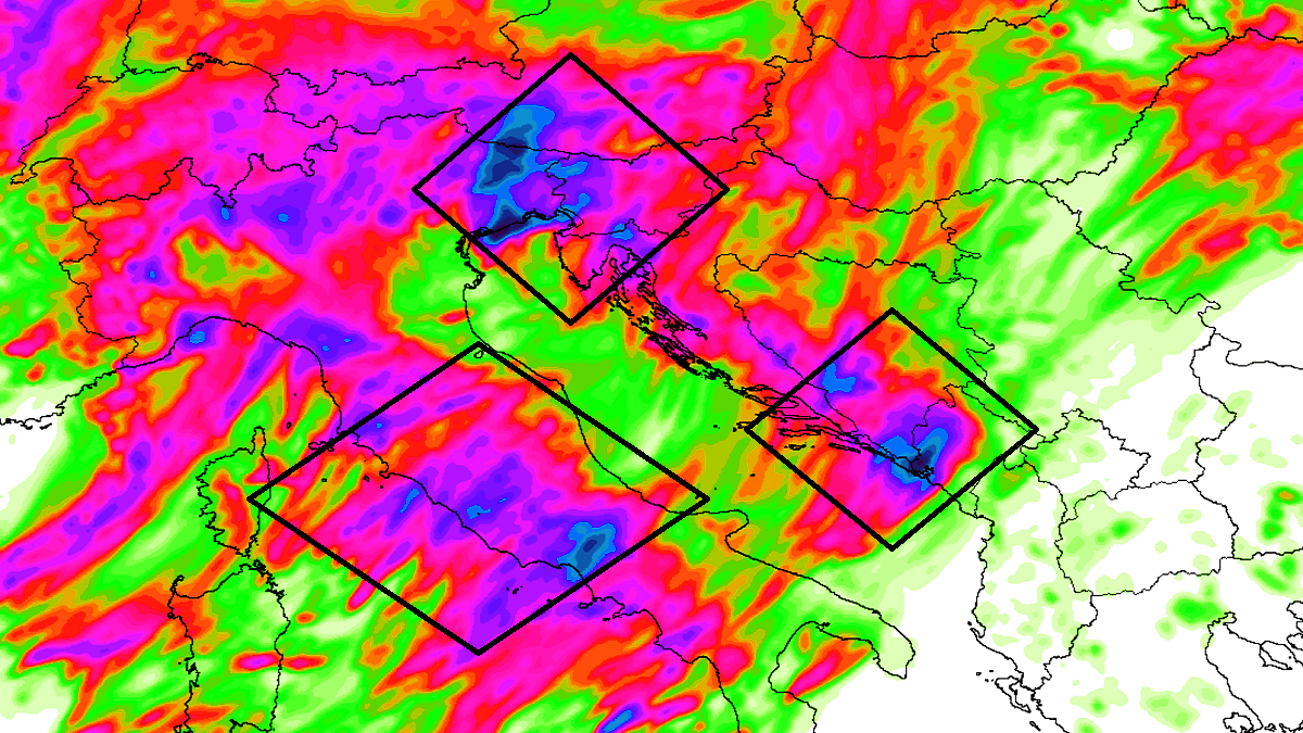
Again, we expect extremely high rainfall in three zones across the north-central Mediterranean.
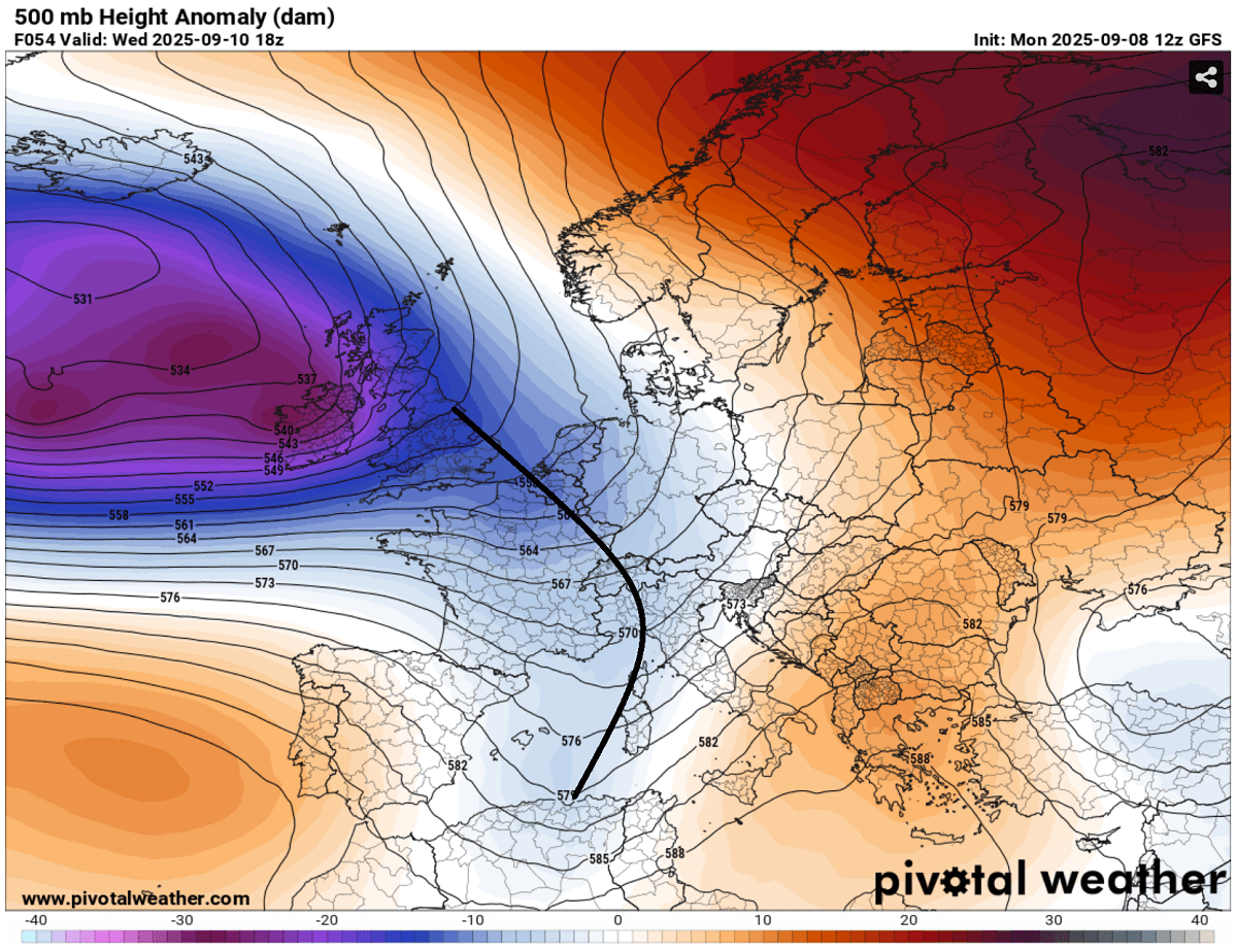
The general weather pattern established over Europe indicates that deep troughing remains over the North Atlantic and western Europe, with secondary waves ejecting towards central Europe and the northern Mediterranean. This supports the development of frontal systems into the region, leading to heavy rain events.
We are ahead of another 36-48-hour severe weather outbreak event that will strike the north-central Mediterranean from Tuesday night through Thursday noon—volatile environmental conditions of moderately strong instability and shear combine. Severe thunderstorms will first support damaging winds, large hail, and a few tornadoes along the western coasts of central Italy, in addition to intense and excessive rainfall with a flooding threat. This is prompting a high-risk event for the region.
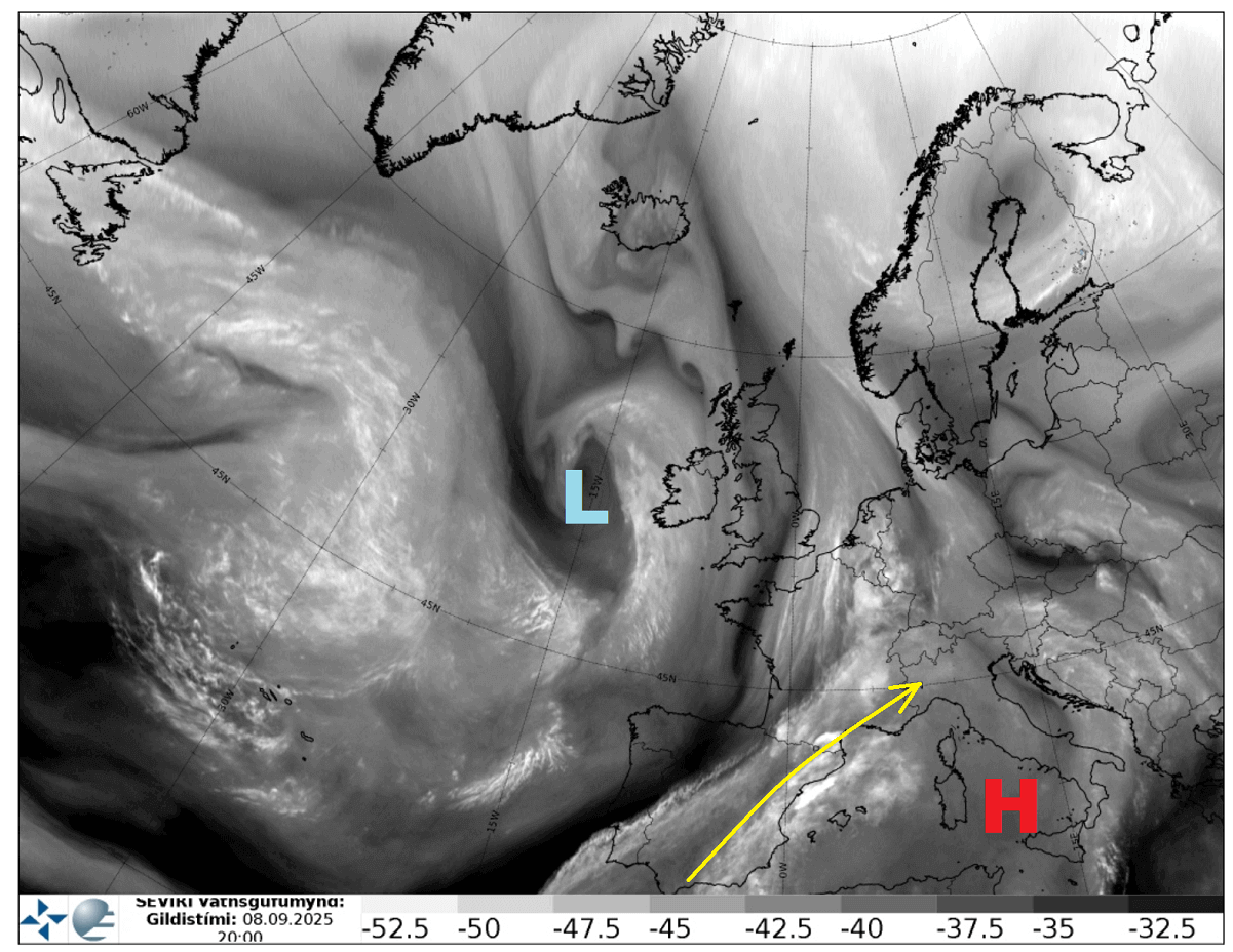
The following image represents a water vapor satellite image from Monday. It reveals a large upper wave/low over the North Atlantic, while a blocking High is visible over the southern Mediterranean. The yellow arrow marks strong subtropical jet stream winds between the two large-scale features.
This will bring a very high moisture content across the Mediterranean towards central Europe, leading to persistent orographic rainfall and intense convective storms with torrential downpours.
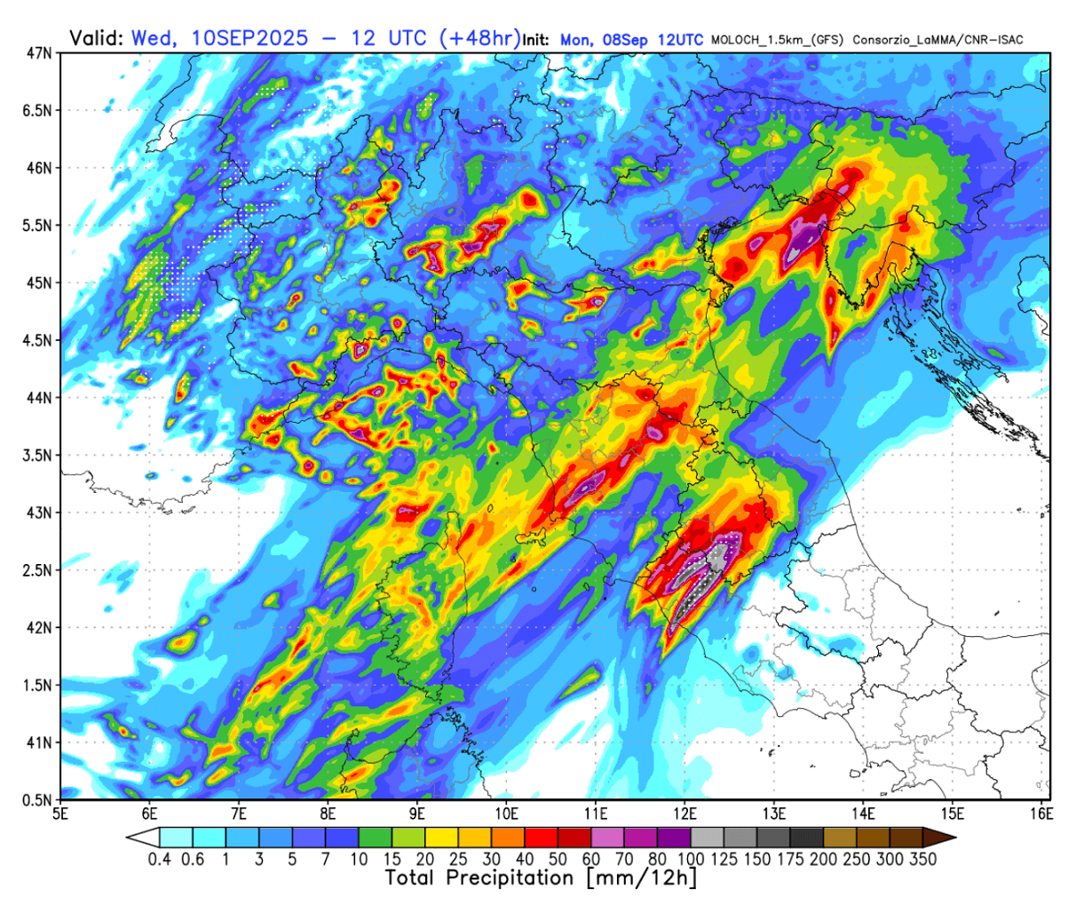
The quick overview video for the next 72 hours indicates the new trough digging from western Europe into the central parts of the continent, inducing a two-day severe weather outbreak with numerous thunderstorms and intense rainfall events across north-central Italy, the south Alpine region, and the northern Adriatic region. Extreme rainfall with flash floods will occur.
With environmental conditions improving and becoming more robust after Monday, the severe weather threat will continue beneath Tuesday’s subtropical jet from the western Mediterranean towards Italy. It will intensify Tuesday night and become widespread and intense on Wednesday as it moves across the northern Mediterranean.
While the main threat will be extreme rainfall and potential significant flash floods, intense supercell thunderstorms with large hail, severe winds, and tornadoes will also form along the western coasts of the Ligurian, Tyrrhenian, and Adriatic seas.
Another secondary upper wave emerges into central Europe
The fully matured and large upper-level trough over the North Atlantic and western Europe ejects another wave east and south. It is forecast to cross the Alpine and North Mediterranean regions on Wednesday, establishing another volatile setup for these regions.
This is the fourth weather setup of a similar scale in the past two weeks, a rare occurrence despite the region’s proneness to intense late summer to early autumn events.
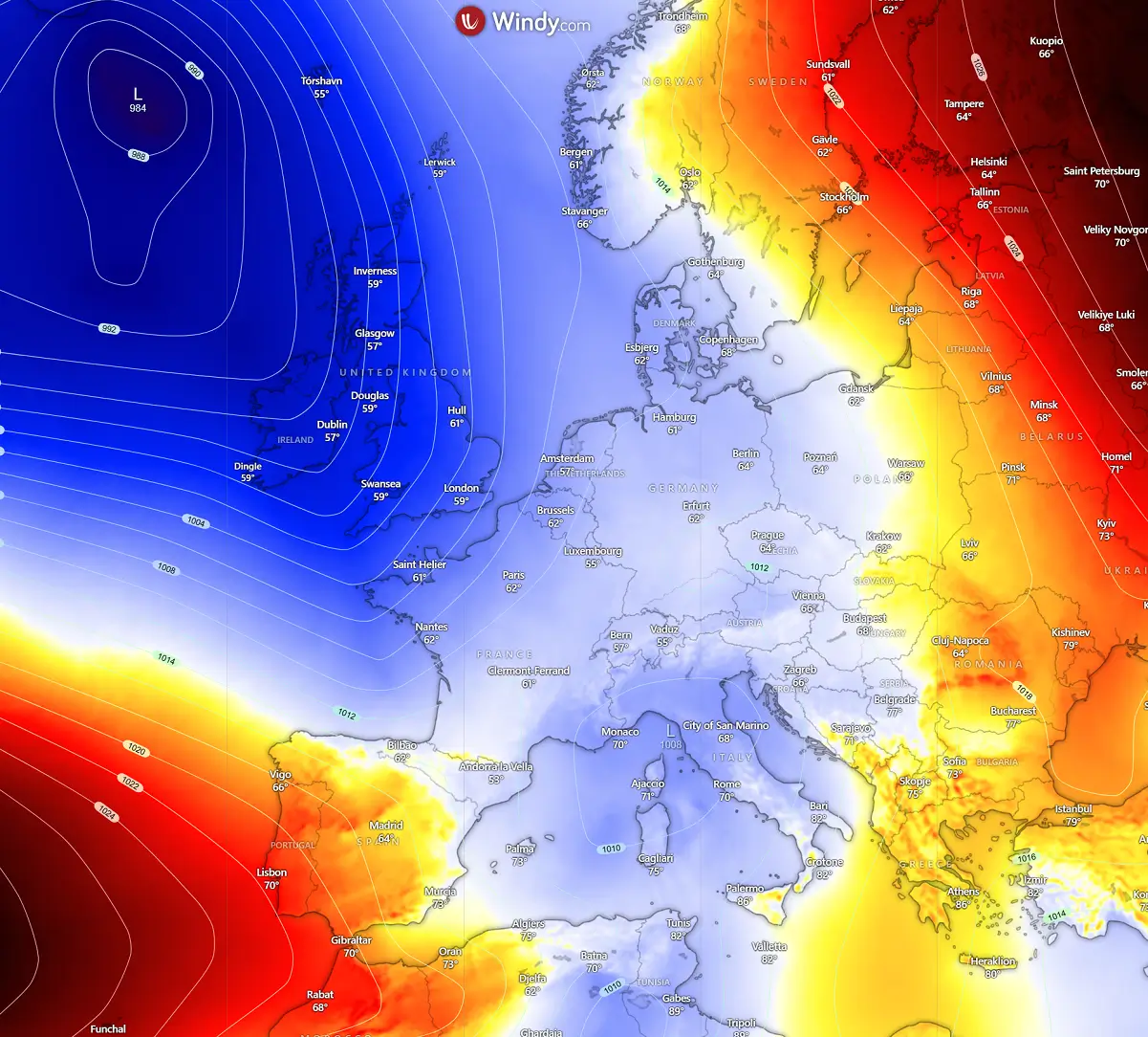
At the surface, an extensive low-pressure system remains centered between the UK and Iceland, with a secondary low forming in the Mediterranean in response to the upper wave moving into the region aloft.
This is an essential factor for the region, as it also amplifies the low-level flow from the south Mediterranean towards northern Italy, enhancing moisture and instability. Therefore, it increases energy to fuel the frontal system and intensifies it.
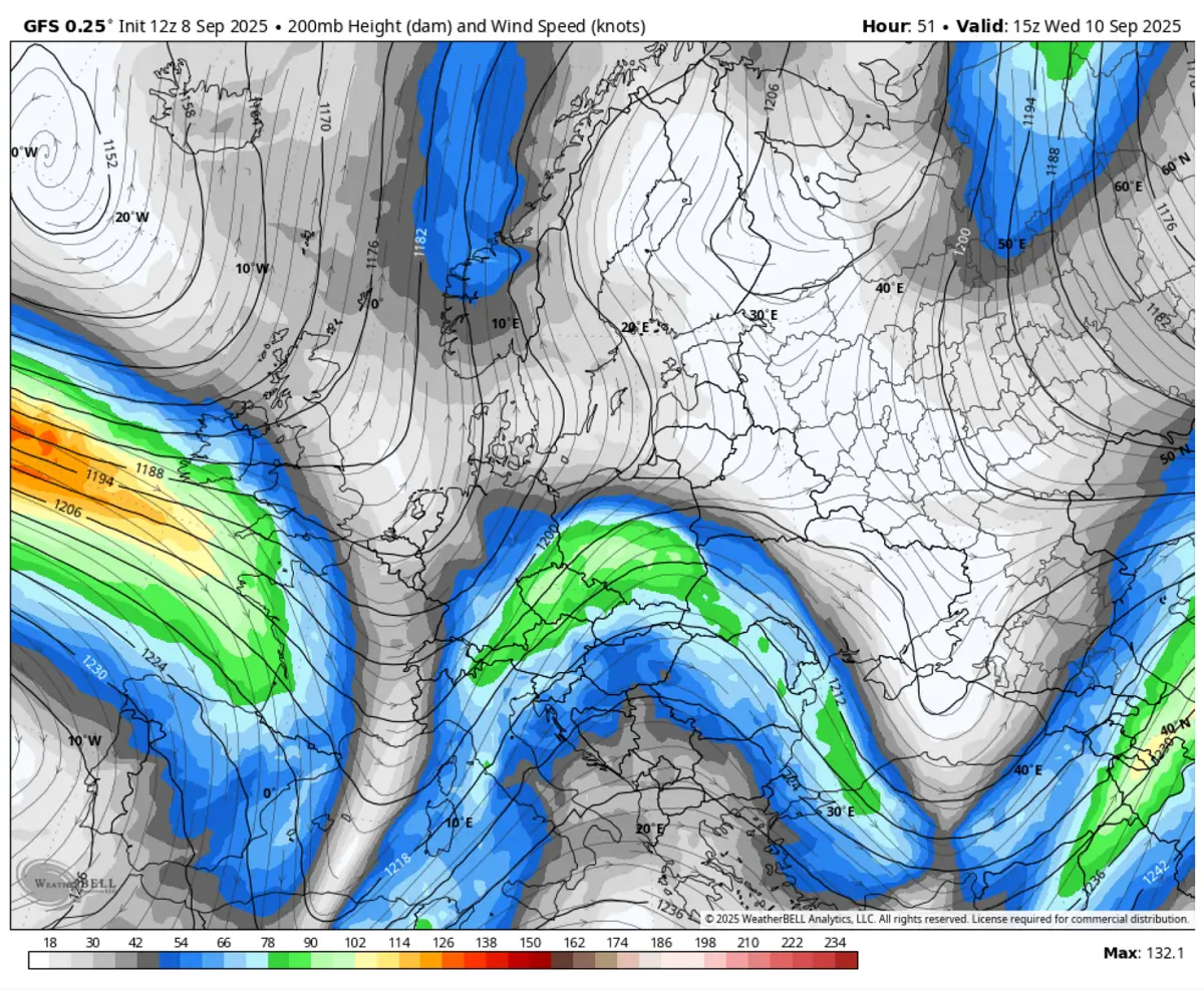
With the blocking High located to its east over southeastern Europe, the deep trough significantly amplifies the subtropical jet stream, thus providing favorable upper-level winds to support widespread forcing for storms.
The following chart represents the 200 mbar geopotential height winds, with a textbook divergence supporting widespread forcing for the Northern Mediterranean. This leads to a powerful shear.
While significant moisture advection and widespread lifting supported convective activity from the western into central Mediterranean on Tuesday, the much more robust environment followed on Wednesday and continued into early Thursday.
A 2-day severe weather outbreak for the central and northern Mediterranean, with a significant flooding risk ahead
Starting midday Tuesday, the extensive trough from western Europe digs south enough to increase the coverage of the convective activity over the Mediterranean. It gradually expands east towards north-central Italy, under the strengthening upper-level winds and building instability.
With the influence of the secondary low-pressure system moving from the central into the northern Mediterranean, the instability maintains the favorable warm and moist fuel over central Italy and the eastern Adriatic region.
On Wednesday morning, instability increases over the Tyrrhenian and Adriatic Seas and pushed towards the north. Most weather models hint at strong to locally extreme instability, in excess of 3500+ J/kg in the south Mediterranean. This supports very high energy for explosive and vigorous storm activity.
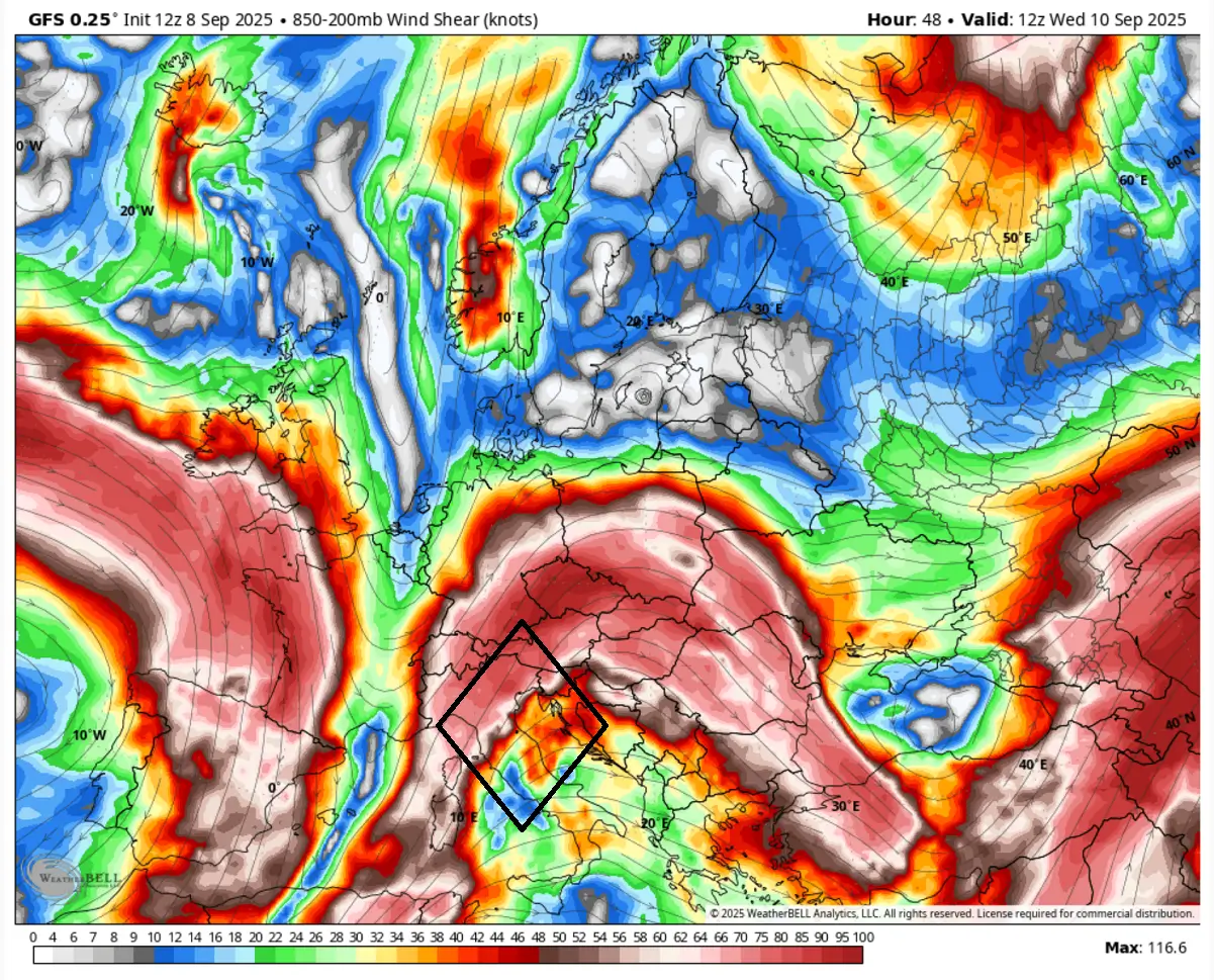
Wednesday and Thursday will provide powerful shear, meaning the environment will be conducive to organized storms across part of Italy, the southern Alpine flank, and across the Adriatic Sea into Slovenia and Croatia.
The left-exit region of the jet stream will provide widespread thunderstorm development over Italy, Slovenia, and Croatia on Wednesday. This will include severe thunderstorms, including supercells with large hail, severe winds, and tornadoes (waterspouts) near the coastal areas. Torrential rainfall will remain the primary threat.
The following sequence indicates the approximate position of the primary frontal activity on Wednesday;
In the morning, the activity expands over the Mediterranean, engulfing central Italy’s Tuscany and Lazio regions. It introduces intense thunderstorm activity along the coastal areas, spreading torrential rainfall into the complex terrain of the Apennines. Localized V-shape convective systems will form, with training cells and flooding rain.
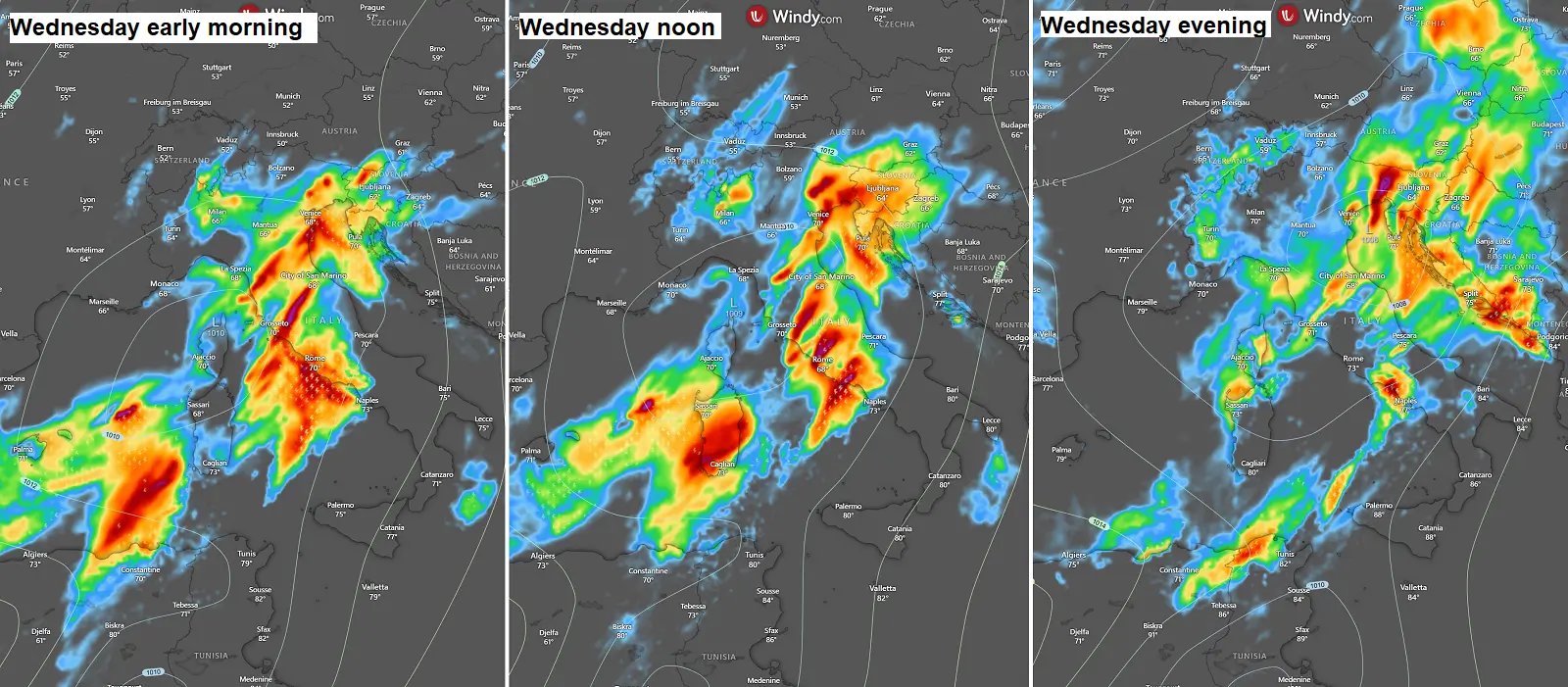
By Wednesday noon, the frontal system moves further east, and the main activity reached the northern Adriatic region. Western Slovenia and Croatia experienced the most robust thunderstorms and intense, excessive rainfall. The activity over Italy continues, with intense MCS gradually tracking southeast along the Lazio region’s coast.
The activity remains most pronounced along the western Balkans through Wednesday evening. Intense thunderstorm activity extends from the North Adriatic to Montenegro and Albania’s coast and into the Thursday morning hours.
As is typical in weather events like this one, the most concerning phenomenon will be the amount of rainfall, especially how intense and persistent the convective training cells will be, and where. The energy reserve from the warmer-than-normal Mediterranean remains huge, supported by around 2-3 °C above normal sea water temperatures.
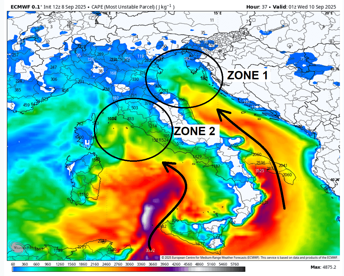
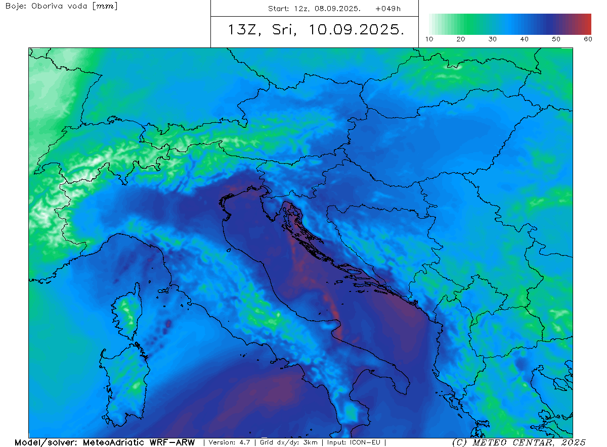
The weather models generally predict 100-200 mm of rainfall within 36-48 hours in three zones over the Mediterranean.
Zone 1 will cover the northeast Adriatic region, Zone 2 will cover the Toscana and Lazio regions in central Italy, and Zone 3 will cover extreme southern Croatia, Montenegro, and Albania.
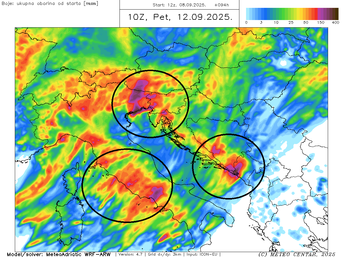
The weather models hint at intense orographic rain combined with severe thunderstorms, with training cells over the same areas resulting in high rainfall sums. Thus, the high-resolution models forecast even more than 300 mm of rain in some places along the complex terrain of the central Apennines and the northern Dinaric mountain ranges.
Activity over central Italy
The Zone 2 areas include the Toscana and Lazio regions in Italy. By Wednesday morning, extremely high precipitable water will push across the central Mediterranean, peaking at around 55 mm. This is concerning as robust thunderstorms will lead to extreme rainfall with monsoon-type intensity and dangerous flash floods.
Since the significant subtropical jet stream overspreads the region, the activity will be widespread, so high rainfall sums will be expected across the Toscana and Lazio regions. Large, V-shaped MCS clusters will likely be ongoing for hours while gradually drifting southeast along the coast, fuelled by extreme instability ahead of the wave.
These regions will see high rainfall sums and severe thunderstorms with intense rain, flash floods, and waterspouts along the coastal areas and inland.
With rainfall accumulations possibly exceeding 250 mm, where robust training cells will take place.
Flash floods are expected.
Activity over the northeast Adriatic region
Once the frontal system ejects further east-northeast on Wednesday midday, the activity shifts to Zone 1 over the northeast Adriatic, which includes northeast Italy, western Slovenia, and northwestern Croatia.
The region will be under the gun for the most intense and excessive rainfall, coming from the orographic effects and the severe thunderstorm activity.

What is concerning about this event is, as we described earlier above, the exceptionally high water/moisture content throughout the atmosphere. The weather models are predicting precipitable water to exceed 50 mm.
This typically means that thunderstorms will support extremely intense, torrential, and monsoon-type rainfall, leading to high rainfall sums in a few hours. 50-100 mm within 2-3 hours could be possible locally.
The persistent intense rainfall will push rainfall sums above 200-300 mm locally, depending on where V-shaped storm clusters can form and support training cells with tremendous amounts of rain locally. Various high-resolution models hint that widespread high rainfall sums are expected, which could lead to larger-scale flooding besides flash floods along the convective lines.
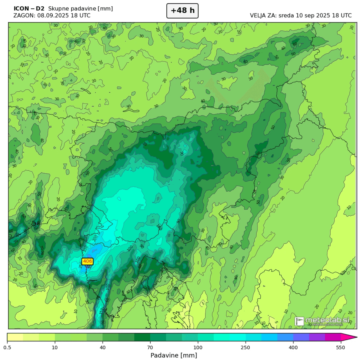
Here is another view of 48-hour rainfall sums, based on the ICON-D2 weather model. This one predicts even more than 400 mm locally. This is extreme and could lead to catastrophic flash floods again. Also note that where precisely these rain maxima would occur is hard to predict, so the whole region is advised to stay on high alert.
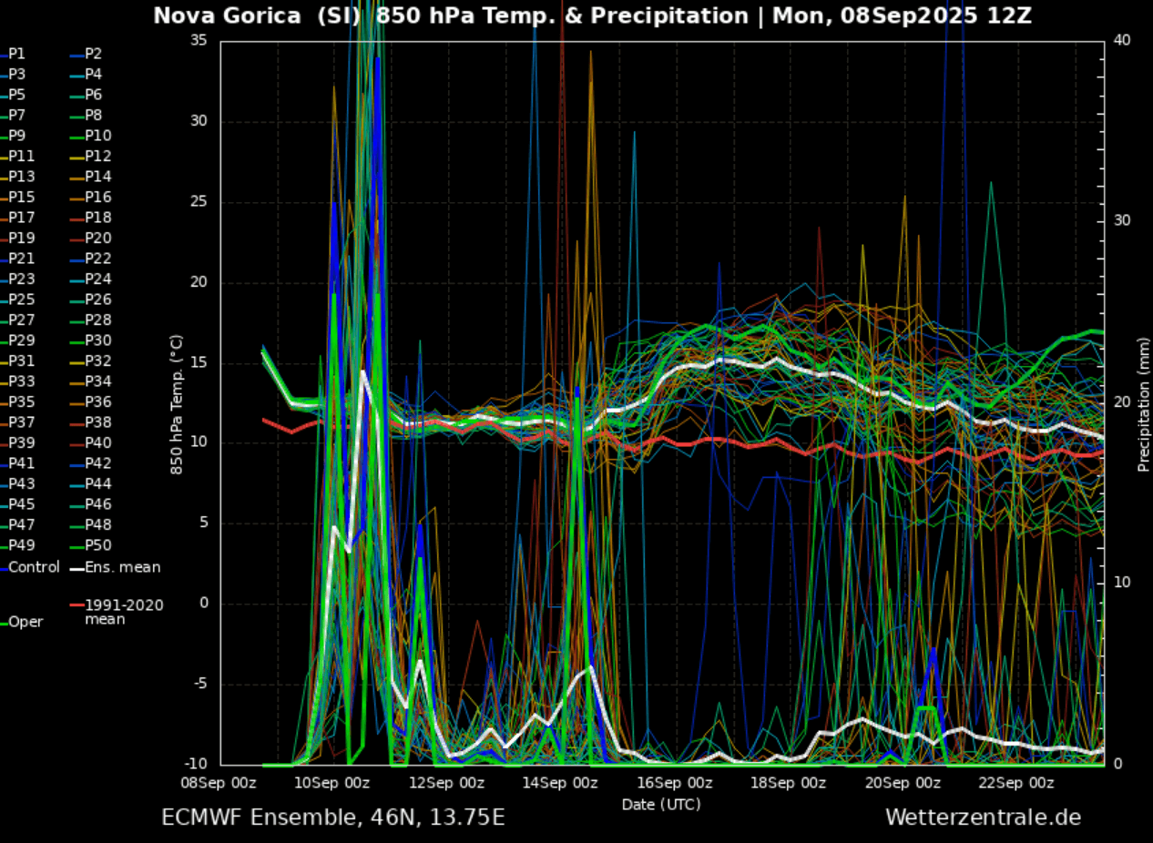
Autumn rainfall events will likely continue, leading to high monthly rainfall sums over southern Europe this month. The chart below is a meteorogram for western Slovenia, with a significant amount of rain predicted on Wednesday. This will be followed by more rain into the weekend and then again late next week.
The temperatures remain warm, with above-normal daily averages.
Recap: There is again a high risk potential for widespread intense rainfall and severe weather outbreaks from Tuesday afternoon through Thursday morning across the central and northern Mediterranean. In the follow-up article, we will soon issue a detailed severe weather outlook for the region. Stay tuned.
Following your local meteorological office/agency for the latest updates and potential warning messages is advised.
Windy, Wxcharts, and WeatherBell provided images used in this article.
See also:
An intense North Atlantic storm towards Ireland and the western UK