After a milder period across much of the United States and Canada, polar air masses are returning across the North American continent. As the Polar Vortex becomes more active, its southern lobe digs far south across the continent, bringing Arctic blasts, periods of snow, and frigid cold through the remainder of the month.
Over the next few weeks, the major shift of the polar vortex’s southerly lobe will send multiple cold outbreaks from Canada into the eastern two-thirds of the CONUS. At the same time, these waves of cold blasts will bring clipper systems and occasional intense lake-effect snow and snow squalls from the Midwest to the Northeast.
After this first cold wave bringing cold across Southeast Thursday through Friday, more cold will follow into the weekend with another strong wave possibly delivering rare snow into southern Georgia and northern Florida on Saturday.
Falling iguanas alerts have been issued, the rare but serious event following the usual cold blast across most of Florida these days.
Key Messages:
A Major shift in the Polar Vortex: A southern shift is bringing Arctic air masses back to North America, with a sustained period of frigid temperatures through the end of the month.
Occasional snow and multiple cold blasts: Multiple cold outbreaks will sweep from Canada across the eastern two-thirds of the US, bringing winter weather from the Midwest to the Northeast.
Extreme Cold reaching the deep South: The cold front is pushing far enough south to potentially trigger rare snowfall in southern Georgia and northern Florida this weekend, with temperatures in Florida dropping low enough to trigger “falling iguana” alerts.
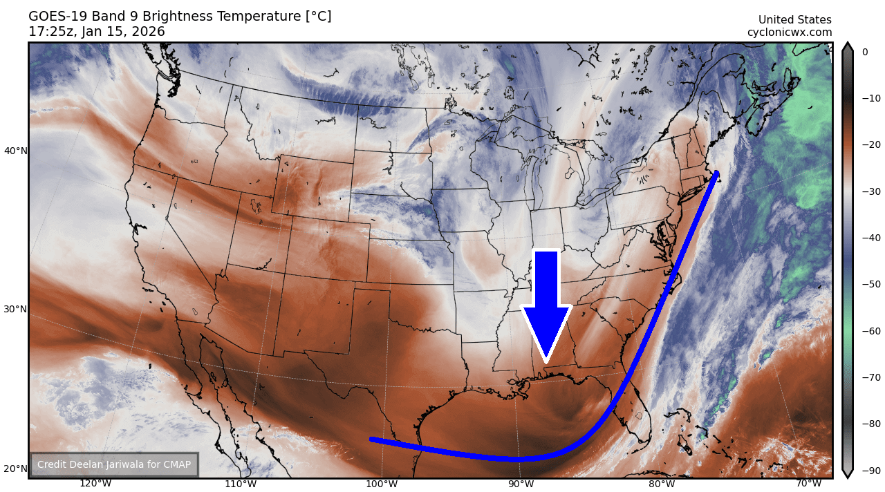
The current satellite view shows a large wave delivering colder, much drier air into the deep South, moving across Florida. This wave will be followed by another, more intense wave over the weekend.
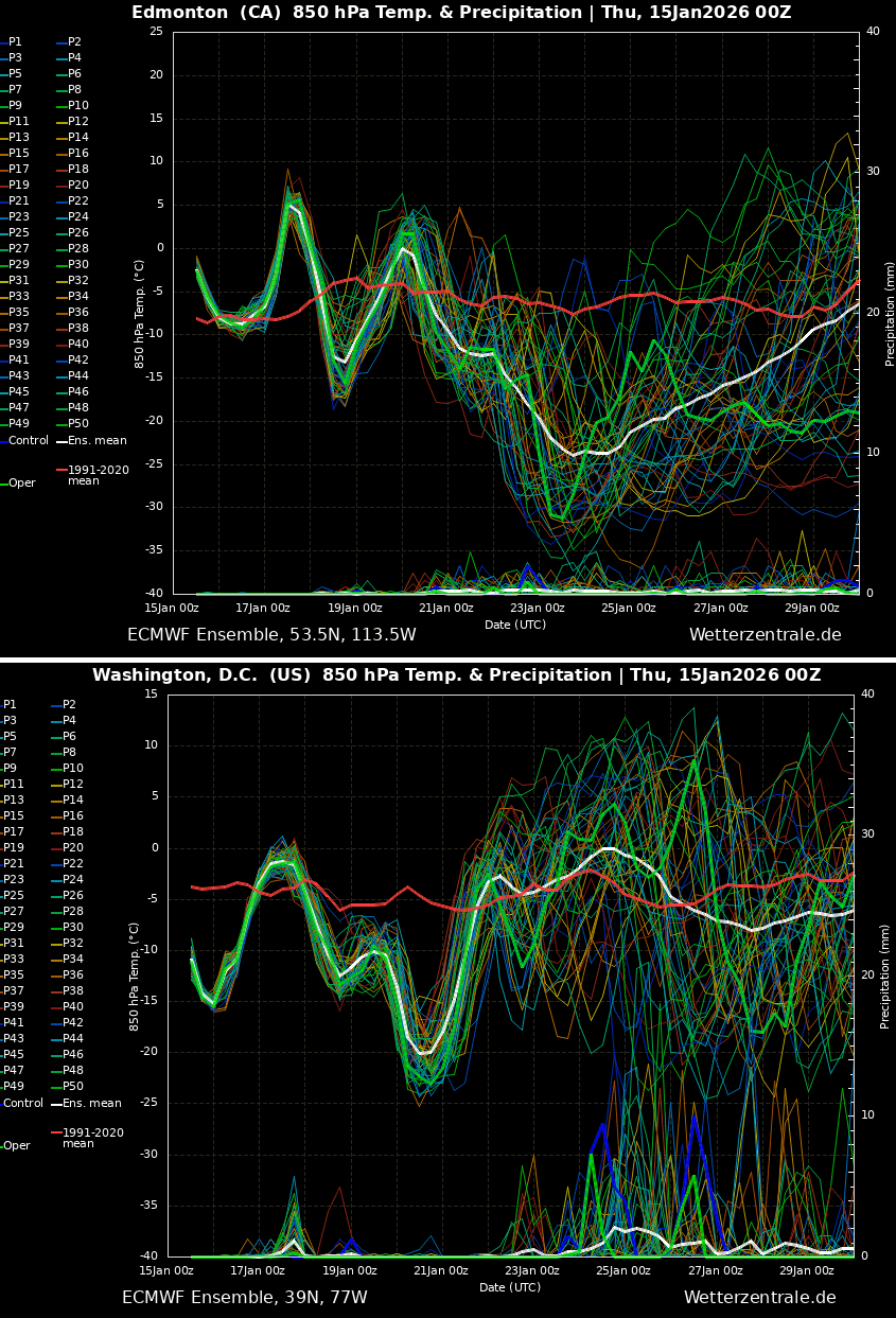
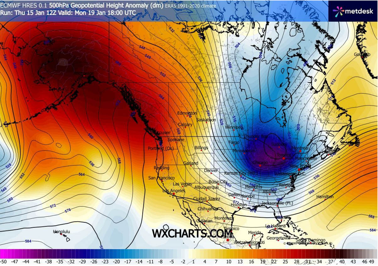
A quick look through the end of January reveals how dynamic and intense the Polar Vortex’s effects are expected to deliver across the NAM continent. The upper chart is for Edmonton, Canada, while the bottom one is for Washington, D.C.
Both show frigid cold blasts to follow over the next two weeks. With sharp temperature fluctuations back and forth.
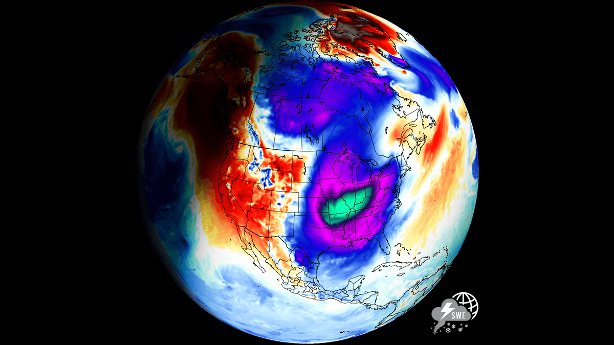
We can see these waves travelling across the continent in the animation below. A dipole weather pattern develops, with blocking Highs over the West and deep troughs/waves over the East. The jet stream turns more meridional, delivering Arctic air masses deep south as the Polar Vortex shifts aloft.
It appears likely that a significantly colder air mass than usual will continue through the remainder of the month.
Before we dig into the details of the weather pattern evolution, it is essential to understand the background mechanisms governing the Polar Vortex. It is the main trigger for rapid weather changes and intense Arctic outbreaks across Canada and the United States during winter.
What is the Polar Vortex?
The Earth’s atmosphere has six layers. Most of the dynamics for our daily weather occur in the lowest two layers, known as the troposphere and the stratosphere.
The troposphere is the layer closest to the Earth’s surface. It is about 12 km deep and extends from the ground up high into the sky. Depending on where you live, its depth varies from around 8 km to almost 20 km. The troposphere is deepest over the equatorial region and becomes much thinner over the North and South poles.
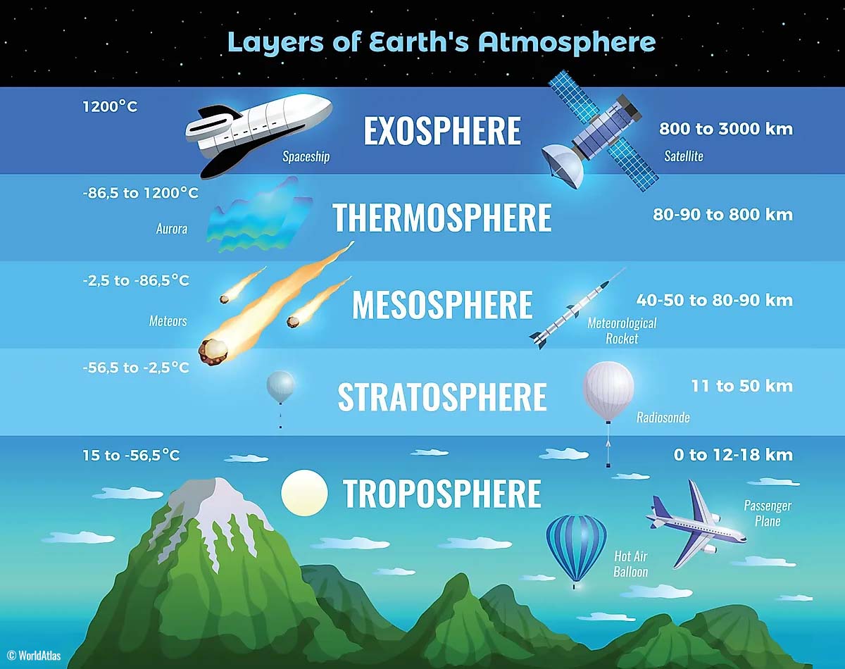
Above this layer is a much deeper one known as the Stratosphere, an 11-50 km thick layer of arid air. Another essential feature in the stratosphere, which makes our weather even more variable, often triggers significant, large-scale, long-lasting winter weather events.
This is the Polar Vortex—an enormous, tri-dimensional ring of powerful winds moving through the sky above us. The Polar Vortex is spinning around the North Pole, grazing through the air at about 20-50 km above the Earth’s surface with violent wind speeds.
How and when does the Polar Vortex form?
Due to the Earth’s inclination, the polar regions receive much less energy from the Sun during the fall months. This makes the cooling over the northern areas more robust. As a result, polar nights can last several consecutive months, followed by days without sunlight.
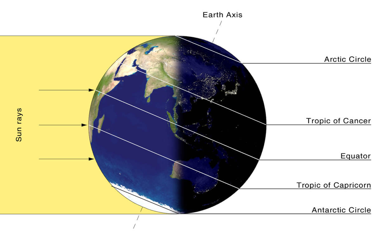
While temperatures in the polar regions are dropping into a deep freeze, the atmospheric layers farther to the south are still relatively warm because they receive more of the Sun’s energy at the same time. Therefore, the south’s equatorial layers remain much warmer than the areas farther north, leading to a high-temperature contrast.
Cooling the polar regions also lowers the ambient surface pressure, and a similar weather process occurs in the stratosphere. The temperature difference between the North Pole and the equatorial areas increases across both layers.
This creates a large, low-pressure cyclonic circulation across the polar stratosphere, where it takes its famous name—the Polar Vortex.
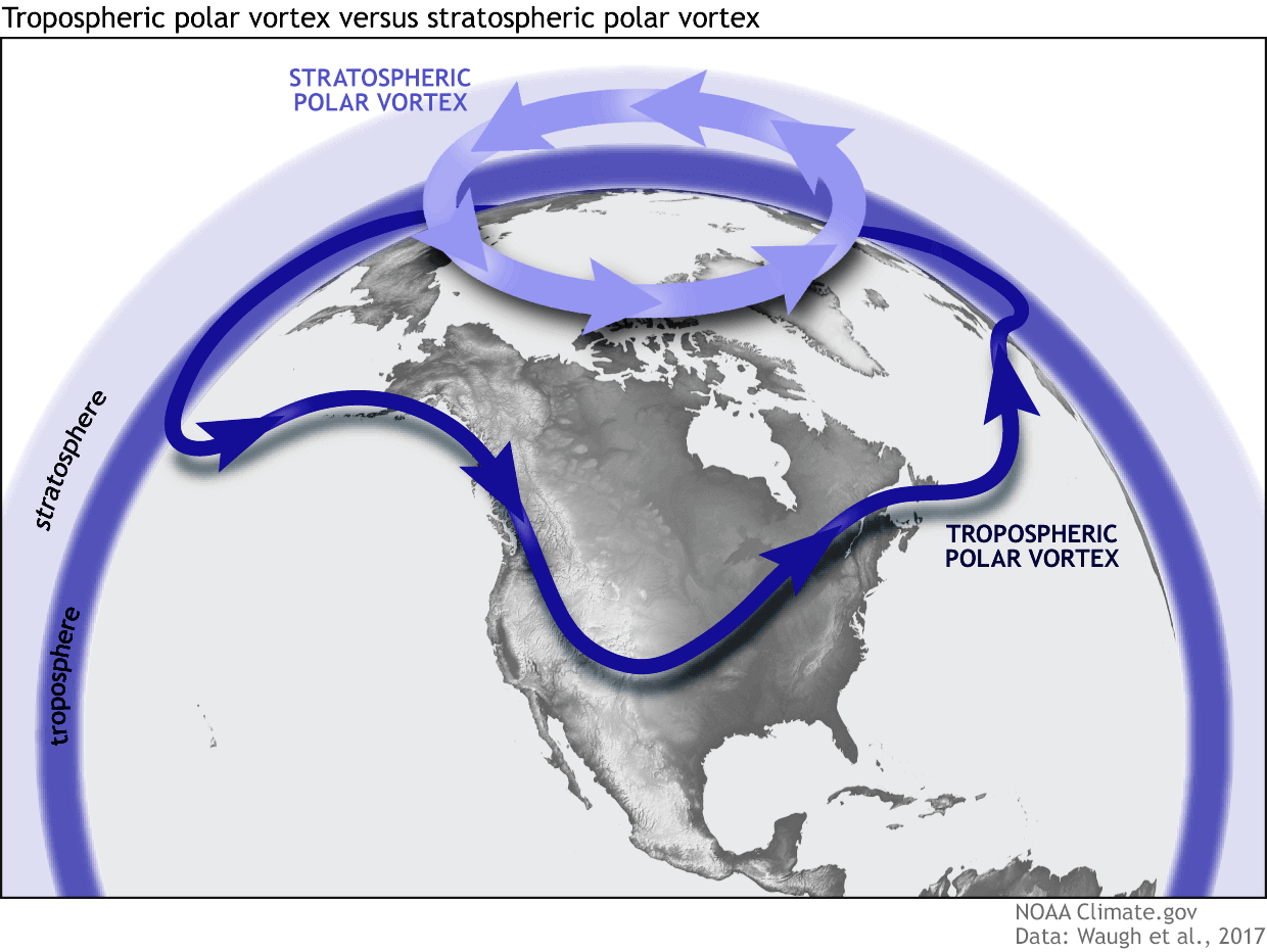
As shown in the image above, we monitor two atmospheric layers during wintertime: the troposphere and the stratosphere. The first is the lowest layer, and the second is at a higher altitude. The Polar Vortex rises through both layers, but with different strengths, shapes, and impacts.
For this reason, we separate the entire Polar Vortex into an upper (stratospheric) and a lower (tropospheric) part. When the Polar Vortex is strong, it traps colder air in the polar regions, preventing its escape and creating milder conditions for most of the United States, Europe, and other mid-latitudes.
But when the Polar Vortex gets disrupted or even entirely collapses, it can’t fully contain the cold air, which can now easily escape from the polar regions into the United States or other mid-latitude regions. Below is an example of how a disrupted Polar Vortex brings cold polar air into the United States and Europe.
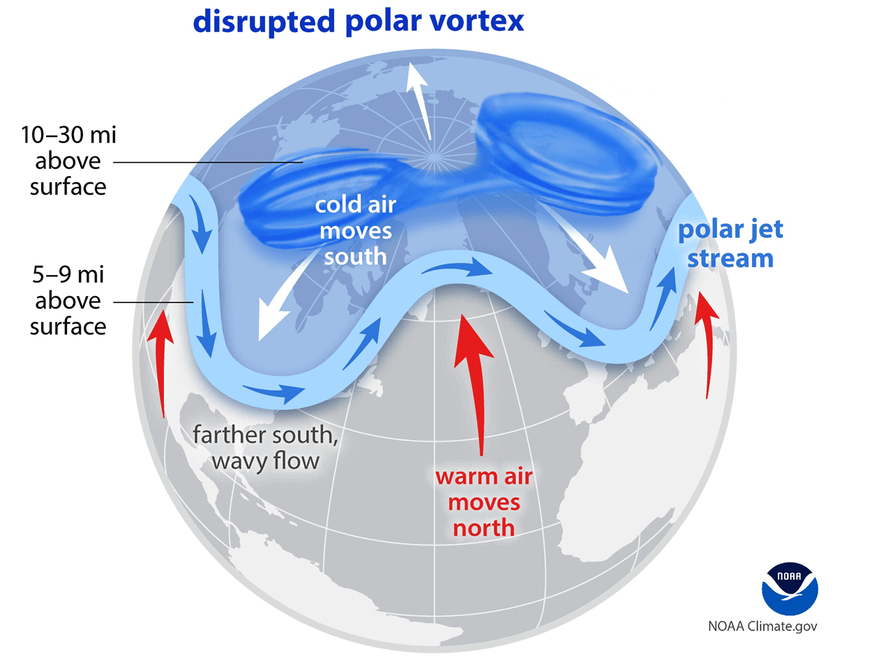
We have experienced this in Asia, Canada, the U.S., and sometimes Europe in recent years. The vortex aloft has been significantly disrupted, and when its lobe shifts on the other side of the northern hemisphere, the extreme cold grips the North American continent.
The disruption of the Polar Vortex and its split at the start of the meteorological Winter season of 2025/26 were the primary triggers of the frigid cold outbreaks in Siberia, Alaska, and Yukon, with temperatures reaching nearly -75 °F (-60 °C) from December through early this month.
Major Dipole establishes – High on the West with Low on the East: Arctic Outbreak follows
The weather pattern shaping up for the weekend is presenting a picture-perfect position of the Highs and Lows over the North Pacific and North American continent. A powerful Omega blocking High forms over the Pacific Northwest, with a deep Polar Low digging far south across the United States.
This is a scenario in which significant cold advection follows into the lowlands, as the Polar Vortex’s southern lobe aloft is disturbed and sends these cold waves into the mid-latitudes. The surface pressure forecast for the weekend hints a low pressure on the East.
To the West and over Western Canada, a major high-pressure system is in place, with the central pressure in the upper 1040s. This is where extreme cold normally descends towards the lower parts of the atmosphere, releasing an Arctic outbreak across the NAM continent.
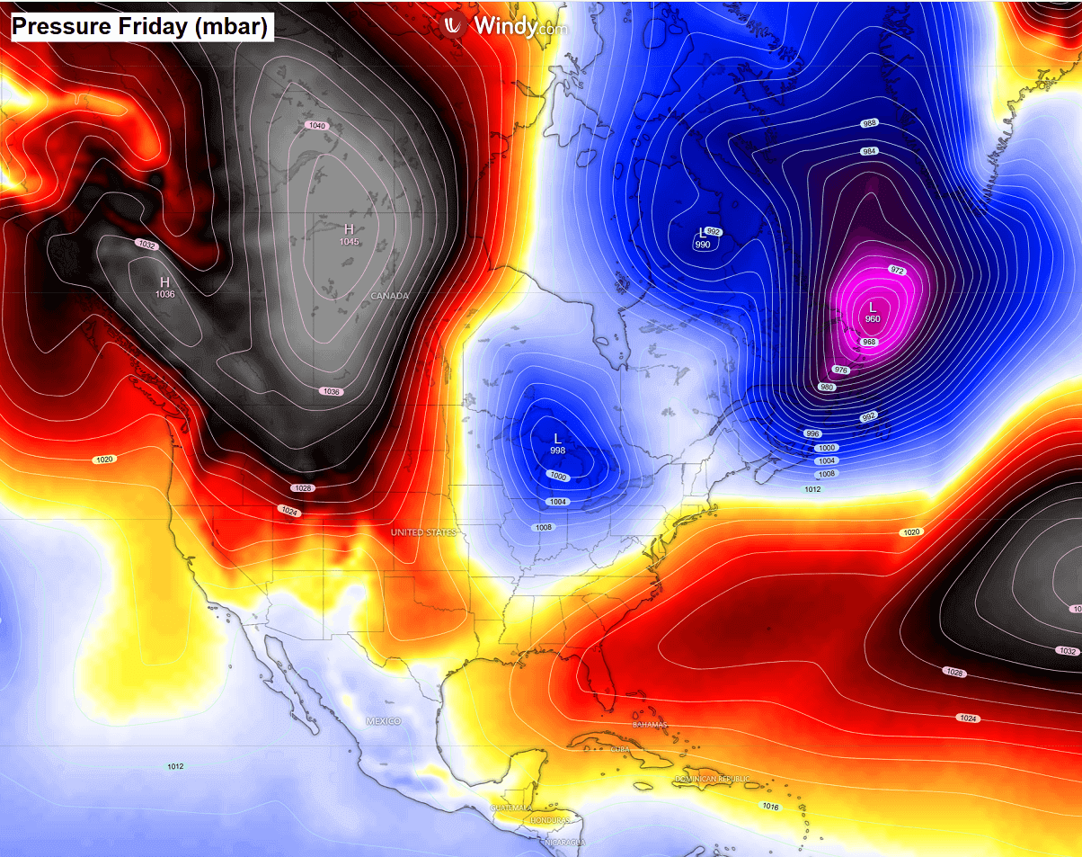
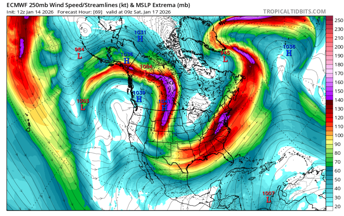
Such a position of the Highs and Lows disturbs the polar jet streams across North America, shifting them into a meridional direction, which sends Arctic air masses deep south across the continent.
We can see the wave across Alaska and Western Canada; this is from where the air mass will be dragged east and south over the coming days and through the remainder of the month. The channeling flow calls for below-normal temperatures to persist for a long period.
The current cold core that’s affecting the Southeast U.S. and Florida this Friday is soon followed by another, even deeper Polar low on Saturday. Frigid cold will blast across the Midwest into the Mississippi Valley, advancing into the Gulf Coast Saturday night into Sunday.
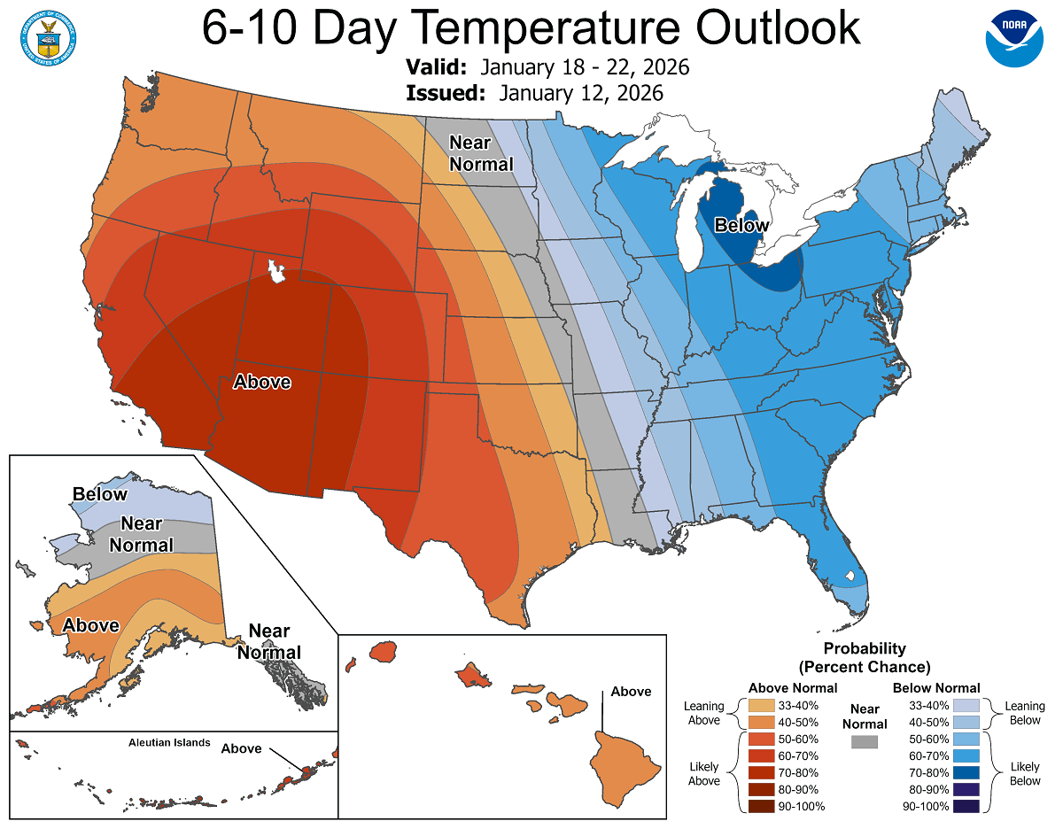
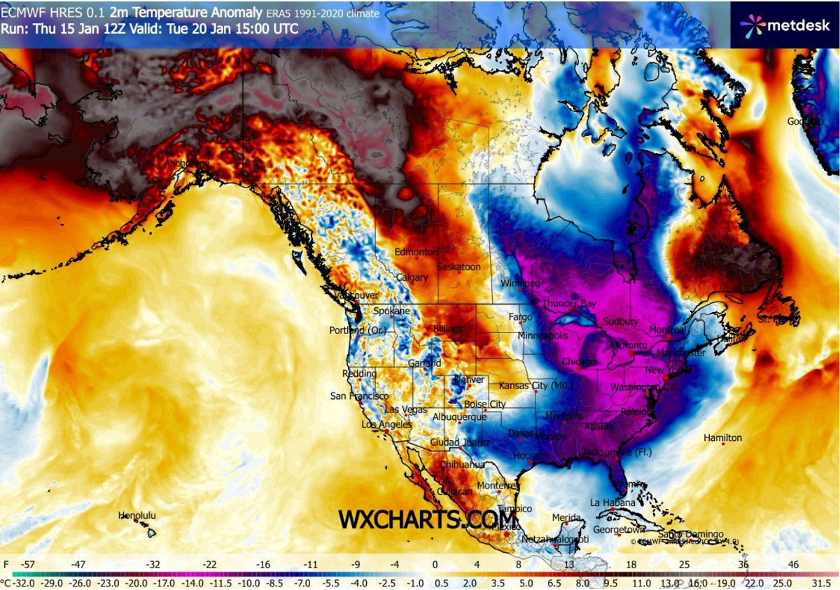
From Sunday into Monday, yet another intense cold wave emerges from Canada, grips millions across the eastern two-thirds of the U.S., and plunges them into a deep freeze. This major cold pool sits over for several days early through mid-next week. Temperatures are forecast to be 20-30 °F below normal for this time of year.
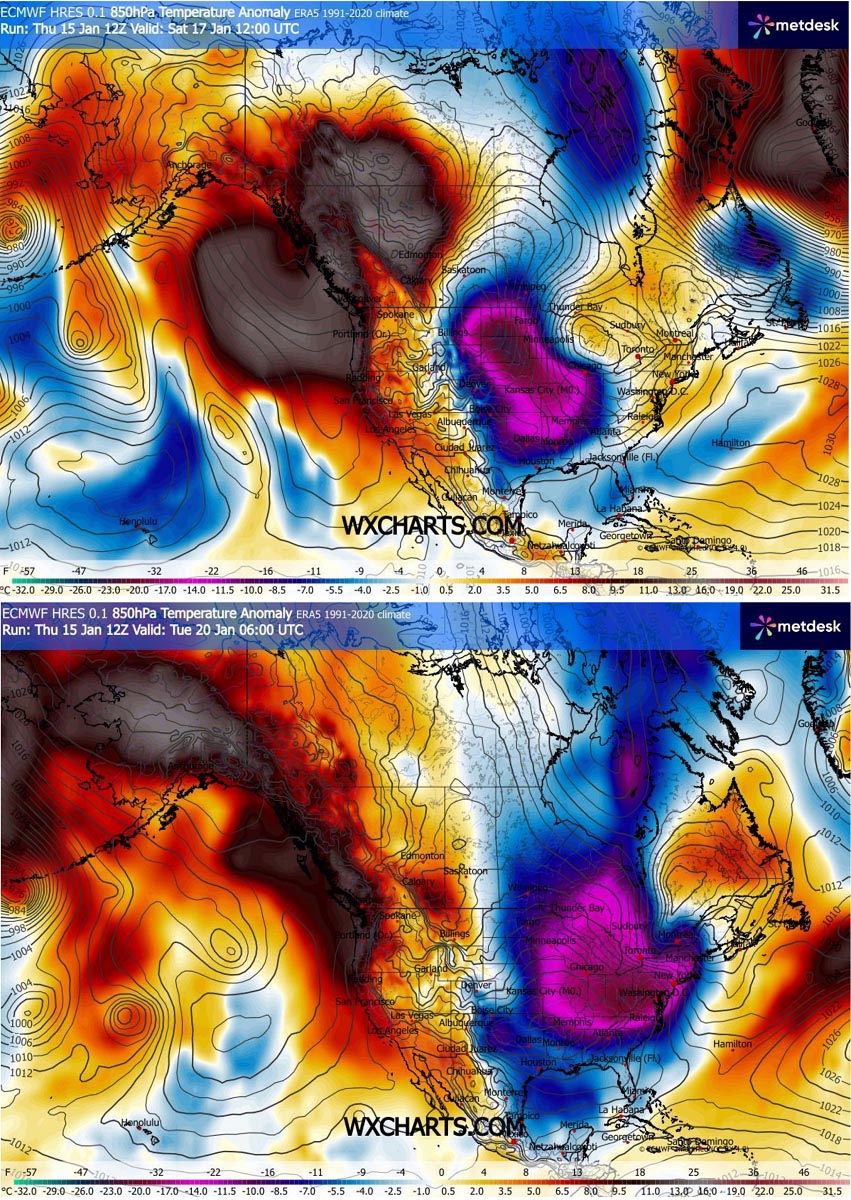
This pool divides the North American continent into two halves: extreme cold in the East and milder in the West. The worst cold will be across the Mid-Atlantic states, the Northeast U.S., the Great Lakes, and Ontario, Canada.
Notice how it warms up over northwest Canada and Alaska early next week, with temperatures at the surface quite above normal. This is due to a descending air mass inside the powerful high-pressure system and a blocking high aloft. Still, temperatures will remain deep below freezing.
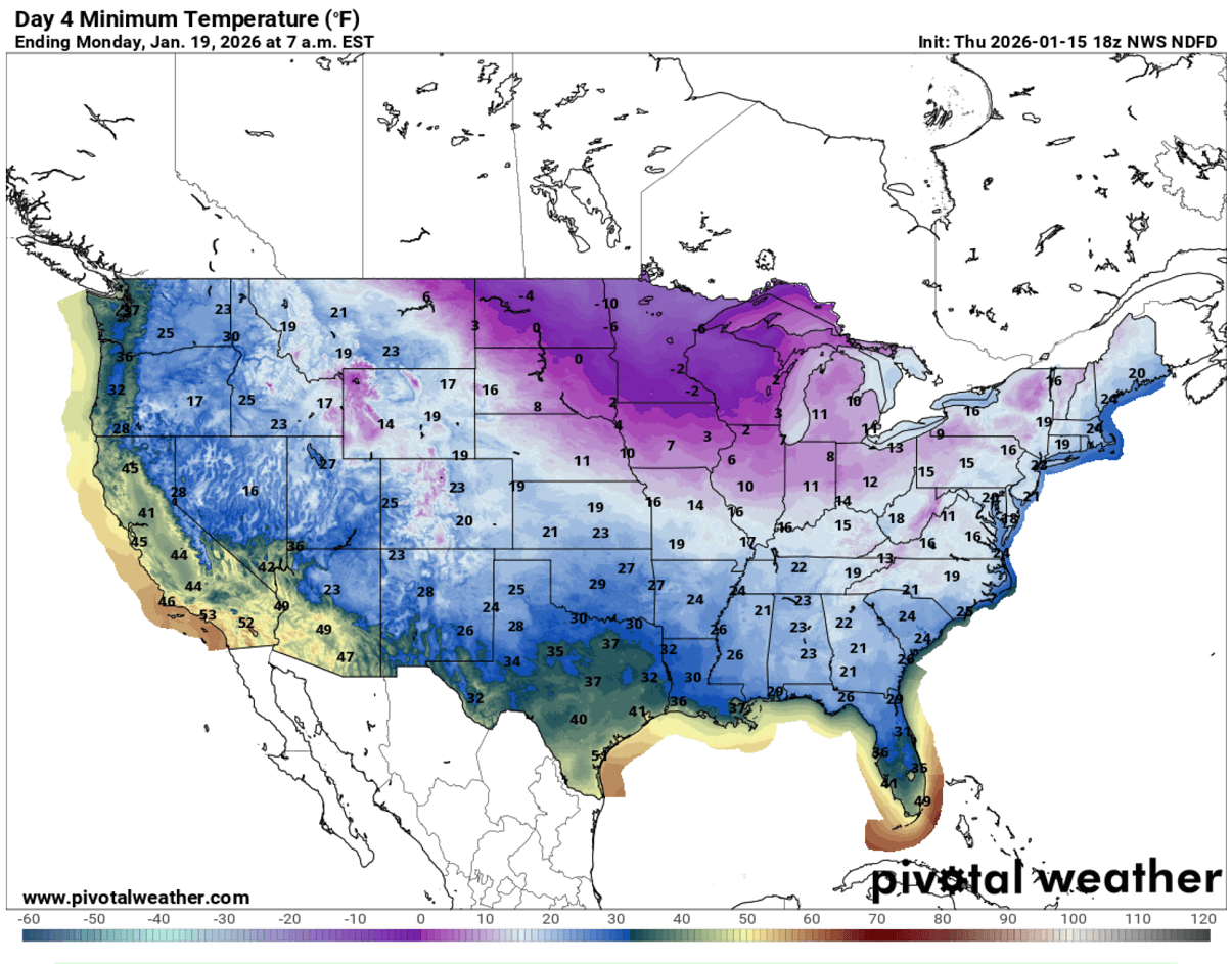
After Friday’s low below freezing as far south as central Florida, another significantly cold morning will be on Monday. Followed the second Polar low, mid-20s are forecast along the eastern Gulf Coast, including the Florida Panhandle and the northern part of the state. Near-freezing in central Florida again.
Further north, frigid cold mornings with lows in the 10s to 20s °F for more than two-thirds of the country. Even below zero °F across part of the Dakotas and the Upper Midwest.
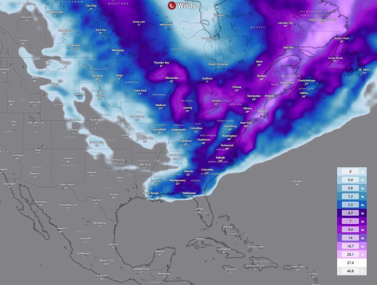
The Arctic front that grazes into the Southeast U.S. delivers a swath of snow from southern Alabama across northern Florida to the East Coast. How much snow will accumulate is still uncertain, as it strongly depends on the timing of the front and the cold surge with it.
About 3-8 inches are possible for parts of the Southeast U.S., along the East Coast, and in the Mid-Atlantic region. More snow across the Great Lakes is expected when a persistent northwesterly flow, following multiple Polar air mass intrusions, will bring abundant lake-effect snow.
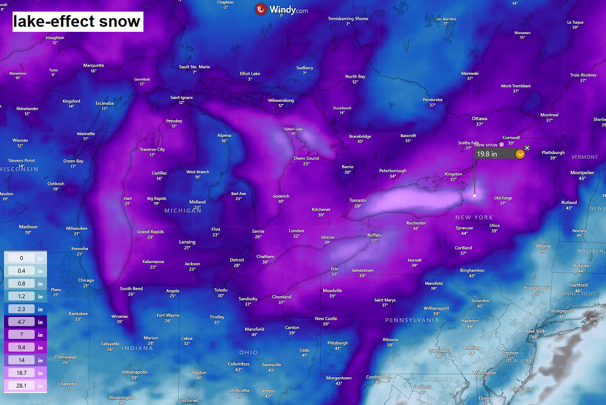
A close-up view of the Great Lakes region hints there will likely be significant snow over all four lakes, with more snow also for Toronto, Canada.
And indeed, across the typical downwind areas, when lake-effect snowfall is maximized during Arctic and Polar outbreaks. 15 to more than 20 inches of snow is forecast.
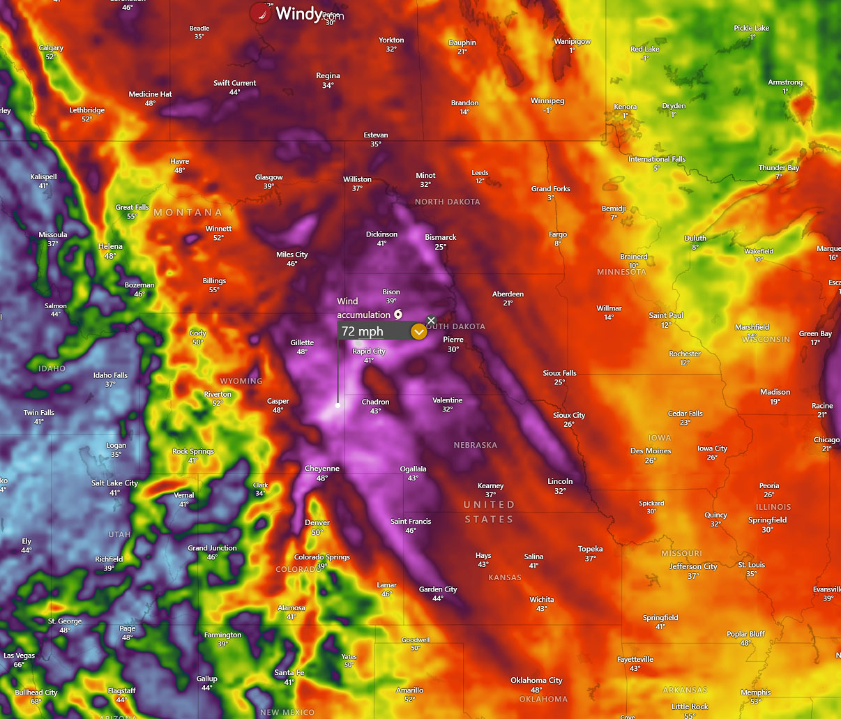
Note that as a result of a strong pressure and temperature gradient across the Great Plains, strong to severe northwesterlies are forecast from Alberta and Saskatchewan, Canada, south across Montana, Wyoming, and the Dakotas to Nebraska, Colorado, and Kansas over the weekend into early next week.
Conditions will be dangerous for traffic traveling west-east with cross-winds of this scale. Peak gusts will locally reach 70-80 mph. Although not much fresh snow will accumulate over the Plains, blowing snow or dust will occur. reducing visibility and disrupt travels.
Conditions will gradually improve mid-week as the gradients vanish.
Windy and Wxcharts provided images used in this article.
See also: La Niña Collapse Begins: How a Major Pacific Flip will Reshape the 2026 Weather Patterns