A rare late-April Arctic cold air mass intrusion is set to plunge temperatures across Eastern and Southeastern Europe, bringing a high risk of damaging frost to vineyards as the 2026 growth season begins.
As the European continent is ending an unusually warm start to spring and preparing to transition into the warmth of May, a significant and unseasonal cold air mass intrusion is ending April 2026.
Key Meteorological Drivers behind the pattern shift:
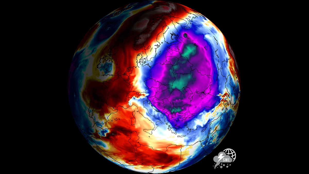
The stratospheric disruptions that have led to a late-season weakening of the Polar Vortex have allowed Arctic air to spill southward, bypassing the usual westerly flow, which gets blocked by the strong Omega Block over the North Atlantic.
The general patterns are shifting due to the La Niña transition; as the Pacific shifts toward ENSO-neutral conditions, the atmospheric response has favored a meridional (north-to-south) flow across the North Atlantic and Europe. Forming a classic Omega Block over Greenland, which stalls over the far north through early May, effectively acting as a conveyor belt for cold air into the heart of Europe.
This late-season cold spell funneling from the Arctic region is characterized by a persistent high-pressure system and a blocking High over the North Atlantic and Greenland. It sends the broad cold pool deep into Central, Eastern, and Southeastern Europe.
The following meteogram charts for Kosice, Slovakia, and Sofia, Bulgaria, show the duration and intensity of the Arctic cold pool from the final week of April into early May.
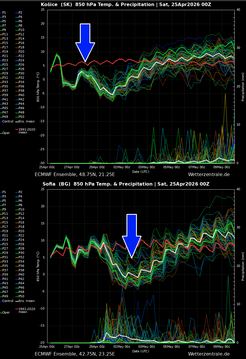
The timing of this cold will remind those familiar with the “Ice Saints” style event: a particularly critical period in mid-May when parts of Europe have tended to experience damaging frosts. But with growth season a few weeks earlier and accelerated crop development this spring, things are the same or even more critical if significant morning frosts occur.
The temperature plunge will bring them as much as 10–15 °C below seasonal norms, which poses a severe threat to the agricultural sector. Particularly to vineyards and fruit orchards currently in their vulnerable flowering stages.
Note that the early April warmth (reaching 20–25 °C and above in some regions) essentially pushed the vegetation into premature growth, making the potential return of the frosty mornings much more lethal than the usual mid-winter freeze.
Widespread frost is likely to follow across eastern and parts of central Europe, portions of the Balkans, and Turkey. And delivers unseasonable snowfall across the higher regions of Romania and deep into the heart of Turkey. While Western Europe experiences a gradual warming trend under a developing ridge.
The timing is catastrophic for the regional agriculture sector. With trees already in blossom, the projected -2°C to -5°C temperatures in central Turkey and the Balkans could lead to total crop failure for local fruit and nut growers.
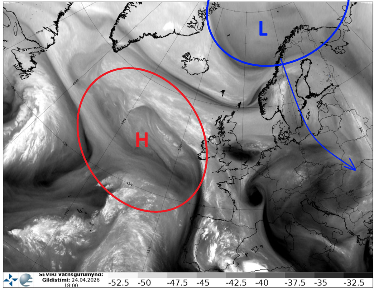
Omega Block over the Atlantic, Arctic cold plunges into Northern and Eastern Europe
The general weather pattern is transitioning this weekend with a strengthening blocking ridge over the Atlantic and Western Europe towards Greenland, which establishes a funneling flow from the Arctic region into Northeastern Europe on Sunday.
A deep upper-level core develops over the Baltic region, with intense surface cyclogenesis, snow, and low wind chills.
The intense cold pool will be racing south into Eastern Europe Sunday night through Monday, delivering a significantly colder air mass as the final week of April unfolds.
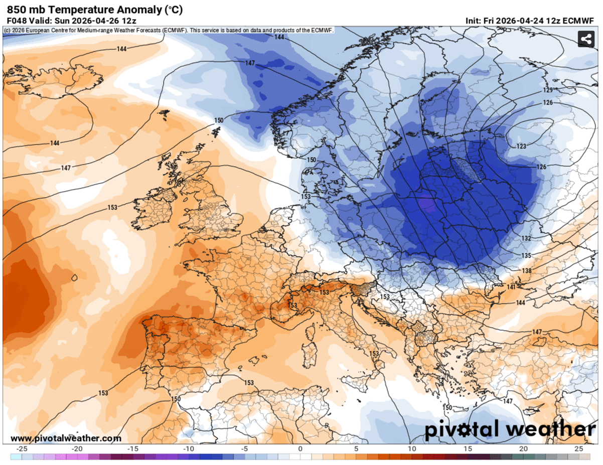
Temperatures will be 8-12 °C below norms for late April, and the large cold pool will engulf Poland, Scandinavia, Belarus, Northern Ukraine, and northwest Russia by midday Sunday.
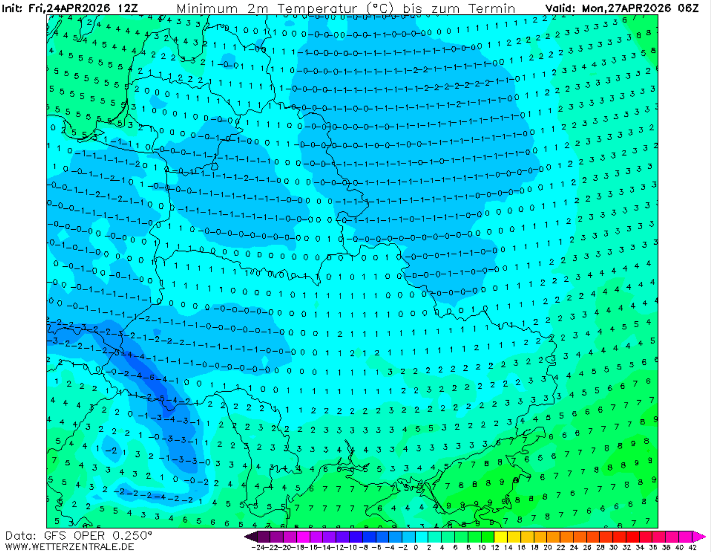
This will deliver significantly colder temperatures into the lower levels, resulting in morning temperatures a few degrees below freezing on Monday.
The coldest air mass and potentially damaging morning frost are forecast for a large part of Poland, Belarus, western Ukraine, northern Slovakia, and northwestern Russia. Although the conditions will remain windy.
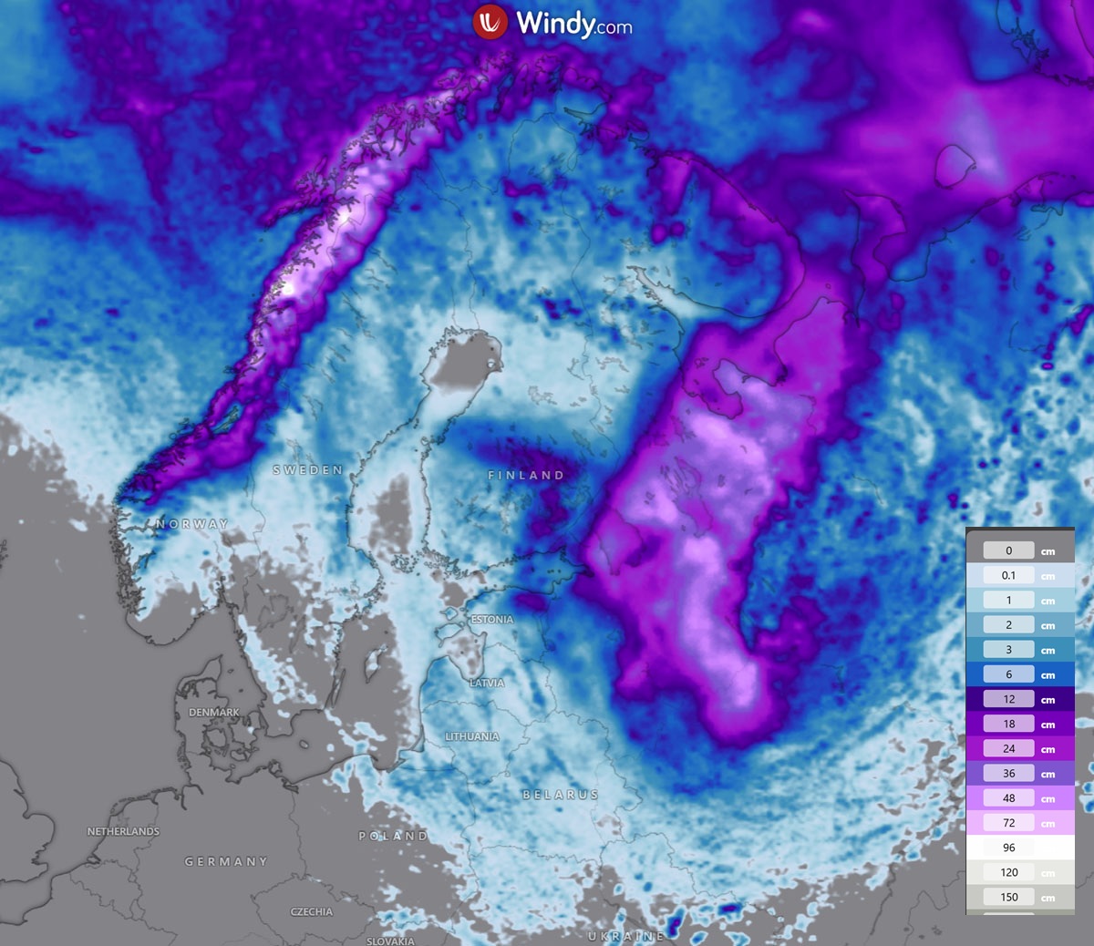
The deep surface low rapidly developing over the Baltic region will also bring significant snow as it tracks across northwestern Russia through Sunday and Monday. Snow amounts could reach 30-50 cm in the swath where the winter storm will travel.
Some snow is also expected across Estonia and southern Finland, and much more over northern Norway with the persistent and strong northerly flow through mid-week.
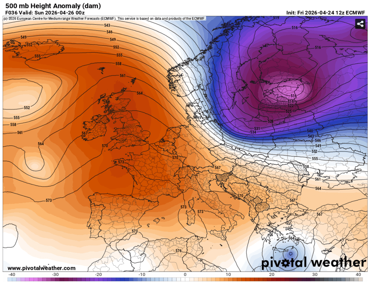
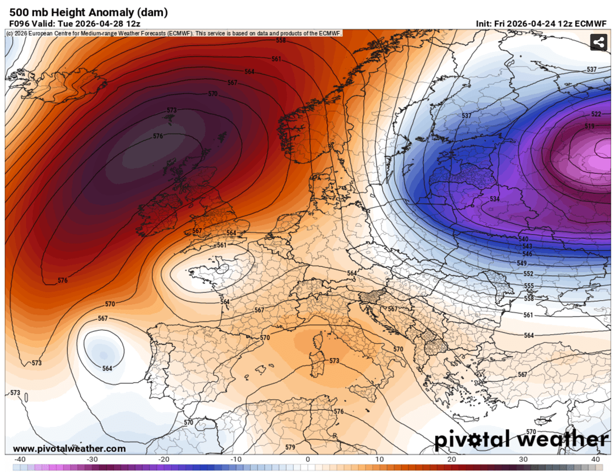
By midweek, the North Atlantic ridge becomes even more pronounced, with significant height, as it expands over Iceland, the Faroes, and Greenland.
This sends the upper cold wave further south across Eastern Europe, reaching Central Europe and the Balkan peninsula.
And so are the temperatures following in the lowest levels. The temperature anomaly will be significant, with 10-12 °C below normal in many countries in Eastern Europe. It also gradually cools across parts of Central Europe, including the Balkans, behind the front on Wednesday.
While further west, warmth persists under the heat dome, blocking high pressure dominating Western Europe. A few degrees warmer than normal will also remain over the western Mediterranean and southwestern Europe.
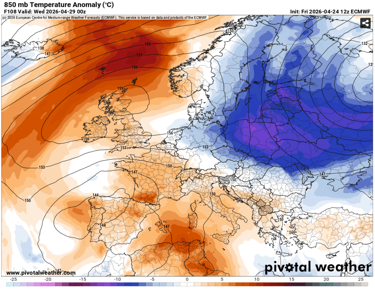
So, there will be quite a temperature contrast across Central Europe, between the warmer ridge on the west and the deep upper cold wave on the east.
It is likely that morning temperatures on Thursday and Friday will be around or slightly above freezing from Eastern Germany across Czechia and Slovakia to Poland, and Austria. Valleys could experience late-season frost, which could cause damage.
This dipole weather pattern, with warmth and a blocking high on the west and deep cold upper troughs on the east, will persist through the remainder of April and into early May.
Arctic plunge continues into the weekend, and May starts
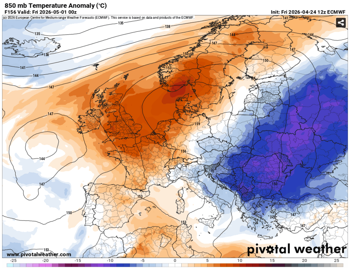
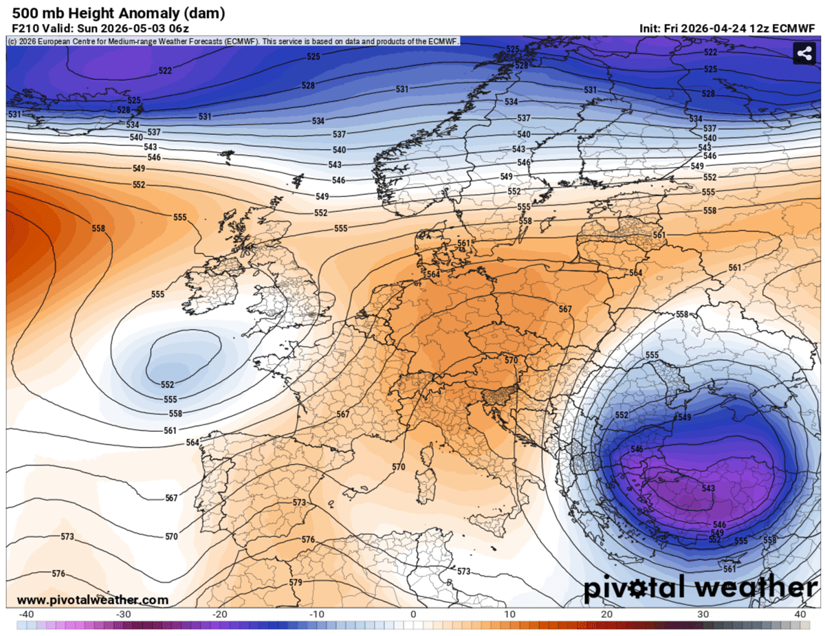
By Friday, May 1st, the strong North Atlantic ridge expands and organizes into a textbook Omega Block pattern. With a deep low on its east side progressing across the Balkans into the Black Sea region, and another low on the western side towards the Azores.
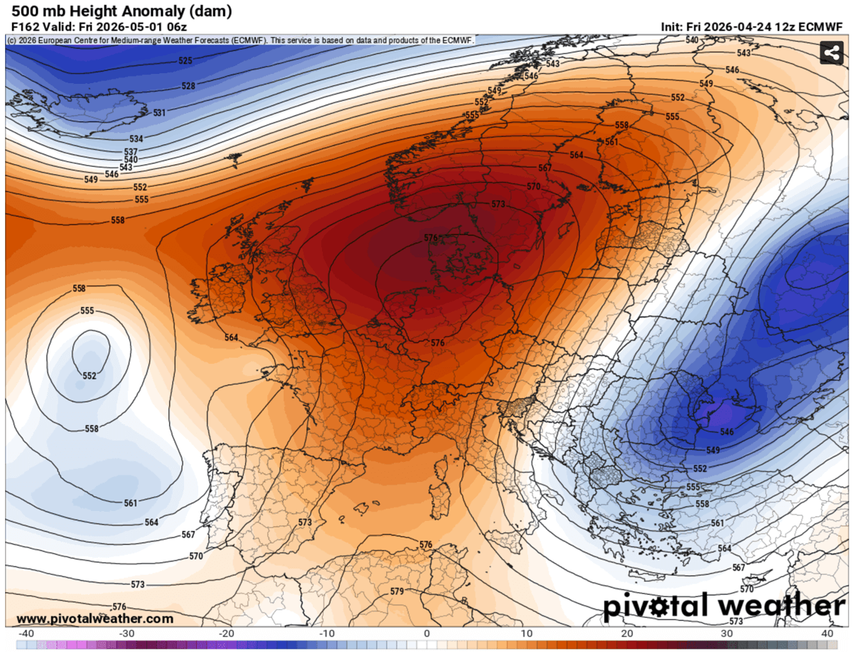
Warmth therefore remains over Western Europe but intensifies across the Balkans and the Black Sea region on Friday.
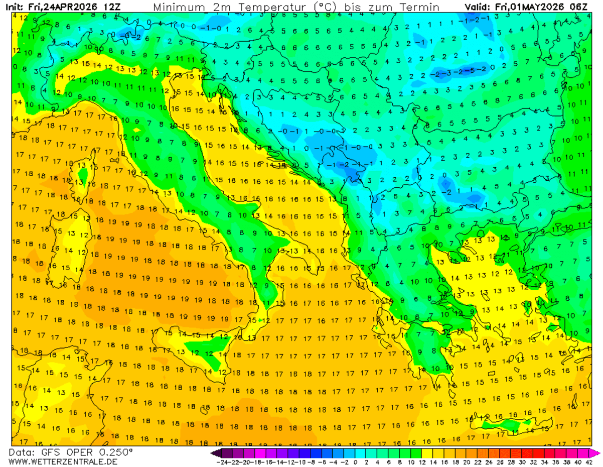
Temperatures will be 10-15 °C below normal, which is rare and pretty extreme for early May.
Such intense anomaly over the region will undoubtedly result in significant cold mornings on Friday and Saturday, most likely with temperatures plunging a few degrees below 0 °C.
This is particularly critical given the damaging frost in vineyards across most countries of the Balkan Peninsula. Damage could be significant or catastrophic.
Late-season intense cold into Southeast Europe, with rare deep snow for Turkey
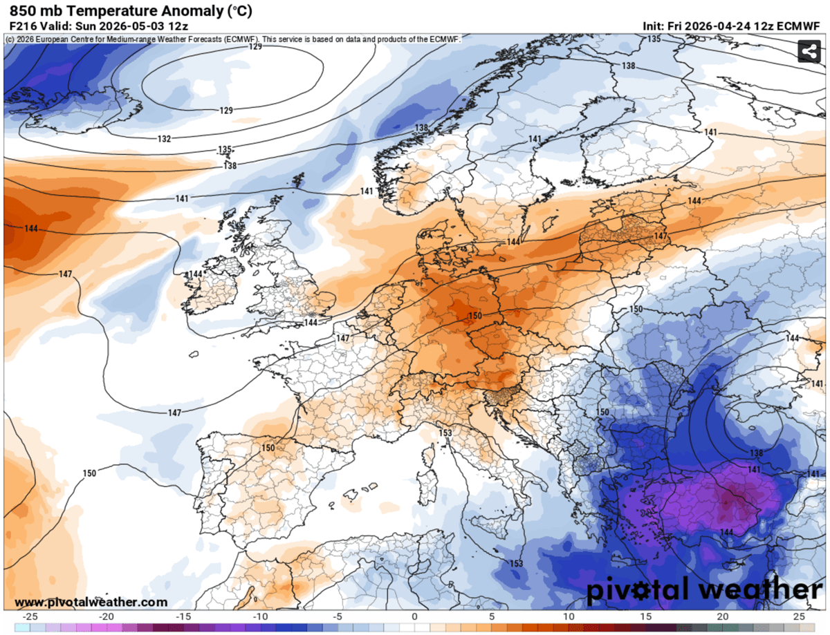
By the following weekend, the strong upper ridge and Omega Block finally begin weakening, but the intense cold core on its eastern flank just gets stronger as a significantly colder air mass clashes with the warmer Eastern Mediterranean region.
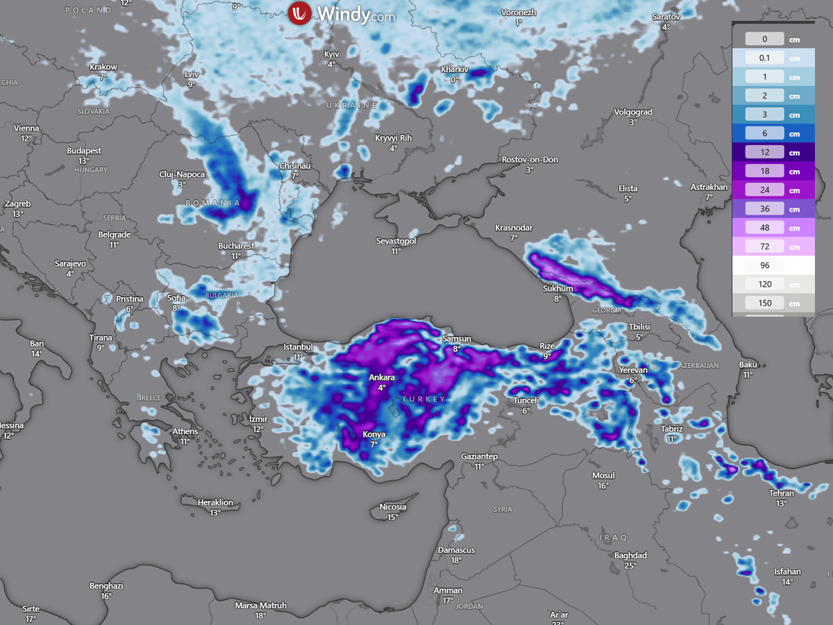
An explosive cyclogenesis is likely to form, bringing a frontal system with heavy rain, deep snow, and winds to parts of Turkey.
With such cold aloft, the temperatures in the lowest levels will be extreme. Turkey is forecast to see temperatures plunging 14-18 °C below the long-term average.
This will support precipitation transition into heavy snow as the winter storm takes place from Sunday into Monday.
Turkey will experience a rare spring snow as May starts next weekend. In a dramatic turn, the central Anatolian plateau, including the city of Ankara, is bracing for late-season snowfall. Snow accumulation is likely to reach significant depths across large portions of Turkey from Sunday through next Monday.
Some areas could receive even more than 30 cm of fresh snow in the first days of May, with the impact of Black Sea-effect snowfall in the wake of the deep surface low.
How low temperatures will plunge will be difficult to define, as there could be mostly cloudy days with the deep upper-low core aloft and the surface low stalling over the region for days.
However, where skies will be clear and nights calm, extremely low temperatures will develop, which could push morning lows next Monday even below -5 °C.
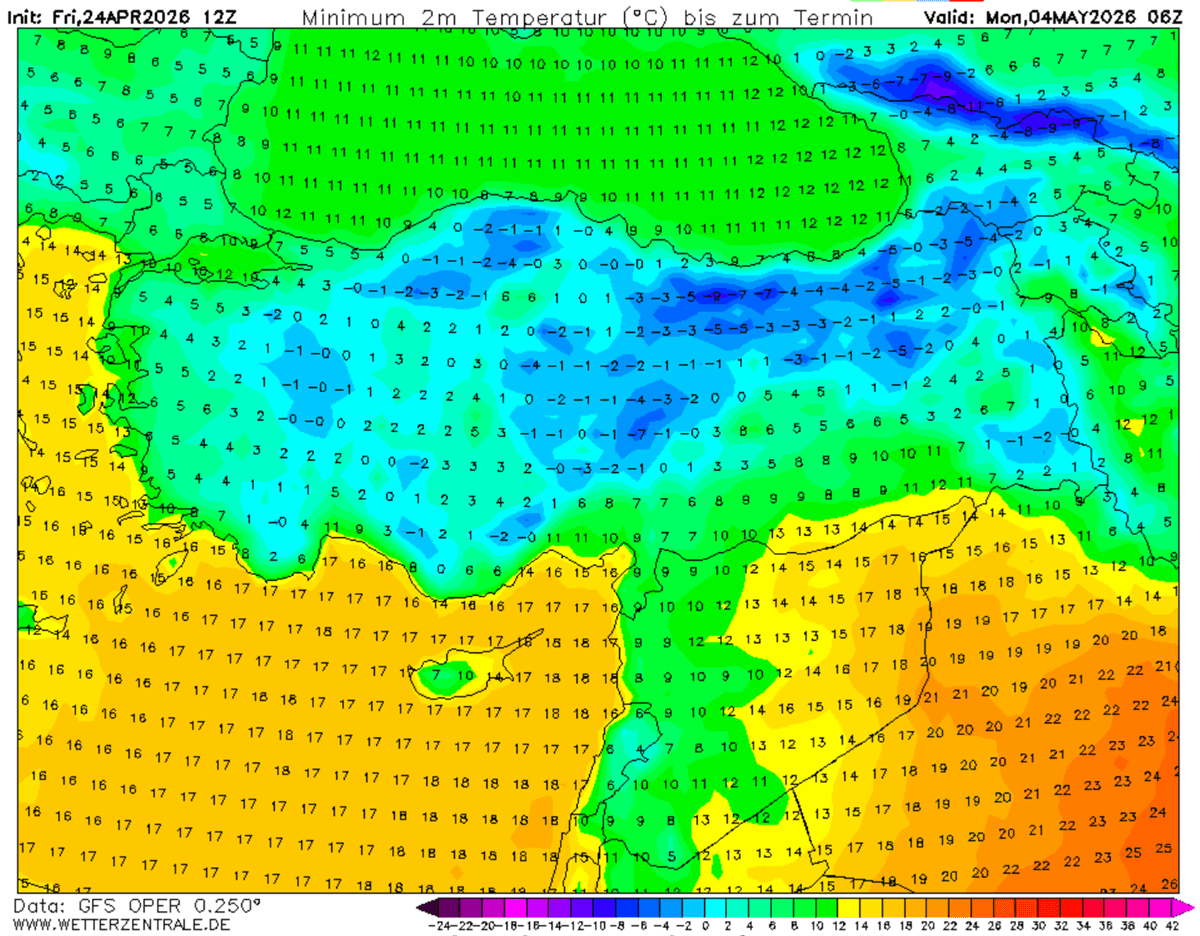
This is potentially a catastrophic event for the Balkans and the Black Sea region, with Turkey, as Arctic air mass intrusions of this scale are rare for early May.
Stay alert!
Pivotalweather and Wxcharts provided images used in this article.