The active North Atlantic weather pattern will continue this weekend and next week, bringing multiple storms and frontal systems to western Europe. On Sunday, an intense surface cyclone bringing gale-force winds into the region is forecast to potentially significantly impact Ireland and the UK.
What is concerning is the rapid development of the surface low from Saturday into Sunday, meaning intense winds and significant wave heights towards Ireland and Northern Ireland will likely develop.
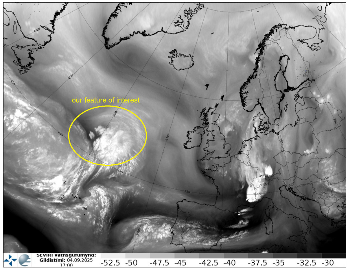
Early Friday, water vapor satellite image analysis over the North Atlantic and Europe revealed a frontal wave moving over western Europe, while frontogenesis was taking place further west over the Atlantic.
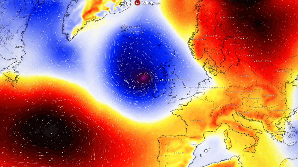
While this is far from European land, the weather model simulations hint at a potentially impactful storm in the coming days. The surface low is forecast to push below 980 mbar.
The most likely scenario involves bringing this low towards Western Europe on Saturday. The system would make a north turn before a cold push from the far North Atlantic would allow the storm to intensify.
The system’s rapid intensification of the surface center low leads to an intense wind field, supporting gale-force winds for Ireland, Northern Ireland, and the Outer Hebrides in western Scotland.
As we enter the autumn season in Europe, the potential for intense Atlantic storms to develop is higher. These storms can bring severe windstorms, high waves, and significant impacts to life and property.
Aside note:
The Irish meteorological agency, Met Éireann, in partnership with the National Meteorological Services of the UK (Met Office) and the Netherlands (KNMI), has launched the new list of names for the 2025/26 storm season. The Atlantic storm season that affects Europe runs from September 1st, 2025, until August 31st, 2026. Of the list of 21 names, each national partner has contributed seven storm names.
A storm is named when it could result in ‘medium’ or ‘high’ impacts in any one of the three partner countries. Naming storms allows for authoritative and consistent communications with the public, enabling them to prepare for and stay safe during potentially severe weather events.
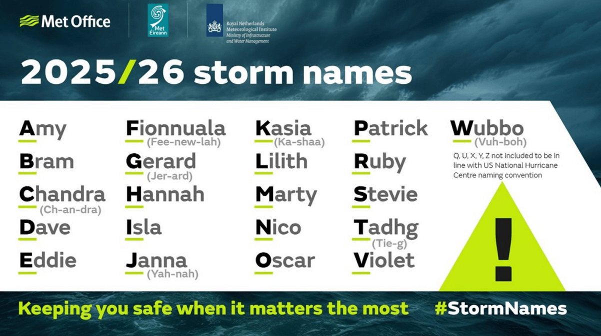
Naming storms is a powerful tool that supports meteorological agencies and other public safety organisations in increasing awareness of severe and impactful weather alongside regular weather warnings. Naming storms makes it easier for people to track essential and up-to-date forecast and safety-related information.
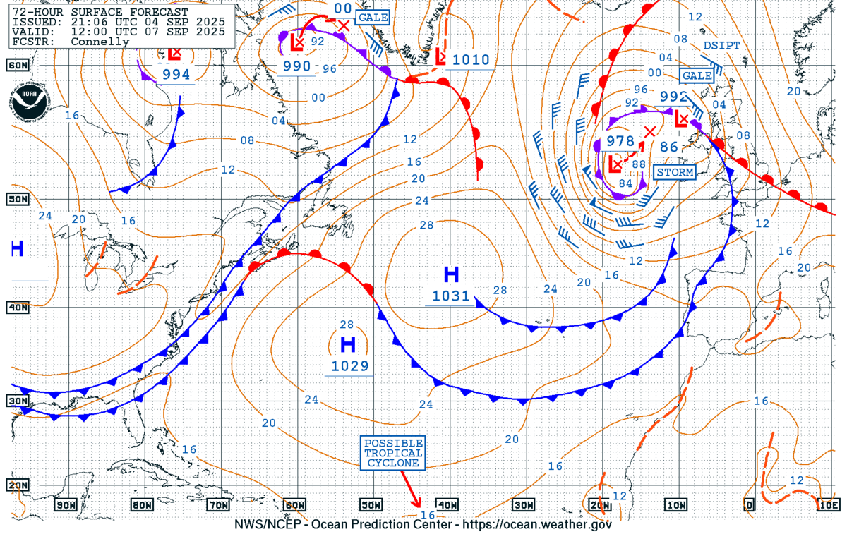
Let’s dig into details regarding the evolution of the intense Atlantic low coming up this Sunday into the following Monday for Ireland and Northern Ireland. If the upcoming windstorm will support enough intensity for Ireland or the UK, the storm will get its name—the first one on the list is Storm Amy.
A major deep wave develops, churns a deep Atlantic storm on Sunday
The general weather pattern developed over Europe indicates the continent is now building up the blocking ridge pattern, and an Omega block is forming. To the west, deep troughs are maintaining over the North Atlantic.
By Sunday, a strong push in the upper levels brings a cold blob from the polar region, significantly deepening the upper wave towards western Europe.
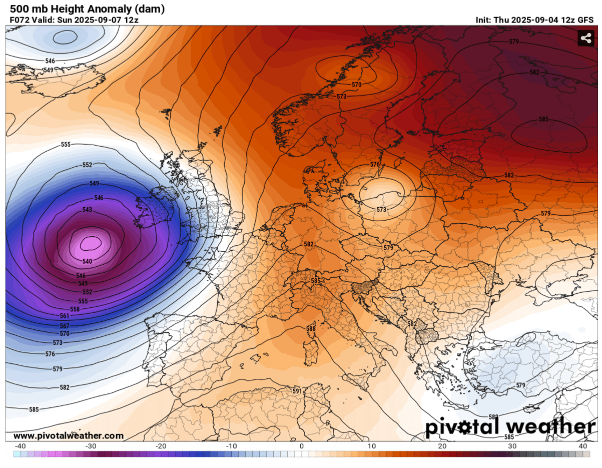
The sharp pressure and temperature gradients lead to rapid surface cyclogenesis, which intensifies from Saturday night into Sunday as the new cold intrusion occurs aloft.
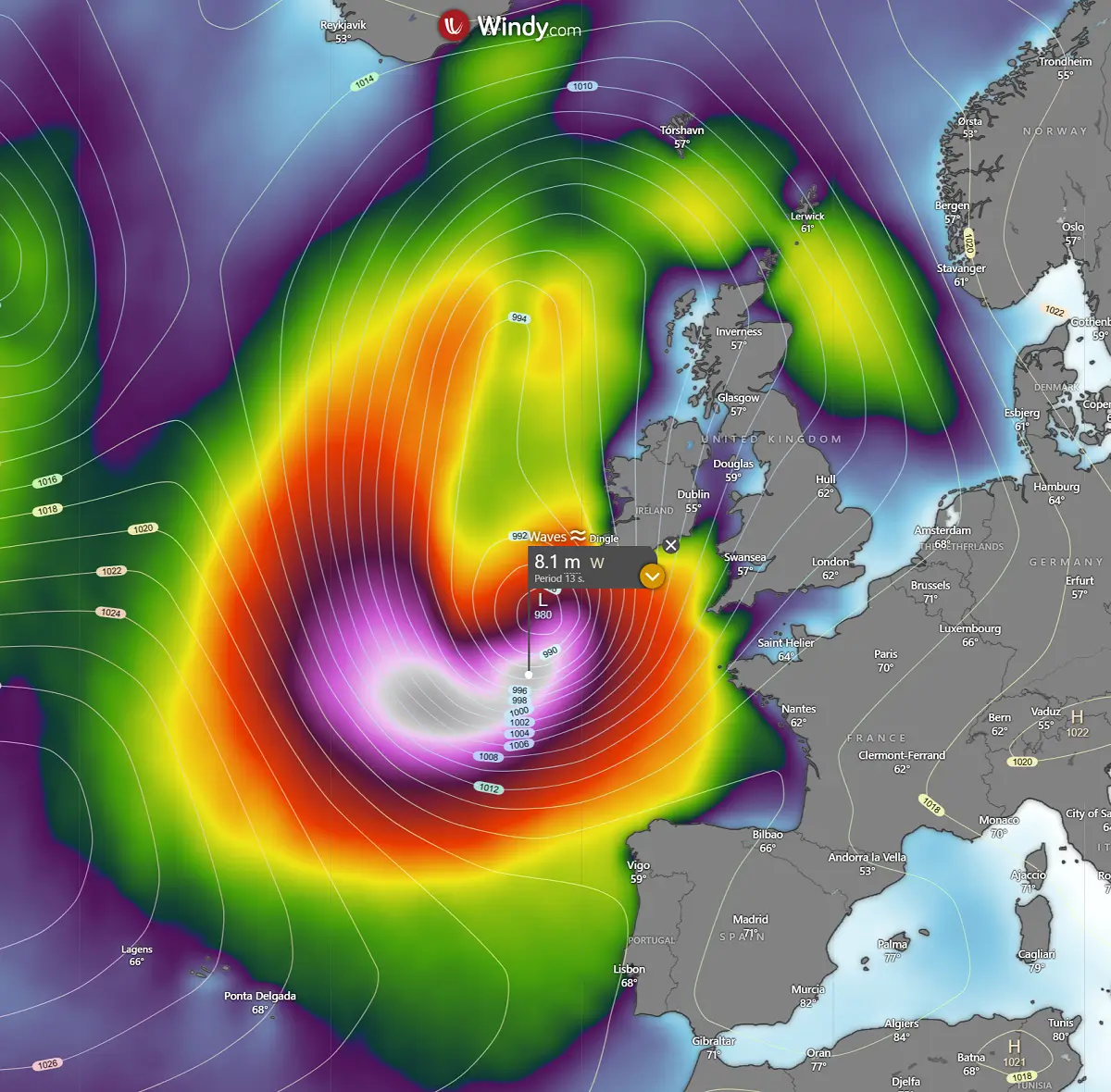
This translates into much deeper surface pressure with the new Atlantic storm, pushing the central pressure to around 980 mbar or even lower per some high-resolution models.
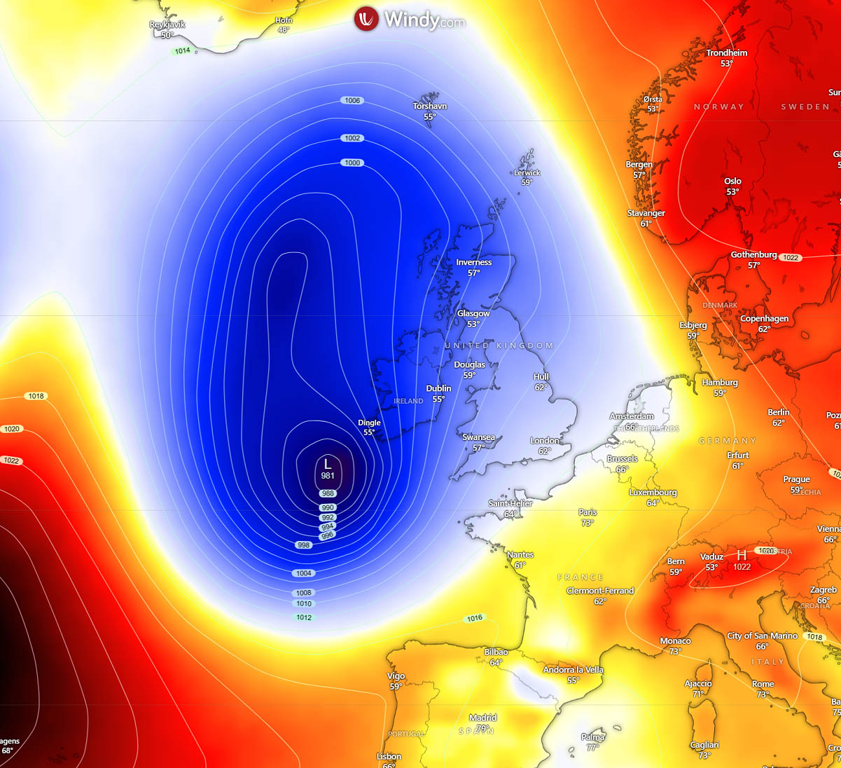
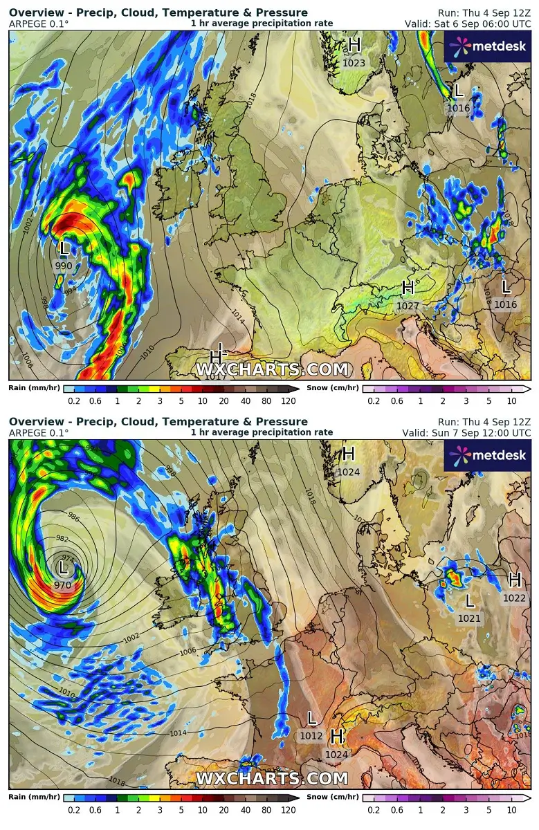
The new surface low emerging from the west travels towards Ireland early Saturday, turning north-northwest into Sunday when it finally encounters the colder air mass aloft.
This begins the rapid intensification process and turns the low again towards the south and east, impacting Ireland and Northern Ireland Sunday night into Monday.
The low’s approach on Saturday brings the cold front, with rain squalls overnight across Ireland and the UK continuing on Sunday.
However, the intense core that develops near the low’s surface center remains the main focus.
It intensifies the wind field and waves, gradually spreading towards the coast on Sunday afternoon into Sunday night.
While the weather models still have some uncertainties regarding the exact trajectory of the main surface low, the general wind impact should bring Ireland into the worst of the storm. High-resolution models suggest winds could be severe locally, gusting above 80 mph.
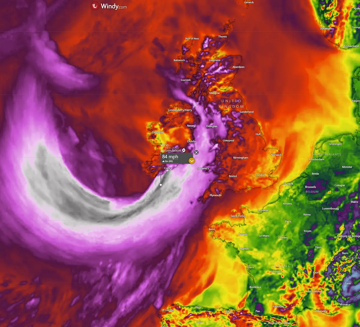
As mentioned earlier, the rapid development of the Atlantic storm typically brings significant wave heights as well. Those could be 8-10 meters high at the peak of the storm’s intensity on Sunday, gradually moving east towards Ireland.
Since the low has no clear path, the impact of the most intense winds and waves is hard to predict. However, most weather models hint at the worst to push towards Ireland’s western and southern coasts.
Due to its fast development and intense core, the storm’s worst impact will be potentially gale-force winds. Rain squalls should support heavy rain and strong to severe winds when the core nears or goes ashore late Sunday into Monday morning.
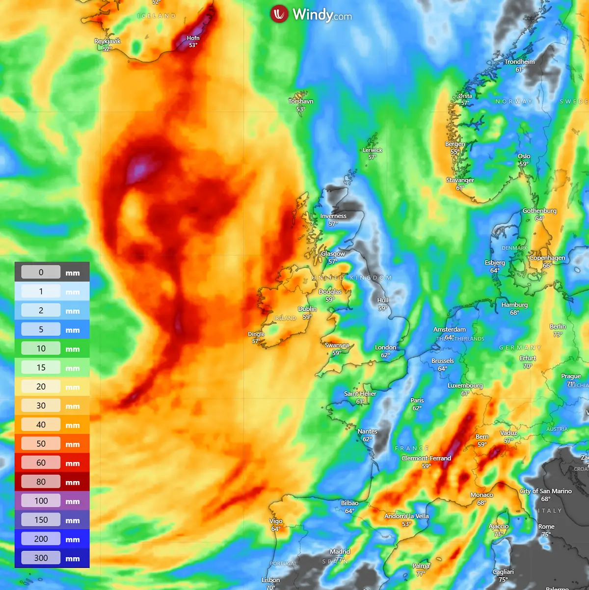
From Saturday through Monday, 72-hour rainfall sums across Ireland, Northern Ireland, and the Outer Hebrides could reach up to around 50 mm.
Despite some uncertainties regarding the exact path of the Atlantic storm, the impact on coastal areas could be significant.
Following your local meteorological office/agency for the latest updates and potential warning messages is advised.
Windy, Wxcharts, and WeatherBell provided images used in this article.
See also:
Winter 2025/2026 First Snowfall Predictions: La Niña Jet Stream Patterns Emerging