The first significant outbreak of Arctic cold air mass is forecast to spread into the eastern two-thirds of the United States this weekend. The cold wave will bring the coldest temperatures of the fall season so far, with areas experiencing historic cold for mid-November. Temperatures will plunge to near 30 °F below normal, with freeze reaching deep South and Florida.
Temperatures will be unusually low for this time, with December-like cold affecting tens of millions across the central and eastern U.S. from Sunday through Tuesday. In addition, the first significant snowfall will blanket the Great Lakes, with massive lake-effect snow dumping up to two feet of snow in some areas.
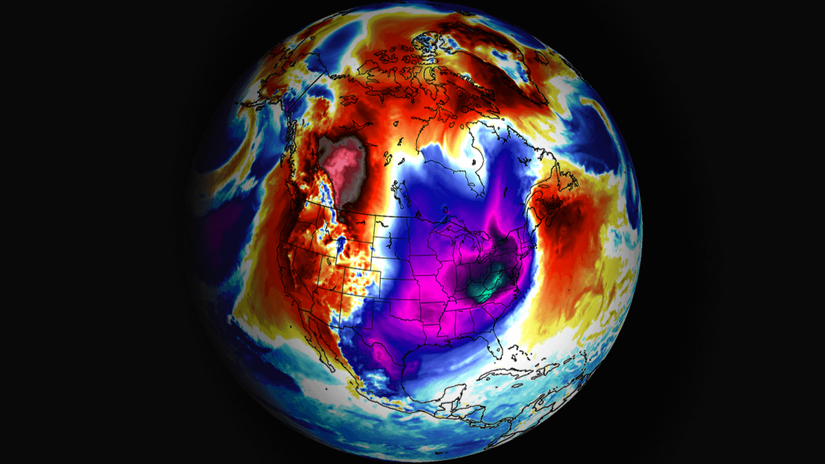
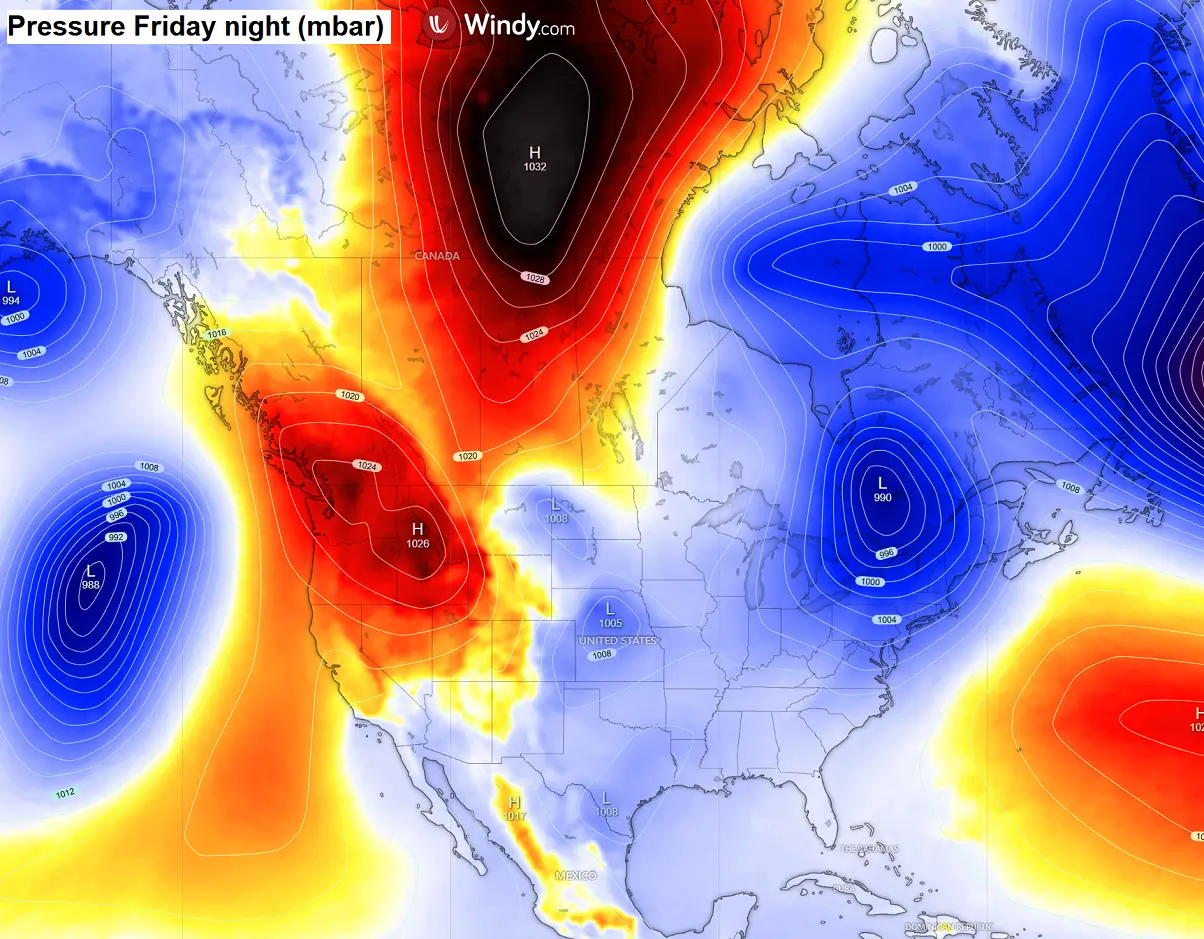
Before the dramatic shift of weather patterns across North America, a look at the satellites reveals two deep mid-latitude lows over the Atlantic and Pacific, with an Arctic cold pool beginning to accumulate over Canada. This will gradually spread south towards the International border by Friday.
Over the weekend, a strong block will establish on the West, with the cold air mass on the East dragging far south towards the eastern CONUS. A textbook dipole weather pattern develops, allowing historic cold to spread rapidly from Canada into the U.S.
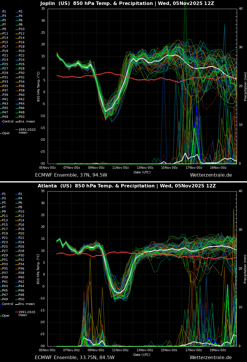
Here’s a brief overview of the primary cold wave moving across the Midwest, mid-Mississippi Valley to Southeast U.S. Sunday through Monday. The upper chart is for Joplin, MO, while the bottom one is for Atlanta, GA. Notice how temperatures drop by more than 20 °C, that is, a 20-25 °F change in 24 hours.
Although the significant anomaly will last for about three days, it will be unusually cold with December-like temperatures for many across the eastern two-thirds of the country.
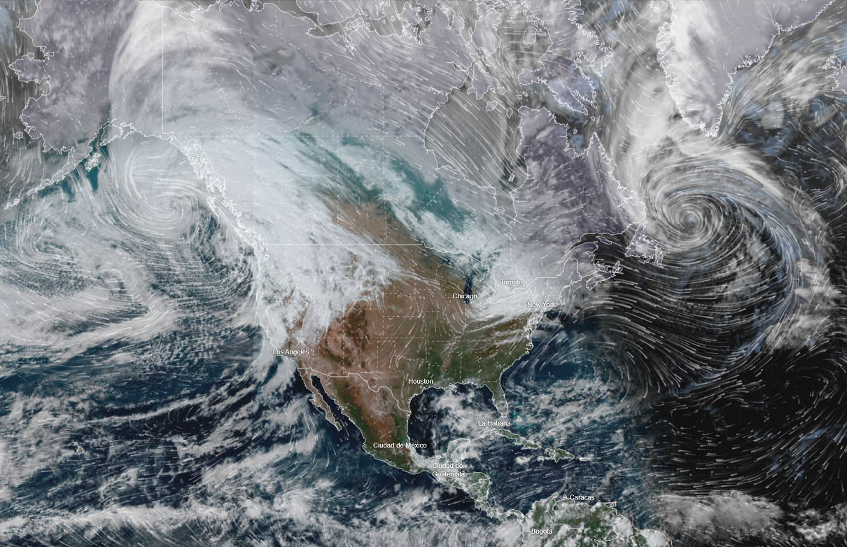
The following video animation presents the weather patterns and temperature changes, including anomalies, across Canada and the United States over the next 7 days.
Warmer-than-normal weather persists until Friday night, then quickly gives way to much colder conditions as the Arctic cold wave spreads southward. The peak of the cold is forecast to be early next week, followed by a gradual warming into mid-November.
Let’s dig into further details and the evolution of the potentially historic cold wave below.
A strong dipole weather pattern develops over North America, sending historic cold into the U.S.
Starting Friday, the upper-level blocking High begins strengthening on the West, expanding into Western Canada. This typically results in the northerly flow establishing over Canada, sending colder weather towards the south. By Sunday, a significant upper wave emerges over the Midwest and Great Lakes, continuing towards the Southeast U.S. while deepening further.
This then establishes a broad corridor of strong north-northwesterly flow into the eastern two-thirds of the Contiguous U.S., allowing temperatures to plunge into significant cold and freeze.
This dipole weather pattern allows the surface high-pressure system to strengthen over Canada, while a surface low forms over the Great Lakes and into the Northeast U.S., beneath the deep cold wave aloft.
The general flow travels typically from high to low, meaning we will see the winds from the north bringing the deep cold far south into the U.S.
With the arrival of the deep cold wave aloft, a surface low with a frontal system forms Saturday night across the Midwest, deepening as it moves east across the Great Lakes and the upper Ohio Valley on Sunday.
Heavy snow will lead to local blizzard conditions over the Lakes, possibly starting as far west as Chicago and then spreading east as the low advances during the day.
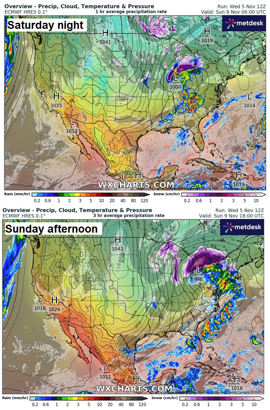
A much colder air mass from Canada enters the U.S. Friday night, intensifying on Saturday as it spreads south and east into the Northern Plains and the Upper Midwest behind the frontal system. By Sunday morning, cold air will reach Oklahoma, the Tennessee Valley, and the interior Northeast U.S.
The air mass will be nearly 20 degrees colder than usual for early November. The cold will continue its southward and eastward progress on Sunday and reach the Gulf Coast and Southeast U.S. by Sunday night.
At the surface, temperatures will be around 20-22 °F below normal across the Midwest, from the mid-Mississippi Valley to the Tennessee Valley. Over the Deep South, from central Texas to Louisiana and Alabama, temperatures 10-15°F below normal are expected to arrive by Sunday afternoon.
Additional stronger cooling will follow on Sunday night as the core of the cold wave continues to deepen as it moves into the Southeast U.S.
Sunday will therefore bring widespread cold to central and eastern CONUS, while the West remains warm.
As mentioned earlier, the frontal system associated with the cold wave progressing from the Upper Midwest into the Great Lakes on Sunday will bring some significant snow from Chicago across the Lakes to the Northeast U.S. 5-8″ of snow will be possible to the north of where the center low traverses.
Once the low ejects east, a strong north-northwesterly cold flow establishes over the Great Lakes. With temperatures far below freezing and the Lakes’ temperatures still warm, a significant lake-effect snowfall is expected to develop. Intense snow squalls are expected, including thundersnow events.
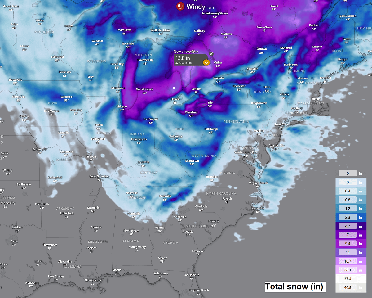
Some areas downwind of the Lakes are likely to be blanketed with around 2 feet of snow over the 48 hours, roughly from Sunday midday through Tuesday morning.
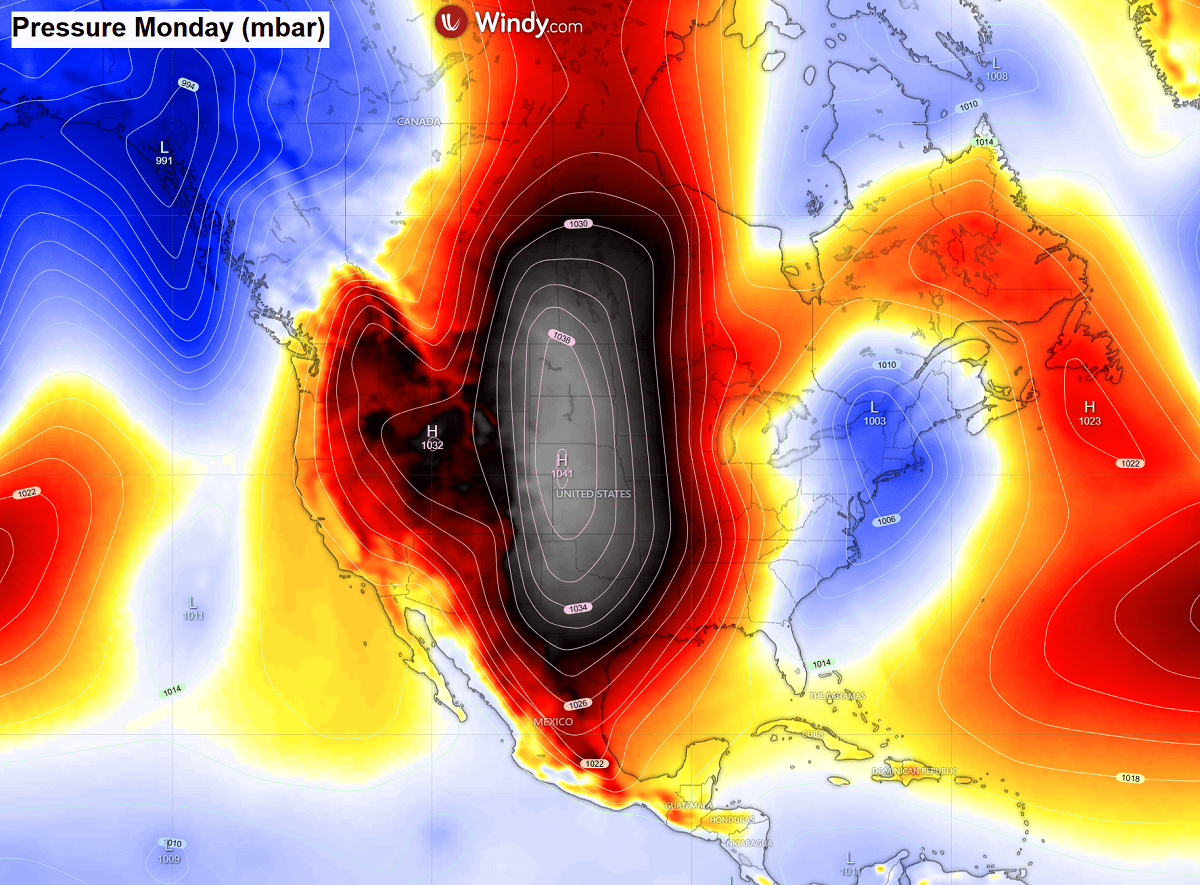
A massive cold wave peaks on Monday, bringing extremely low temperatures
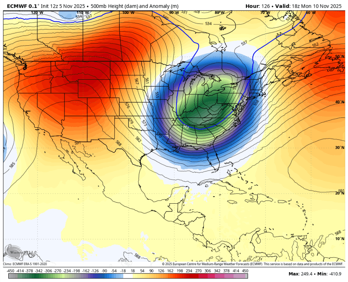
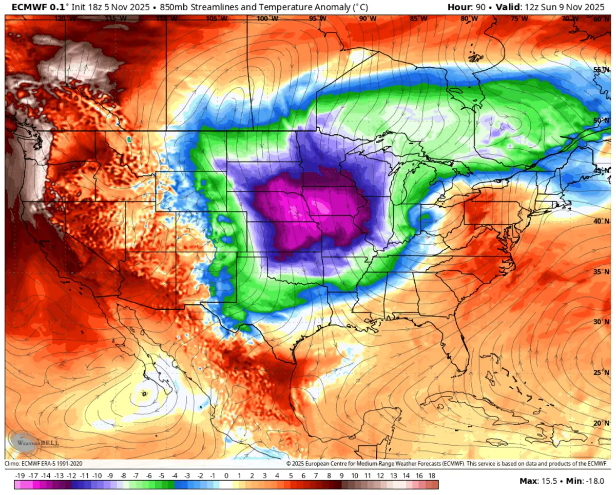
With the deep upper cold wave peaking over the Southeast U.S. on Monday, a powerful surface high-pressure area is taking place across central Canada and the United States. This is a typical yet textbook setup to allow extreme cold weather to be dragged far into the Deep South, reaching Florida as well.
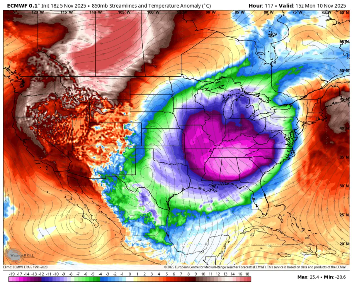
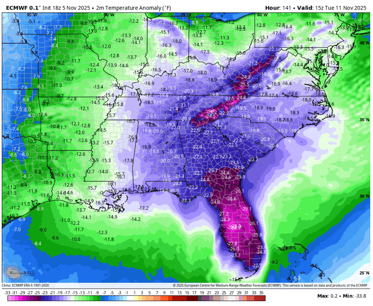
The temperature anomaly in the mid and lower levels will be pretty extreme for November, with more than 20 °C below normal spread across the Southeast U.S. on Monday. This is likely to become a historic event for the region.
Notice how the air mass significantly warms up underneath the strong blocking High on the West and in western Canada, with temperatures 20-25 °C warmer than usual on Monday. This will create an impressive temperature contrast between the Southeast and the Northwest United States.
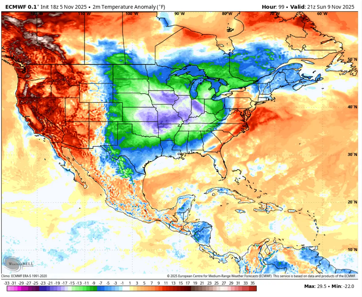
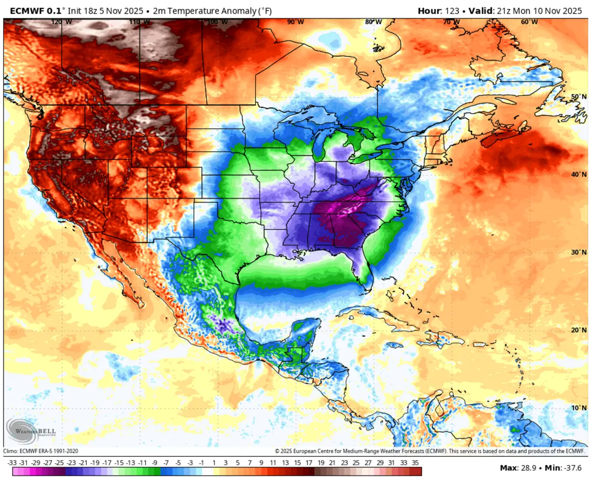
Here is the 2m temperature anomaly on Monday afternoon across southern Canada and the United States. As we see, temperatures will be frigid for most of the central and eastern CONUS on Monday, with generally 10-20 degrees F below normal, with the worst across the Southeast.
The air mass over Alabama, Georgia, Tennessee, and western Carolinas will be 25 to 35 °F below normal. This is an extremely cold anomaly for the area, with a strong freeze expected.
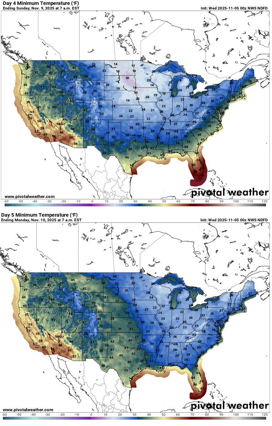
The morning low temperatures across the U.S. are expected to be very low on Sunday and Monday. Sunday will push morning temperatures into the 10s °F across the Upper Midwest and Dakotas, low to mid-20s across the Central Plains and Midwest, as well as over the Great Lakes and the Ohio and Tennessee Valleys. Freezing levels will reach North Texas, Louisiana, and central Alabama on Sunday morning.
On Monday morning, as the upper cold wave moves over the Southeast U.S., the coldest temperatures will spread to the region, including Florida and the East Coast. Temperatures are forecasted to range from the mid-20s to the low 30s from the Midwest to the Great Lakes, Ohio to the Tennessee Valley, the Mid-Atlantic, and northern Florida.
While the cold wave peaks on Monday night before its core shifts east, the windy, chilly day across the Southeast will hold temperatures low during the day. Once the wind vanishes overnight, temperatures will also significantly drop over Florida.
Extreme, historic morning lows are expected on Tuesday, with the air mass being more than 30 °F colder than usual, also during midday.
We will continue to monitor the evolution and update accordingly as the pattern develops over the next two weeks.
Windy, WeatherBell, wxcharts, and Ventusky provided images used in this article.
See also:
A significant Polar Vortex slowdown is forecast, bringing Cold Weather for Winter 2025/2026