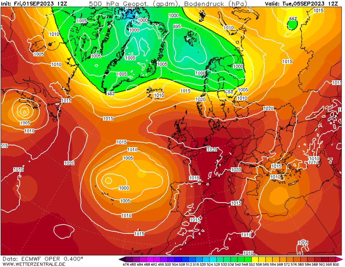
The wintry, abundant-snow era is hitting a sudden, dramatic pause over Europe. After almost a month-long marathon of Atlantic-driven troughs and major flooding across Iberia and the Mediterranean, the European continent is shifting gears into spring-like temperatures.
A powerful Heat Dome is set to expand over the heart of Europe through the final week of February, surpassing seasonal norms and delivering an aggressive “taste of spring” with temperatures into the 20s for many across the continent.
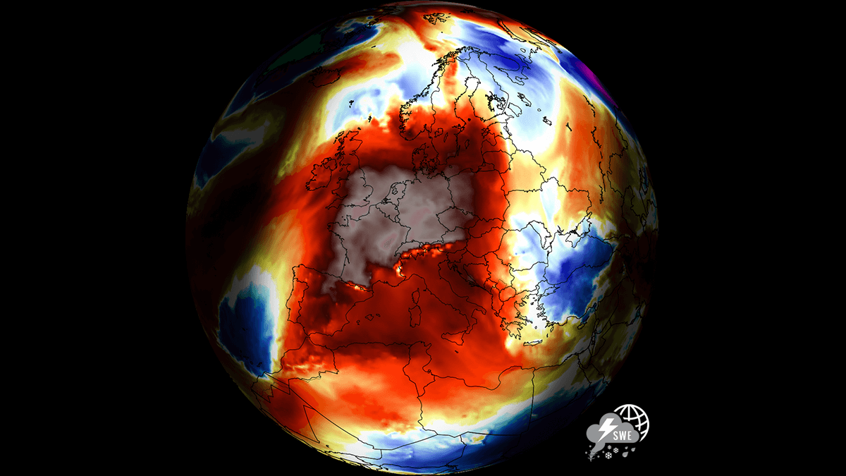
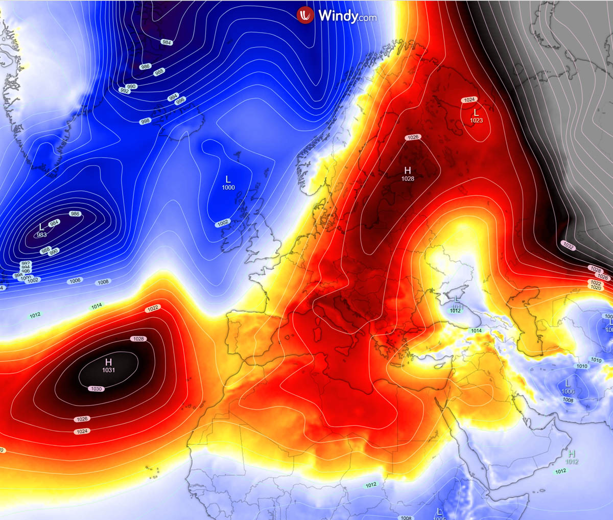
This week, the atmospheric geometry is shifting as high-amplitude ridging develops, driven by a robust blocking high surging north from Iberia and the Mediterranean, effectively shutting down the polar jet’s influence over the continent.
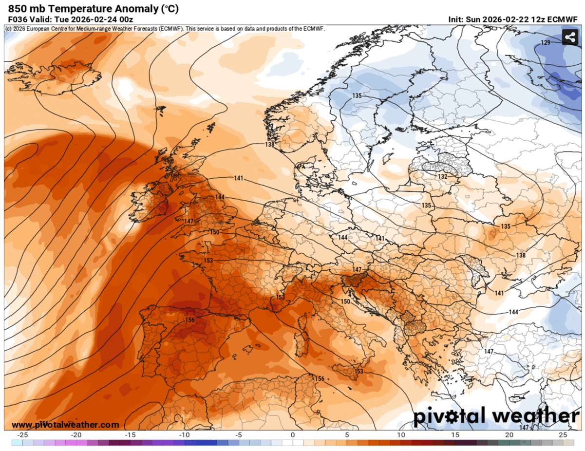
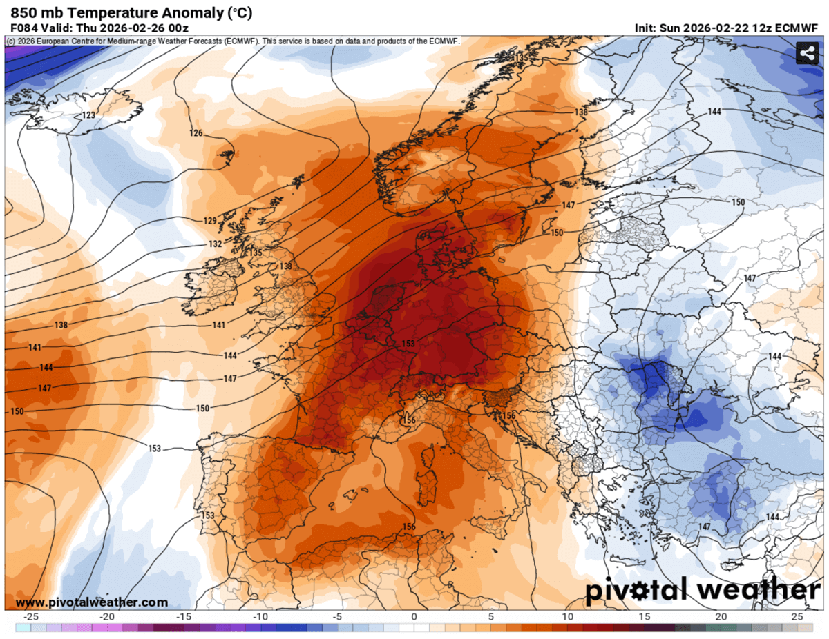
By mid-week, the temperature contrast will be strong across central and western Europe with anomalies that could push 12–15 °C above the long-term average. The core of the warmth will first spread from Spain and Portugal into France, Germany, and the Benelux region, with temperatures soaring into the low-to-mid 20s.
Much higher temperatures are also expected across the Alpine region, including areas where recent snow was accumulating, particularly at higher elevations. This will lead to significantly accelerated snowmelt and potential flooding.
The warmth will gradually increase and spread across central Europe into eastern Europe and the Balkans after mid-week, bringing unseasonable mildness to Italy and the Balkan Peninsula.
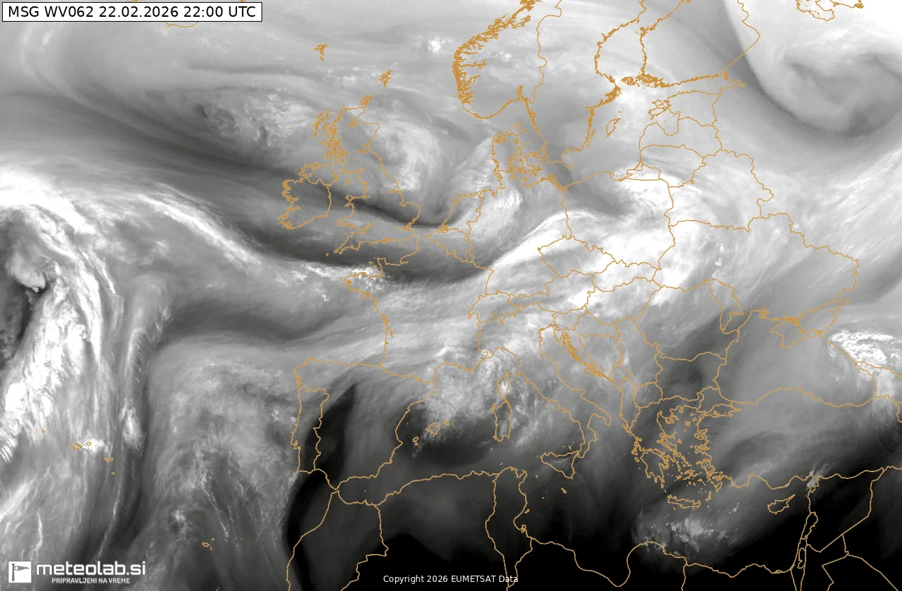
The Sunday’s water vapor imagery hints that the North Atlantic remains active, with troughs, but a large upper ridge is pushing northwards from the Mediterranean and Iberia.
This ridge is forecasted to peak in intensity between Wednesday and Friday, creating a persistent warm airmass until the end of the month.
However, the pattern will remain active, and the mid to long-range trends hint at a potential breakdown not far ahead. Later in the week, a deep North Atlantic trough is already gathering strength, waiting to challenge the dome’s dominance as March approaches.
What is a Heat Dome?
When significant and historic record-breaking warmth events or heatwaves occurred in Europe, the United States, and Canada in the past, the Heat Dome was a contributing factor. The heat dome is usually the dominant feature of summer weather patterns on both continents. But it can happen in winter months as well.
We refer to this phenomenon as a heat dome when extremely high temperatures develop. Here’s how it works and why understanding it on a broader scale is essential.
The upper-level ridge pattern, or a very warm air mass at higher altitudes, also known as the Upper High (or blocking High), often forms a heat dome. This weather pattern brings high, and sometimes record-breaking, temperatures to the region below.
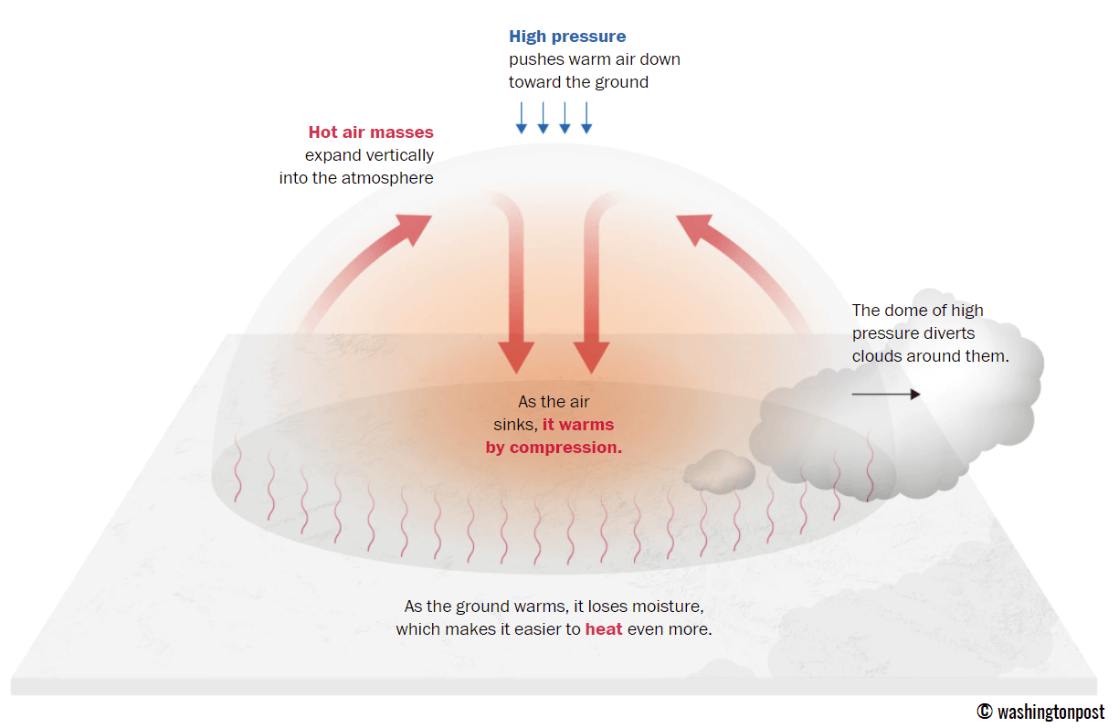
This term is used when a broad area of high-pressure air parks over a large portion of the continent. If the event is remarkably stable and extreme, it usually lasts several days or weeks.
The heat dome works like a lid on a pot. The extensive dome traps warm air at all levels underneath, with layers sinking toward the ground. Therefore, the air mass becomes anomalously warm at the lowest elevations and extremely hot near the surface.
How does a heat dome impact the life underneath?
Excessive heat in heat domes can significantly impact human health and be dangerous to particularly vulnerable populations, such as elderly individuals, children, and those with pre-existing health conditions that can be worsened by extreme heat.
Due to prolonged exposure to high temperatures, construction workers, farmers, and other outdoor workers who work long hours are at increased risk of heat-related illnesses. People living in poverty are also more susceptible to the fatalities of heat domes, as their houses are often built with heat-trapping surfaces such as concrete and asbestos.
Heat exhaustion occurs upon exposure to high temperatures for extended periods. It leads to dehydration, dizziness, and, in more severe cases, heat exhaustion can progress to heat stroke.
High relative humidity during a heatwave can also significantly affect the body. For this reason, we use a Heat Index to represent the natural feel of scorching hot temperatures and high humidity. It illustrates the natural relationship between temperature and humidity.
Strong upper High expands, develops an Omega Block, and the Heat Dome
Starting Monday, a deep trough over the Atlantic allows the ridge from Iberia and the Mediterranean to expand northward, reaching France, Benelux, and the British Isles by Tuesday. The troughing in the east finally decays, allowing the ridge to grow further.
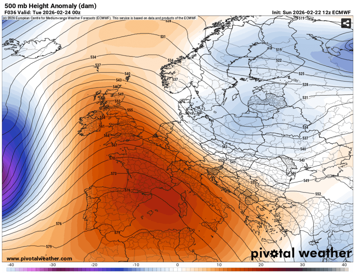
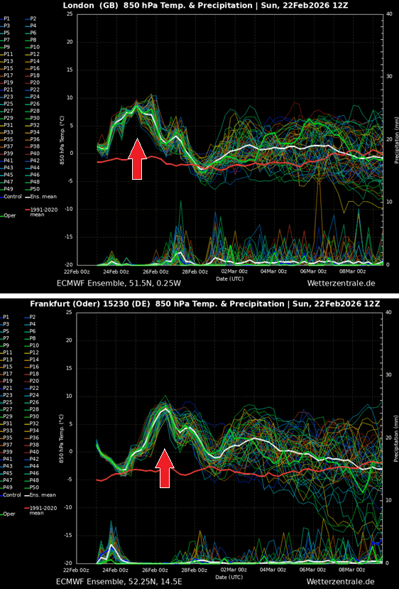
So the temperature increased quite significantly during the early days of the final week of February, reaching 6-10 °C above normal in western and southwestern Europe and the Mediterranean.
It also begins to warm up over Central Europe and the Alpine region on Tuesday.
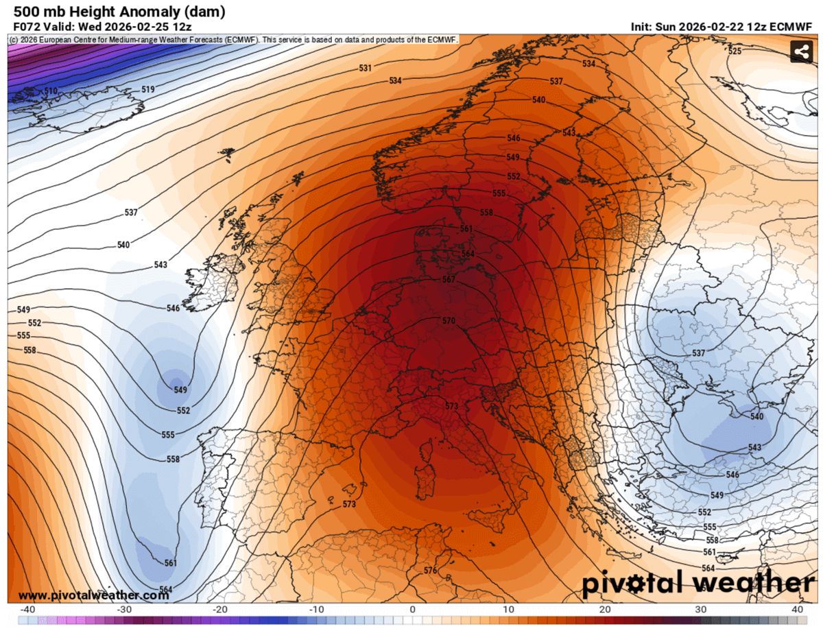
Through mid-week, the upper ridge expands further north and east, establishing a textbook Omega blocking pattern. With two lows on each side, over the Bay of Biscay and Portugal, and a deeper wave over the Black Sea and Turkey.
The ridge therefore dominates most of the continent as midweek arrives, with higher-than-normal geopotential heights from the Mediterranean across Central to Northern Europe.
The surface pressure also responds to the building upper ridge, covering much of the continent with high-than-normal pressure through most of the working week.
A strong Azoric High is a sign that the Atlantic remains active further north, but at least holds the areas further south in a more stable environment than it was during the recent marathon race of troughs day by day from the west.
So the heat home fully develops by Wednesday, pushing temperatures into the 12-15 °C range in the lowest levels of the atmosphere.
The strongest temperature anomalies will be over France, Benelux, Germany, Central Europe, and across Denmark into southern Sweden and Norway through mid-week.
Late week, as new troughs may become more active over the Atlantic, the zonal push will make the upper ridge more elongated, expanding into Eastern Europe and Scandinavia, reaching northwestern Russia as well.
This will send temperatures much higher across the rest of Scandinavia, including Lapland. It will be significantly warmer than recently over Poland, the Baltic region, and Belarus.
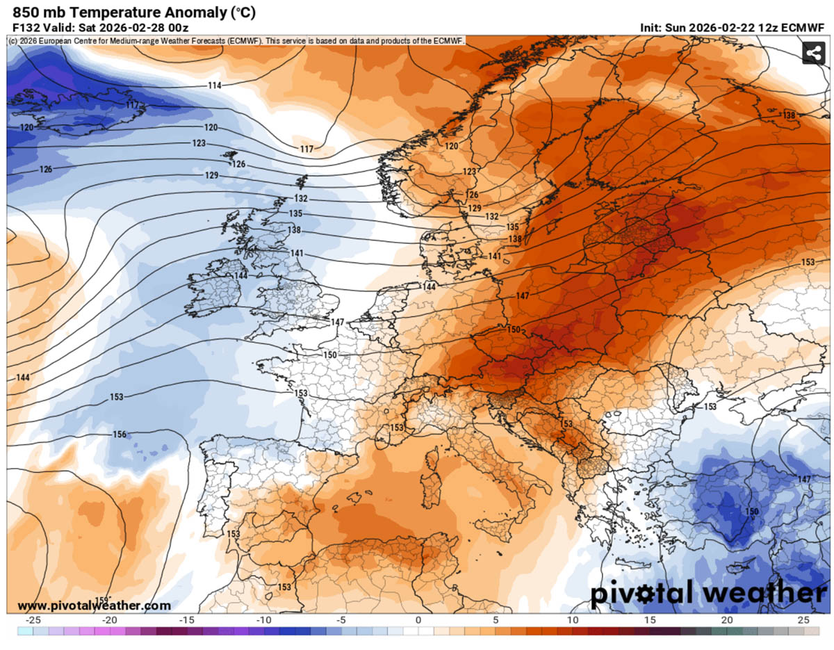
So, looking at the 2m temperature anomalies from Wednesday through Friday, the warmth will be most significant across Western and Central Europe.
Temperatures will be 12-16 °C above the long-term average in the lowlands for the end of February.
To conclude, the final week of February will deliver a proper taste of spring for a large part of Europe.
A taste of Spring with low 20s in parts of the continent
Let’s take a closer look at the highest temperatures across parts of Europe this week.
France, Spain, and Portugal
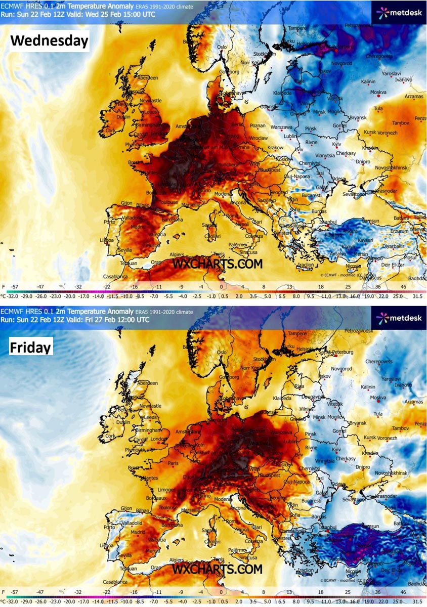
The temperature will warm up into the low 20s across most of France by mid-week.
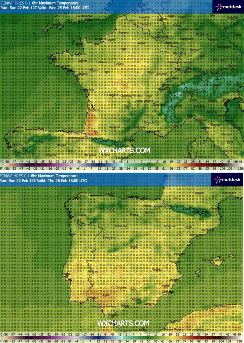
While temperatures over southern Iberia will reach into the mid-20s, with peak daytime temperatures higher from 23-25 °C across southern Spain.
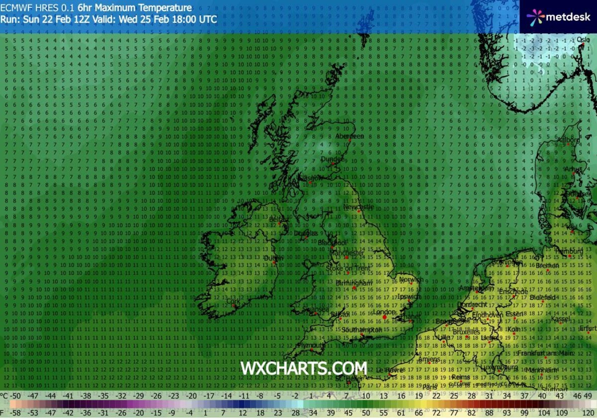
Ireland, the UK, and Benelux
Temperatures will also become much warmer over the rest of western Europe, with daily highs from 15 to 18 °C across southern and central England. 12-15 °C over Ireland as well. Up to the lower 10s over the northern UK.
Benelux will also experience a taste of spring-like weather, with temperatures reaching the upper 10s to near 20s from northeast France across Belgium and the Netherlands to western Germany.
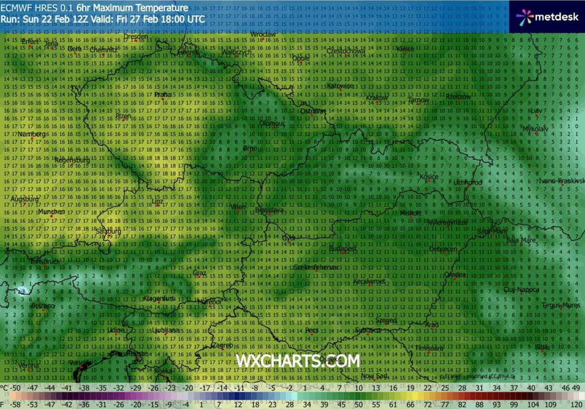
Central Europe, Germany, and the northern Balkans
A significantly warmer air mass will also overspread central Europe and the Balkans from mid-week into the late week period. Germany, the Czech Republic, Austria, Slovenia, and Croatia will push into the 14-18 °C range in many lowlands.
**Note: Snowmelt will be significant in the Alpine region!
It will be a bit warmer also over Slovakia, Hungary, Poland, and the areas further south across the Balkans during the second half of the week. At least mid-10s are forecast for many areas, possibly reaching near-20s in some.
The mid-term trends suggest a more dynamic weather may return as March starts, so we will keep monitoring and update the outlooks as the pattern evolves. Stay tuned for further updates.
Windy, PivotalWeather, and Wxcharts provided images used in this article.
See also:
Spring 2026 Europe Forecast: The La Niña Collapse Signal in the Seasonal Weather Patterns