After a progressive weather pattern through the first half of September, the European continent is taking a short break. A strong Heat Dome will develop the following weekend, significantly warming up the forecast, with low to mid-30s back into France, Germany, Italy, and the Balkans. Trends also hint that a new cold intrusion will emerge into western Europe by Sunday.
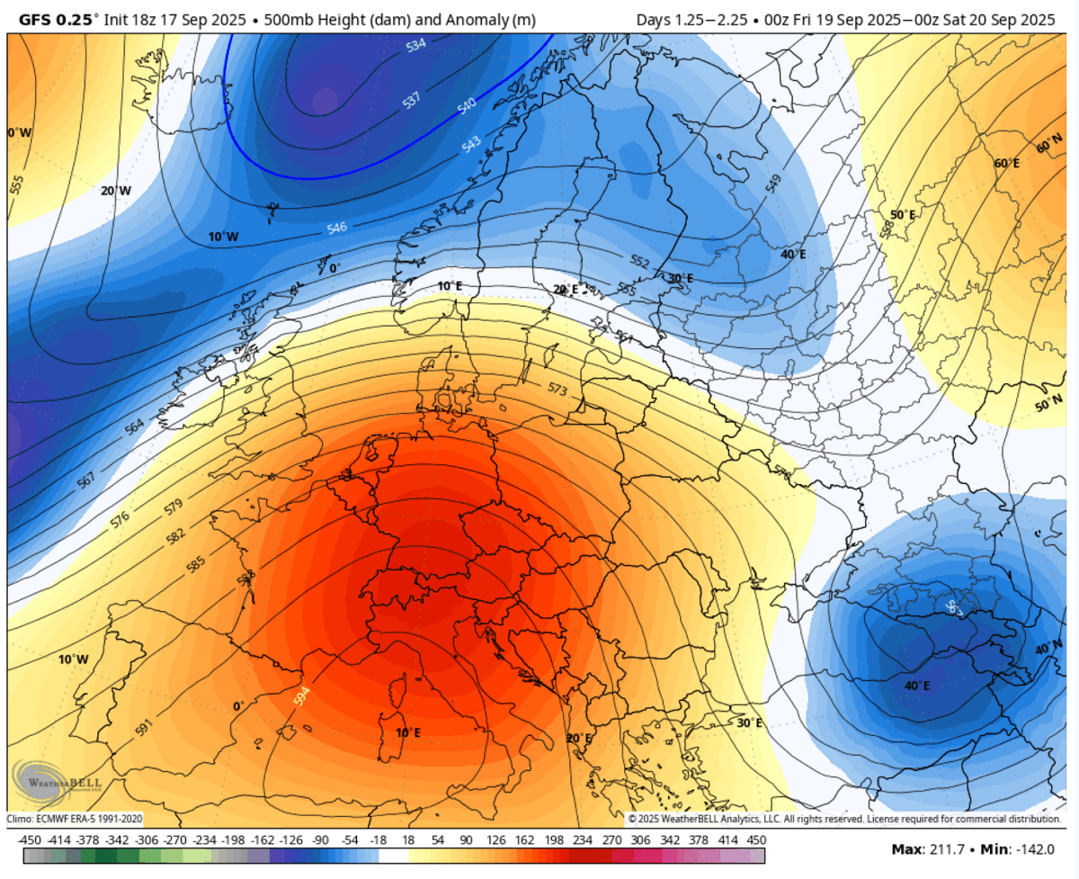
Over the next few days, central parts of the European continent will experience a nearly 15 °C warmer period. A short but intense warm wave is developing under the Heat Dome and blocking high aloft.
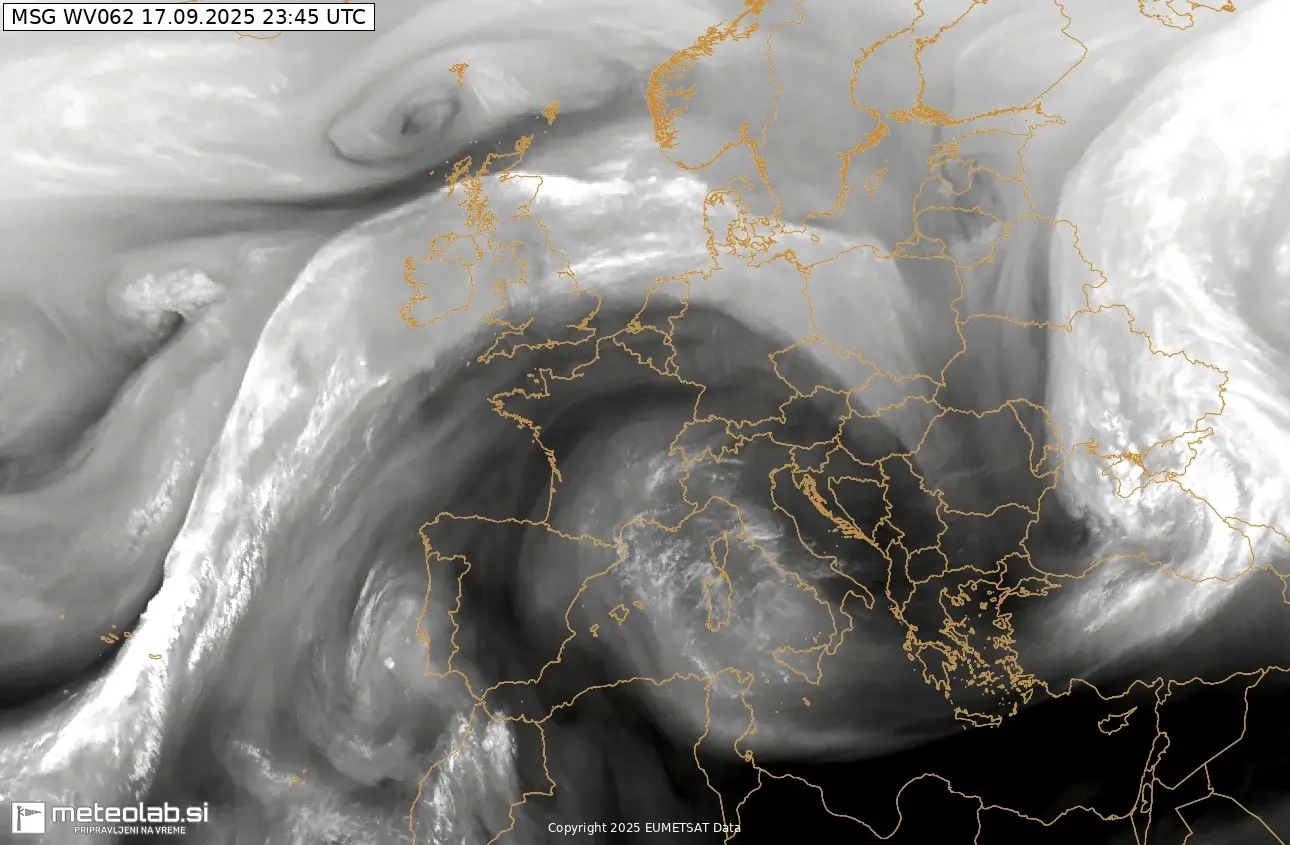
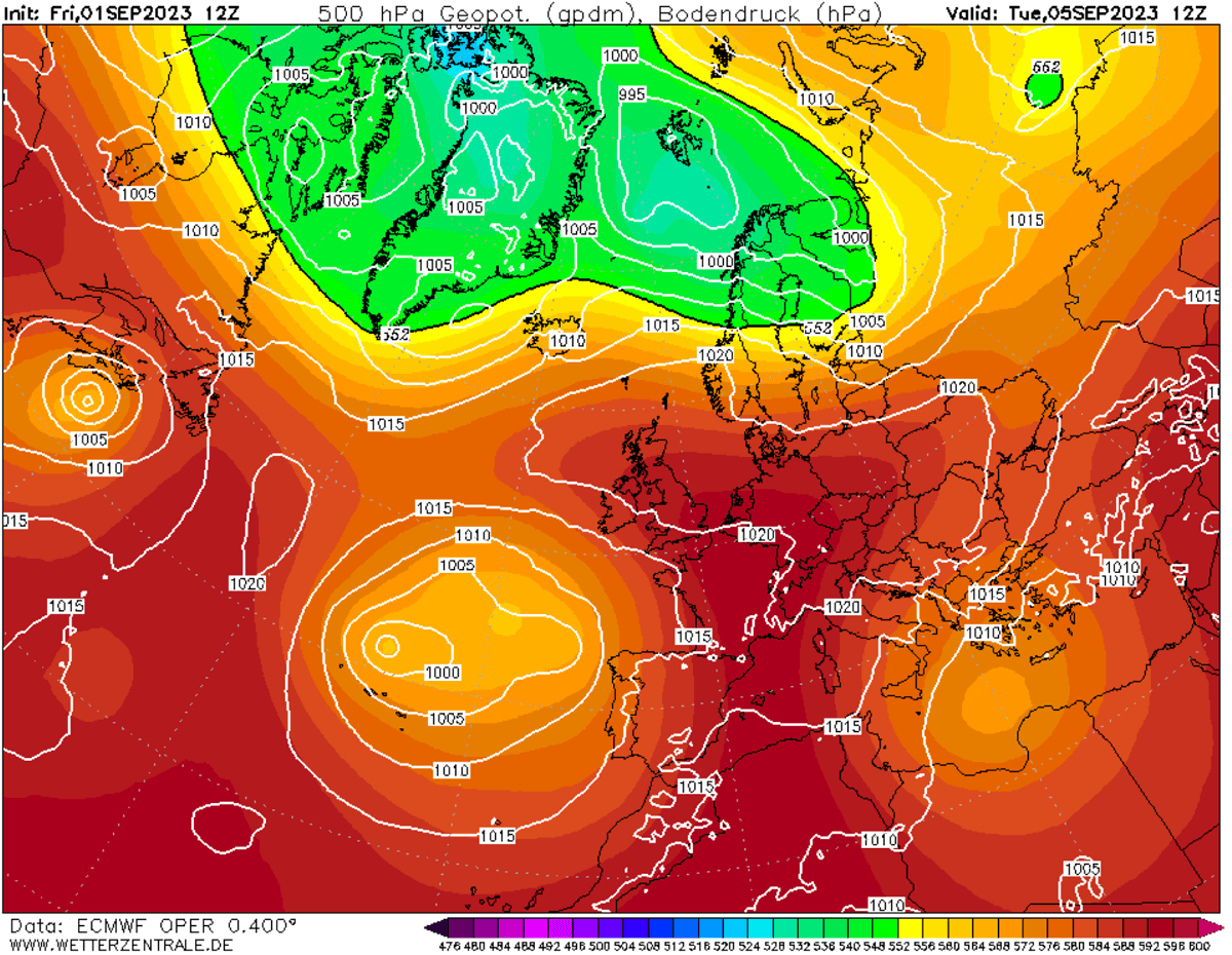
The changing pattern over Europe is already seen on the water vapor satellite, which reveals still active troughs over the North Atlantic while an upper ridge is building over from the Mediterranean northwards.
It will continue expanding and strengthening through Saturday when it peaks over central Europe.
Here’s a brief overview of the pattern development for the following weekend. An extensive ridge dominates a large part of the continent, rapidly strengthening the warm wave underneath.
While the heat will not be scorching hot, daytime temperatures over Iberia will push into the upper 30s, followed by mid-30s over France and Italy and low-30s over Germany, Poland, and the Balkans.
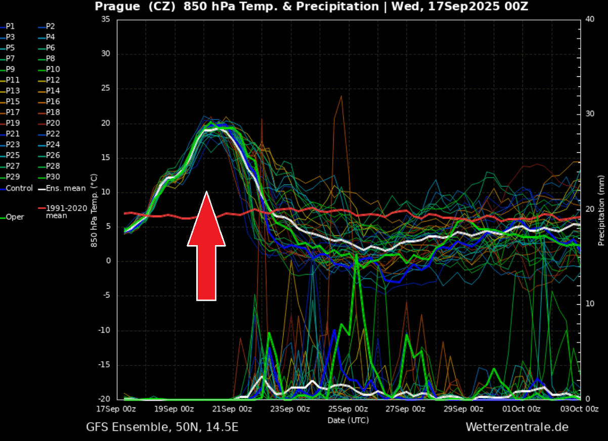
This meteogram chart for Prague, Czech Republic, best represents how a significant temperature anomaly develops. From the currently slightly colder-than-normal temperatures, it boosts up to nearly 15 °C above normal in just two days.
The heatwave peaks on Saturday over central Europe, then a good refreshment follows. So, it will be a short breath of the upcoming warm wave, but pretty intense.
Again, the heatwave typically results from the development of the heat dome feature aloft. Let’s examine this large-scale feature and why understanding its behavior is essential.
What is a Heat Dome?
When significant and historic record-breaking heatwaves occurred in Europe, the United States, and Canada in the past, the Heat Dome was a contributing factor. The heat dome is usually the dominant feature of summer weather patterns on both continents.
We refer to this phenomenon as a heat dome when extremely high temperatures develop. Here’s how it works and why understanding it on a broader scale is essential.
The upper-level ridge pattern, or very warm air mass in the higher altitudes, also known as the Upper High (or blocking High), usually forms the heat dome. This weather pattern brings high and sometimes record-breaking temperatures to the region underneath.
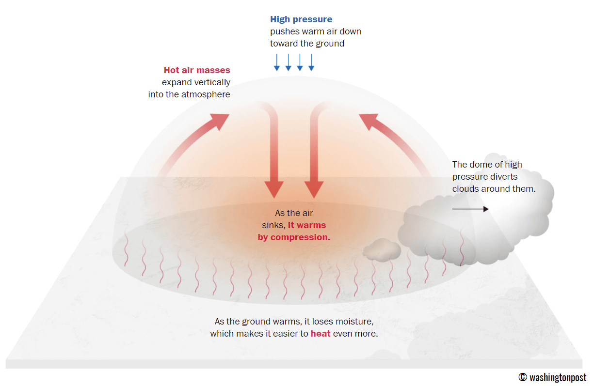
This term is used when a broad area of high-pressure air parks over a large portion of the continent. If the event is remarkably stable and extreme, it usually lasts several days or weeks.
The heat dome works like a lid on a pot. The extensive dome traps warm air at all levels underneath, with layers sinking toward the ground. Therefore, the air mass becomes anomalously warm at the lowest elevations and extremely hot near the surface.
How does a heat dome impact the life underneath?
Excessive heat in heat domes can significantly impact human health and be dangerous to particularly vulnerable populations, such as elderly individuals, children, and those with pre-existing health conditions that can be worsened by extreme heat.
Due to prolonged exposure to high temperatures, construction workers, farmers, and agricultural workers who work outdoors for long hours are at increased risk of heat-related illnesses. People living in poverty are also more susceptible to the fatalities of heat domes, as their houses are often built with heat-trapping surfaces such as concrete and asbestos.
Heat exhaustion occurs upon exposure to high temperatures for extended periods. It leads to dehydration, dizziness, and, in more severe cases, heat exhaustion can progress to heat stroke.
High relative humidity during a heatwave can also significantly affect the body. For this reason, we use a Heat Index to represent the natural feel of scorching hot temperatures and high humidity. It illustrates the natural relationship between temperature and humidity.
Intense blocking high expands over the continent, developing a Heat Dome
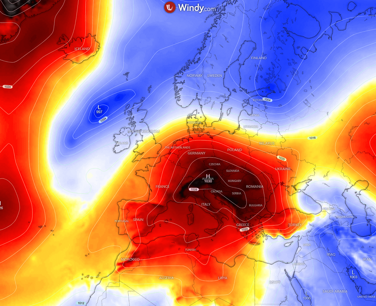
The general weather pattern developing over Europe indicates a strong blocking High expanding from northwest Africa into Iberia and the Mediterranean, spreading north and dominating a large part of the continent in the coming days.
Meanwhile, a deep low emerges into the Black Sea and Turkey, with more lows remaining over the North Atlantic.
With rising geopotential heights, surface pressure will also increase over the following days, with a high-pressure system parked over the Mediterranean and central Europe until Sunday.
With time, the system expanded north and east while the pressure remained above 1030 mbar.
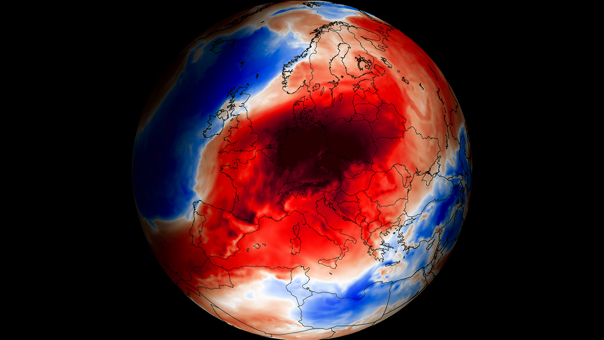
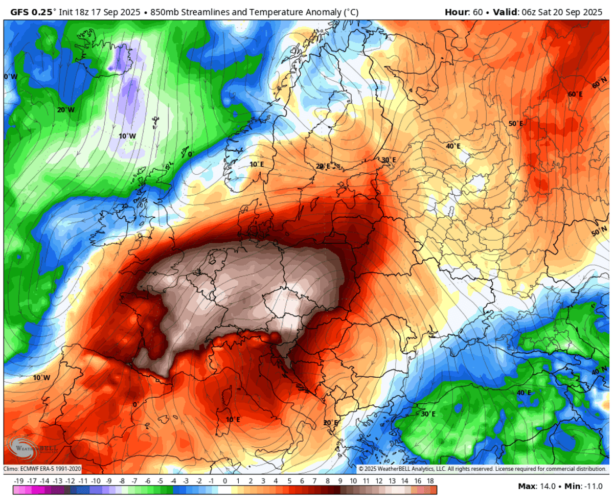
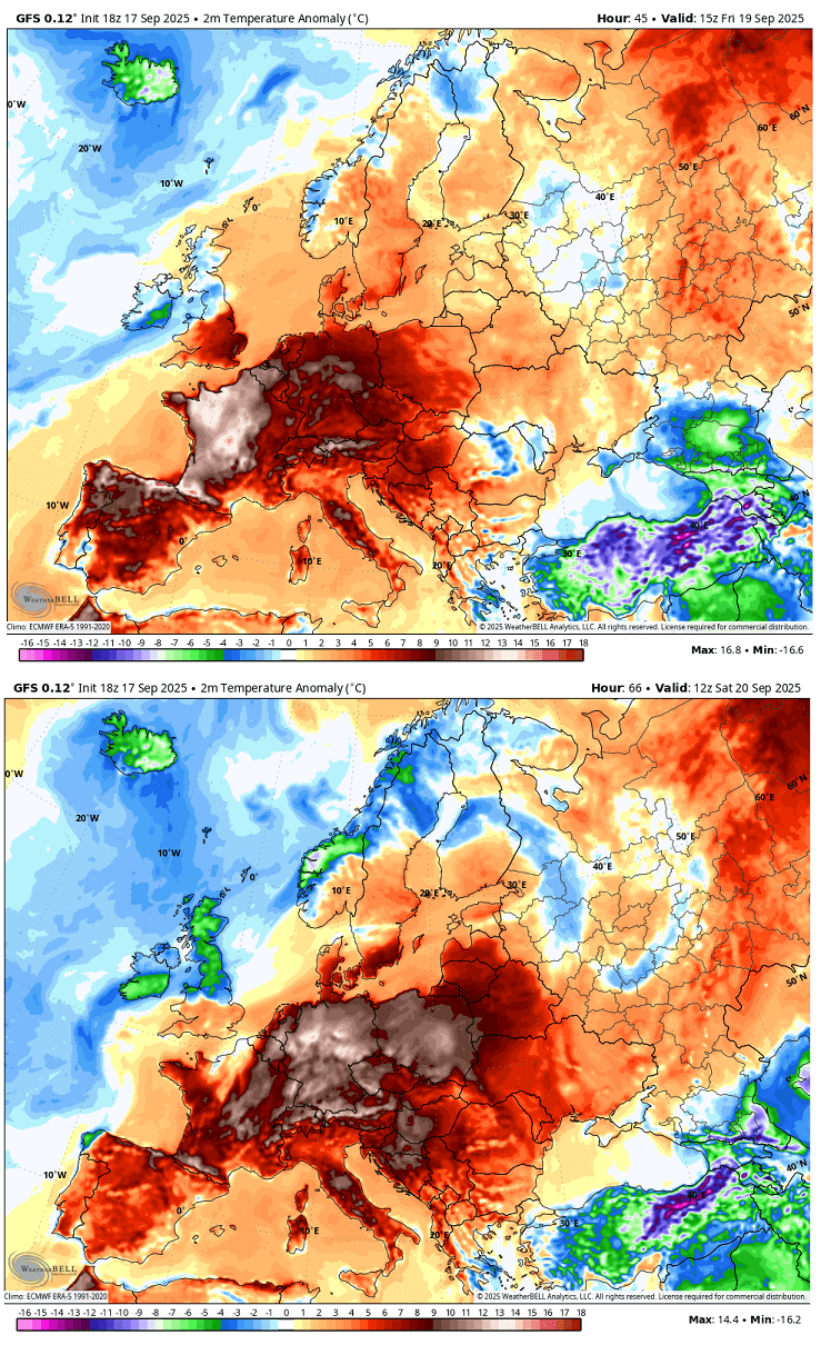
Underneath the heat dome, warm plume intensify the heatwave, and temperatures climb much higher, making the air mass 12-15 °C warmer than usual for central Europe.
Around two-thirds of Europe will experience significantly warmer weather in the coming days. Apart from Scandinavia, part of western Europe, and Turkey, temperatures will be unusually warm for late September.
Based on the 2m temperature forecast charts, Friday and Saturday will be the most anomalous. Thursday and Friday bring the highest temperatures for Spain, Portugal, France, the Mediterranean, and Benelux into England.
Saturday expands the heat further east, making September in Germany, Poland, central Europe, and the Balkans an unusually hot day.
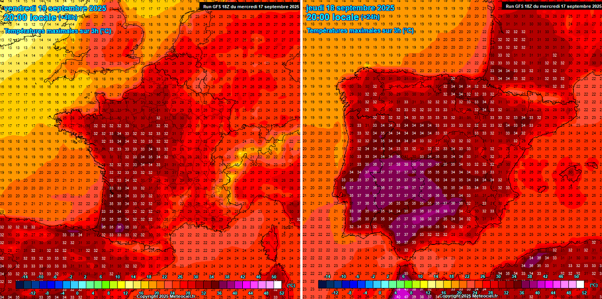
With the heat dome strengthening today, the hottest air mass will spread over Portugal and Spain in the afternoon, reaching 35 to 39 °C in many areas. Some locations may approach the 40s mark.
France follows with its hottest day on Friday, reaching 34-37 °C across its southwestern parts in the peak afternoon hours. Friday also brought mid-30s temperatures into central France.
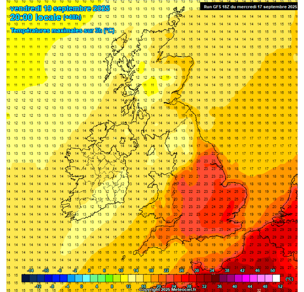
A warm wave also reaches the UK; however, it does not spread much west due to deep lows over the Atlantic, delivering maritime air mass into Ireland and Scotland.
Southern UK warms up significantly on Friday, bringing afternoon temperatures into the 24 to 26 °C. This is pretty warm for late September, nonetheless.
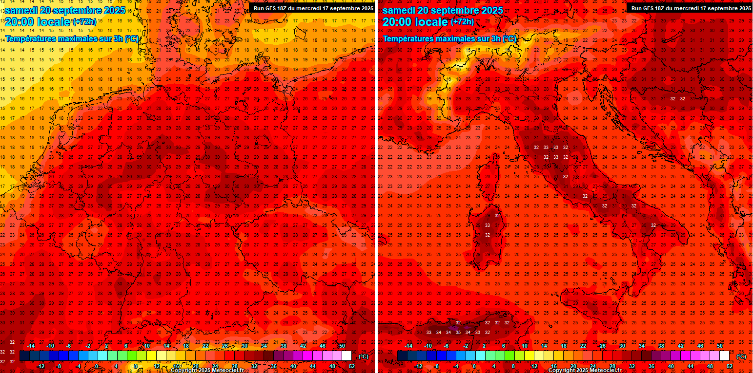
The peak of the blocking ridge and heat dome was on Saturday over central Europe, and over the weekend, the hottest air mass reached Germany, Italy, and the Balkans.
The highest temperatures will reach the low 30s in most of Germany, the upper 20s over the Czech Republic and Poland, and the low to mid-30s over Italy and the north-central Balkans.
Temperatures gradually become lower on Sunday into Monday as the upper ridge finally collapses and moves east.
Heat Dome moves east by Sunday, a potential substantial cold intrusion follows into Western Europe
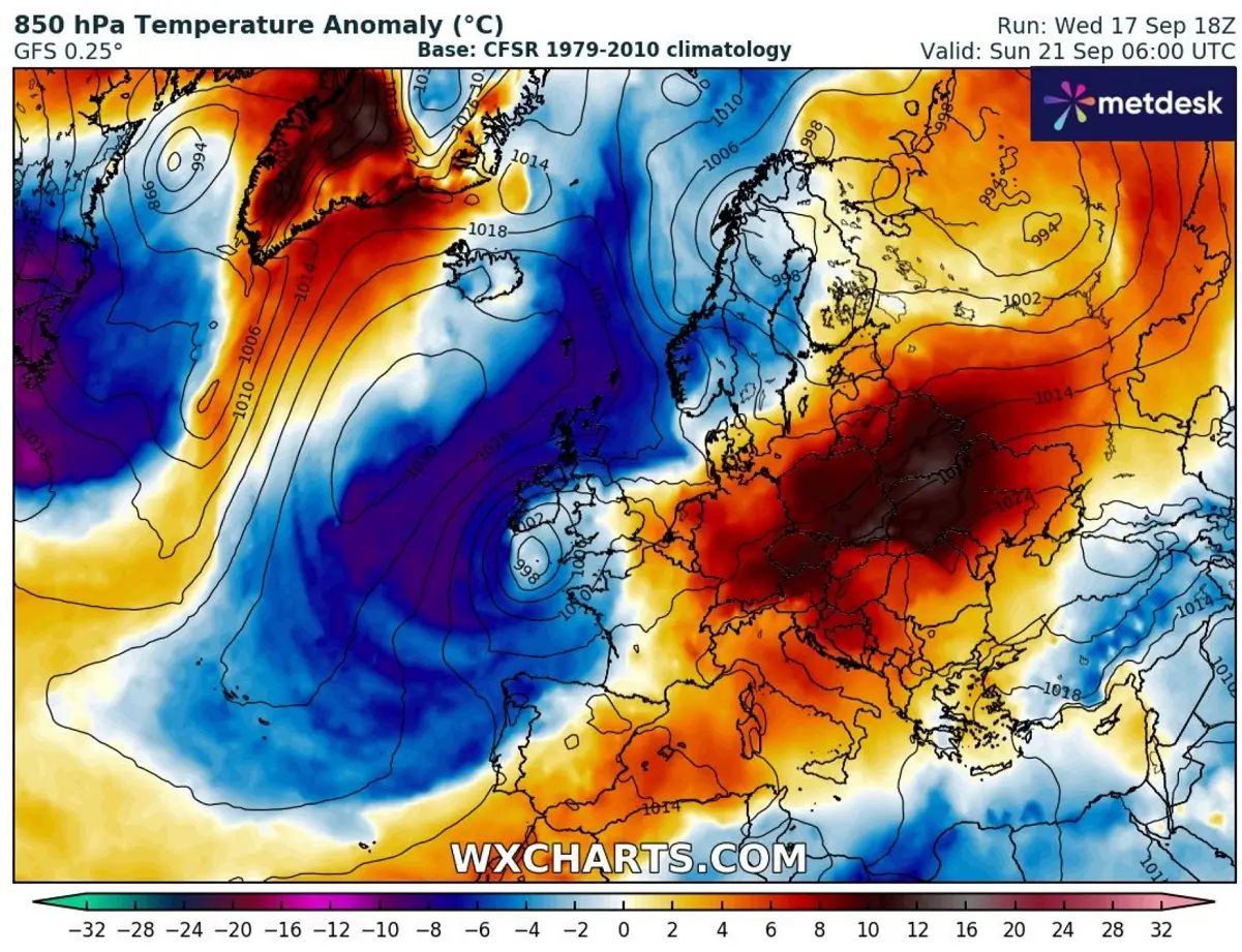
The global mid-range weather models hint that a cold air mass intrusion could blast into western Europe on Sunday due to a temporal ridge developing over the far North Atlantic and Iceland.
This typically means the air flow turns meridional, pushing air masses from north to south. Below is Sunday’s GFS model trend map, which indicates a robust temperature anomaly that overspreads Western Europe towards the Azores.
We are closely monitoring the evolution of the patterns and will adjust the forecasts and updates in the coming days. We will discuss this potential cold wave for Western Europe in one of the articles tomorrow.
Windy, Wxcharts, and WeatherBell provided images used in this article.
See also:
Ireland and the UK were hit by an intense North Atlantic storm on Sunday