The North Atlantic is turning into an active pattern with dynamics returning, sending deep waves with unsettled conditions towards the European continent as October ends and we head into the final month of autumn season 2025. Warmer-than-normal seas around Europe will help fuel frontal systems with higher moisture and more rain.
A typical autumn season pattern is shaping up over the North Atlantic and the western half of Europe. Large and deep upper troughs develop on the west, sending vast amounts of moisture and warmth onto the continent. This will establish a long unsettled weather with rainy periods and increasing flooding potential as we head into early November.
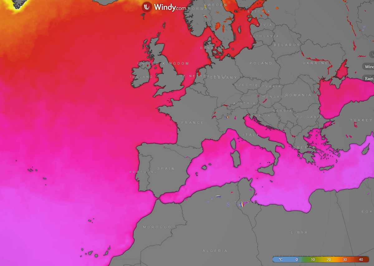
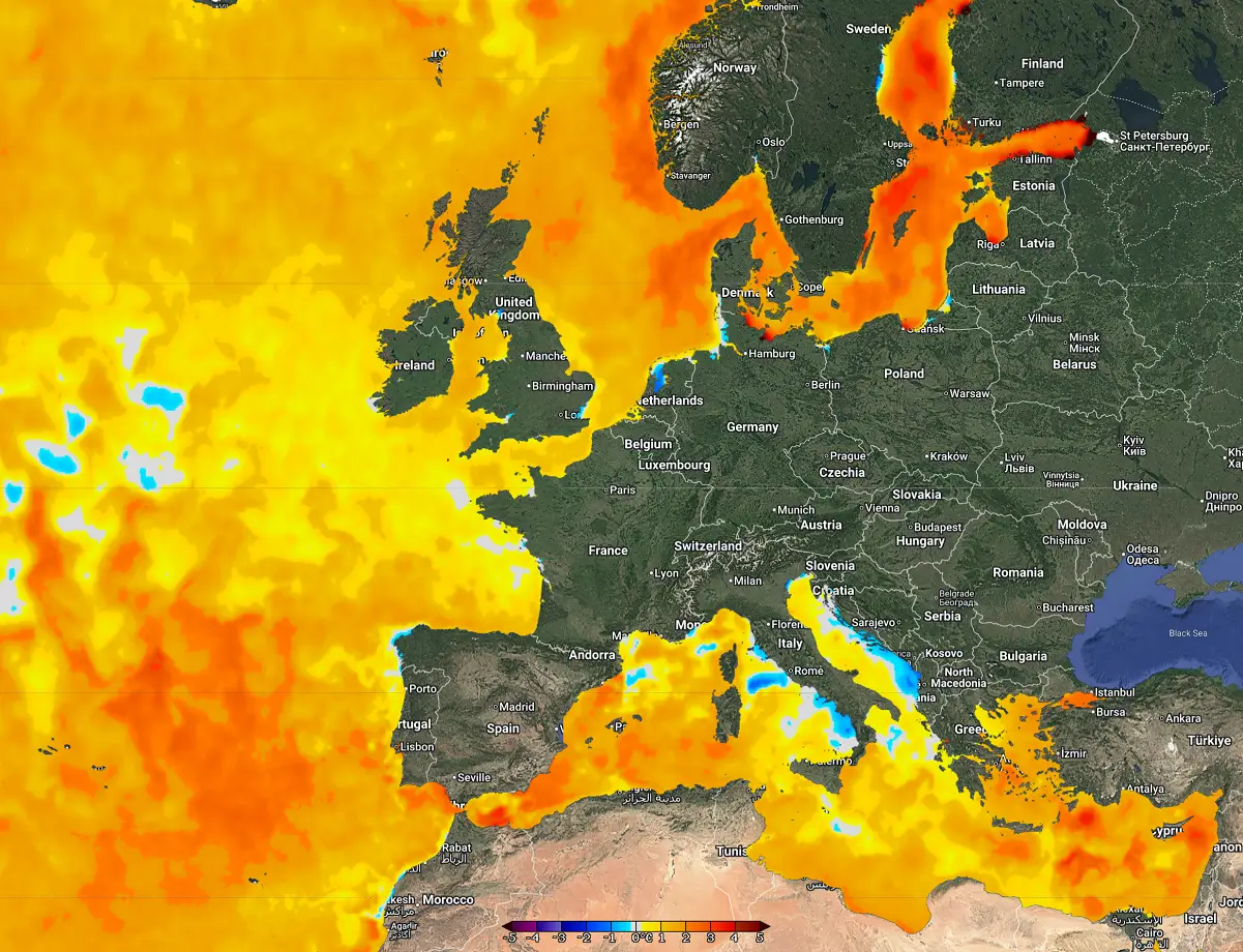
While the persistent and strong zonal flow from the Atlantic into Europe typically brings warmer weather, the much-above-normal sea temperatures will also contribute to higher moisture on the continent. Most of the seas around Europe and across the western Mediterranean are strikingly warmer than usual for the end of October.
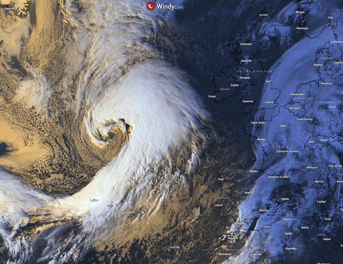
Today, large waves are seen over the Atlantic and Europe, with one general wave over the continent and a much more pronounced one further west. A deep wave is emerging into the North Atlantic, fueled by cold intrusion from Greenland.
The following visible satellite image reveals this large and deep wave, which is forming a rapidly developing surface cyclone, gradually approaching western Europe.
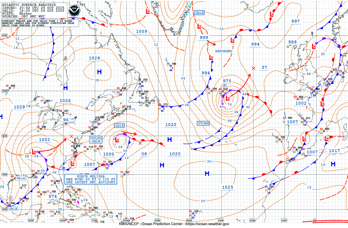
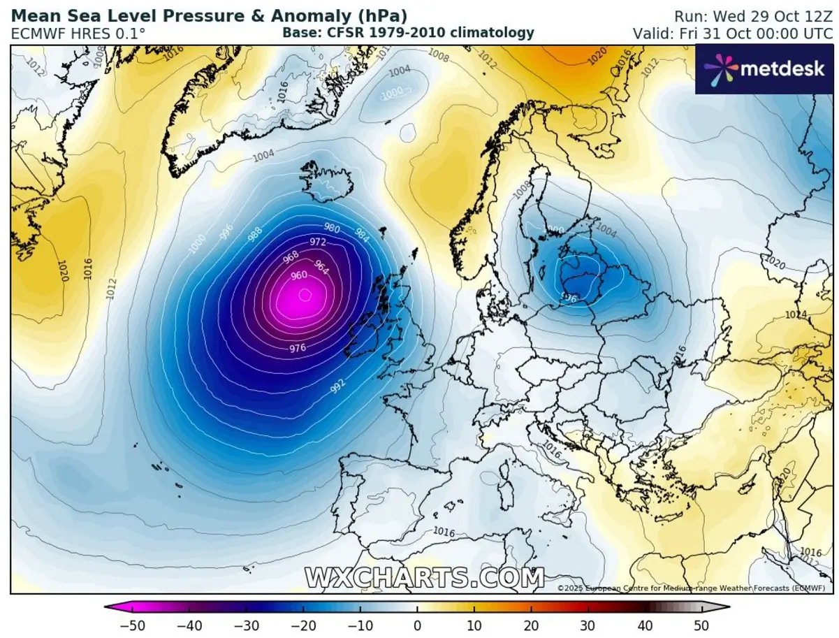
The current Atlantic Ocean surface analysis has this low around 975 mbar in its center, expected to deeping into the mid-950s by Thursday afternoon.
As the pressure deepens for more than 24 mbars in 24 hours, it is characterized as a bomb cyclone or bombogenesis, a mid-latitude storm with rapidly falling central pressure as it develops.
Notice a gradually decaying hurricane, Melissa, further west over the Bahamas, which devastated Jamaica on Tuesday.
Before we dig deeper into the pattern evolution through early November, let’s examine the animation of the patterns strengthening over the North Atlantic.
First, we see the ongoing waves with water vapor and airmass satellite scans, followed by the 500 mbar pattern waves over the next 7 days.
So, October ends with deep waves returning to Western Europe, continuing into early November. Persistent southwest flow also brings back the warmth across much of the continent.
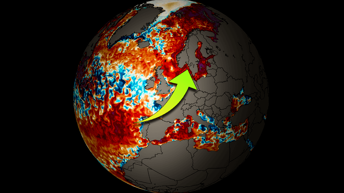
Sea surface waters around Europe are much above normal temperatures this autumn
Due to the hot summer months and the general warming trends of global sea waters, the seas around Europe remain much warmer than usual for mid-autumn again this year.
If we look at the temperatures, they are indeed much cooler in the north than in the south, but the anomalies are striking. 22-23 °C water temperatures are observed across the west-central Mediterranean and west of Iberia towards the Azores, low to mid-10s around western Europe, and across the North Sea and the Baltic Sea.
Looking at the anomalies compared to the long-term average, we see that sea water temperatures remain much warmer than usual, especially across the western Mediterranean and Iberia.
Another concerning area with unusually high water temperatures is around Scandinavia, and especially over the Baltic region. These high water temperatures will fuel winter frontal systems and storms later this year and could lead to more abundant snow or rain events.
The higher sea surface temperature anomaly leads to an increased latent heat flux. In other words, warmer Mediterranean or eastern Atlantic waters bring more moisture into the boundary layer, enhancing low-level instability and creating a more buoyant marine boundary layer.
Therefore, we get more moisture-rich air mass available for cyclogenesis. This is also why the Atlantic wave will become so intense this week, as the warm seas provide more fuel for the cyclogenesis forming underneath the cold wave arriving from the north.
The moisture advection from these warm sea pools feeds the frontal zones that move eastward from the Atlantic into Europe. The air mass is more “juicy,” containing more moisture for rain events and increasing flooding potential with each frontal system.
To conclude, with much warmer-than-normal sea temperatures, we expect heavy rainfall, flash floods, and more organized and deeper frontal systems that can support convective lines with embedded thunderstorms on cold fronts.
Major North Atlantic wave develops, prompting dynamic weather in the western half of Europe
A look over the general weather pattern over the North Atlantic and Europe reveals a deep wave establishing on the west, pushing frontal systems towards the east. Ahead of these systems, a warmer air mass will overspread the continent.
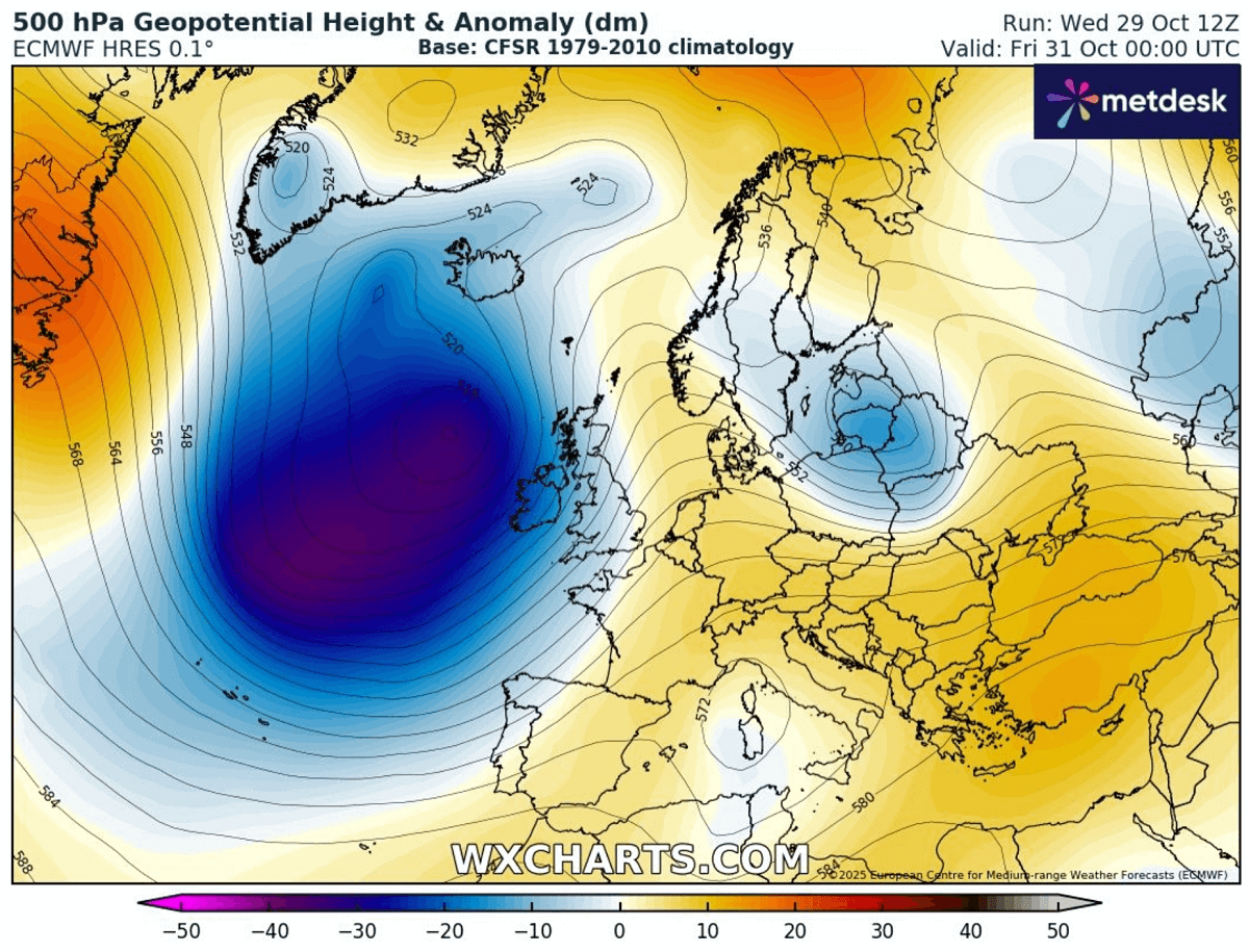
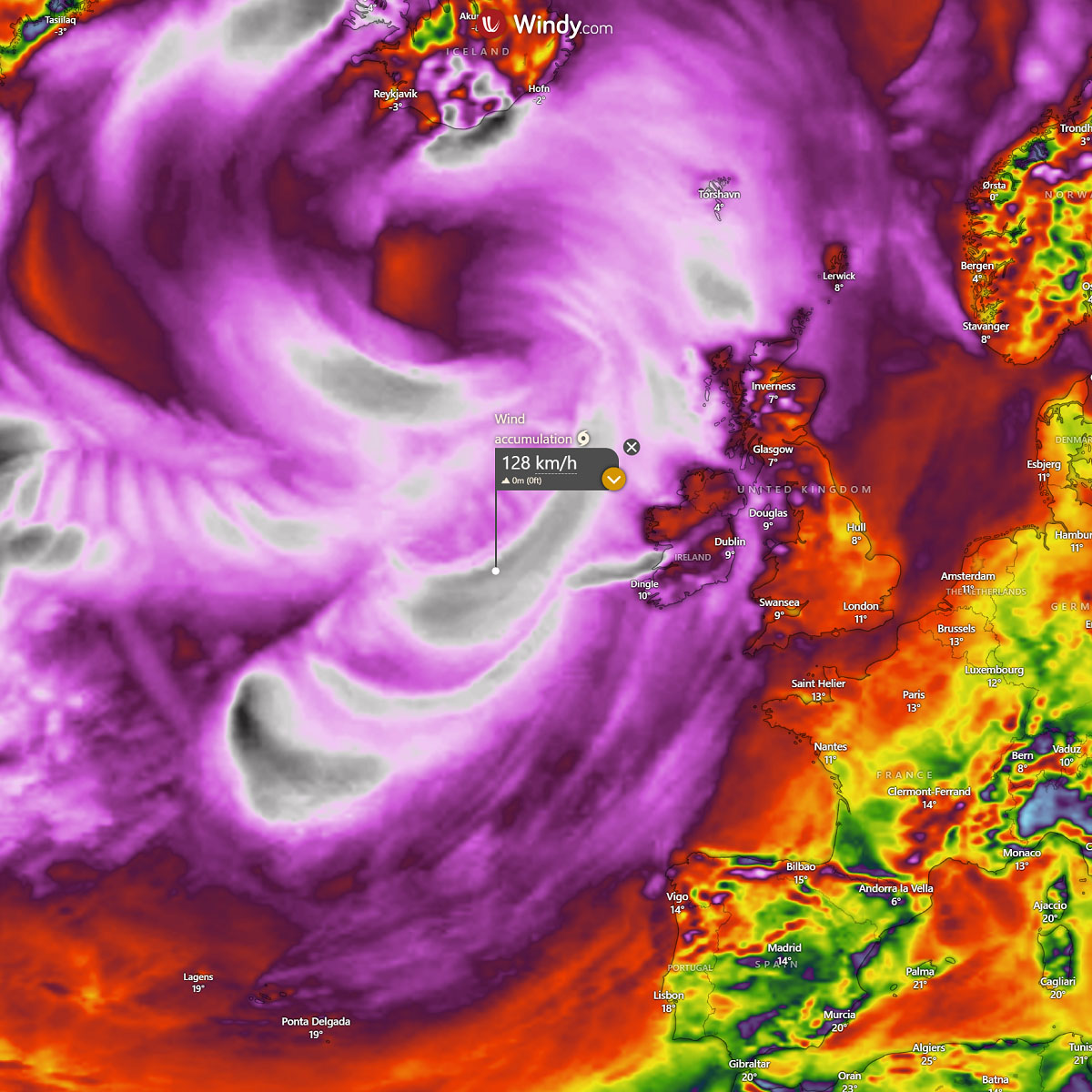
The first system we discussed is already over the Atlantic, with a rapidly developing surface low. It will peak Thursday night into Friday as it nears Western Europe.
On Friday, the central pressure will deepen into the low to mid-950s, located west of Ireland and Scotland.
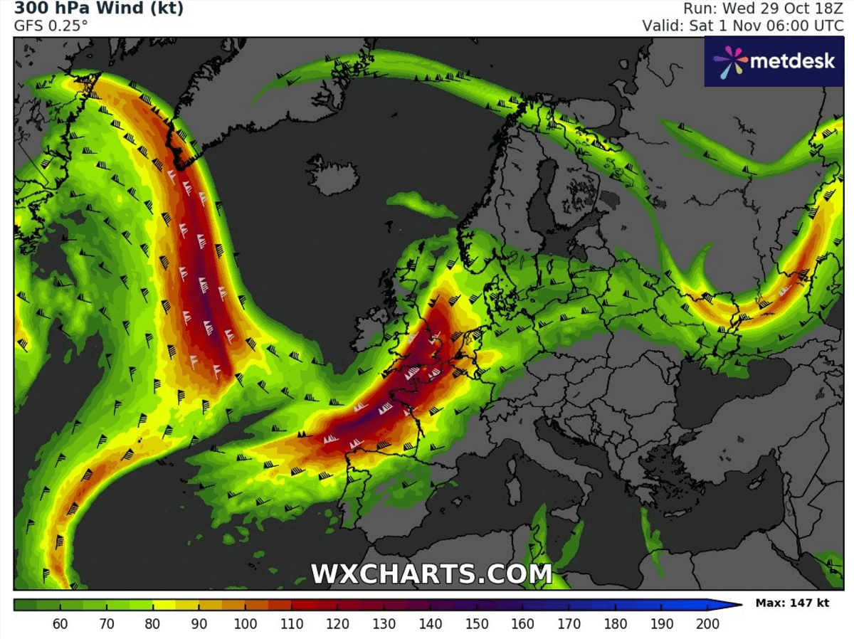
The pronounced pressure and temperature difference between the Atlantic and Europe will also intensify the upper-level jet stream winds into the western part of the continent for the weekend.
Notice how the northwesterly polar jet stream is also well-defined on the rear side of the Atlantic deep wave. This jet stream delivers more cold air mass from the Arctic, which will help maintain the wave’s strength and longevity.
While the new deep Atlantic storm will not be too unusual for autumn, widespread unsettled, windy, and rainy conditions will prevail over Western Europe as we end October and head into early November.
The strongest winds, up to around 130 km/h, will mostly remain west over the Atlantic and the Bay of Biscay but will also develop strong rip currents and high waves towards the Atlantic coast of Iberia, France, Ireland, and Scotland over the next several days.
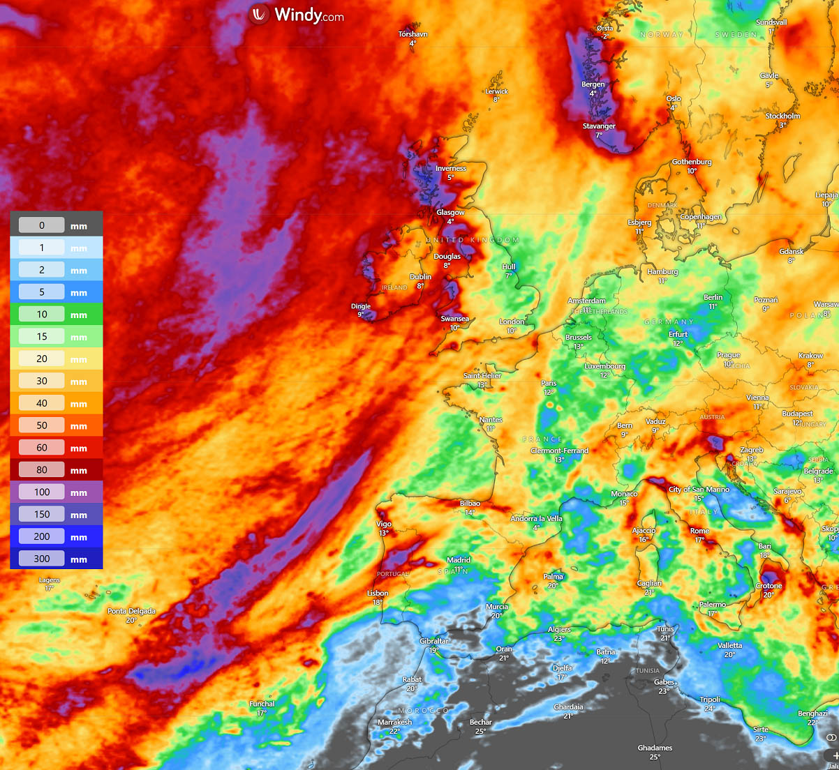
From tonight until early next week, the persistent southwesterly flow will establish orographic rainfall across the higher terrain of Ireland, the UK, Scotland, western Iberia, and southwest Norway.
The highest amounts of rain will exceed 100 mm in some areas over 4-5 days and may cause some flooding.
The overall weather pattern into November supports a dynamic North Atlantic, with multiple deep waves ejecting frontal systems into Western Europe and warm waves further east across the continent.
We will continue monitoring the evolution and update accordingly as the pattern evolves over the next two weeks.
Windy, wxcharts, and NOAA provided images for use in this article.