Over the last few days, temperatures have been unusually hot, with temperatures back into the 30s in many countries. This is thanks to an unusually warm wave within a heat dome over the European continent. This weekend, a significant cold wave will emerge in Western Europe. It will spread east, shutting down the summer-like weather and bringing severe weather back to France, the Alpine region, and Italy.
This weekend, a dramatic temperature change is expected, followed by a weather pattern flip from warm and stable to progressive activity again. A strong ridge will form over the North Atlantic, turning the flow northerly and delivering a cold air mass into western Europe. Unseasonably hot weather over the continent will gradually vanish by Monday next week.
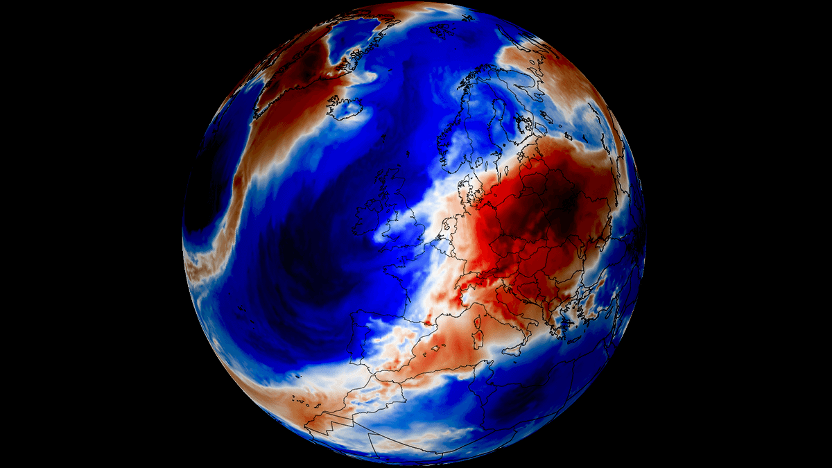
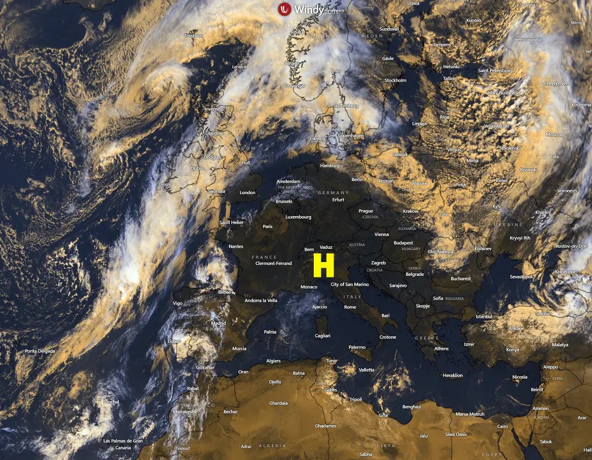
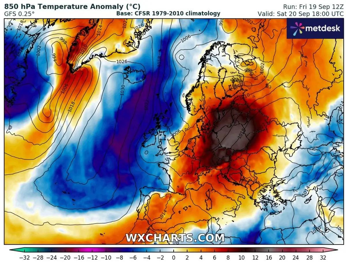
The satellite imagery clearly showed how stable and warm weather has dominated Europe this week. On Friday, a large surface high-pressure system was fully developed over western, central, and southern Europe. It was pretty hot across France, Spain, Portugal, Benelux, Germany, Italy, and the Balkans, with temperatures reaching 32-35 °C locally.
The only frontal activity with colder temperatures remained over the North Atlantic, the eastern Black Sea region, and Russia.
This stable pattern is soon changing, as a new blocking High develops over the North Atlantic, turning the general flow into a meridional one and bringing a much colder air mass from the north towards the continent.
It first emerges into Ireland and the UK on Saturday and into Sunday, continues east-southeast early next week, and introduces another active frontal system and severe weather period, as seen in the following video animation. The unusually warm period will end with a sharp cold front, pushing temperatures below normal for late September next week.
The London, England, meteogram forecast clearly shows a significant drop in temperatures following this weekend, bringing 850 mbar level (approximately 1250m above sea level) temperatures from much above usual into much below average.
The temperature at this level changes from around 18 °C to around 0 °C in less than three days, so a quite sharp flip from warm to cold is foreseen.

According to the ensemble forecasts, the cold pool will persist until September 2025.
Let’s examine the first details of a pattern evolution that will bring a sharp end to summer-like weather in the following days.
Heat Dome weakens and moves east, and a deep trough emerges into Western Europe
Over the weekend, the weather pattern over the North Atlantic and Europe revealed a large omega-blocking high surrounded by a cold core ejecting the Black Sea region. On the western side, a deep trough digs into Western Europe.
This follows in response to a building upper ridge over the North Atlantic, allowing a cold wave aloft to progress south. The trough spreads east and south with time as the heat dome over the continent ejects eastward.
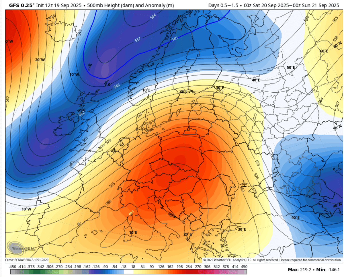
Pushing south across Western Europe raises the surface pressure, a typical response to the ridge build-up behind the cold wave.
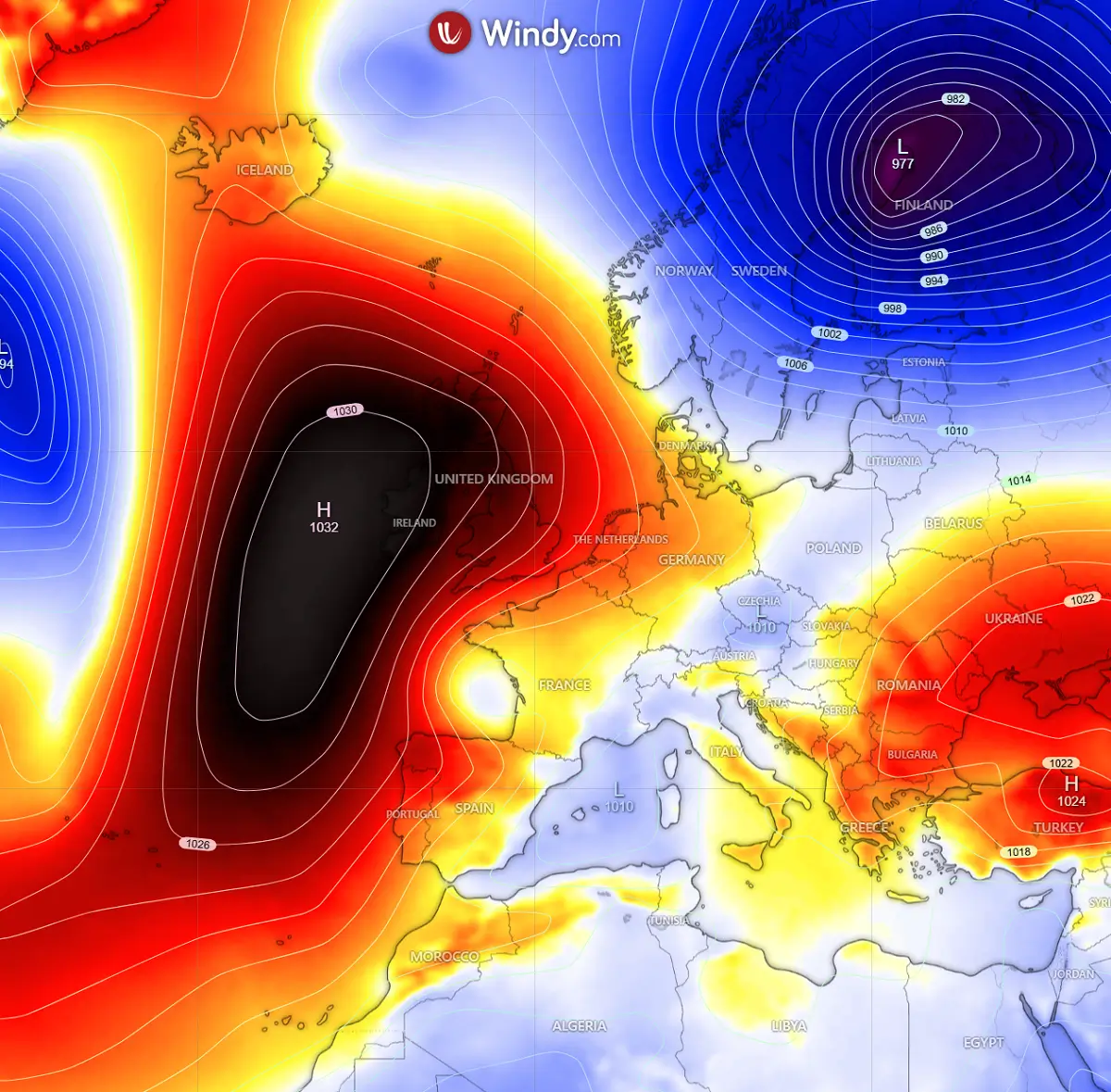
A powerful low forms over Scandinavia on the nose of the departing blocking, bringing significant weather for Sweden and Finland on Sunday. From this low, a cold frontal zone extends towards central Europe.
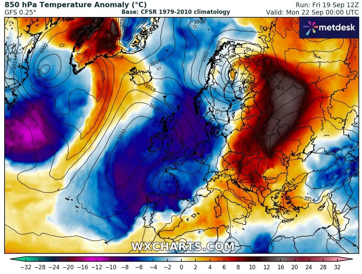
This dipole pressure pattern creates a high-temperature contrast between eastern and central Europe, the North Atlantic, and western Europe from Saturday into Sunday.
Temperatures over Poland and the Baltic region will be around 15 °C above normal, while those over Scotland, Ireland, and further west will be 10-12 °C colder than usual.
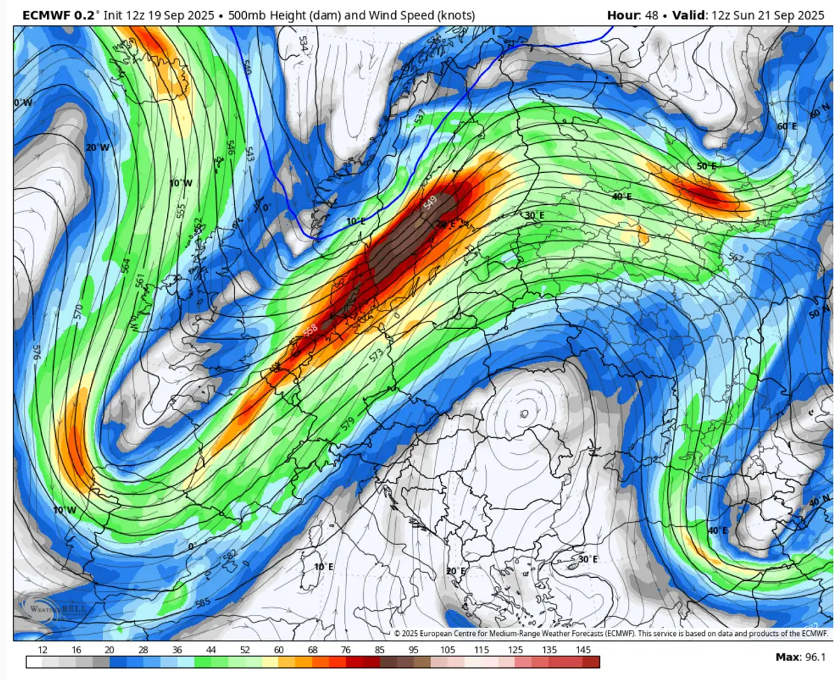
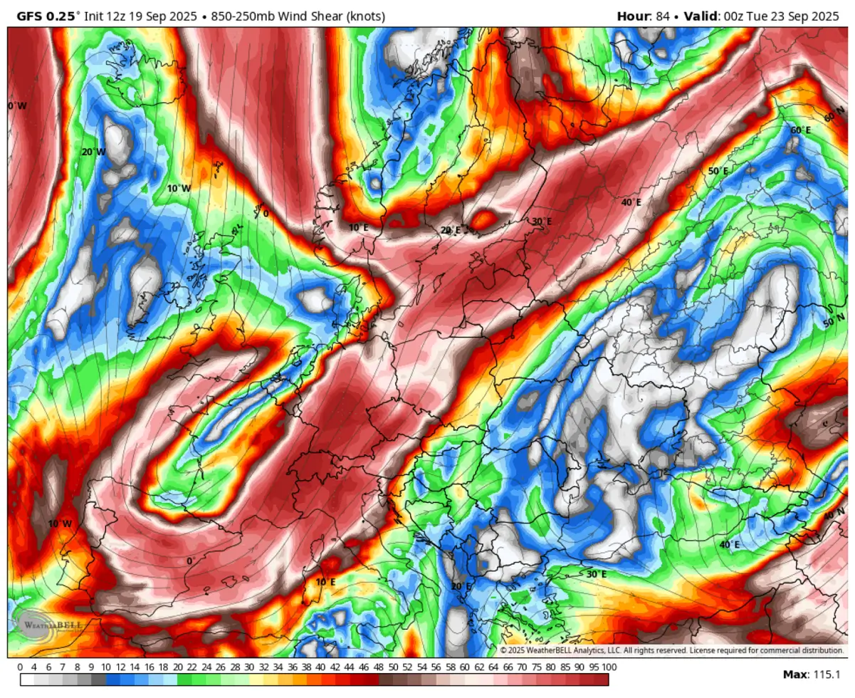
So, this high-pressure and temperature gradient between the departing ridge and deep wave over western Europe results in an intense jet stream entering continental Europe on Sunday.
Violent winds will occur at higher altitudes, near 100 knots at the 500 mbar level. This is also why the rapid cyclogenesis over Scandinavia takes place on Sunday.
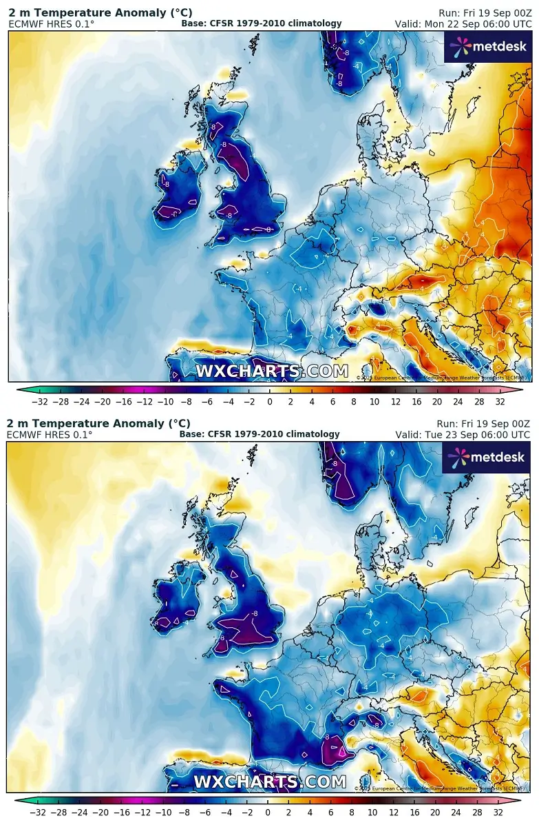
While the jet stream axis gradually advances east on Monday, the large cold pool over Western Europe matures and reaches its peak by Monday and Tuesday. Near-surface temperatures will be pushed much lower than they have been experiencing lately.
So, both Monday and Tuesday should expect around 5-10 °C colder temperatures than usual for this time. This might not be particularly extreme for the end of September, but it will be a dramatic and quick change from the recent days.
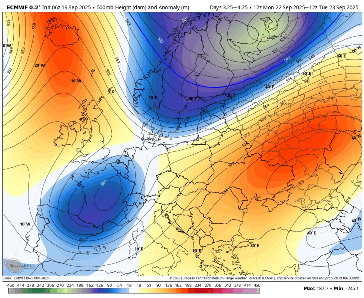
The cold pool will move east through mid-week, gradually losing its breath on the west.
With the trough moving east, it cuts off and supports widespread severe weather early next week
By Tuesday, the forecast pattern over Europe indicates that the deep trough over Western Europe cuts off its core over France, moving towards the Alpine region—meanwhile, the ridge on the east ejects into Russia.
A high contrast is seen between the ridge and deep low over Scandinavia, where, based on the isohietes gradient, we can judge that the jet stream will be even more powerful.
The cold wave continues south and east on Monday, following the large cold pool that overpreads Western Europe Saturday night into Sunday. Temperatures at the 850 mbar level (approximately 1250 m above sea level) are forecast to be 8-15 °C below normal for this time.
The rapidly developing low over Finland allows the extreme warmth from Eastern Europe to advance further north into western Russia. This will most likely bring near-record high temperatures for late September there.
Strong winds always result when a tight pressure and temperature gradient is present. Therefore, the powerful jet stream will also support strong wind shear along the eastward progressing cold frontal zone on Sunday, Monday, and Tuesday.
This means that the large-scale lifting mechanism will occur, producing widespread frontal activity with high precipitation and thunderstorms.
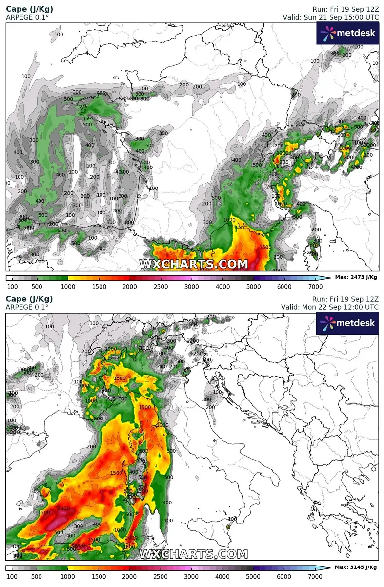
Thanks to the warm air mass that has warmed up significantly over central Europe, the moisture will quickly recover, and south-southwesterly winds will develop ahead of the frontal system’s arrival on Sunday.
This helps to increase potential convective energy from France to the Alpine region and across the Northern Mediterranean across the warm sector ahead of the cold front.
On Sunday, the highest instability develops across the western Mediterranean and advects into southeast France and the western Alps. On Monday, the unstable air mass advanced east into the north-central Mediterranean, as it typically does in these weather fronts.
The cold front will bring widespread thunderstorm activity over southeast France on Sunday, moving into the western Alps on Sunday night. The front’s progress into Monday spreads severe convective activity into Northern Italy and the Alps. Excessive rainfall will likely develop with intense orographic rain over the northern Apennines and northwest Italy.
While the upper wave cuts off Monday into Tuesday and stalls over the western Alps, the front will move further east, bringing thunderstorms, excessive rainfall, and severe weather to central and southern Italy and the North Adriatic region.
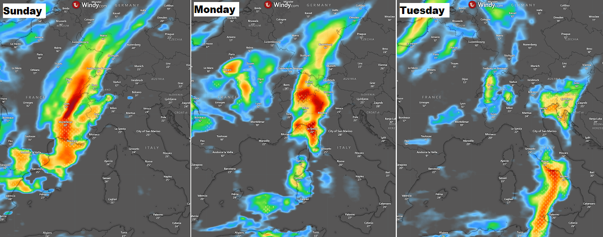
The frontal system’s relatively slow progress across central Europe, thanks to the upper wave cutting over while drifting east, means excessive rainfall is expected across the Alpine region and along mountain ranges, e.g., the northern Apennines and the Dinaric Alps.
This is where the maximum precipitation is forecast, likely to bring 150-200 mm of rain in three days in some areas, possibly even more. Convective lines will comprise the training cells effect, combined with orographic rainfall from persistent southwestern winds.
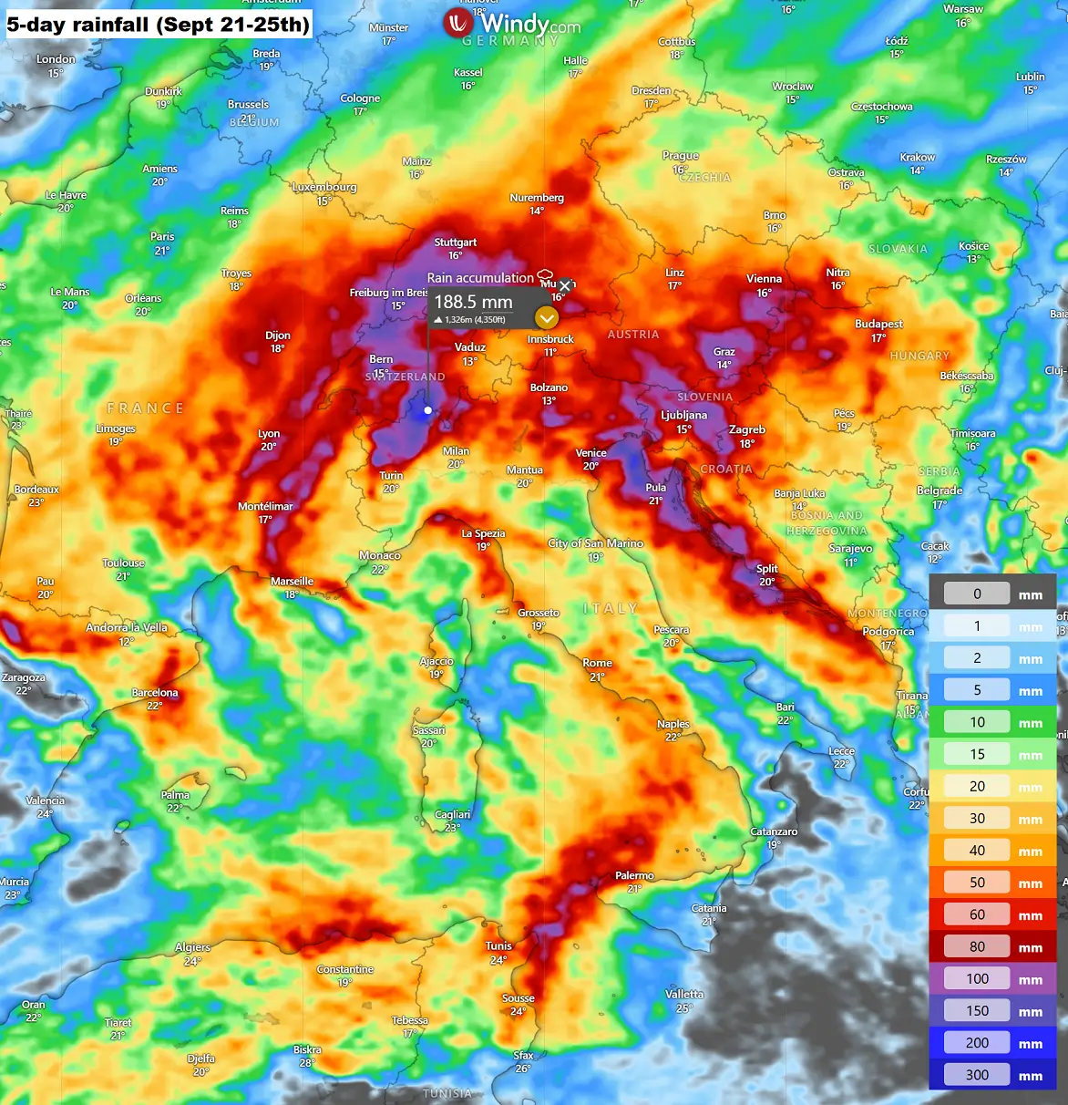
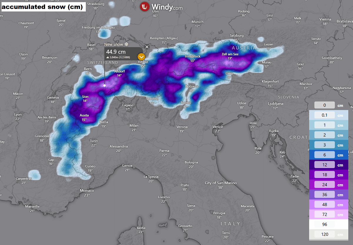
Towards Tuesday into Wednesday, as the cold pool advances east enough, it will be cold enough over the higher Alps to support heavy snowfall. Therefore, we can expect around 50 cm of fresh snow in some southern Switzerland and western Austria areas.
Snow line will, however, mostly remain above 2000m ASL.
We are closely monitoring the evolution of the changing patterns back into more progressive ones as we approach the end of September. Forecast updates will be required in the coming days if they result in more severe weather potential.
Windy, Wxcharts, and WeatherBell provided images used in this article.
See also: