A much-needed temperature relief is coming, replacing the hot air that has been baking most of the U.S. recently. The first touch of the fall season is shaping up on the horizon, with a significant cold wave resulting in an outbreak of cooler air mass from Canada into the Midwest, Great Lakes, and Northeast over the weekend, extending into the final days of August 2025.
Temperatures will be 15 to 25 degrees below normal for the end of August. Thanks to a large upper cold wave dominating the eastern portion of the North American continent, temperatures will persist for multiple days. They will feel similar to those typically experienced in late September.
Much colder temperatures will also reach the South U.S. by early to mid-next week. This kind of late August refreshment does not come around too often; typically, the summer heat persists into September.
This is the most substantial cool air outbreak since last spring’s cold outbreaks across the United States.
This significant temperature change follows the above-normal weather that has persisted over the U.S. and Canada for the past few weeks. It will follow behind the slow-moving cold front on Friday.
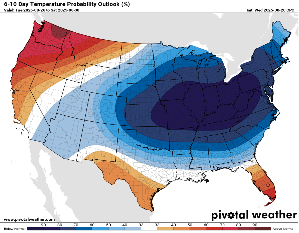
According to the CPC (Climate Prediction Center) outlook, more than two-thirds of the Contiguous U.S. can expect below-normal temperatures from Sunday throughout next week. The highest probability of much colder days will be over the Midwest, Great Lakes, the Ohio Valley, and the Northeast U.S.
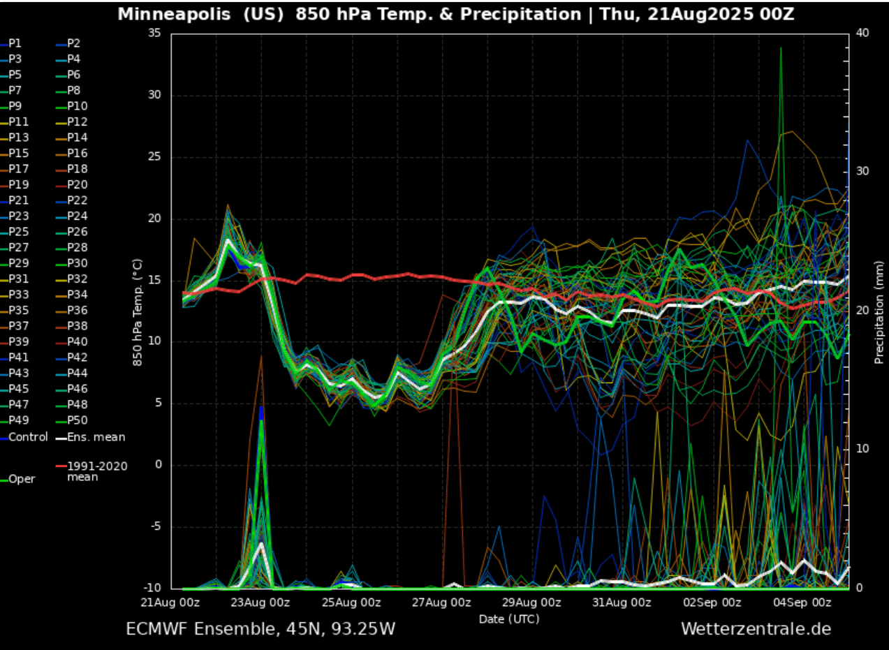
Below is the 14-day meteogram for Minneapolis, MN. It represents the temperature and precipitation forecast, and we can see that a long period of below-average temperatures will follow after Saturday and end late next week.
So a cold pool will dive south from Canada and be pretty deep and long-lasting, 5-7 days on average for most states from the Midwest to the East Coast.
Before we discuss the evolution of the significant temperature change in detail, here is a video overview of the cold wave emerging from Canada into the United States.
Starting late Friday, it continues to spread into the Northern Plains and Midwest, following into the Great Lakes and Ohio Valley before Monday, and then reaching the East Coast and Northeast U.S. mid-next week.
Colder-than-normal weather is expected to persist until the final days of August, so the meteorological summer 2025 ends with an unusually strong cold refreshment.
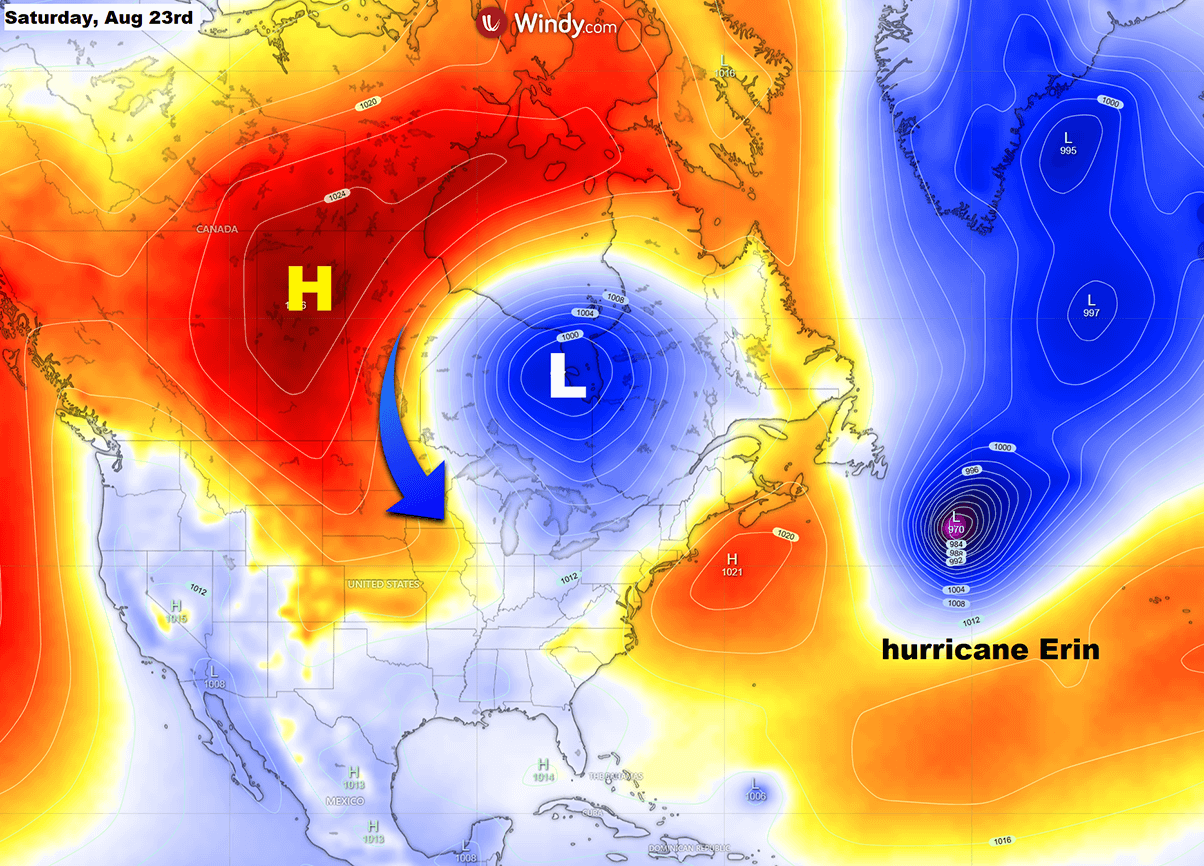
Hurricane Erin flips the pattern over North America, drags Canada and the US into a colder period
An ongoing large hurricane Erin will strongly influence the weather pattern over North America in the North Atlantic Basin. While the tropical storm did not significantly affect the U.S. mainland, its large size did affect the continent’s weather.
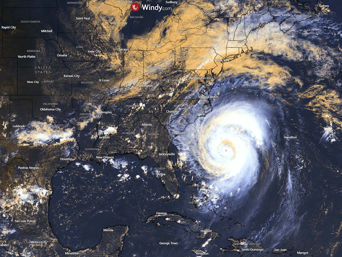
With Erin travelling east of the U.S. this week, the surface pressure patterns over North America boosted the flow from the Arctic towards the south. This is helping to establish the high-pressure system far north, which helps to trigger the frontal system in central Canada.
This combination of Highs over Lows gradually builds up the meridional (northerly) flow from Canada into the U.S. this weekend, providing an undisturbed corridor for the cold air to spread far south across the CONUS.
With time, the upper wave deepens and drags a much colder air mass in the higher levels from Canada into the Upper Midwest and Great Lakes, thus deepening the core of the wave as the weekend comes.
A typical North American weather pattern unfolds, with a high-pressure system on the west and a deep low-pressure system on the east side of the continent. This pattern is similar to those we face with massive cold outbreaks in winter and spring.
A strong temperature and pressure gradient between the High on the West and Low on the East also boosts the polar jet stream, which travels much further south than is typical for late August.
The following chart shows powerful upper-level winds rounding the core of the cold wave over the Great Lakes on Monday, with wind speeds exceeding 65 knots at the 500 mbar pressure level.
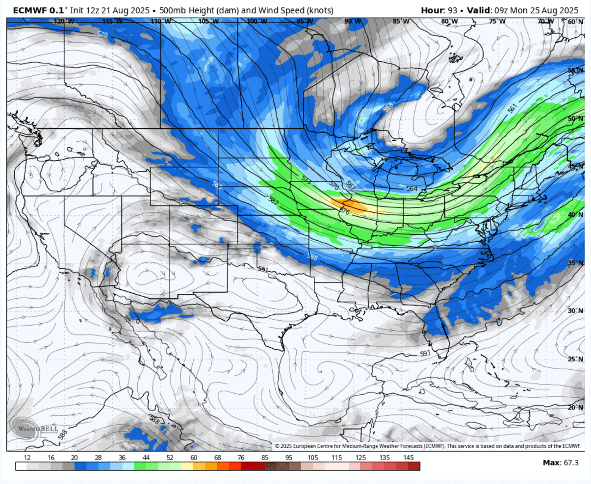
Aside note: Those travelling east by airplane in the coming days will take advantage of these strong winds aloft and have their travel times shorter than usual.
Cold wave refreshment starts Saturday and continues into the following week
Behind the slow-moving cold on Friday, the cooling period starts from southern Canada towards the northern U.S., reaching the Northern Plains and Upper Midwest on Saturday. The cold pool develops and gradually moves southeast over the weekend.
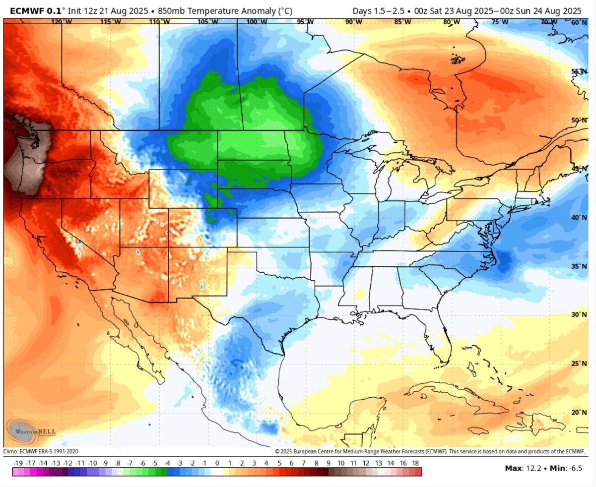
By Monday, the cold pool core will reach further south towards Nebraska, Iowa, and Illinois, bringing the cities of Des Moines, Kansas City, and Chicago much colder weather than they have experienced lately.
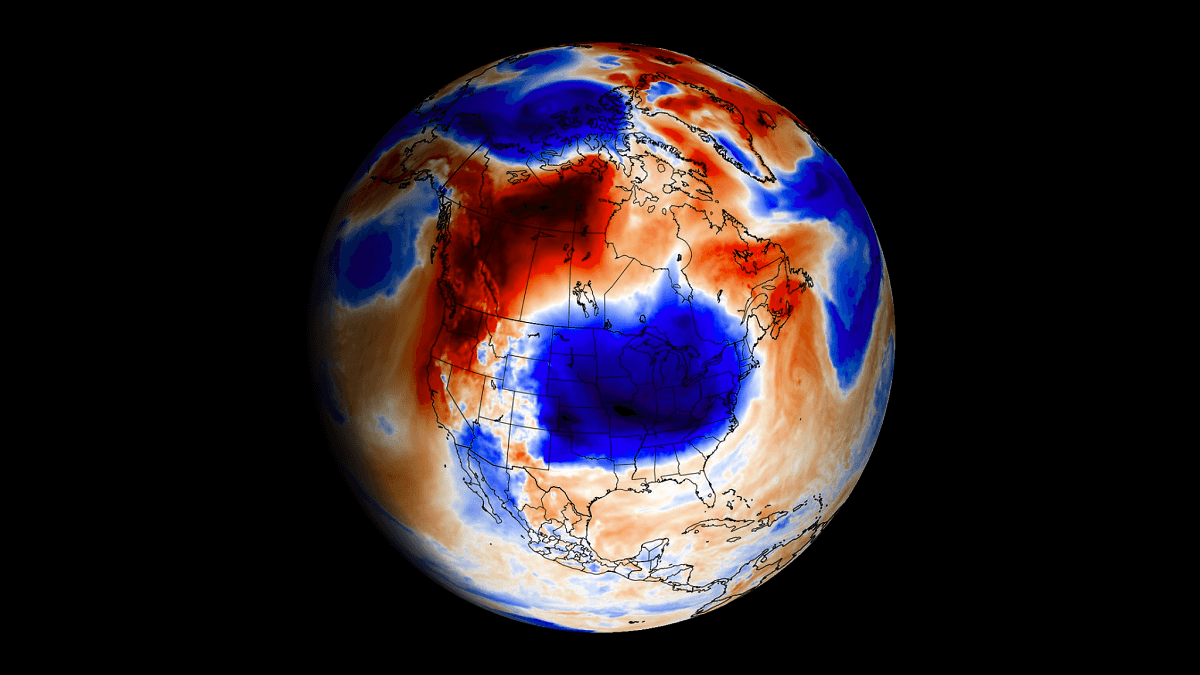
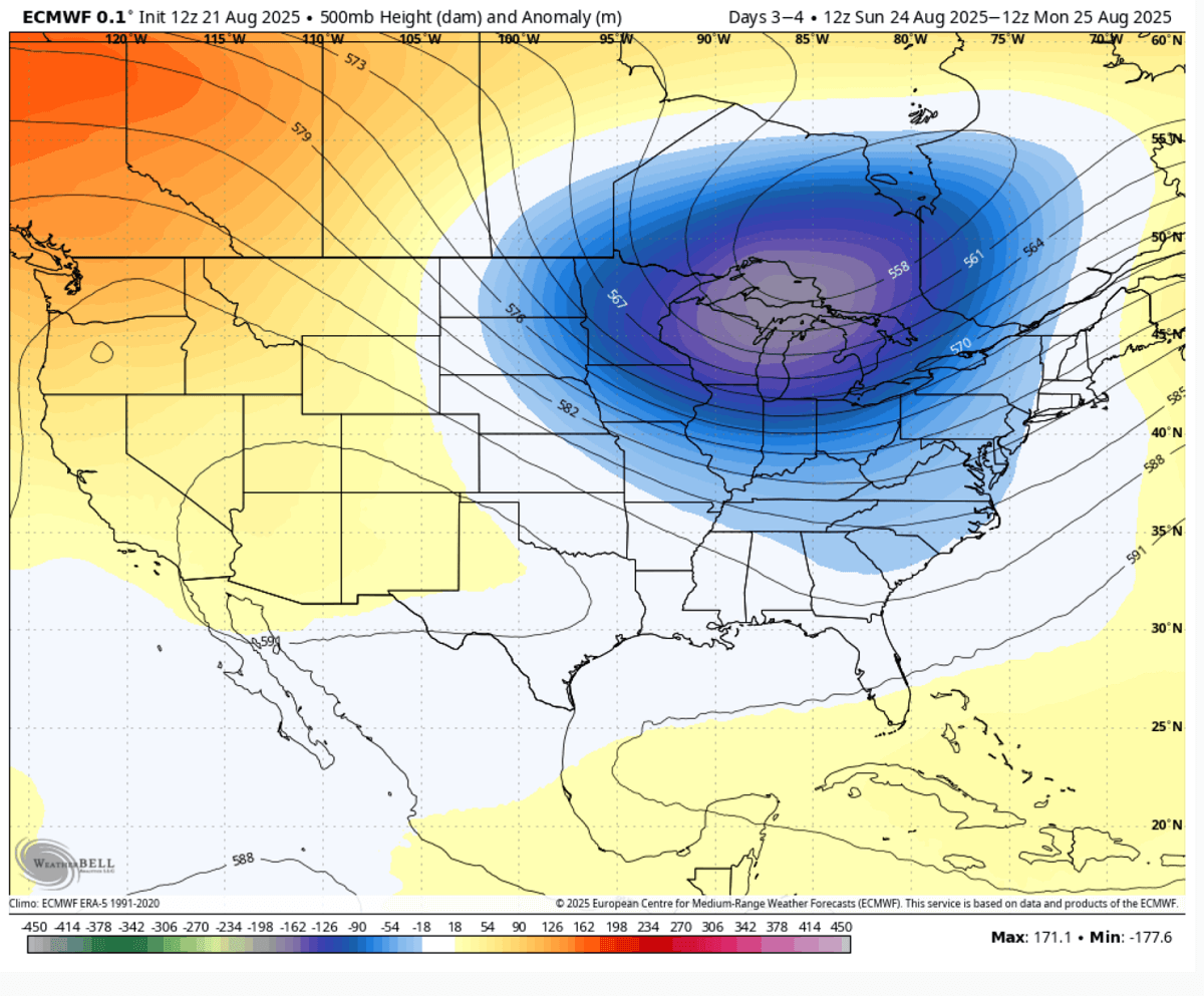
As we see on the following chart, the pool of cold air mass grows larger, covering tens of millions of people with 8-12 °C colder mid-level temperatures than usual.
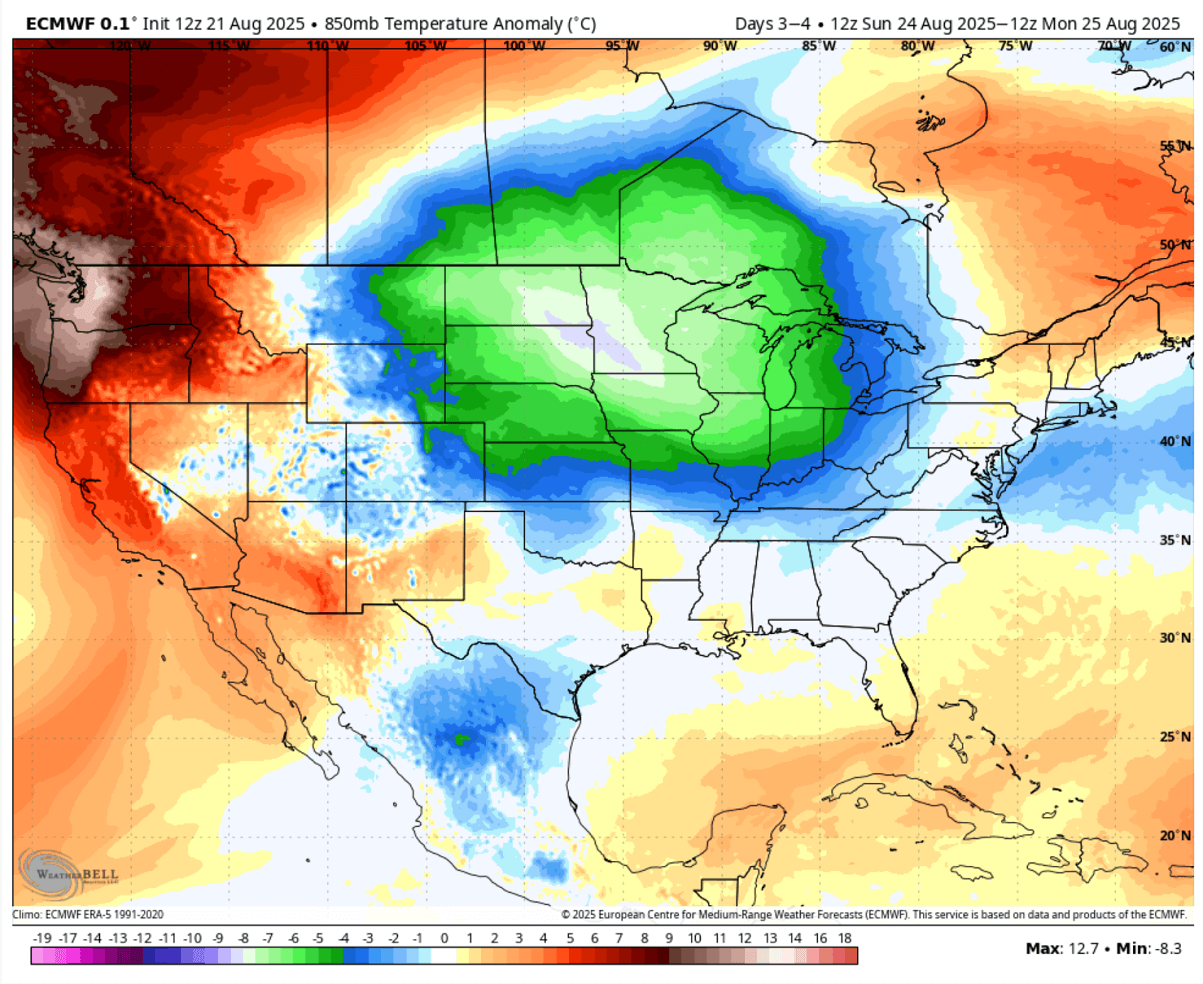
These temperatures spread the surface temperatures into 10-15 °F, locally close to 20 degrees below normal at the end of August.
Most of the eastern two-thirds of the Contiguous U.S. and southern Canada will feel this air mass change into fall-season vibes. Temperatures will trend 10–20 degrees below the historical average for late August.
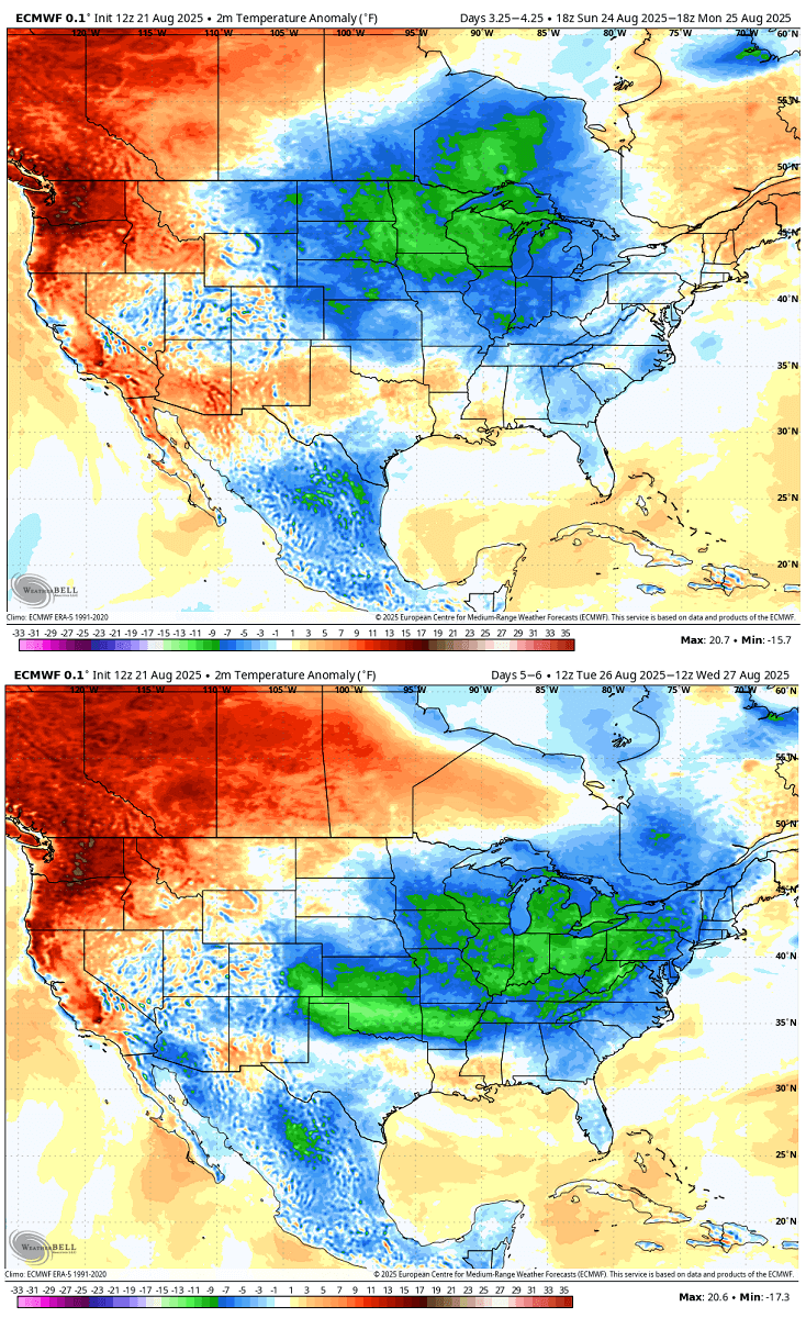
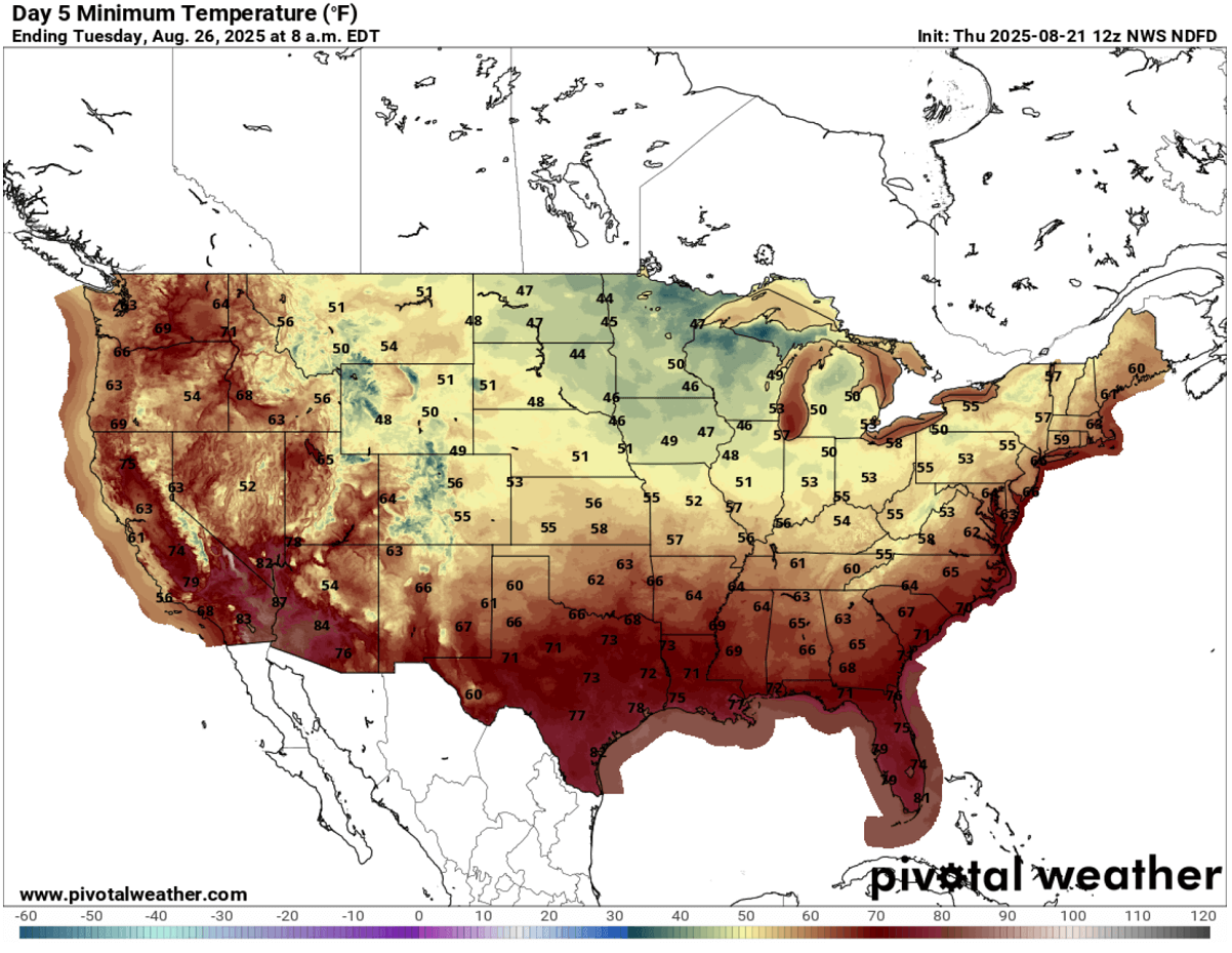
Monday and Tuesday morning are forecast to bring the lowest temperatures over the continent for many, as the cold wave core matures over the Midwest and the Great Lakes before the cold spreads further east into the Northeast U.S.
Temperatures will be in the low to mid-40s across eastern Dakotas, Minnesota, and Wisconsin. Low to mid-50s across the Midwest and Ohio Valley. 60s or higher will only remain across the southern and southeast U.S.
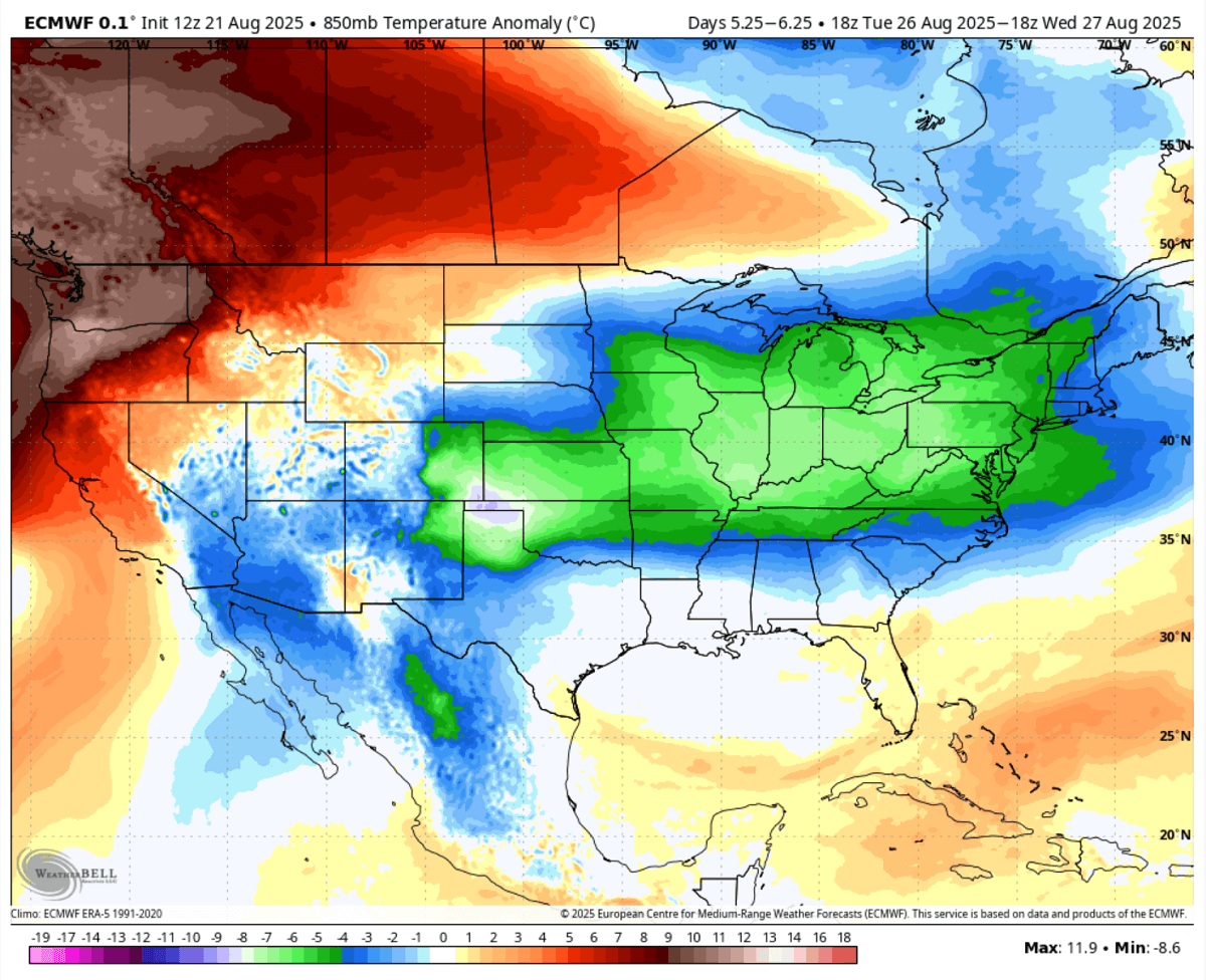
The cold pool will gradually lose strength around mid-week as the upper wave weakens. Wednesday will still, however, keep the temperatures well below normal from the central Plains and Midwest to the Great Lakes, Ohio Valley, East Coast, and Northeast U.S.
The Wednesday chart reveals that only the Pacific Northwest region will see temperatures above normal; the rest of the CONUS will still enjoy the cooler days.
The upcoming cold wave and significant temperature change from the recent heatwaves are pretty unusual for the summer ending. Typically, the heat persists into September.
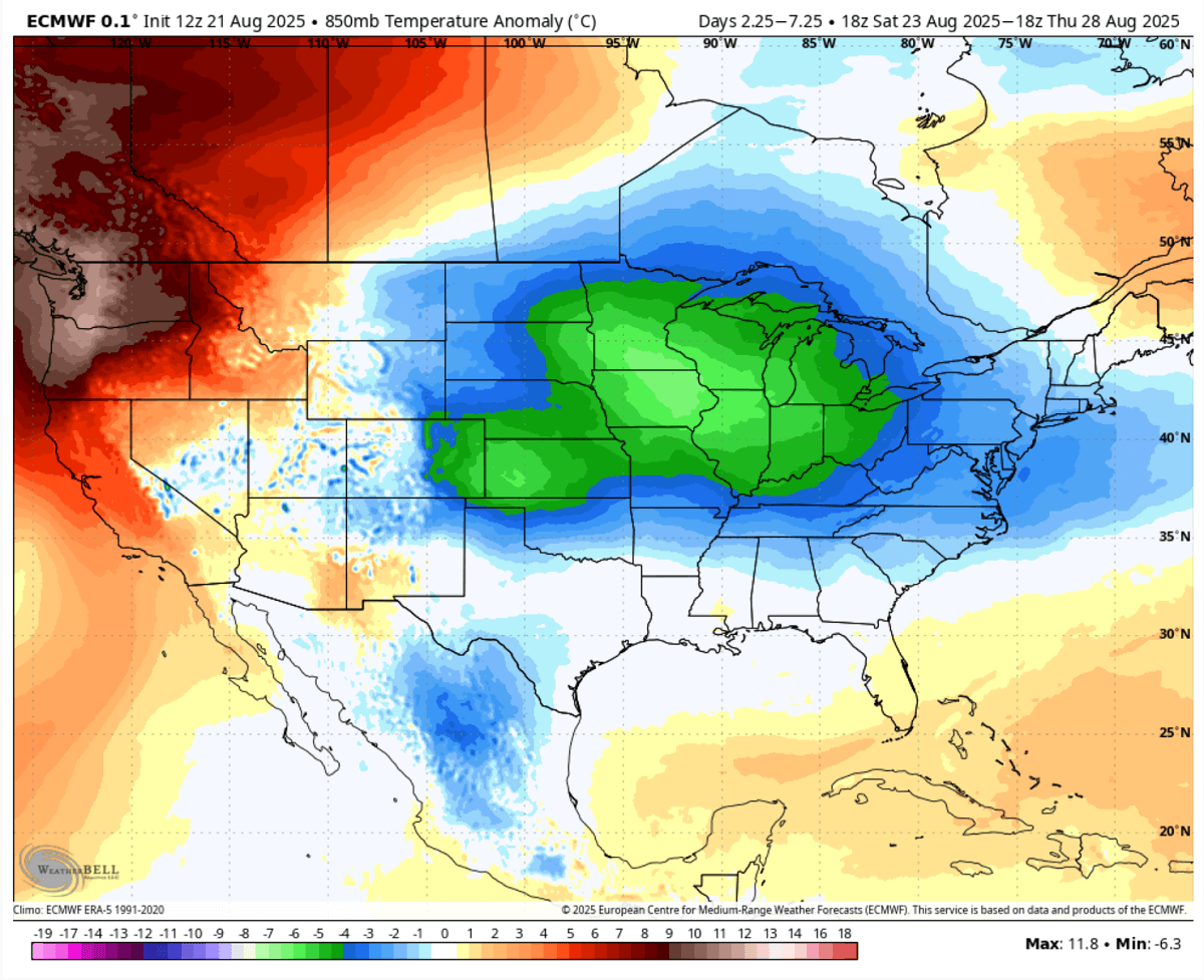
The 5-day temperature anomaly from Saturday through Thursday next week shows that a large portion of the U.S. and southern Canada will be colder than normal for this time. The colder air mass and strongest temperature anomalies will be over the Upper Midwest and the Great Lakes.
But this does not mean the summer weather is over. Mid-range trends suggest that warmth will return early next month. We are monitoring the pattern evolution and will update the forecasts once we get closer to the changes into the warmer phase.
Windy, Wxcharts, and WeatherBell provided images used in this article.
See also: