The latest forecasts show cooler weather to start off August over the United States, with a dynamic jet stream pattern. The atmospheric pressure pattern is then forecast to make a reversal, with a high-pressure anomaly emerging over the western and central United States, shaping the August weather, along with a strong low-pressure area over Canada.
August is the final month of meteorological Summer, after which we enter meteorological Fall at the start of September.
We will first look at the amplified jet stream pattern in Summer so far, and how it shaped the seasonal weather over North America. Then you will see what the latest forecasts for August are for the United States and Canada, and how the weather patterns are expected to develop as meteorological Summer comes to an end.
SUMMER WEATHER SO FAR
As mentioned, August is the final month of the meteorological summer, which covers the three warmest months of the year. With that in mind, we can look at the Summer development so far.
The pressure pattern below for June and July shows interesting dynamics over North America. What stands out right away is the strong low-pressure area over Canada with an extension into the west-central United States.
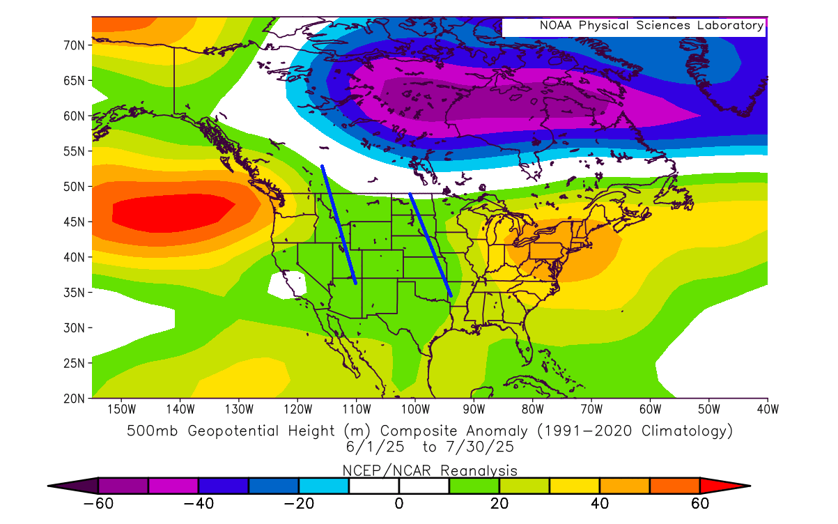
The image above is an average for two whole months, so naturally, the daily weather patterns were more varied. But this helps us to see the prevailing weather pattern and where the main pressure areas are located, and the jet stream between them.
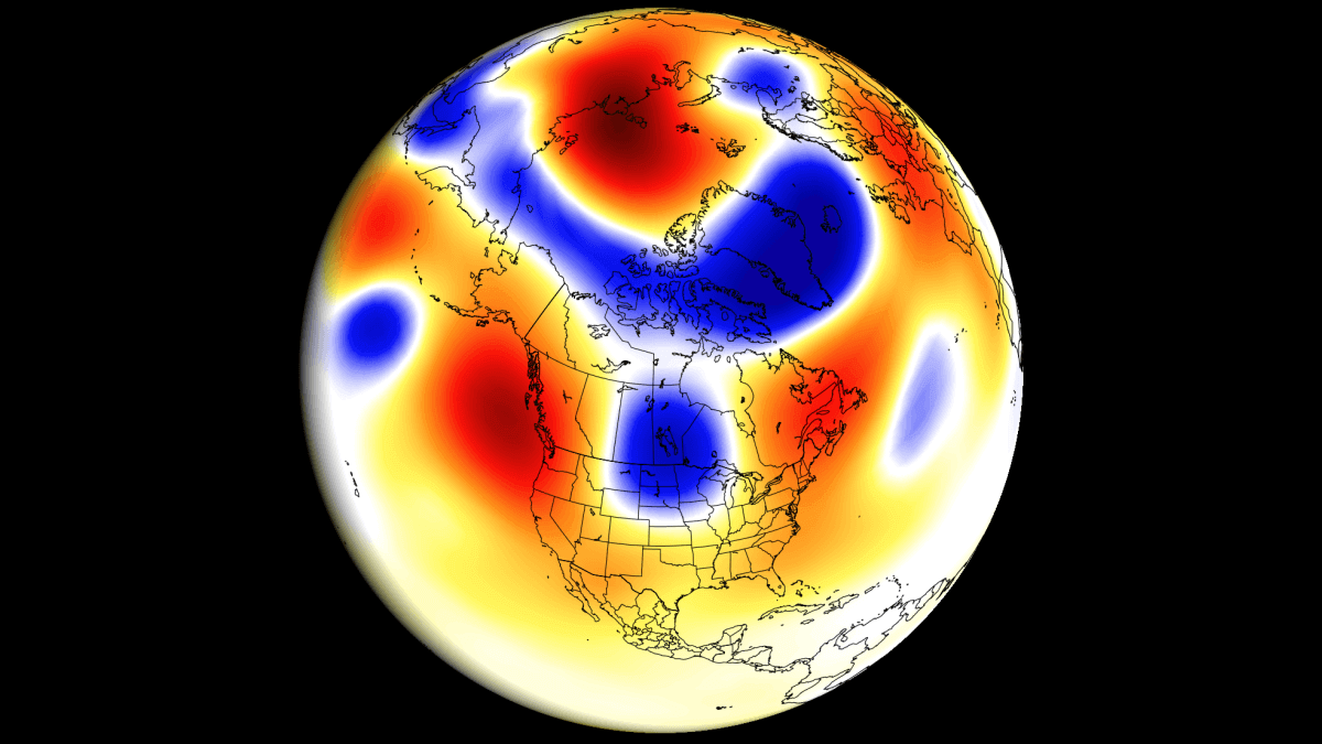
The jet stream is a narrow, fast-moving stream of air at higher altitudes (9-13km or 6-8 miles). It helps to shape our daily weather, steer pressure systems, and can create floods or droughts. It is directly linked to daily to monthly weather development.
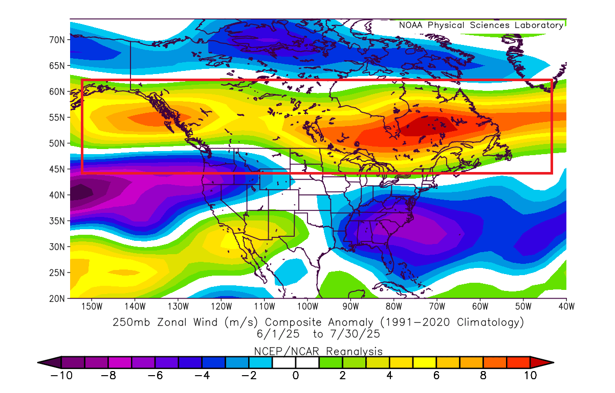
A strong low-pressure area over Canada helped to amplify the jet stream over the northern United States and southern Canada. You can see the jet stream analysis for June/July in the image below, with the amplified jet stream marked.
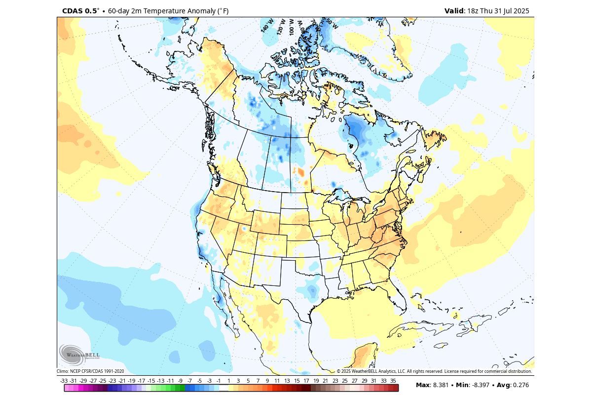
This helped bring a cooler and more unsettled weather pattern to southern and southeastern Canada, as well as parts of the northern United States. Below is the Summer 2025 temperature anomaly so far, over the United States and Canada, which shows mostly warmer-than-normal weather over the west and northeast, with a more dynamic pattern over the whole central area of the United States, from border to border.
Below, you can also see the June/July precipitation analysis from the CPC dataset, and it shows a dry month over the western and northeastern United States and over a large part of Canada. But you can see more rainfall over the central and eastern parts of the United States, the southern U.S., and deep southeastern Canada.
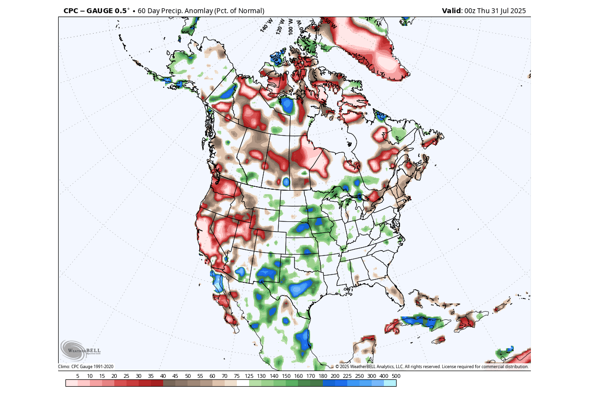
This is an expected pattern where we see less precipitation in the rear part of the jet stream, and more precipitation and (amplified) severe weather over the front (exit) part of the jet stream.
But as we now enter August, the latest model predictions show a cooler start to the month, after which a pressure reversal brings a new wave of seasonal temperatures.
THE LAST SUMMER MONTH FORECAST
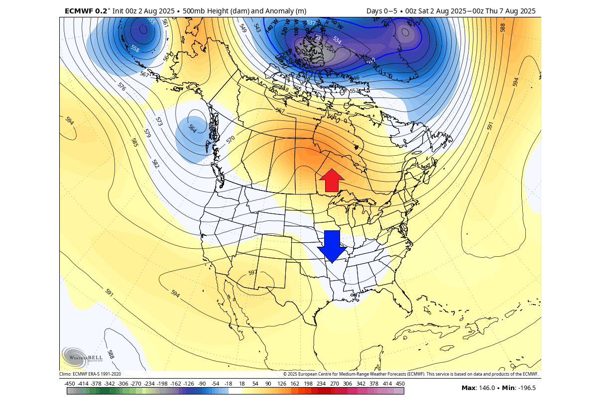
Below is the pressure anomaly forecast for the first week of August. You can see an amplified ridge over the far northern United States and into southern Canada. There are also local low-pressure areas entering the western United States, extending into the East. This looks to be very similar to a Rex block pattern.
The temperature forecast for the same period shows colder-than-normal weather over much of the central and eastern United States and eastern Canada. This is due to the pressure pattern that allows the transport of cooler northerly air into the United States.
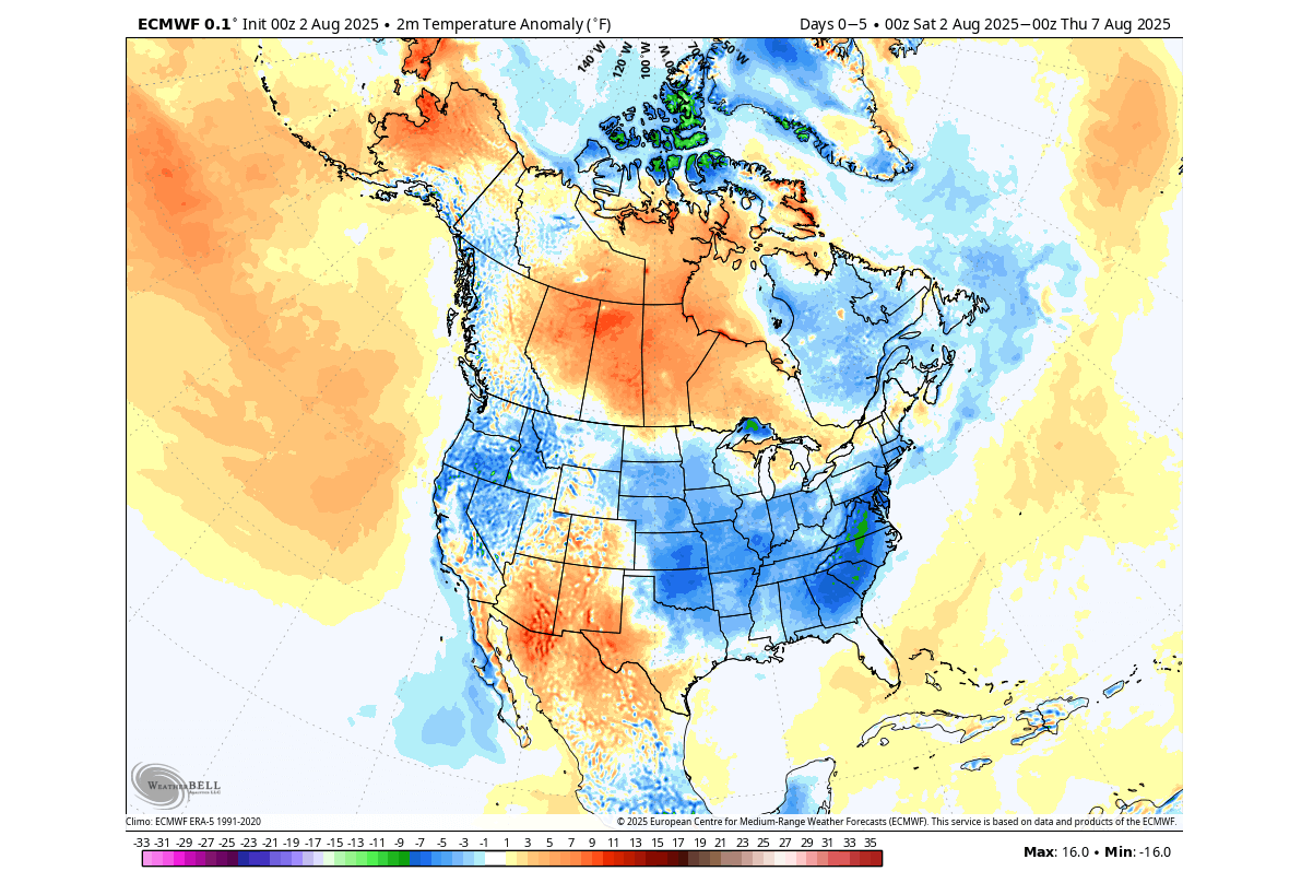
Above normal temperatures are forecast over southern Canada, under the strong high-pressure anomaly.
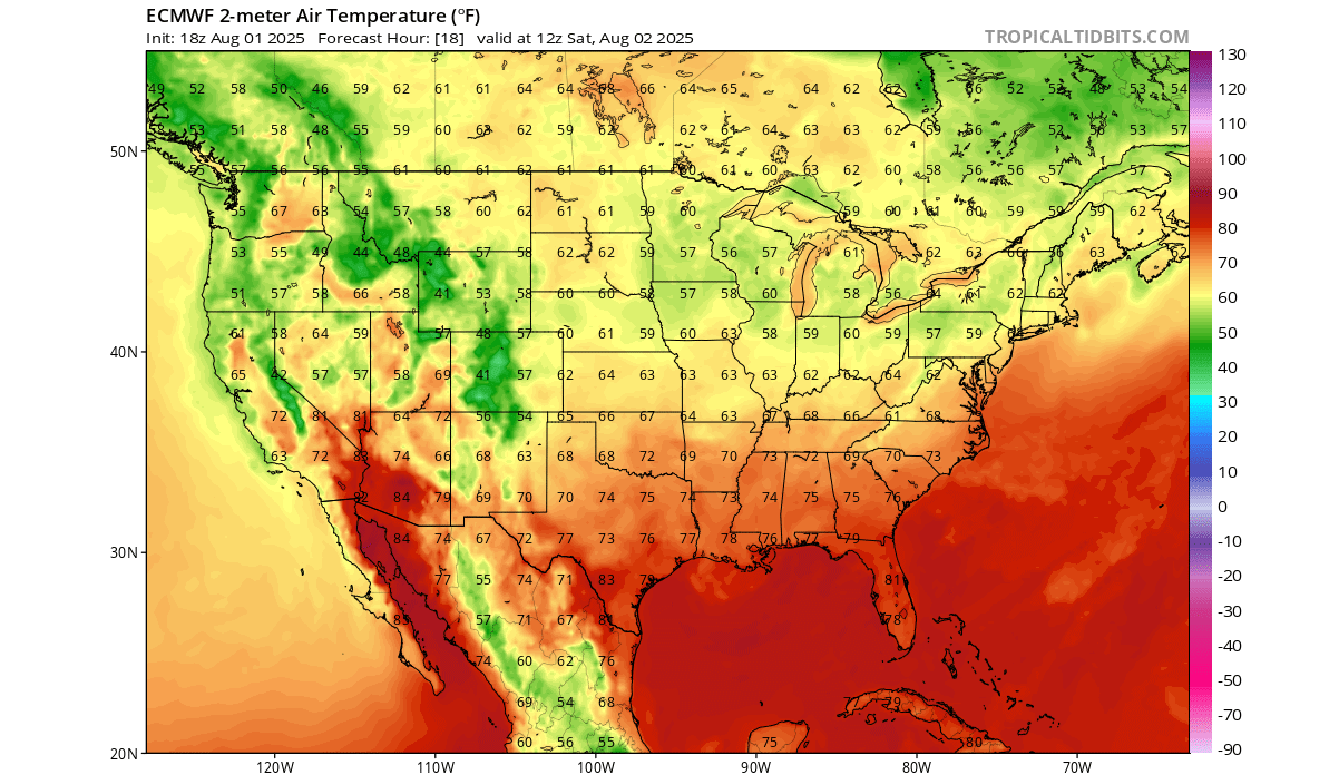
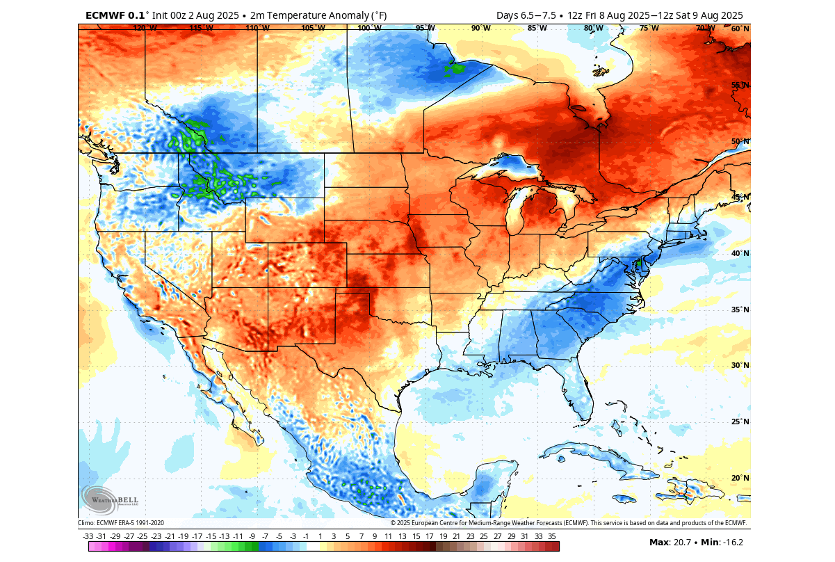
But we can also look at some individual days, and below you can see the forecast for tomorrow, where an unseasonably cool airmass will expand over the central and eastern United States, also reaching into some southern states.
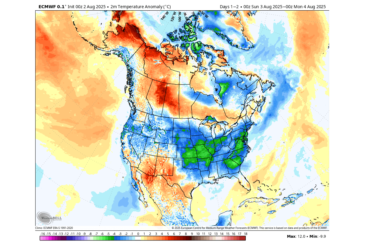
At the same time, anomalous warmth will spread over western Canada.
The morning temperatures in this period are forecast to stay in the 50s across the Midwest, and in the 60s across a large part of the central U.S., northern Plains, and the northeast.
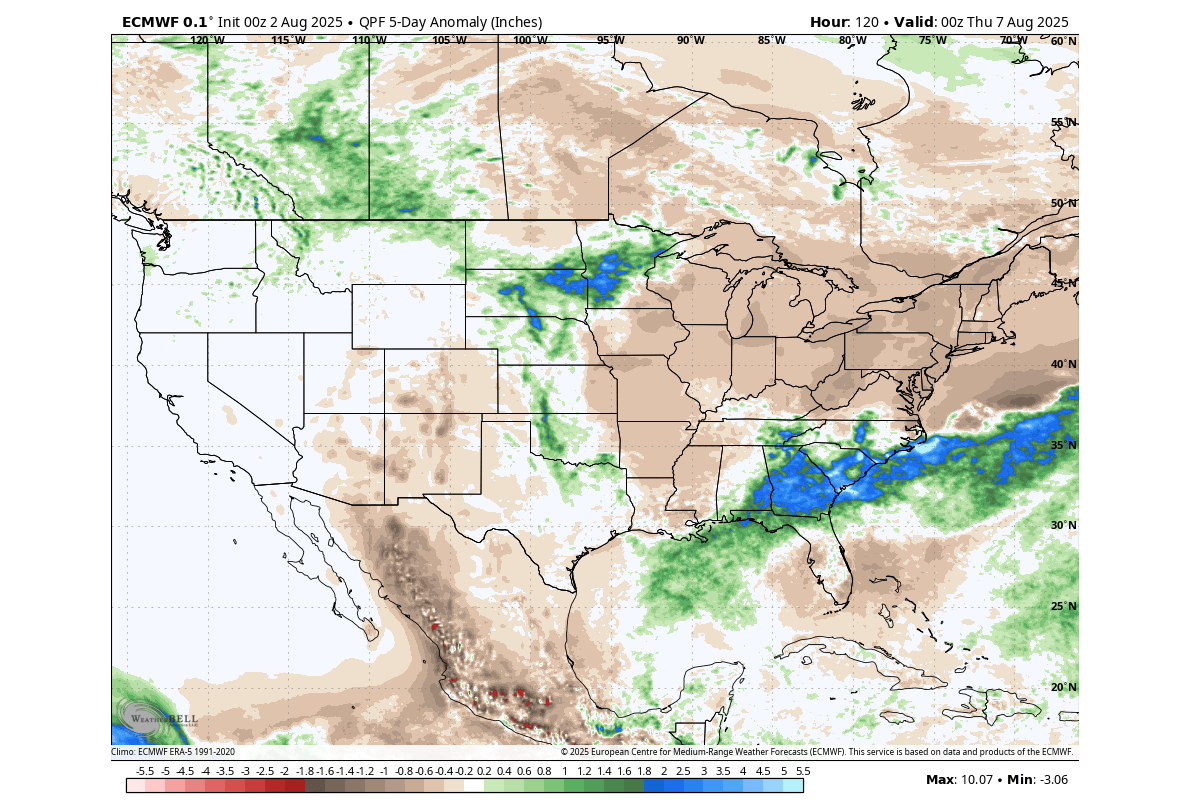
The precipitation forecast for the first week of July shows a rather dry trend over the eastern United States and southeastern Canada, due to the high-pressure ridge. But you can see more rainfall over the southeastern and northern United States.
WEATHER PATTERN STABILIZES
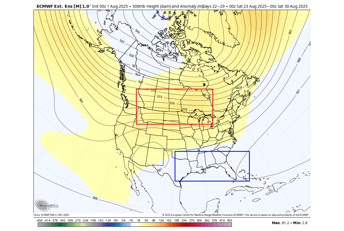
Below is the latest pressure anomaly forecast for the second week of August. You can see an unusually strong low-pressure area over northern Canada and the polar regions. There is also an extension of the low-pressure area indicated over the northern United States, and a ridge rising over the east and up into eastern Canada.
This is a change from the pressure pattern in the first week, and also brings along more seasonable weather across the United States.
The temperature forecast below for the same period shows below-normal temperatures over the southeastern United States with a small pressure disturbance. But the rest of the United States and also southern Canada show above-normal temperatures as a new pressure pattern stabilizes.
A ridge in the west will also bring warmer temperatures over the western United States. A strong area of below-normal temperatures will also persist over the northern flow in northern Canada.
To better showcase the pressure pattern change, you can look at the temperature anomaly forecast for Friday next week. It shows a large spread of above-normal temperatures over the central United States, the Midwest, and southeastern Canada. The areas cooler in early August will see a reversal in the second week.
A high-pressure anomaly over the Midwest and eastern Canada also usually helps to lower pressure over the southeastern United States, which translates to more unsettled weather.
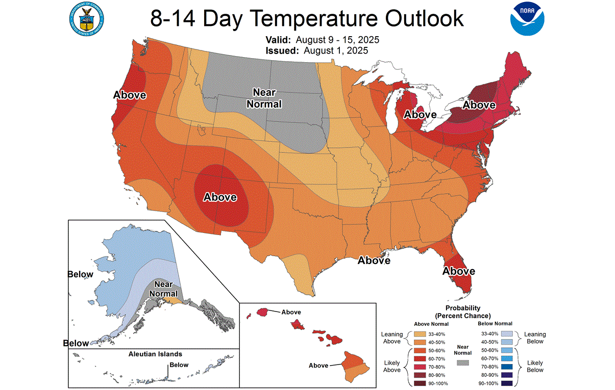
The official NOAA temperature outlook for this period also indicates warmer weather in the western and northwestern United States and over the Midwest and Northeast. But you can also see a large normal area over the northern United States, under the influence of the regional small low-pressure area.
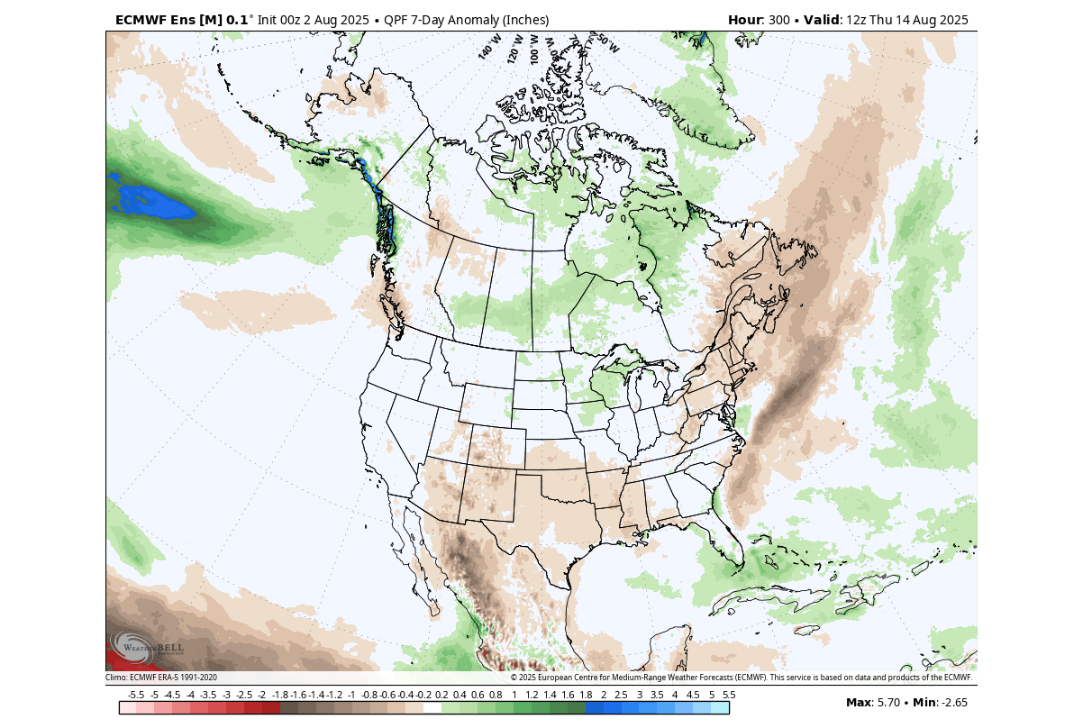
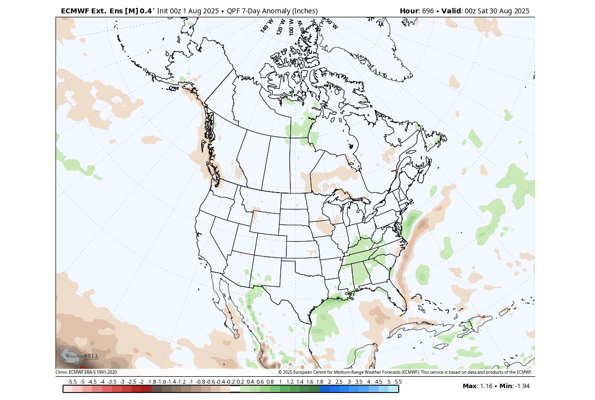
The precipitation forecast for this period shows a drier trend over the southern and northeastern United States and far eastern Canada. But more rainfall is forecast over the northern United States and southern Canada under the influence of the regional low-pressure system, and also around Florida.
As we go beyond this mid-August period, we start to use the extended range forecasting system. This is used to provide us with weekly weather trends that can indicate areas of above-normal or below-normal pressure areas and temperatures.
WEATHER PATTERNS IN THE SECOND HALF
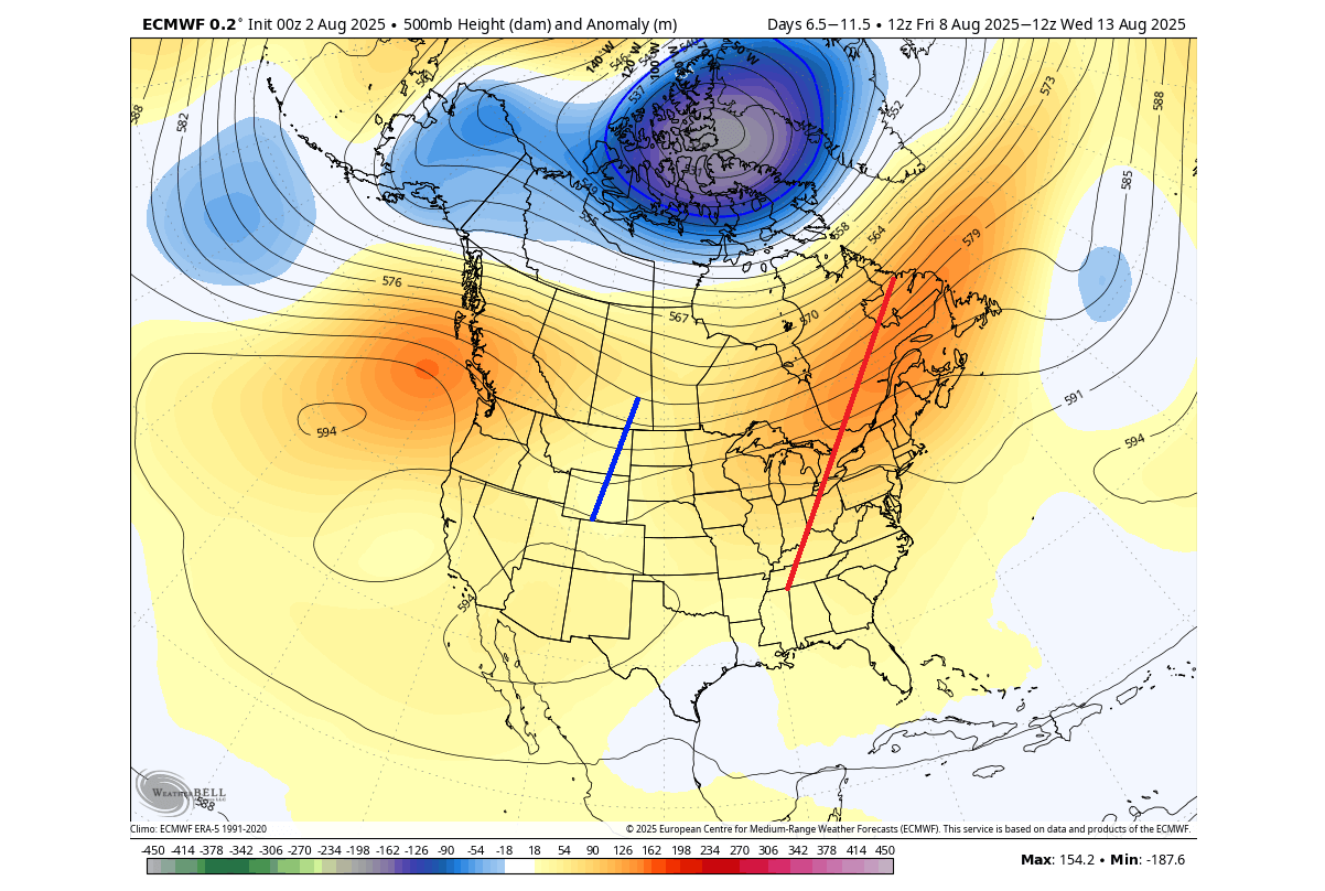
Going into the third week of August, the latest extended range forecast shows the continued presence of the broad low-pressure area over northern Canada.
This amplifies the jet stream over north-central Canada, and can help to stabilize the pressure pattern over the United States, with a high-pressure zone over the north bringing a warmer airmass, and lower pressure over the southern parts.
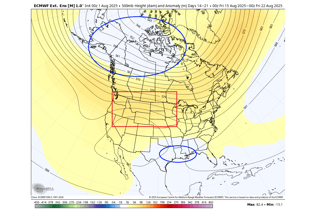
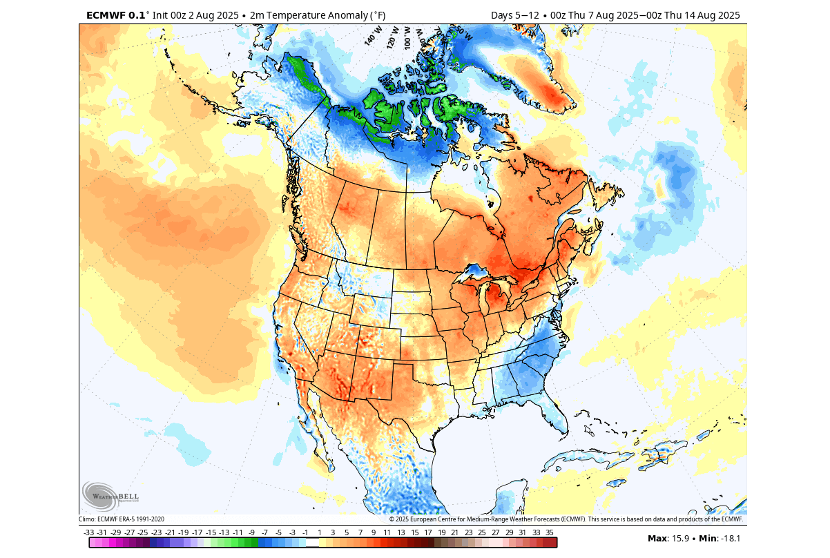
You can see this in the image below, which shows the temperature forecast for the same period. A warmer airmass spreads across the northern and central United States and into southern Canada. But a cooler trend still prevails over the eastern and southeastern United States, southern Canada, and Alaska under the broad low-pressure area.

This is just the latest forecast trend, which always seems to understate the cooler anomalies. So as we get closer to this period, it is likely that a cooler period can prevail over a larger area of the United States, if the pressure pattern persists, like we have seen a few times this summer.
The main rainfall area during this period is forecasted over the southeastern United States, due to lower pressure forecast over the southern states. The central and northern U.S. and southwestern Canada are forecast to receive less rainfall than normal due to a high-pressure system.

This is also a period when tropical activity starts to increase, and we can see some increased rainfall over the Caribbean, worth monitoring for development.
LATE MONTH WEATHER FORECAST
The final week of August shows little change in the extended range forecast. You can still see the presence of a low-pressure area over northern Canada and a low-pressure signature over the southeastern United States. A high-pressure ridge looks to be a fixed feature of the August pressure anomaly overall.
You can also see that the temperature forecast is trending in a very similar direction to the previous week. But some of this is also just down to the model itself and the fact that this is a very extended range forecast. Still, week-to-week changes are usually seen, and this just shows a potential for a stable weather pattern.

You can see the same warm anomaly spreading over the central and northern United States and southern Canada. But you can also see hints of normal to below-normal conditions over the eastern and southeastern United States.
This is just the latest forecast trend, which always seems to understate the cooler anomalies. So as we get closer to this period, it is likely that the cooler anomalies will get stronger and expand over a larger area of the United States, if the pressure pattern persists.
The above-normal rainfall area in the final week of August is forecast to shift a bit further north compared to the previous week. It covers the eastern United States in the latest forecast and can indicate a broader drop in pressure over the east.
Less rainfall than normal is still expected over the central and northern United States and southern Canada.
AUGUST WEATHER OUTLOOK AND TROPICS
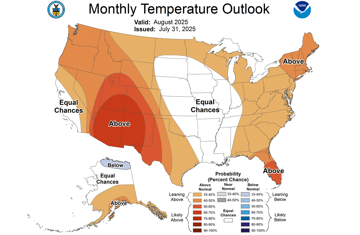
Below is the official monthly outlook for August, issued by NOAA. It shows a warmer anomaly over the western half of the United States and parts of the East. But notice the central United States and parts of the Midwest, where we see an area of “normal” temperatures or equal probability, giving reduced chances for prolonged heat periods.
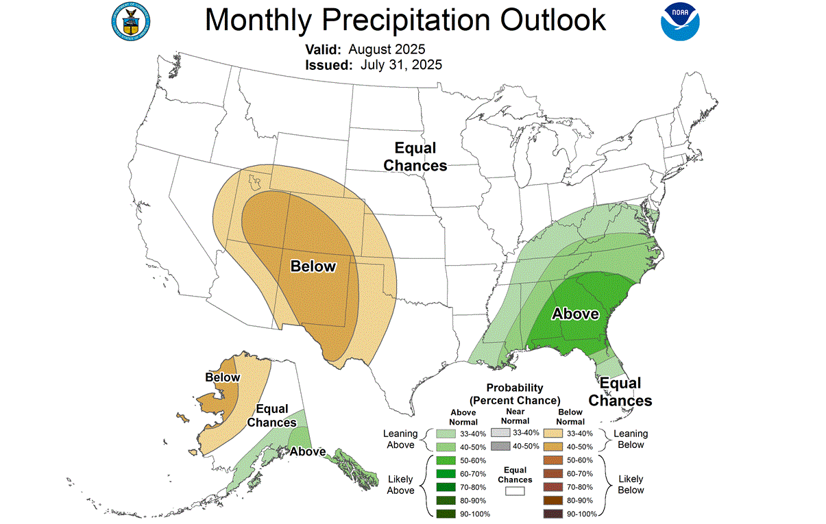
The official precipitation forecast for August is as expected, with a drier area over the southwestern United States. But more rainfall than normal is forecast over the eastern United States, due to the frequent pressure disturbances and potentially more weather fronts.
As we look at August overall, we also have to look at the tropics, because this is usually the month when tropical activity starts to increase.
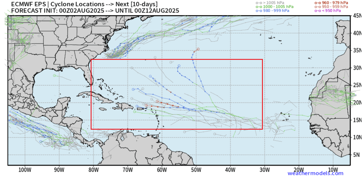
Looking at the updated EPS ensemble forecast below, you can see individual cyclone locations from all its 51 members for the next 15 days. It actually shows some potential for tropical development towards mid-August, for a system or two coming from the tropical waves in the Atlantic region.
Below is also the precipitation forecast for the whole of August, and it is perhaps the most telling indicator you can use in extended-range tropical forecasting. This is the latest model run, and you can see an area of more rainfall in the Bermuda area and towards the eastern United States. Some of that could be from tropical systems that are more likely to develop closer to the United States.
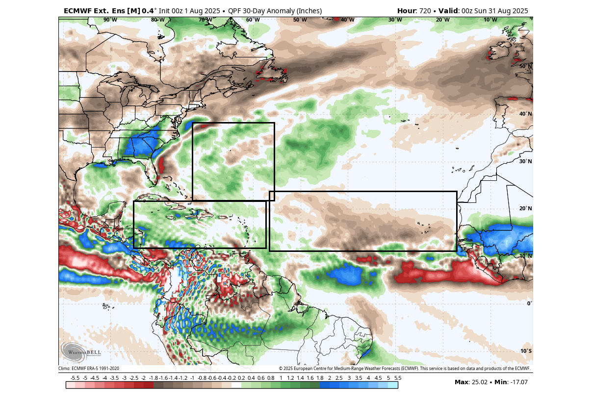
But you can see a broad area of below-normal rainfall over the main development region. This indicates suppressed convection and tropical activity, which greatly reduces hurricane potential, as expected during Atlantic Niña events.
You can still see increased rainfall in the Caribbean, indicating more tropical potential closer to the United States rather than from deeper in the Atlantic. This tells us that despite a slower Atlantic area, the regions closer to the U.S. still require close monitoring.
One of the reasons for this reduced Atlantic activity is also the so-called “Atlantic Niña” anomaly in the tropical Atlantic. You can see this cold anomaly in the image below from NOAA CRW. We have marked the two main areas, the cold Atlantic Nina in the right and the cool-neutral ENSO regions in the Pacific (left).
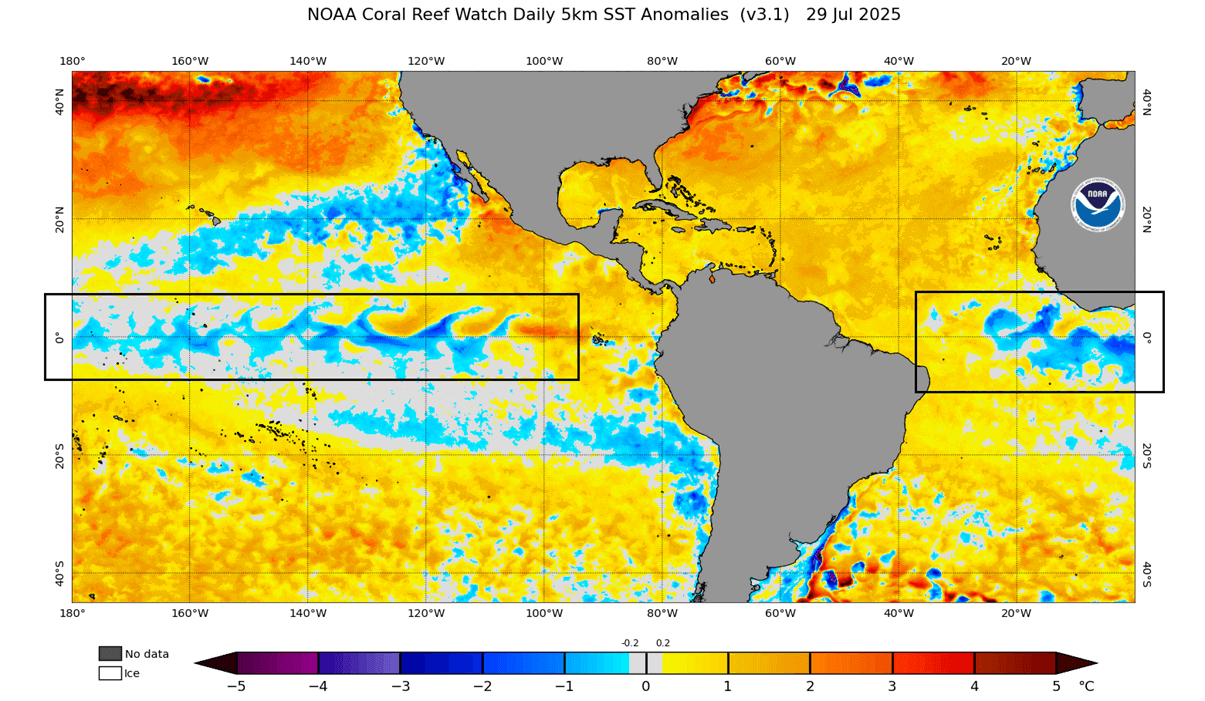
This indicates continued strong trade winds in the tropical Atlantic, which have implications for the hurricane season and the overall atmospheric conditions. The ENSO regions in the Pacific currently have less of an impact, but the long-range predictions do show a La Niña returning.
Below is a high-resolution video that shows a rapid ocean cooling process in the Atlantic, made from NOAA CRW analysis. It shows the emergence of the Atlantic Niña event in the May-June period.
We still have to remind ourselves that, despite a slower and suppressed hurricane season, you can still get some individual systems spinning up. There is never a zero-hurricane season, and only one landfall is enough to cause serious damage. So we must never let our guard fully down, despite a currently active Atlantic Niña.
Forecast images in the article are from WeatherBell and Weathermodels pages, using a commercial license.
We will keep you updated on the global weather pattern development, so don’t forget to check back. Also, if you have seen this article in the Google App (Discover) feed, click the like button (♥) or a star there to see more of our forecasts and our latest articles, and weather forecasts.
Don’t miss our first Fall 2025 Long-Range Forecast for the United States, Canada, and Europe